Discover 10 hidden attractions, cool sights, and unusual things to do in Fitzpatrick Wilderness (United States). Don't miss out on these must-see attractions: Gannett Peak, Fremont Peak, and Mount Sacagawea. Also, be sure to include Whiskey Mountain in your itinerary.
Below, you can find the list of the most amazing places you should visit in Fitzpatrick Wilderness (Wyoming).
Table of Contents
Gannett Peak
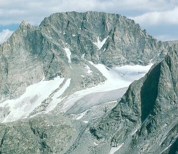
Mountain in Wyoming. Gannett Peak is the highest mountain peak in the U.S. state of Wyoming at 13,804 feet. It lies in the Wind River Range within the Bridger Wilderness of the Bridger-Teton National Forest. Straddling the Continental Divide along the boundary between Fremont and Sublette counties, it has the second greatest topographic prominence in the state after Cloud Peak, and is the highest ground for 290.36 miles in any direction.[1]
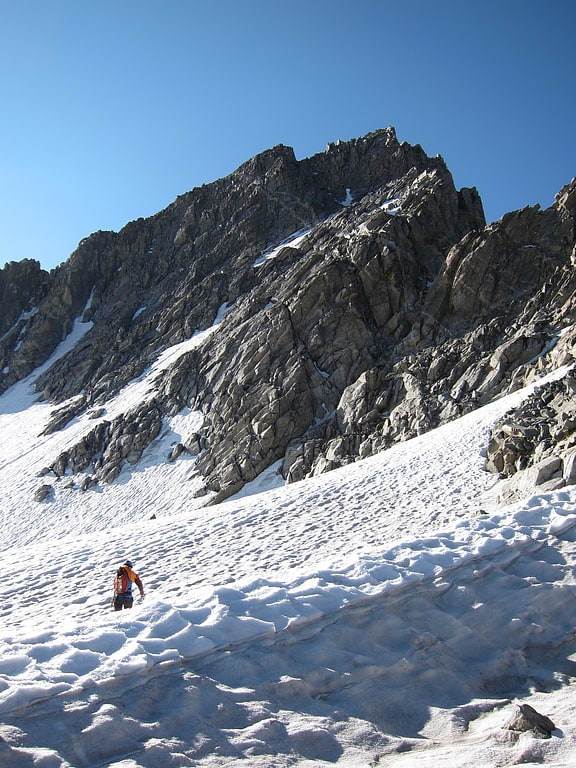
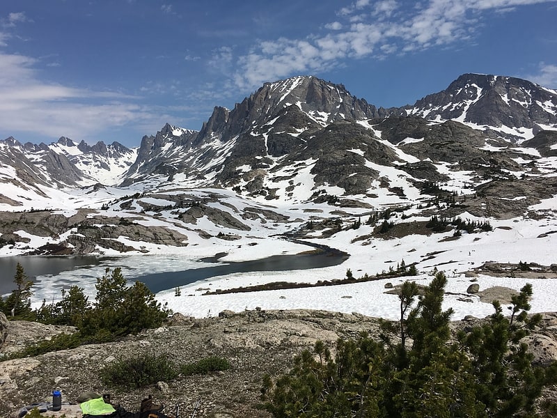
Fremont Peak

Peak in Wyoming. Fremont Peak is the third highest peak in the state of Wyoming, surpassed only by Gannett Peak and Grand Teton, and straddles the boundary between Fremont and Sublette counties in the Wind River Range. It is named for American explorer John C. Fremont who climbed the peak with Charles Preuss and Johnny Janisse from August 13 to August 15, 1842. Kit Carson had been with the climbing party on its first attempt at the peak, but had gone back for supplies the day Fremont and his men reached the summit. Carson is thought by some to have been the first to climb neighboring Jackson Peak. At that time, Fremont Peak was mistakenly thought to be the highest mountain in the Rocky Mountains, although there are actually over 100 higher peaks in the Rocky Mountain range.[2]
Mount Sacagawea
Peak in Wyoming. Mount Sacagawea is the eighth-highest peak in the U.S. state of Wyoming and the seventh-highest in the Wind River Range. It was named after Sacagawea, the young Lemhi Shoshone woman who accompanied the Lewis and Clark Expedition as an interpreter and guide. The Upper Fremont Glacier is located southeast and the Sacagawea Glacier is northeast of the mountain. Straddling the Continental Divide, Mount Sacagawea is one mile northwest of Fremont Peak.[3]
Whiskey Mountain
Mountain in Wyoming. Whiskey Mountain is located in the northern Wind River Range in the U.S. state of Wyoming. Located 5 mi south of Dubois, Wyoming, Whiskey Mountain is within the Whiskey Mountain Wilderness Study Area, which has the largest wintering concentration of Rocky Mountain Bighorn sheep in the coterminous United States.[4]
Address: 925 N Lapeer Rd, Fitzpatrick Wilderness
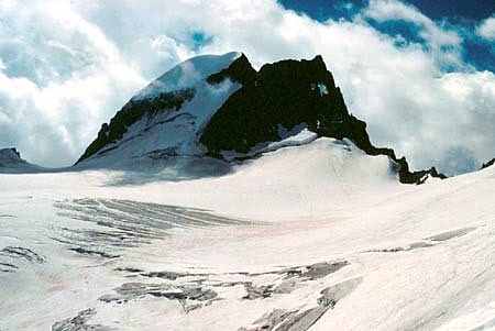
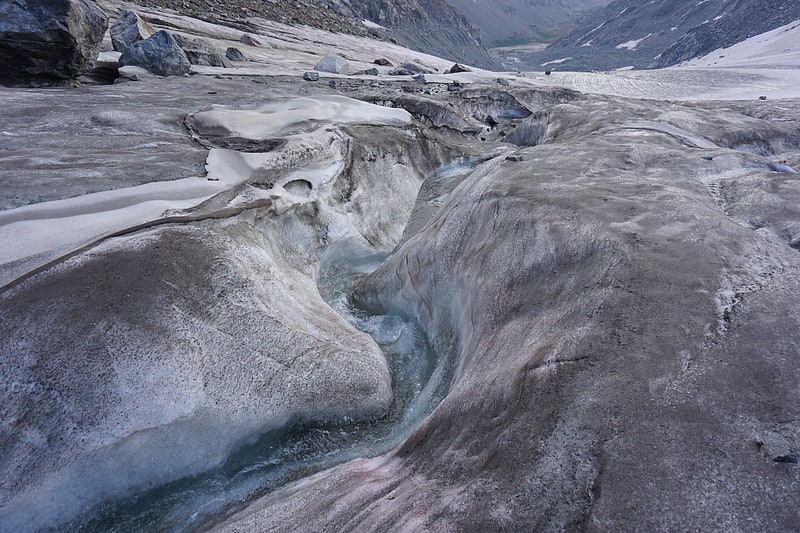
Upper Fremont Glacier
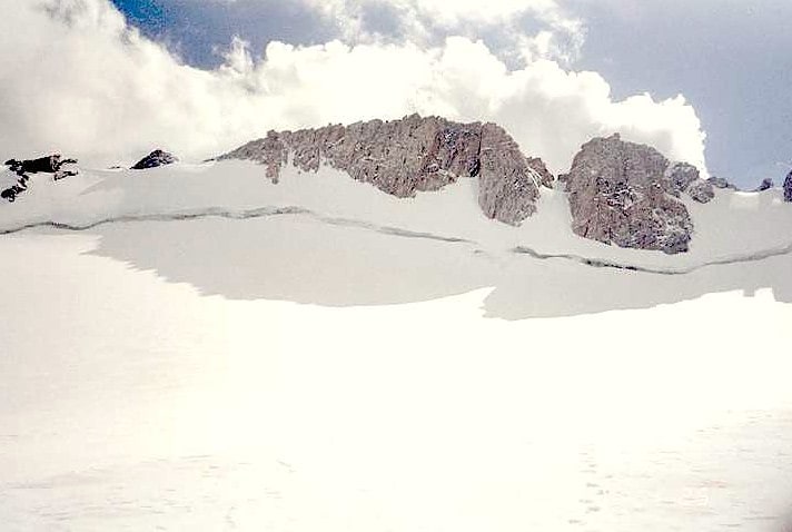
Glacier in Wyoming. Upper Fremont Glacier is in the Fitzpatrick Wilderness of Shoshone National Forest in the U.S. state of Wyoming. This Wind River Range alpine glacier is associated with the largest grouping of glaciers in the U.S. Rocky Mountains and lies on the north slope of Fremont Peak, the third tallest mountain in Wyoming. Upper Fremont Glacier is at an average altitude of 13,450 ft and is one of the highest altitude glaciers in the American Rockies.
Ice core samples were taken from Upper Fremont Glacier in 1990-1991. These ice cores were analyzed for climatic changes as well as alterations of atmospheric chemicals. In 1998 an unbroken ice core sample of 538 ft (164 m) was taken from the glacier and subsequent analysis of the ice showed an abrupt change in the oxygen isotope ratio oxygen-18 to oxygen-16 in conjunction with what is widely regarded as the end of the Little Ice Age, a period of cooler global temperatures between the years 1550 and 1850. A linkage was established with a similar ice core study which had been undertaken on the Quelccaya Ice Cap in Peru, which also demonstrated the same changes in the oxygen isotope ratio during the same period. The climatic implications from the ice cores taken from both sites support evidence of a sudden global climate change during the mid 19th century.
Ice cores from the glacier also showed increased levels of Tritium (3H) and chlorine-36 around the year 1963, which coincides with the peak period of above ground nuclear testing.
The same ice cores were also tested for mercury deposition from natural and human-induced activities. This is the first known instance in which ice cores have been used to determine mercury deposition from a mid-latitude glacier in North America, as all previous studies have been derived from other sources. The majority of mercury deposition is by way of the atmosphere and sources of the element may be from volcanic activity or from industrialization, but volcanoes are believed to contribute a small proportion of the mercury. The ice core samples from the Upper Fremont Glacier indicated that levels of mercury increased dramatically during the industrial revolution and have decreased significantly since the mid-1980s. It is believed that the decrease in mercury deposition since the 1980s coincides with the passage of the Clean Air Act.[5]
Wind River Range
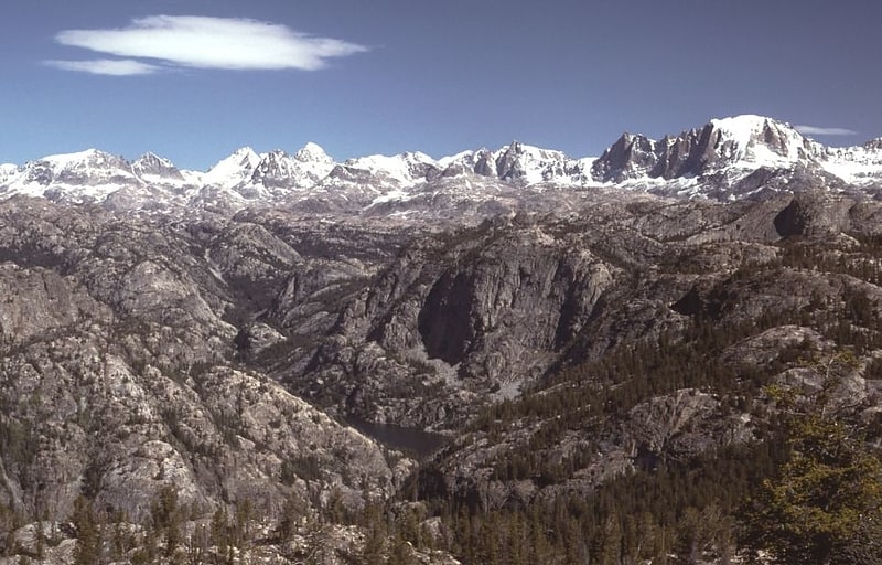
Mountain range in Wyoming. The Wind River Range is a mountain range of the Rocky Mountains in western Wyoming in the United States. The range runs roughly NW–SE for approximately 100 mi. The Continental Divide follows the crest of the range and includes Gannett Peak, which at 13,802 ft, is the highest peak in Wyoming; and also Fremont Peak at 13,750 ft, the third highest peak in Wyoming. There are more than 40 other named peaks in excess of 12,999 ft. With the exception of the Grand Teton in the Teton Range, the next 19 highest peaks in Wyoming after Gannett are also in the Winds.
Two large national forests including three wilderness areas encompass most of the mountain range. Shoshone National Forest is on the eastern side of the continental divide while Bridger-Teton National Forest is on the west. Both national forests and the entire mountain range are an integral part of the Greater Yellowstone Ecosystem. Portions of the east side of the range are inside the Wind River Indian Reservation.[6]
Gannett Glacier
Glacier in Wyoming. Gannett Glacier is the largest glacier in the Rocky Mountains within the United States. The glacier is located on the east and north slopes of Gannett Peak, the highest mountain in Wyoming, on the east side of the Continental Divide in the Wind River Range. Gannett is but one of dozens of glaciers located in the Fitzpatrick Wilderness of Shoshone National Forest.
As is true with many glaciers around the world, Gannett Glacier is slowly disappearing. Photographic evidence clearly demonstrates that there has been an enormous reduction in the area of the glacier since the 1920s. The area of the glacier was estimated in 1950 to be 4.6 square kilometres (1,137 acres) and was measured in 1999 to be 3.63 square kilometres (897 acres). Measurements taken in 1958 and again in 1983 showed a depth reduction of 18.6 metres (61 ft) over 25 years. A general warming pattern and a reduction in moisture is widely believed to be the reason for the glacier retreating. Numerous other glaciers are located in the immediate area including six more that are within the top ten in size within the Rocky Mountains of the U.S.
In a 1989 study, both Gannett and Dinwoody glaciers were researched to determine the amount of melt water they supplied to streams. Both glaciers supply melt water which flows into Dinwoody Creek, which in turn flows into the Wind River. The melt water was found to have contributed increasingly lower amounts to the total water supplied to Dinwoody Creek. This has been attributed to the glaciers thinning and retreating, especially since 1950, when Gannett Glacier was measured to be almost 20 percent larger than in 1999. The impact on reduced stream flow from Gannett Glacier due to glacial retreat affects more than just the amount of water available for the local ecosystem and downstream agricultural and ranching interests.[7]
Sacagawea Glacier

Glacier in Wyoming. Sacagawea Glacier is east of the Continental Divide in the northern Wind River Range in the U.S. state of Wyoming. The glacier is located in the Fitzpatrick Wilderness of Shoshone National Forest, and is among the largest grouping of glaciers in the American Rocky Mountains. Sacagawea Glacier flows to the east, from a northeast facing cirque, starting near the summit of Mount Sacagawea. A large moraine and small proglacial lake are situated beyond the terminal east end of the glacier.[8]
Jackson Peak
Peak in Wyoming. Jackson Peak 13,523 feet is the eighth-highest peak in the U.S. state of Wyoming and the seventh-highest in the Wind River Range. The Bull Lake Glacier is located immediately north and east of the mountain. Situated on the Continental Divide, Jackson Peak is.75 miles southeast of Fremont Peak.[9]
Helen Glacier
Glacier in Wyoming. Helen Glacier is located east of the Continental Divide in the northern Wind River Range in the US state of Wyoming. The glacier is located in the Fitzpatrick Wilderness of Shoshone National Forest, and is among the largest grouping of glaciers in the American Rocky Mountains. Helen Glacier flows to the east from a cirque to the northeast of Mount Helen.[10]