Discover 35 hidden attractions, cool sights, and unusual things to do in Grand Teton National Park (United States). Don't miss out on these must-see attractions: Granite Canyon, Jenny Lake Trail, and Grand Teton. Also, be sure to include String Lake in your itinerary.
Below, you can find the list of the most amazing places you should visit in Grand Teton National Park (Wyoming).
Table of Contents
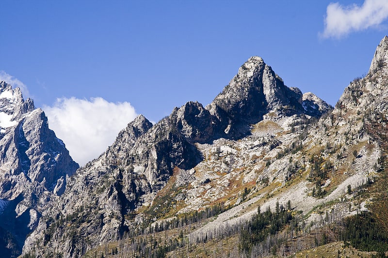
Granite Canyon
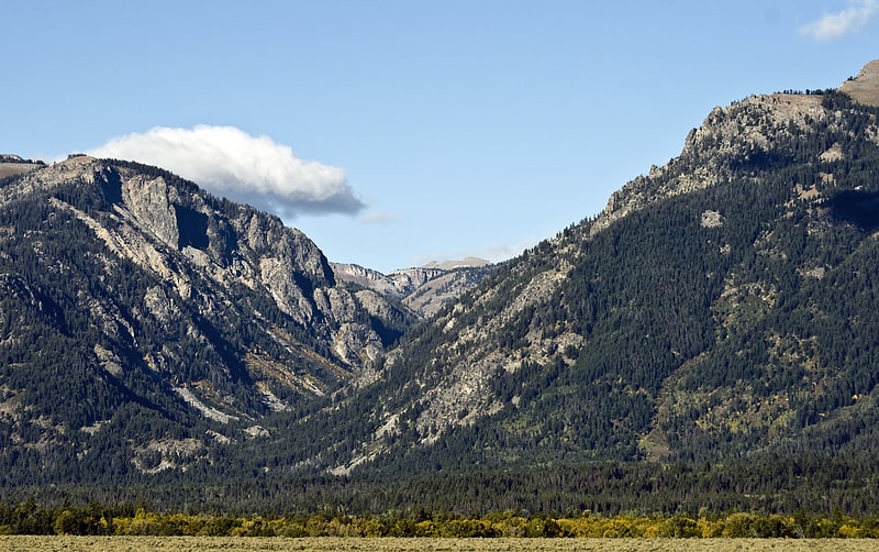
Granite Canyon is located in Grand Teton National Park, in the U. S. state of Wyoming. The canyon was formed by glaciers which retreated at the end of the last glacial maximum approximately 15,000 years ago, leaving behind a U-shaped valley. The canyon lies between Rendezvous Mountain to the south and Mount Hunt to the north. The trailhead for the canyon is on the Moose–Wilson Road about 2 miles north of Teton Village. One of the most popular hikes from the trailhead is to Marion Lake by way of the Granite Canyon Trail which traverses the length of the canyon. Another popular hike involves riding the aerial tram located at the Jackson Hole Mountain Resort in Teton Village to the top of Rendezvous Mountain, and then descending back to Teton Village by way of Granite Canyon. The descent from the summit of Rendezvous Peak back to Teton Village is an often steep one with an altitude loss of 4,100 feet. The historic Upper Granite Canyon Patrol Cabin is situated near the entrance to the canyon and was listed on the National Register of Historic Places in 1998.
Granite Canyon is also the original name of one of the most scenic canyons in Colorado located in Lake George, CO. Now known as ElevenMile Canyon, the Colorado Midland Railroad ran through the canyon from 1887 to 1918. Almost a decade after the rails were removed from the canyon, construction of ElevenMile Reservoir Dam started and was completed in 1931. Today, Granite Canyon is more commonly known as ElevenMile Canyon.[1]
Jenny Lake Trail

The Jenny Lake Trail is a 7.1-mile long hiking trail which circles Jenny Lake located in Grand Teton National Park in the U.S. state of Wyoming. The trail begins at the Jenny Lake campground or can be accessed at several other trailheads. One of the most popular and easiest hikes in the park, the trail provides pedestrian access to the Cascade Canyon Trail and is overlapped by the Valley Trail along the west side of Jenny Lake.[2]
Address: Jenny Lake, Grand Teton National Park
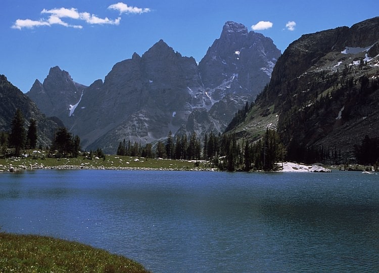
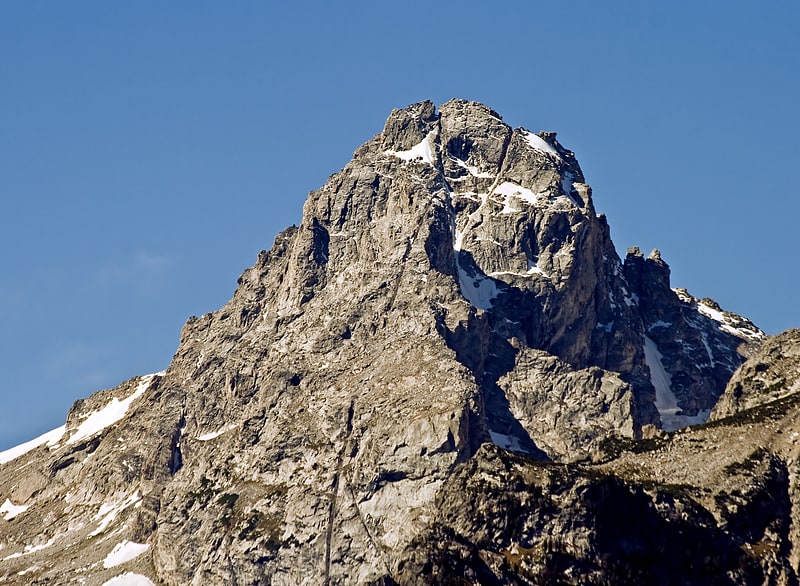
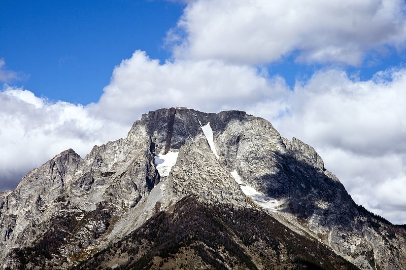
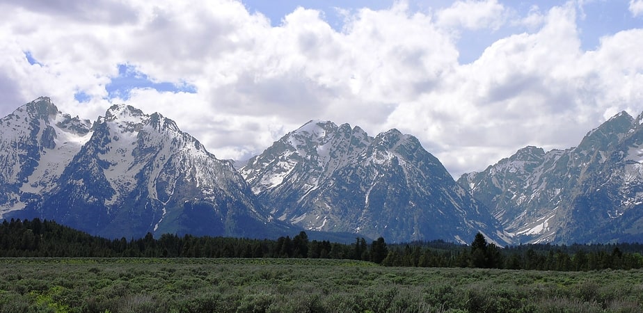
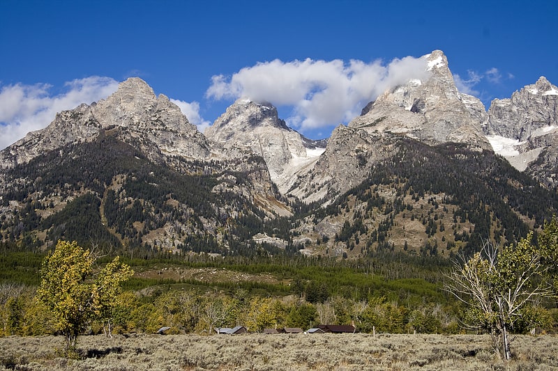
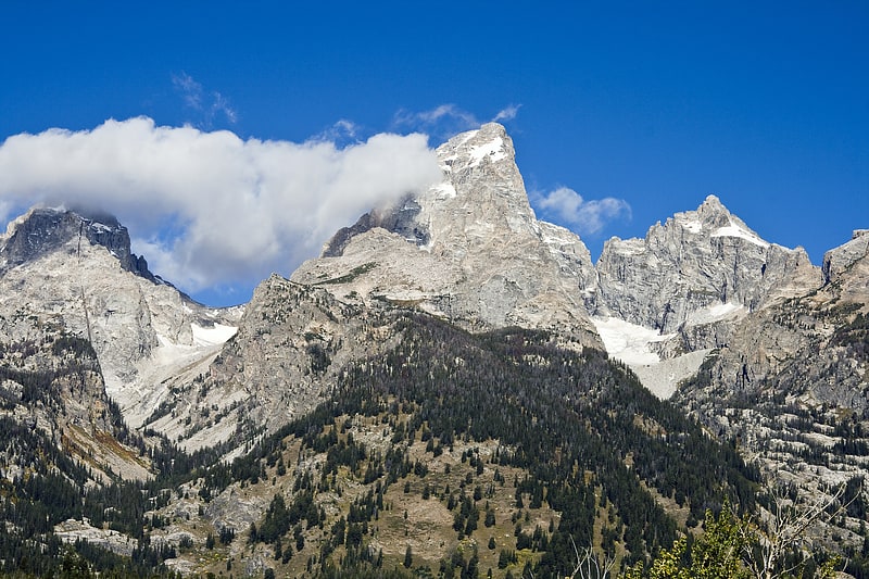
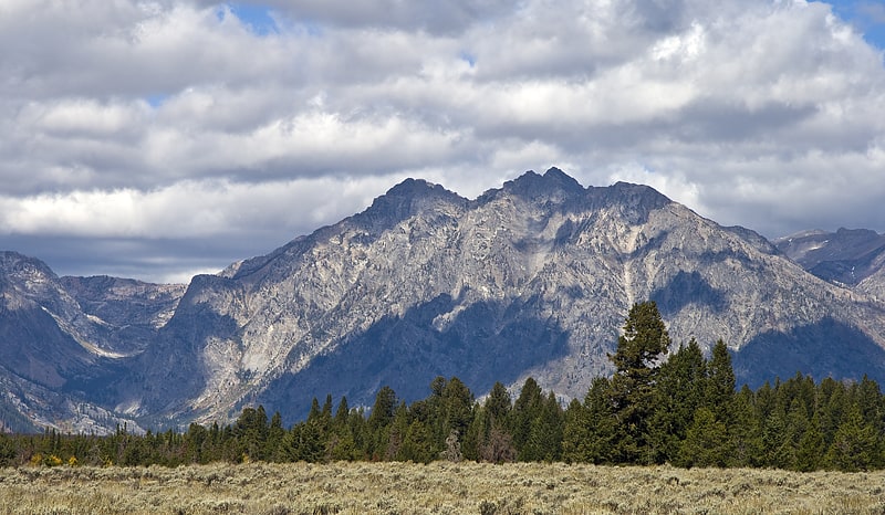
Grand Teton
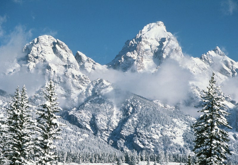
National park peak and hiking destination. Grand Teton is the highest mountain in Grand Teton National Park, in Northwest Wyoming, and a classic destination in American mountaineering.[3]
String Lake
Lake in Wyoming. String Lake is located in Grand Teton National Park, in the U. S. state of Wyoming. The natural lake is located at the outflow of Leigh Lake. A small wetland area is on the northwest side of the lake and is prime moose habitat. A short half mile long creek connects String Lake to Jenny Lake to the south. The lake can easily be accessed by vehicle and a number of trails commence from the String Lake trailhead parking area.[4]
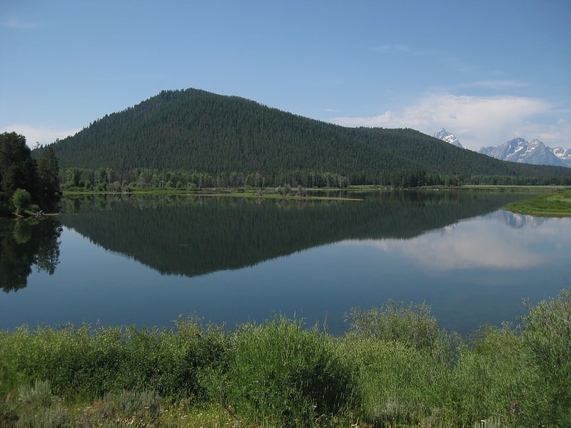
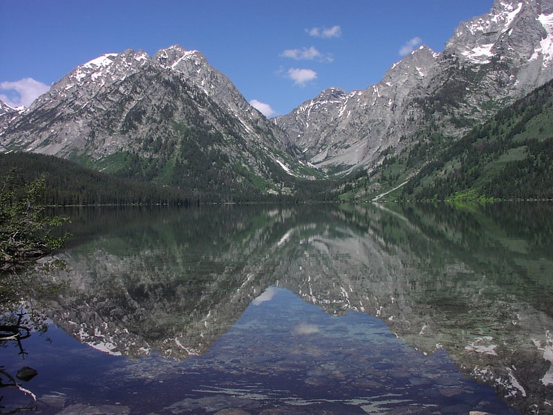
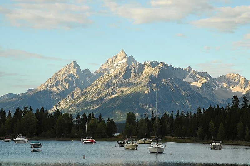
Jenny Lake
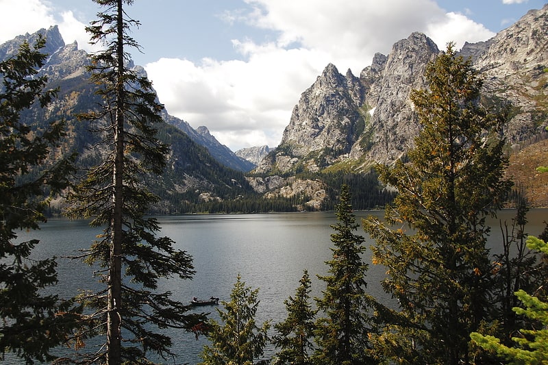
Boating and hiking in dramatic surrounds. Jenny Lake is located in Grand Teton National Park in the U.S. state of Wyoming. The lake was formed approximately 12,000 years ago by glaciers pushing rock debris which carved Cascade Canyon during the last glacial maximum, forming a terminal moraine which now impounds the lake. The lake is estimated to be 256 feet deep and encompasses 1,191 acres. Jenny Lake is considered to be a major focal point in Grand Teton National Park, with many hiking trails, scenic boat rides, and quick access to the major climbing routes onto the tallest peaks of the Teton Range.
Jenny and Jackson Lakes are the only lakes in Grand Teton National Park where motorboats are permitted; both lakes have scenic tours available. A 2005 study of the water quality of the lakes in Grand Teton National Park indicated that all the lakes in the park were still considered pristine and that they had not been impacted by air or water pollution.
Jenny Lake is a starting point for many day and overnight hiking trips. The 7.1-mile (11.4 km) Jenny Lake Trail loops around the lake and is considered to be relatively easy due to the small altitude gain of 700 feet (210 m). However, the altitude increases rapidly once Cascade Canyon is entered.
Jenny Lake is named after a Shoshone Indian woman who married an Englishman, Richard "Beaver Dick" Leigh. Jenny, and their 6 children, died of Smallpox in 1876.[5]
Lake Solitude
Lake in Wyoming. Lake Solitude is a lake located in Grand Teton National Park, in the U.S. state of Wyoming. The 0.5-mile in circumference natural lake is situated at the head of north Cascade Canyon and is a popular destination for hikers and backpackers. From the Cascade Canyon trailhead on the west shore of Jenny Lake, the lake is a distance of 7.2 miles and there is an altitude gain of 2,252 feet along the Cascade Canyon Trail and Lake Solitude Trail. An alternate route to the lake from the north begins at String Lake and steeply climbs through Paintbrush Canyon to Paintbrush Divide on the Paintbrush Canyon Trail and then descends to Lake Solitude after a 11.5-mile hike with an altitude increase of over 4,000 feet to the divide.[6]
Craig Thomas Discovery and Visitor Center
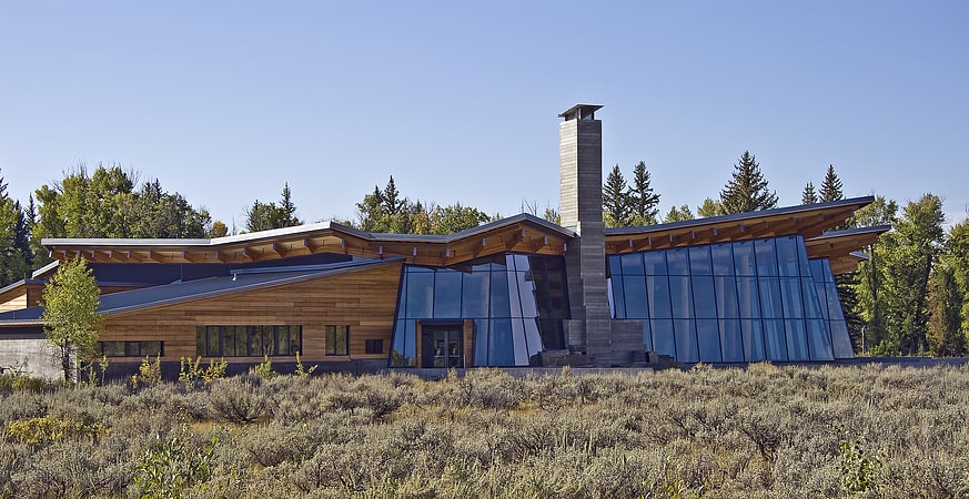
Visitor center in Moose, Wyoming. The Craig Thomas Discovery and Visitor Center is located in Grand Teton National Park in the U.S. state of Wyoming. The visitor center is open from early spring until the fall.
Opened in 2007 to replace an old and inadequate facility, the Craig Thomas Discovery and Visitor Center was built with a combination of federal grants and private donations and is adjacent to the park headquarters in Moose, Wyoming. Fund raising efforts for an adjoining 154-seat auditorium were nearing completion as of 2011. Exhibits include the park's natural history, mountaineering and Western artifacts.[7]
Address: Teton Park Rd, 83012 Moose
Chapel of the Transfiguration
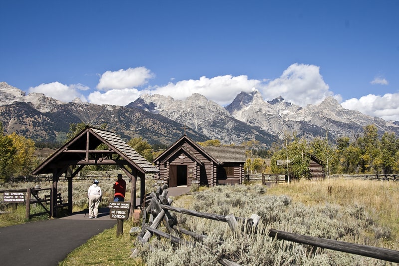
Episcopal church in Moose, Wyoming. The Chapel of the Transfiguration is a small log chapel in Grand Teton National Park, in the community of Moose. The chapel was sited and built to frame a view of the Cathedral Group of peaks in a large window behind the altar. The chapel, which was built in 1925, is owned and operated by St. John's Episcopal Church in Jackson.[8]
Address: Chapel of the Transfiguration Rd, Grand Teton National Park
Trapper Lake
Lake in Wyoming. Trapper Lake is located in Grand Teton National Park, in the U. S. state of Wyoming. Trapper Lake is only 0.10 mi north of Bearpaw Lake and at the eastern base of Mount Moran. The lake can be accessed on foot by the Leigh Lake Trail which is an easy 4.6-mile hike on level terrain.[9]
Signal Mountain
Summit in Wyoming. Signal Mountain is an isolated summit standing 7,720 feet above sea level. The mountain is located in Grand Teton National Park in the U.S. state of Wyoming. The next closest higher summit is more than 10 miles distant, and this isolation provides sweeping views of the Teton Range, much of the northern Jackson Hole area as well as the Snake River. Though located adjacent to the Tetons, Signal Mountain was not formed in the same manner or period. The mountain originally was formed by volcanic ashfall from one of the eruptions of the Yellowstone hotspot. The peak is also partially a glacial moraine formed by a receding glacier that came south out of the Yellowstone icecap. This same glacier also created neighboring Jackson Lake.
Signal Mountain has a 5-mile (8.0 km) long road providing vehicular access to an observation area located just below the main summit. The Signal Mountain Trail is a hiking trail that goes from Signal Mountain Lodge to the summit and covers a distance of 6.8 miles (10.9 km). The trail splits mid-way for a portion of approximately 1.5 miles (2.4 km), allowing hikers to take either a trail along the lower part of the ridge or south of the ridge past a series of small ponds. The trails then rejoin and steepen over the last mile to reach the secondary summit of the mountain, the Jackson Lake Overlook. The trail rises approximately 800 feet (240 m) from the lodge to the overlook, though on the ridge trail there is quite a bit of up and down that adds a few hundred feet to the cumulative elevation gain. The trail is a hiking only trail, mountain biking and horseback riding are not permitted by the park service. The road is a popular biking destination due to the difficult climb up and then (after turning around at the summit) continuous downhill experienced on a 3.5-mile (5.6 km) portion of the road.[10]
Bradley Lake

Lake in Wyoming. Bradley Lake is located in Grand Teton National Park, in the U. S. state of Wyoming. The glacially formed lake is located near the terminus of Garnet Canyon. Bradley Lake can be accessed by the Bradley Lake Trail, a 4 miles roundtrip hike commencing from the Taggart Lake trailhead parking area. The lake is less than one and a half miles north of Taggart Lake.[11]
Death Canyon
Death Canyon is located in Grand Teton National Park, in the U.S. state of Wyoming. The canyon was formed by glaciers which retreated at the end of the last glacial maximum approximately 15,000 years ago, leaving behind a U-shaped valley. The trailhead for the canyon is located on a side road off the Moose-Wilson Road, approximately 5 miles from the park headquarters at Moose, Wyoming. At the base of the canyon is Phelps Lake which was created by glacial activity. The Death Canyon Trail extends the length of the canyon to Fox Creek Pass, at which point the Death Canyon Shelf, a relative narrow and level plateau, can be traversed. The canyon has many Whitebark Pine stands, particularly near the tree line. At the junction of the Death Canyon and the Alaska Basin trails, the historic Death Canyon Barn is preserved after being listed on the National Register of Historic Places in 1998.[12]
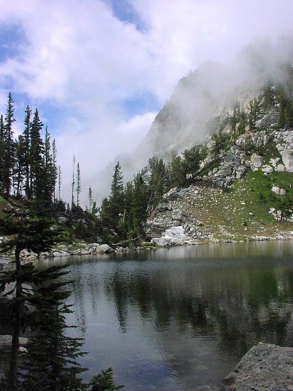
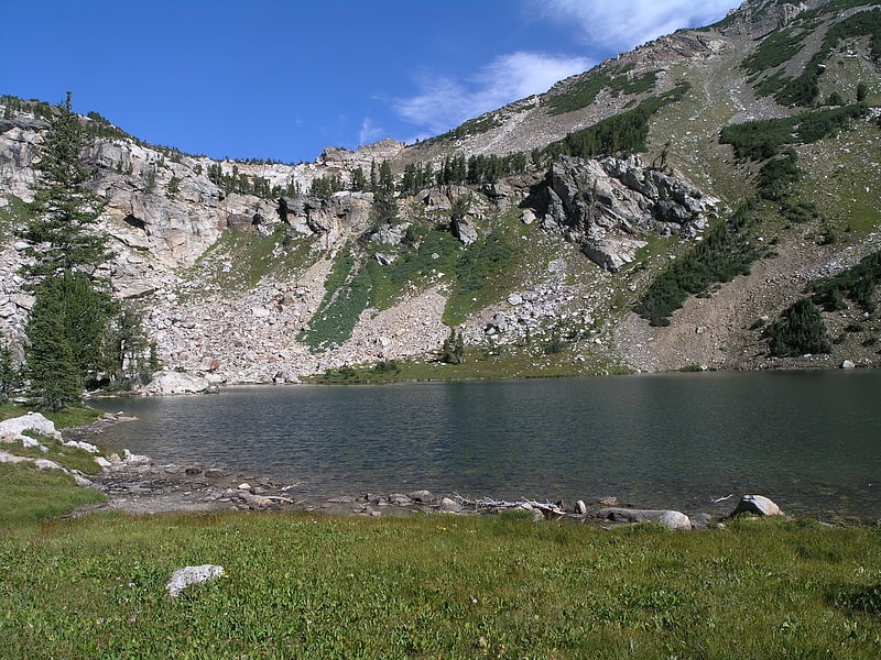
Marion Lake
Lake in Wyoming. Marion Lake is located in Grand Teton National Park, in the U. S. state of Wyoming. Marion Lake is situated near the head of Granite Canyon and is adjacent to the Teton Crest Trail. The round trip hike on the Rendezvous Mountain Trail to the lake from the top of Rendezvous Mountain by way of the ski tram from Jackson Hole Mountain Resort is considered a strenuous 11.8 miles.[13]
Taggart Lake
Lake in Wyoming. Taggart Lake is located in Grand Teton National Park, in the U. S. state of Wyoming. The natural lake is located at the terminus of Avalanche Canyon. A number of hiking trails can be found near the lake including a 3 miles roundtrip hike commencing from the Taggart Lake Trailhead parking area. The lake is approximately one mile south of Bradley Lake reckoned by trail distance. A 2005 study of the water quality of the lakes in Grand Teton National Park indicated that the lakes in the park were still considered pristine and that they had not been impacted by air or water pollution.
Taggart lake was named after William Rush Taggart, an assistant surveyor to Frank Bradley as part of the Snake River division of the Hayden expedition of 1872 to document the geology and topography of the Yellowstone area.
Other lakes in the area were named after the below individuals:
- Bradley Lake - Frank Bradley
- Taggart Lake - William Rush Taggart
- Leigh Lake - Beaver Dick Leigh
- Jenny Lake - Jenny Leigh (his wife)
- Phelps Lake_(Wyoming) - George Phelps (a hunter)
Surprise Lake
Lake in Wyoming. Surprise Lake is a lake in Grand Teton National Park, in the U. S. state of Wyoming. Surprise Lake is on.20 miles east of Amphitheater Lake and can be accessed via a strenuous climb of just under 10 miles round trip from the Lupine Meadows trailhead. The National Park Service has three backcountry campsites at Surprise Lake which are allocated by permit only.[15]
Two Ocean Lake
Lake in Wyoming. Two Ocean Lake is located in Grand Teton National Park, in the U. S. state of Wyoming. The glacially formed lake is 2.4 miles long and can be reached from a parking area adjacent to the lake. The Two Ocean Lake Trail is 6.4 miles long and circles the lake passing through forests and clearings. The larger Emma Matilda Lake is one mile to the south.
Two Ocean Lake, in the northeastern portion of the park near Moran, was named for Two Ocean Pass about 25 miles (40 km) to the northeast where Atlantic Creek flows east and Pacific Creek flows west. Two Ocean Lake only flows into Pacific Creek so the name is a misnomer.[16]
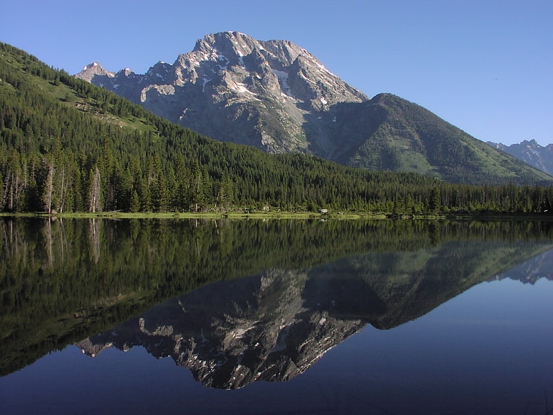
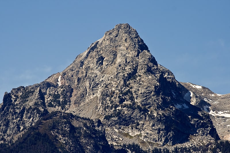
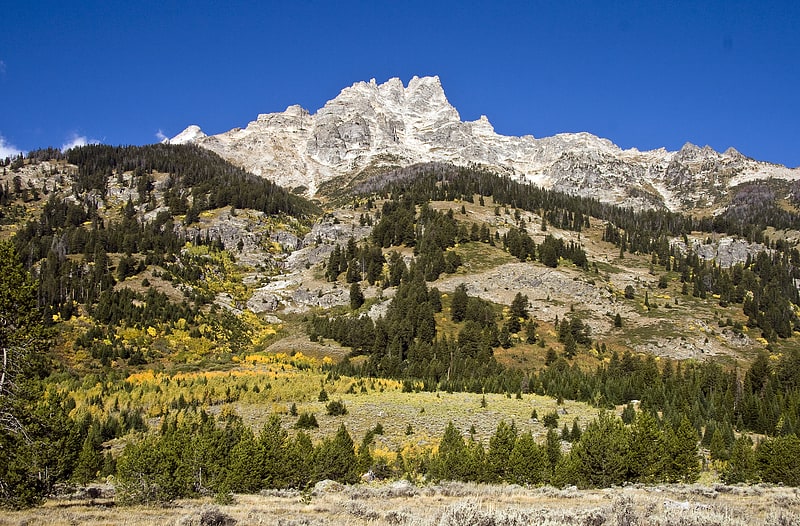
Middle Teton
Alpine summit in a national park. Middle Teton is the third-highest peak in the Teton Range, in the U.S. state of Wyoming. Located within Grand Teton National Park, the peak is immediately southwest of Grand Teton, from which it is separated by a broad high ridge at 11,600 feet, known to local climbers as the Lower Saddle. The Middle Teton Glacier is located on the eastern slopes of the peak.
Middle Teton is a classic pyramidal alpine peak and is sometimes included as part of the Cathedral Group of high Teton peaks. The 40-mile-long (64 km) Teton Range is the youngest mountain chain in the Rocky Mountains, beginning its uplift 9 million years ago, during the Miocene. Several periods of glaciation have carved Middle Teton and the other peaks of the range into their current shapes. From the Lower Saddle, a distinctive feature known as the black dike appears as a straight line running from near the top of the mountain down 800 feet (240 m). The black dike is a basaltic intrusion that occurred long after the surrounding rock was formed.[17]
Holly Lake
Lake in Wyoming. Holly Lake is located in Grand Teton National Park, in the U. S. state of Wyoming. Holly Lake is situated in Paintbrush Canyon and is.70 miles SSW of Mount Woodring.[18]
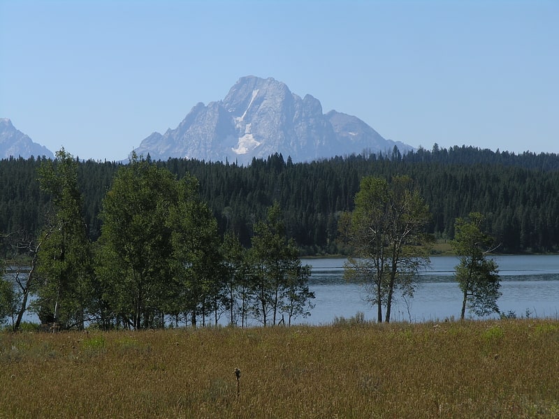
Mount Moran
Flat-topped national park summit. Mount Moran is a mountain in Grand Teton National Park of western Wyoming, USA. The mountain is named for Thomas Moran, an American western frontier landscape artist. Mount Moran dominates the northern section of the Teton Range rising 6,000 feet above Jackson Lake. Several active glaciers exist on the mountain with Skillet Glacier plainly visible on the monolithic east face. Like the Middle Teton in the same range, Mount Moran's face is marked by a distinctive basalt intrusion known as the Black Dike.[19]
Leigh Lake
Lake in Wyoming. Leigh Lake is located in Grand Teton National Park, in the U. S. state of Wyoming. The glacially formed lake is 2.4 miles wide and 2.8 miles long from north to south. Situated just southeast of Mount Moran, the lake is at the terminus of both Paintbrush and Leigh Canyons. The lake can be accessed from the Leigh Lake Trail which follows the eastern shores of String Lake a distance of one mile and is an easy hike over level terrain. The Leigh Lake Ranger Patrol Cabin is located on the northeast shore of the lake and is on the National Register of Historic Places.
The lake was named for Richard "Beaver Dick" Leigh, a mountain guide.[20]
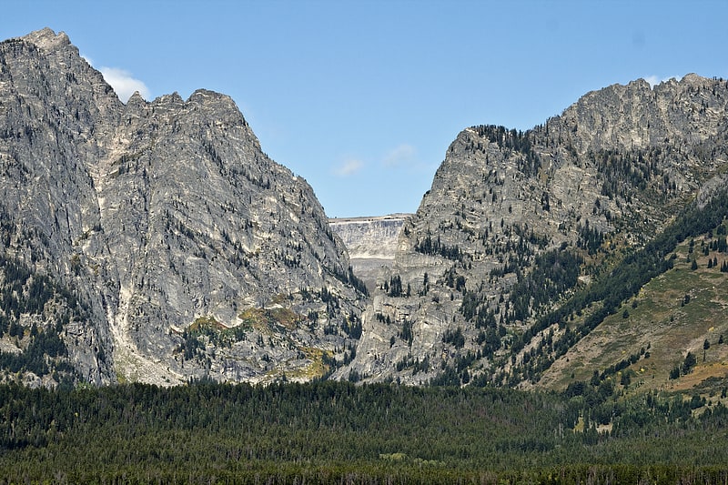
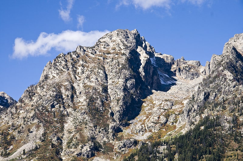
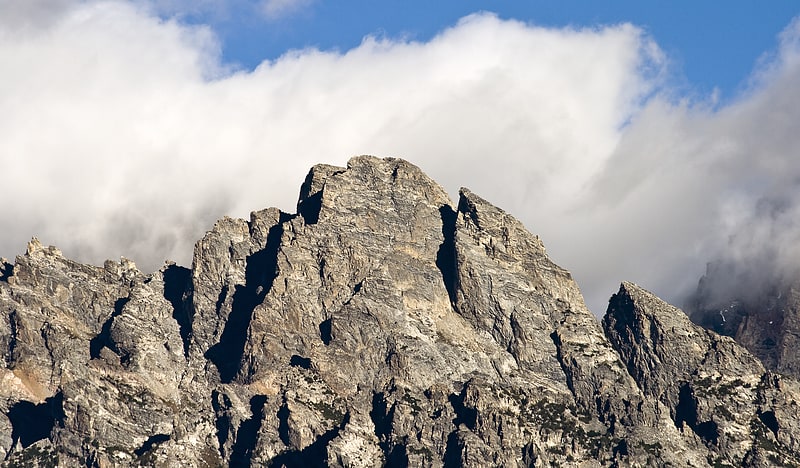
Cascade Canyon
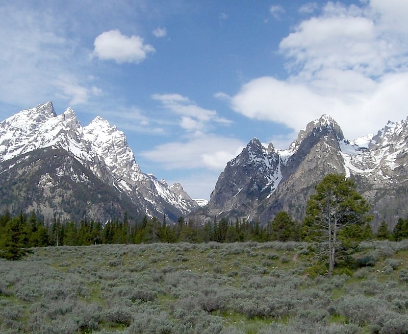
Cascade Canyon is located in Grand Teton National Park, in the U.S. state of Wyoming. The canyon was formed by glaciers which retreated at the end of the last glacial maximum approximately 15,000 years ago. Today, Cascade Canyon has numerous polished glacial erratics, hanging cirques and a U-shape as evidences that demonstrate that glaciers once filled the canyon to a depth of at least 2,000 feet. Rock debris that was transported out of the canyon by glacial motion formed moraines which now impound the waters of Jenny Lake which is located at the base of the canyon. Cascade Creek now flows where the glaciers once did and the numerous waterfalls, such as the 100-foot tall Hidden Falls, found within the gorge are popular destinations with tourists.
The canyon is immediately west of Jenny Lake. The Cascade Canyon Trail follows the length of the canyon and is one of the most heavily used hiking trails in the park. The canyon can be reached from the Jenny Lake campground after a level hike of 1.8 miles (2.9 km) along the Jenny Lake Trail, or by way of a scenic boat ride from the campground to the west shore of Jenny Lake. At the foot of the canyon it is 4.5 miles (7.2 km) to the junction of the north and south Cascade Canyon trails. From there, hikers have the option of heading north along the Lake Solitude Trail to Lake Solitude (another 2.8 miles (4.5 km) or south via the South Fork Cascade Canyon Trail to Hurricane Pass (5.1 miles (8.2 km). From Lake Solitude there are sweeping views of the Cathedral Group and Grand Teton. Just below Hurricane Pass, a small glacier known as Schoolroom Glacier can be reached via a short side trail. The canyon is situated between Grand Teton which is 13,770 feet (4,200 m) high to the south and several peaks over 11,000 feet (3,400 m) to the north. Steep cliffs descending from these peaks ensure that the high points to the north and south are not visible until one hikes considerable distance into the canyon.
Five miles (8 km) west of Jenny Lake the Cascade Canyon Barn is preserved. Built in 1935 by members of the Civilian Conservation Corps, the barn was placed on the National Register of Historic Places in 1998.[21]
Paintbrush Canyon
Paintbrush Canyon is located in Grand Teton National Park, in the U. S. state of Wyoming. The canyon was formed by glaciers which retreated at the end of the last glacial maximum approximately 15,000 years ago. The canyon lies between Rockchuck Peak and Mount Saint John to the south and Mount Woodring to the north. Leigh Lake is at the base of the canyon to the east and the alpine Holly Lake is located mid canyon. Popular with hikers, the canyon is part of a popular circuit hike of 19.2 miles which is rated as very strenuous and includes a total elevation change of 3,845 feet due to the ascent to Paintbrush Divide 10,720 feet. Views from Paintbrush Divide include Lake Solitude and of Mount Moran to the north and the Cathedral Group including Grand Teton to the south. An ice axe may be necessary for hikes in the early summer. The Paintbrush Canyon Trail is part of the Teton Crest Trail, which spans the southern section of the Teton Range from Teton Pass along Wyoming Highway 22 to String Lake, a total distance of 39 miles.[22]
Garnet Canyon
Garnet Canyon is located in Grand Teton National Park in the U.S. state of Wyoming. The canyon was formed by retreating glaciers which reached their last glacial maximum around 15,000 years ago. While Garnet Canyon is a less popular destination for recreational hikers than nearby Cascade Canyon or Death Canyon, it is an important approach to many significant and popular mountaineering climbs including routes found on Grand Teton, Middle Teton, South Teton and Disappointment Peak.
The trailhead for Garnet Canyon is found at Lupine Meadows, and the canyon itself is reached after several miles of hiking through forest and switchbacks which climb a large lateral moraine. The entrance to the canyon is guarded by a boulderfield that requires some Class 3 scrambling to cross. Beyond the boulderfield is the popular camping area known as the Meadows, above which the canyon divides into north and south forks. The north fork leads up to the lower saddle between Middle Teton and Grand Teton and is the starting point for many classic climbs on Grand Teton. The south fork climbs up to a saddle between Middle Teton and South Teton and is the starting point for some of the easier routes up those two summits.
Backcountry camping is allowed, by permit, in Garnet Canyon at areas designated by the National Park Service. Camping permits can be obtained in advance via registration or in person at the Jenny Lake Ranger Station.[23]
Blacktail Butte
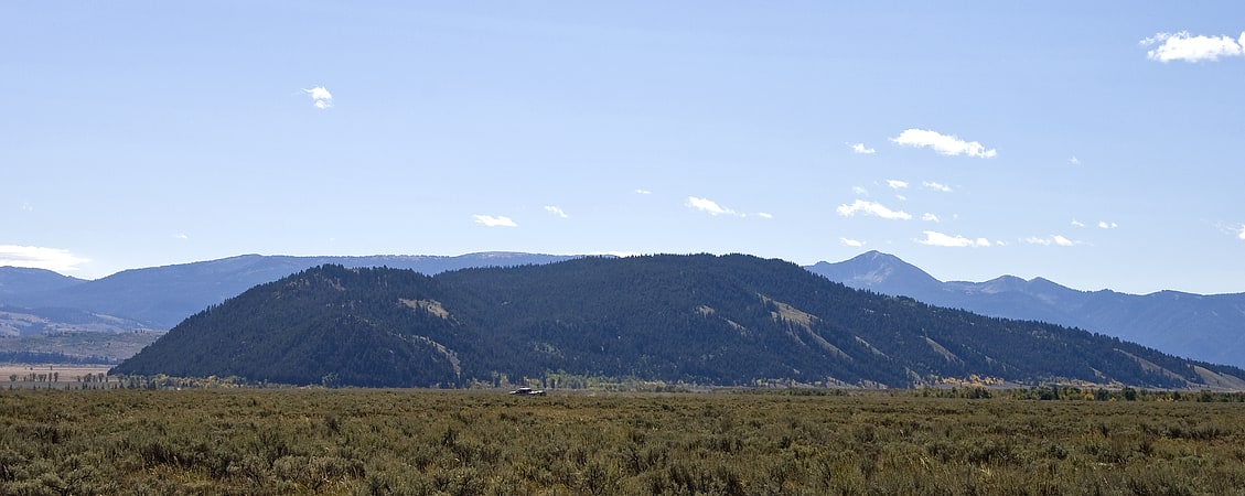
Mountain in Wyoming. Blacktail Butte is a butte mountain landform rising from Jackson Hole valley in Grand Teton National Park in the U.S. state of Wyoming. Blacktail Butte was originally named Upper Gros Ventre Butte in an early historical survey conducted by the U.S. Geological Survey. Most of Blacktail Butte is densely forested with a mixed fir forest of lodgepole pine, Douglas fir and Engelmann spruce, with scattered pockets of aspen. There are several large sedimentary rock outcroppings, which are used by rock climbers. This butte is a principal landmark in Jackson Hole, with much of the Jackson Hole valley floor and many portions of the Teton Range visible from its hillsides.
The butte is named after black-tailed deer, also known as mule deer. Bighorn sheep, mule deer, white-tailed deer, pronghorn antelope, and bison are commonly found in the area, along with grizzly bears and gray wolves. Most notably, many thousands of elk cross through the area during their annual migration to and from their winter feeding grounds on the National Elk Refuge.
Local lore claims that the name reflects the fact that the north face and ridge lines are so heavily wooded that they appear black, as compared to the other slopes, which have sage brush, scrub grass, and fewer trees. There is also a scenic overlook nearby with the same name, Blacktail Pond.
At the base of the butte is Mormon Row, a popular place for photographers and tourists, with the photogenic Moulton Barn and herds of bison.[24]
South Teton
Peak in Wyoming. South Teton is the fifth-highest peak in the Teton Range, Grand Teton National Park, in the U.S. state of Wyoming. The peak is south of Middle Teton and just west of Cloudveil Dome and is part of the Cathedral Group of high Teton peaks. The 40-mile-long Teton Range is the youngest mountain chain in the Rocky Mountains, and began their uplift 9 million years ago, during the Miocene. Several periods of glaciation have carved South Teton and the other peaks of the range into their current shapes.[25]
Mount Saint John
Mountain in Wyoming. Mount Saint John, height 11,435 feet, is located in the Teton Range, Grand Teton National Park, Wyoming, northwest of Jenny Lake. The mountain towers above the northwest shore of Jenny Lake, and along with Symmetry Spire and Rockchuck Peak, form a massif which looms to the north above Cascade Canyon. The scenic Lake of the Crags, a cirque lake or tarn, is located immediately south of the summit and is accessed by way of Hanging Canyon.[26]
Disappointment Peak
Peak in Wyoming. Disappointment Peak is in the Teton Range of Wyoming, in Grand Teton National Park and immediately southeast of Grand Teton. The peak is part of the Cathedral Group, a region of the Tetons noted for particularly rugged mountains. Disappointment Peak rises to the north of Garnet Canyon and to the west of Amphitheater and Surprise lakes. The peak has a variety of mountaineering routes, including the most difficult in the range.
Disappointment Peak was given its name in 1925 when four Colorado climbers, led by Phil Smith (who was soon to become the first park ranger), set out to climb the Grand, but found an impasse on this peak where a 450 foot (140 m) drop is encountered to the saddle between the two summits. After a failed rappel attempt, they gave the peak this name. They were later satisfied to learn they had made a first ascent.[27]
Bearpaw Lake
Lake in Wyoming. Bearpaw Lake is located in Grand Teton National Park, in the U. S. state of Wyoming. Bearpaw Lake is south of Trapper Lake and north of Leigh Lake. Bearpaw Lake is an easy to moderate 8-mile round trip hike along the Leigh Lake Trail.[28]
Jackson Lake
Glacial waters for boating and fishing. Jackson Lake is in Grand Teton National Park in northwestern Wyoming. This natural lake was enlarged by the construction of the Jackson Lake Dam, which was originally built in 1911, enlarged in 1916 and rebuilt by 1989. As part of the Minidoka Project the top 33 ft of the lake is used by farmers in Idaho for irrigation purposes under water rights legislation that was enacted prior to the establishment of Grand Teton National Park. The lake is the remnant of large glacial gouging from the neighboring Teton Range to the west and the Yellowstone Plateau to the north. The lake is primarily fed by the Snake River, which flows in from the north, and empties at Jackson Lake Dam. Jackson Lake is one of the largest high altitude lakes in the United States, at an elevation of 6,772 ft above sea level. The lake is up to 15 mi long, 7 mi wide and 438 ft deep. The water of the lake averages below 60 °F, even during the summer.
Numerous species of fish inhabit the lake including nonnative brown and lake trout and the native Snake River fine-spotted cutthroat trout and mountain whitefish.
There are over 15 islands in the lake, including the largest, Elk Island, and Donoho Point.
John D. Rockefeller, Jr. Memorial Parkway is located near the northern end of Jackson Lake and extends to the south entrance of Yellowstone National Park. This roadway combines with the roads in Grand Teton National Park that follow the eastern side of the lake, and provides access for boating and fishing. There are several marinas and lodges along the eastern shore such as Leeks marina, Colter Bay Village, Jackson Lake Lodge and Signal Mountain Lodge. All of these except Jackson Lake Lodge have boat access points and ramps. The western shore of Jackson Lake is primitive, with only hiking trails and a handful of primitive campground spots.[29]
Teewinot Mountain
Peak in Wyoming. Teewinot Mountain is the sixth highest peak in the Teton Range, Grand Teton National Park, Wyoming. The name of the mountain is derived from the Shoshone Native American word meaning "many pinnacles". The peak is northeast of the Grand Teton, and the two are separated from one another by the Teton Glacier and Mount Owen. Teewinot Mountain rises more than 5,500 feet above Jenny Lake. The 40 miles long Teton Range is the youngest mountain chain in the Rocky Mountains, and began their uplift 9 million years ago, during the Miocene. Several periods of glaciation have carved Teewinot Mountain and the other peaks of the range into their current shapes. Broken Falls is one of the tallest cascades in Grand Teton National Park and descends 300 feet down the eastern slopes of Teewinot Mountain.[30]
Symmetry Spire
Mountain in Wyoming. Symmetry Spire is located in the Teton Range, Grand Teton National Park in the U.S. state of Wyoming. The mountain, first climbed via the east ridge route on August 20, 1929, by Fritiof Fryxell and Phil Smith, towers above the northwest shore of Jenny Lake and Cascade Canyon. The scenic Lake of the Crags, a cirque lake or tarn, is located northwest of the summit and is accessed by way of Hanging Canyon. Popular with mountaineers, the spire has numerous challenging cliffs.[31]
Nez Perce Peak
Peak in Wyoming. Nez Perce Peak is located in the Teton Range, Grand Teton National Park, Wyoming, immediately southeast of Grand Teton. The peak is in the central portions of the range, immediately east of Cloudveil Dome and is sometimes considered to be part of what is collectively known as the Cathedral Group. Nez Perce rises to the south of Garnet Canyon and is a dramatic peak that dominates the skyline to the west of Bradley and Taggart Lakes. When viewed from the western section of Jackson Hole, Nez Perce often obscures the view of Cloudveil Dome as well as South Teton, even though both summits are higher.[32]
Static Peak
Mountain in Wyoming. Static Peak is located in the Teton Range, Grand Teton National Park, in the U.S. state of Wyoming. Located.48 miles southeast of Buck Mountain, the summit is also east of the Alaska Basin Trail, from a point known as Static Peak Divide, the summit can be climbed in a scramble. Below the summit on the north face, a small remnant glacier persists, sheltered from direct sunlight by steep cliffs. Timberline Lake lies to the north of the peak.[33]
Jackson Lake Dam
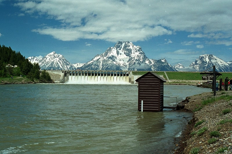
Dam in Teton County, Wyoming. Jackson Lake Dam is a concrete and earth-fill dam in the western United States, at the outlet of Jackson Lake in northwestern Wyoming. The lake and dam are situated within Grand Teton National Park in Teton County. The Snake River emerges from the dam and flows about eight hundred miles through Wyoming, Idaho, Oregon, and Washington to its mouth on the Columbia River in eastern Washington.
The chief purpose of the dam is to provide water storage for irrigation in the Snake River basin in the state of Idaho as part of the Minidoka Project. Jackson Lake is a natural lake, but its depth was increased by the dam to provide water storage.[34]
Waterfalls Canyon
Waterfalls Canyon is located in Grand Teton National Park, in the U. S. state of Wyoming. The canyon was formed by glaciers which retreated at the end of the last glacial maximum approximately 15,000 years ago, leaving behind a U-shaped valley. Waterfalls Canyon is south of Ranger Peak and north of Eagles Rest Peak and the entrance to the canyon is along the western shore of Jackson Lake, directly across the lake from the Colter Bay Village. There are several cascades in the canyon, including Wilderness Falls and Columbine Cascade, which descend from an unnamed lake below Ranger Peak.[35]