Discover 11 hidden attractions, cool sights, and unusual things to do in Bridger–Teton National Forest (United States). Don't miss out on these must-see attractions: Lower Slide Lake, Wyoming Peak, and Snake River Canyon. Also, be sure to include Jackson Hole Aerial Tram in your itinerary.
Below, you can find the list of the most amazing places you should visit in Bridger–Teton National Forest (Wyoming).
Table of Contents
Lower Slide Lake
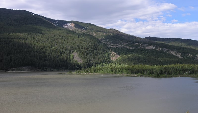
Lake in Wyoming. Lower Slide Lake is located in Bridger-Teton National Forest, in the U.S. state of Wyoming. The natural lake was created on June 23, 1925, when the Gros Ventre landslide dammed the Gros Ventre River. The lake was once much larger, however part of the rock dam failed less than two years later, on May 18, 1927, causing deadly flooding downstream. The lake waters have natural and stocked fish including lake and Snake River fine-spotted cutthroat trout, and mountain whitefish.[1]
Wyoming Peak
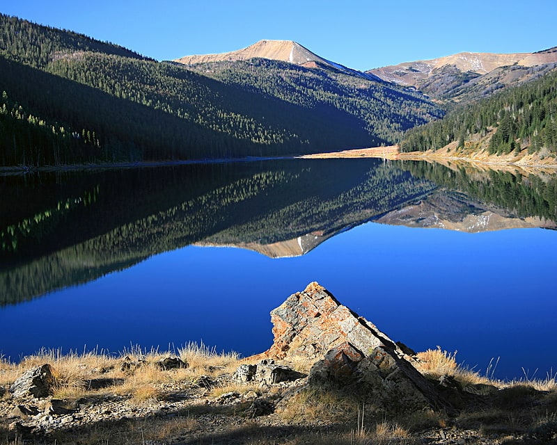
Mountain in Wyoming. Wyoming Peak is the tallest mountain in the Wyoming Range in the U.S. state of Wyoming. Situated in Bridger-Teton National Forest, a now collapsed fire lookout is located on the summit. Wyoming Peak is.75 miles south-southeast of Coffin Peak, the second highest peak in the Wyoming Range.[2]
Snake River Canyon
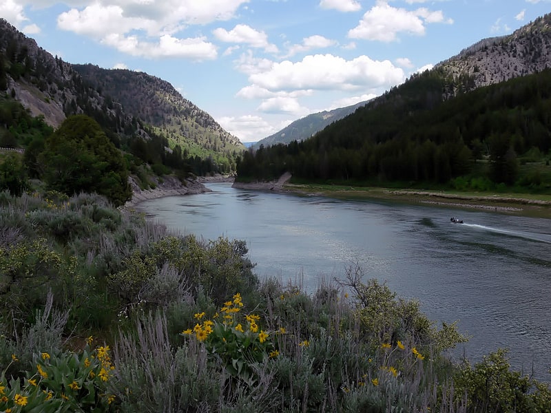
The Snake River Canyon is formed by the Snake River in western Wyoming, United States, south of Jackson Hole.
At the southern end of this canyon is the town of Alpine, Wyoming where the Snake River meets the Greys River and the Salt River at Palisades Reservoir on the Wyoming-Idaho border. It is a popular destination for rafting trips and is known for having some of the best white-water rafting in the United States. Running through the canyon is US 89.[3]
Jackson Hole Aerial Tram
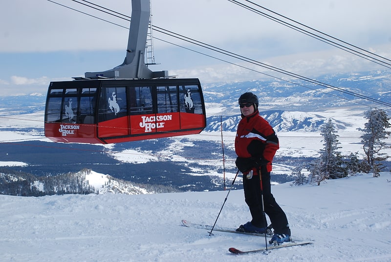
The Jackson Hole Aerial Tram is an aerial tramway located at Jackson Hole Mountain Resort in Jackson Hole, Wyoming, and has become an iconic symbol of the Valley. The tram takes people to the top of Rendezvous Mountain, at a summit of 3,185 meters. The first tram started operation on July 31, 1966, while the second tram started operation on December 20, 2008. The current tram holds 100 skiers and 1 operator in the winter. At 4,000 feet in elevation gain, it is the longest ski lift in North America. The original tram carried 62 skiers and 1 conductor, and took 10.5 minutes[4]
Rendezvous Peak
Peak in Wyoming. Rendezvous Peak is in the Teton Range in the U.S. state of Wyoming. Situated just south of Grand Teton National Park and within Bridger-Teton National Forest, Rendezvous Peak is the highest point on Rendezvous Mountain.[5]
Church of St. Hubert the Hunter and Library
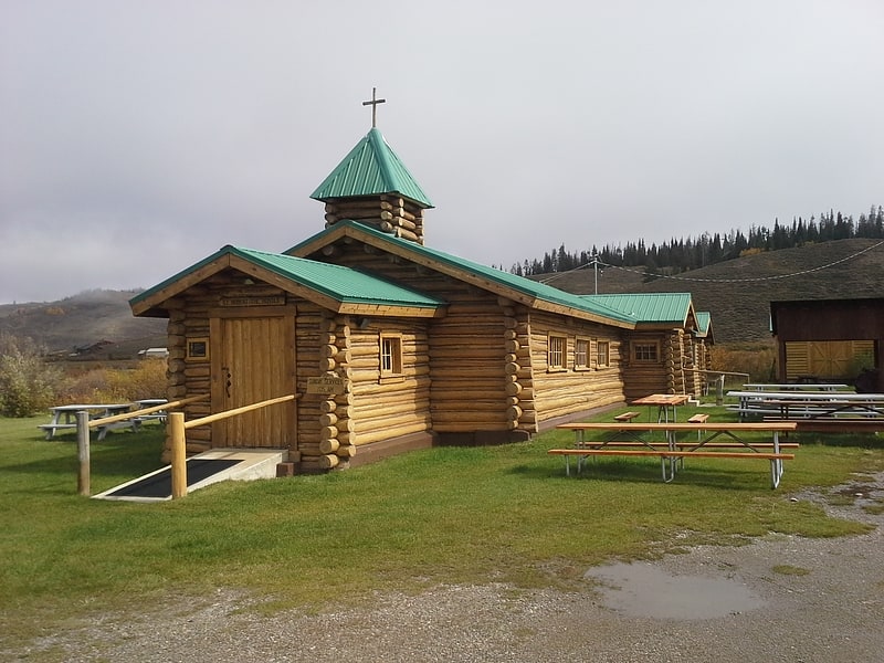
The Church of St. Hubert the Hunter and its associated library, also known as the Bondurant Protestant Episcopal Church were built in Bondurant, Wyoming, the church in 1940-41 and the library in 1943. The church was financed by the sale of a diamond bequeathed to the Episcopal Church by Mrs. John Markoe, which was to be sold to finance a memorial church. According to some versions, the church was to be built in the most remote part of the United States. Wyoming Bishop Winfred H. Zeigler suggested Bondurant, where he had been forced to take shelter from a blizzard while traveling in 1937. The diamond was sold for $1400, and Zeigler returned to Bondurant to organize the construction of the church by local volunteers.
The rustic log church and library function as a community center for Bondurant. The church is operated by St. John's Episcopal Church in Jackson.[6]
Atlantic Peak
Peak in Wyoming. Atlantic Peak is located in the southern Wind River Range in the U.S. state of Wyoming. Atlantic Peak sits along the Continental Divide, less than 1 mi southeast of West Atlantic Peak.[7]
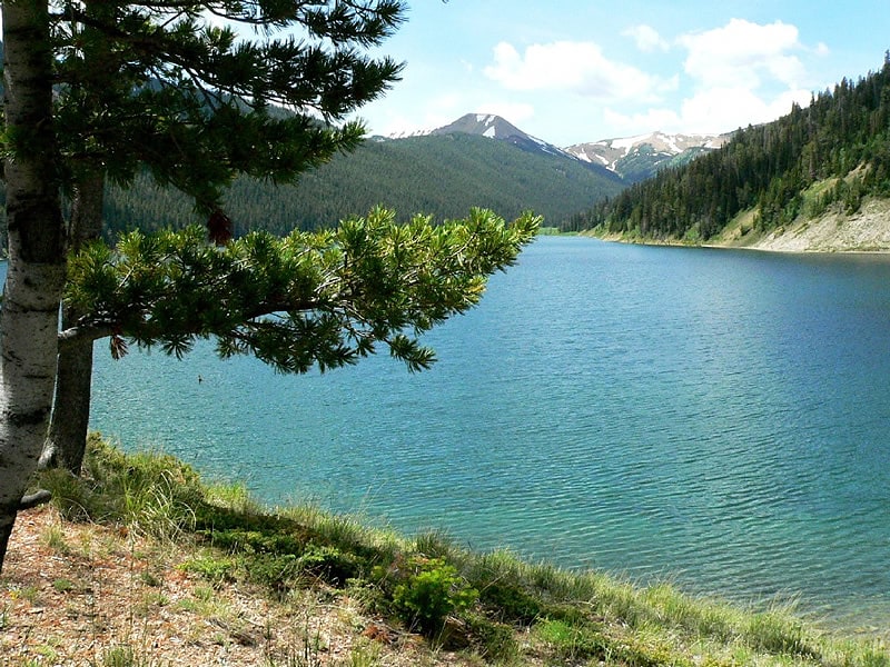
Lake Alice
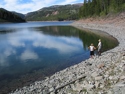
Lake in Wyoming. The 3 miles long, 7,745 feet elevation, 230-acre, and 200 feet max depth Lake Alice is the largest natural lake found in the western portion of the Bridger-Teton National Forest in the state of Wyoming. It is a unique lake that was created thousands of years ago when a massive landslide peeled from the 9,325-foot Lake Mountain and dammed Poker Creek with debris. The lake's outlet flows below the surface through the natural dam and emerges from the mountain as a creek 1 mile away. The mountainside scar from the landslide is still visible today. Lake Alice is the home of the only known pure lake strain of naturally reproducing Bonneville cutthroat trout caused by the isolation of the landslide preventing outside genetic influence. At one time the subspecies was thought to be extinct in Wyoming.
The nearest city is Cokeville, Wyoming about 34 miles (55 km) to the southwest. Access to the lake requires traversing a winding 28-mile (45 km) dirt mountain road, and fording a creek with water as deep as 18 inches (0.5 m) in the spring time. A high clearance vehicle is recommended. The road ends at Hobble Creek campground and from there a 1.5-mile (2.4 km) hike up a moderately steep mountain trail is required to reach Lake Alice. Nine primitive tent campsites are available though camping is not restricted to a campsite.
Multiple drownings have occurred at the lake which is named after a young girl who drowned in the early 1900s. The most recent drowning occurred on August 12, 2019. Schuyler McKnight, 22, drowned while canoeing at the lake. His body was recovered 41 days later.[8]
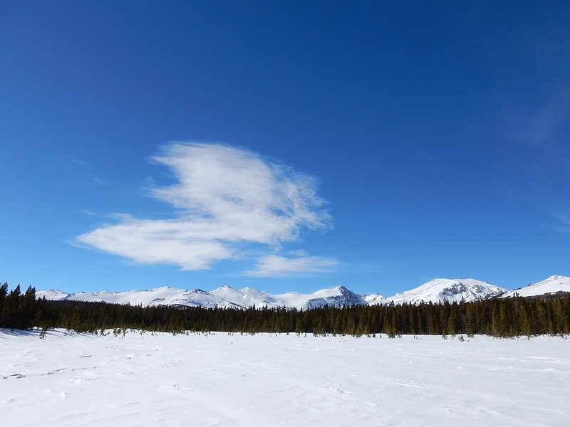
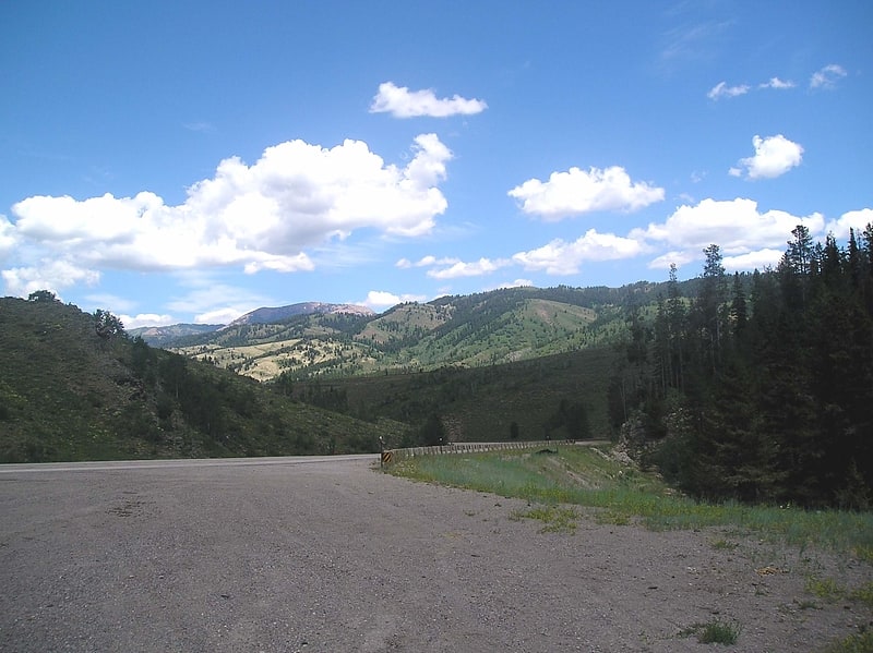
Union Pass
Mountain pass in Wyoming. Union Pass is a high mountain pass in the Wind River Range in Fremont County of western Wyoming in the United States. The pass is located on the Continental Divide between the Gros Ventre mountains on the west and the Wind River Range on the east. A triple divide exists nearby, where water may flow to the Mississippi River, Columbia River, or Colorado River. The pass was historically used by Native Americans and early mountain men including the Astor Expedition in 1811 on its way west. On the return trip, fearing hostile Indian activity near Union Pass, the Astorians chose a southern route and discovered South Pass.
The pass was named by U.S. Army Captain William F. Raynolds in 1860. Raynolds was in charge of the Raynolds Expedition which was exploring the Yellowstone region immediately prior to the Civil War. After mountain man and guide Jim Bridger led the expedition over the pass, Raynolds gave the pass its current name.[9]
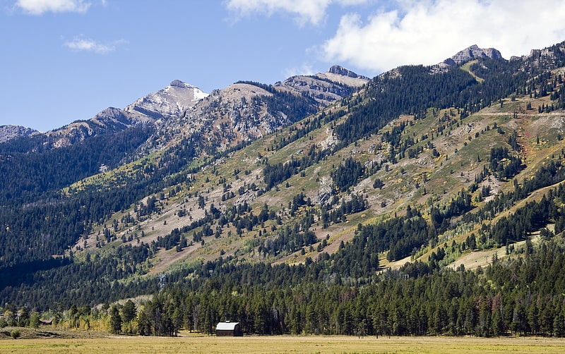
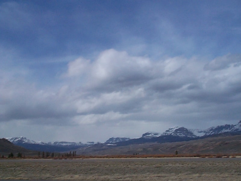
Wyoming Range
Mountain range in Wyoming. The Wyoming Range is a mountain range located in western Wyoming. It is a range of the Rocky Mountains that runs north-south near the western edge of the state. Its highest peak is Wyoming Peak, which stands at 11,383 feet above sea-level. The range is sometimes referred to as The Wyomings.
The vast majority of the range is public land administered by the U.S. Forest Service as part of the Bridger-Teton National Forest and is a popular destination for hiking, camping, fishing, horseback riding, snowmobiling, hunting, and other activities. The range contains numerous lakes and developed campgrounds, in addition to many wild and primitive areas. The closest towns to the range include Big Piney, Marbleton, La Barge, and Kemmerer.
A branch of the Oregon Trail known as the Lander Road traverses the mountain range. The cutoff offered emigrants a shorter travel option. Numerous grave sites and historical markers can be found relating to the trail.
The range is not to be confused with the Salt River Range, which runs closely parallel to the Wyoming Range on its western side. The two ranges are separated by Greys River that flows north through the Star Valley into the Snake River.
The United States House of Representatives voted March 25, 2009, to grant wilderness status to two million acres (8,000 km²) of public land in nine states. The Omnibus Public Land Management Act, which had already been passed by the Senate, was approved in the House by a 285-to-140 vote. It was signed into law March 30 by President Barack Obama. The legislation included the Wyoming Range Legacy Act, which shields 1,200,000 acres (4,900 km2) of the Wyoming Range from future oil and gas leasing. Leases that were issued in the 1,200,000 acres (4,900 km2) withdrawal area prior to passage of the Omnibus Public Land Management Act were not affected by the legislation.[10]
Salt River Range
Mountain range in Wyoming. The Salt River Range is a mountain range in western Wyoming. The 56 mile long range forms the eastern boundary of Star Valley as well as the western boundary of the Greys River valley. The highest point is Mount Fitzpatrick at 10,907 feet.[11]