Discover 11 hidden attractions, cool sights, and unusual things to do in Santiago (Cape Verde). Don't miss out on these must-see attractions: Serra da Malagueta, Jardim Botanico, and Ponta Preta Lighthouse. Also, be sure to include Monte Graciosa in your itinerary.
Below, you can find the list of the most amazing places you should visit in Santiago (São Salvador do Mundo).
Table of Contents
Serra da Malagueta
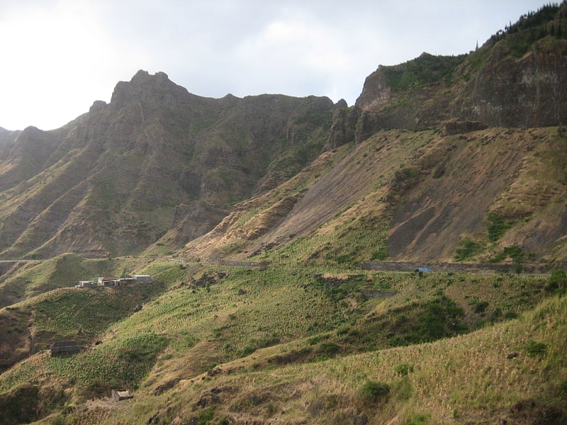
Mountain range in Cape Verde. Serra Malagueta is a mountain range located in the northern part of the island of Santiago, Cape Verde. At 1064 m elevation, it is highest point of northern Santiago. The mountain range is protected as the Serra Malagueta Natural Park, that was established on February 24, 2005 and covers 774 hectares. The natural park is situated in the municipalities Tarrafal, São Miguel and Santa Catarina. The summit is in São Miguel, south of the Ribeira Principal valley. The Serra Malagueta formation is of volcanic origin, and was formed between 2.9 and 2.4 million years ago.[1]
Jardim Botanico
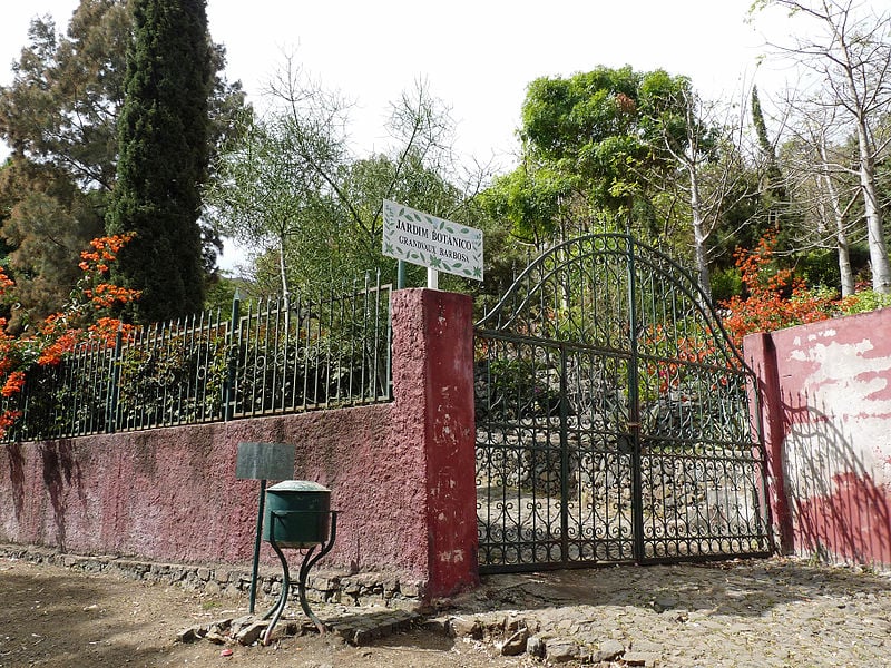
Hotel in São Jorge dos Órgãos, Cape Verde. The Jardim Botânico Nacional Grandvaux Barbosa is the only botanical garden in Cape Verde. The garden is located in São Jorge, in the middle of the island Santiago. Its collection focuses on endemic and native plants of Cape Verde.
The garden was created in 1986 and was named after the Franco-Portuguese botanist Luís Augusto Grandvaux Barbosa (1914-1983). It is located 400 m above sea level and covers 20,000 m2. It is part of the School of Agricultural and Environmental Sciences (the former "INIDA", National Institute of Agrarian Studies and Development), part of the University of Cape Verde.
Endemic and native plants in the garden include Phoenix atlantica, Euphorbia tuckeyana, Echium hypertropicum, Echium stenosiphon, Artemisia gorgonum, Micromeria forbesii, Aeonium gorgoneum and Campanula jacobaea.[2]
Ponta Preta Lighthouse
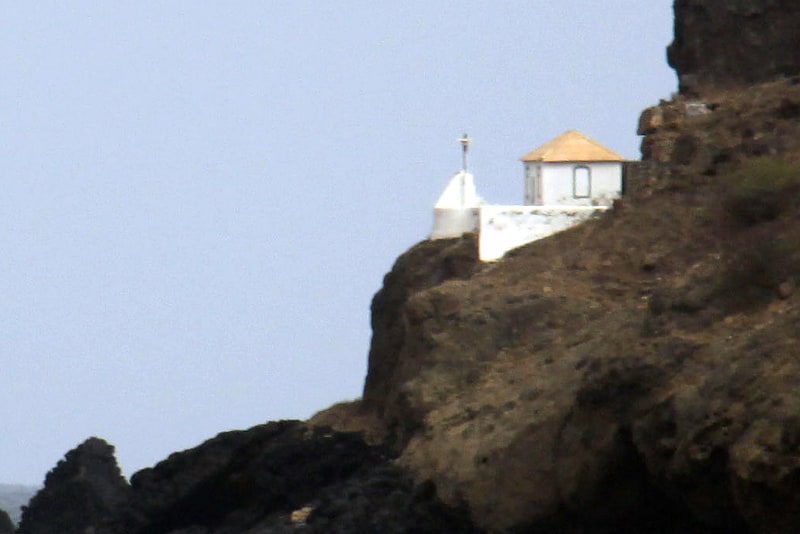
Also known as: Farol da Ponta Preta
Farol da Ponta Preta is a lighthouse in the northwesternmost part of the island of Santiago, Cape Verde. It stands on the headland Ponta Preta, 3 km northwest of the city Tarrafal. The lighthouse was constructed in 1889. Its lantern stands on a white column with a pyramidal base, in front of a small one storey building. The lighthouse was depicted on a Cape Verdean stamp in 2004.[3]
Monte Graciosa
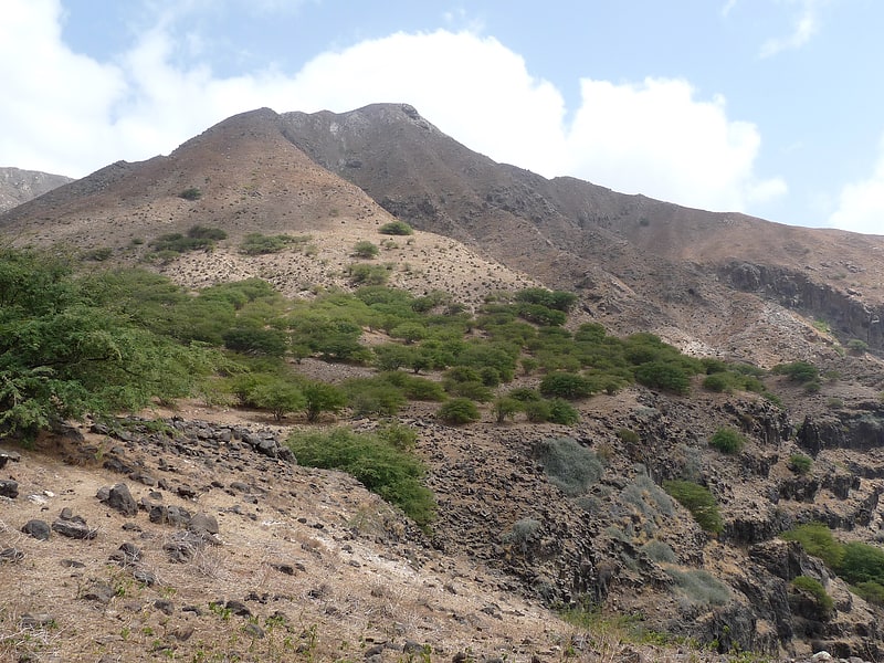
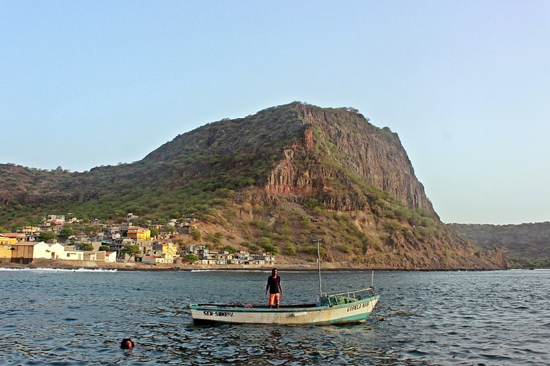
Mountain in Cape Verde. Monte Graciosa is a mountain in the northern part of the island of Santiago in Cape Verde. It lies 2.5 km north of the town of Tarrafal, overlooking the Baía de Tarrafal. Its elevation is 643 m. Towards the west it ends in the headland of Ponta Preta. It is part of a larger proposed natural park. The mountain is of volcanic origin, composed of phonolite and rich in feldspar and olivine.
Several endemic plants grow on the mountain, notably Campylanthus glaber ssp. glaber, Euphorbia tuckeyana, Kickxia webbiana (agrião de rocha), Kickxia dichondrifolia, Nauplius daltonii ssp. daltonii, Paronychia illecebroides, Sarcostemma daltonii and Macaronesian ironwood (Sideroxylon marginatum).[4]
Barragem de Poilão
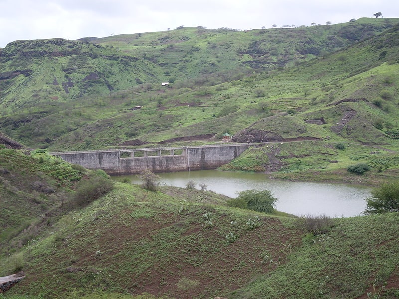
Also known as: Barragem do Poilão
Barragem de Poilão is a dam located in the eastern part of the island of Santiago, Cape Verde, in the municipality of São Lourenço dos Órgãos. It impounds the stream Ribeira Seca, the island's largest river. the reservoir, used for irrigation, stretches between the villages Poilão and Levada. North of the reservoir is the national road from João Teves to Achada Fazenda.[5]
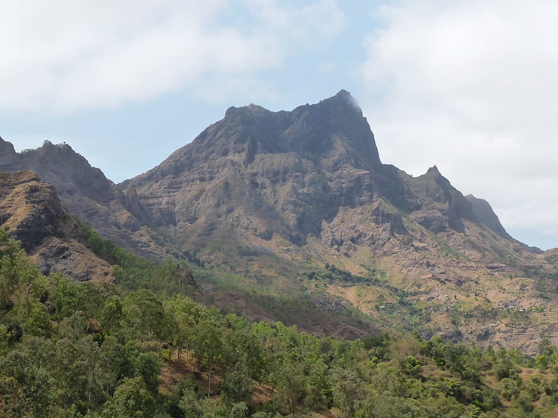
Pico da Antónia
Santiago's tallest mountain. Pico de Antónia is a mountain located in the central part of the island of Santiago in Cape Verde. At 1,392 m, it is the highest point of the island. The mountain is part of the protected area Parque Natural da Serra do Pico de Antónia. The towns Picos and Assomada lie close to the mountain. The Serra do Pico da Antónia has been identified by BirdLife International as an Important Bird Area.
The mountain is at the tripoint of the municipalities of São Salvador do Mundo, São Lourenço dos Órgãos and Ribeira Grande de Santiago. North of the summit is the source of the Ribeira de Pico da Antónia, a source river of the Ribeira Seca.
The Pico da Antónia formation is of volcanic origin, and was formed between 3.3 and 2.3 million years ago during the Piacenzian and the Gelasian periods.[6]
Museu da Tabanka
Also known as: Museu da Tabanca
Museum in Cape Verde. The Museu da Tabanca is a museum in the town Chã de Tanque in the western part of the island of Santiago in Cape Verde. It is dedicated to local culture, including tabanka music. The museum was first opened in 2000 in Assomada, the seat of the municipality of Santa Catarina, but in December 2008 it was moved to its current location in Chã de Tanque, also part of Santa Catarina. After two years of renovation, it was reopened in November 2017.[7]
Serra do Pico da Antónia Important Bird Area
The Serra do Pico de Antónia is a mountain range in the centre of the island of Santiago in the Cape Verde archipelago. It contains the Pico de Antónia, at 1,392 m the highest point of the island. It is protected as a natural park, covering 28.73 km2. The natural park covers the connected mountain ranges of Serra do Pico de Antónia and of Rui Vaz.[8]
Igreja da Ribeira da Barca
Also known as: Ribeira da Barca
Town in Santiago, Cape Verde. Ribeira da Barca is a town in the municipality of Santa Catarina, on the island of Santiago, Cape Verde. In 2010 its population was 2,317. It is situated on the west coast, at the mouth of the stream Ribeira da Barca, 11 km northwest of Assomada. The settlement was mentioned as "Rivera das Baras" in the 1747 map by Jacques-Nicolas Bellin.[9]
Serra da Malagueta

Municipality. Serra Malagueta is a settlement in the northwestcentral part of the island of Santiago, Cape Verde. It is part of the municipality of Santa Catarina. It is situated on the main road between Assomada and Tarrafal, 1 km south of Curral Velho, 3 km north of Fundura and 11 km north of Assomada. In 2010 its population was 572. The main village, Locotano, sits at about 800 m elevation, northwest of the summit of Serra Malagueta, and lies partly in the Serra Malagueta Natural Park.[10]
Fort Real de São Filipe
Also known as: Forte Real de São Filipe
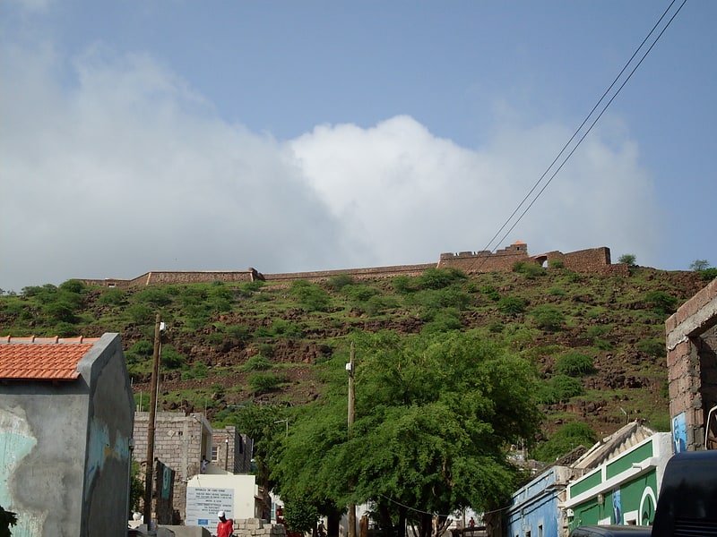
Fortress in Cidade Velha, Cape Verde. Forte Real de São Filipe is a 16th century fortress in the city of Cidade Velha in the south of the island of Santiago, Cape Verde. It is located on a plateau above the town centre, 120 meters above sea level. The historic centre of Cidade Velha is an UNESCO World Heritage Site since June 2009. The fort was part of a system of defence for the city, which also included six smaller forts on the coast and a wall along the port.[11]