Discover 9 hidden attractions, cool sights, and unusual things to do in Sal (Cape Verde). Don't miss out on these must-see attractions: Monte Curral, Baía da Parda, and Rabo de Junco. Also, be sure to include Ponta do Norte Lighthouse in your itinerary.
Below, you can find the list of the most amazing places you should visit in Sal (Sal).
Table of Contents
Monte Curral
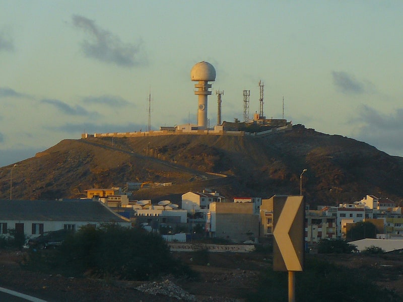
Hill in Cape Verde. Monte Curral is a hill in the city of Espargos, on the island of Sal, Cape Verde. Its elevation is 109 meters. On the summit there is an air control tower for the nearby Amílcar Cabral International Airport, as well as several telecommunication masts.[1]
Address: Strasse neben Igreja Catolica hinauf, Sal
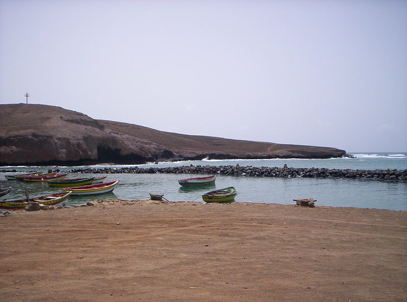
Baía da Parda
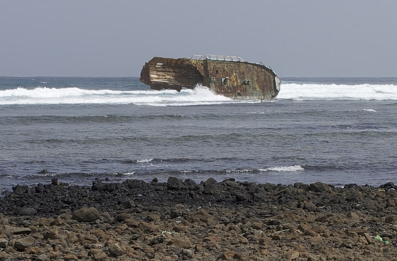
Baía da Parda is a small bay on the east coast of the island of Sal, Cape Verde. It lies about 3 km south of Pedra de Lume, and 5 km southeast of the island capital Espargos. It is known for its reefs, which are frequented by sharks.[2]
Rabo de Junco
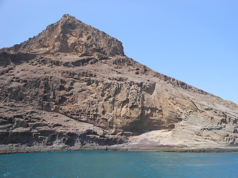
Rabo de Junco is a hill on the west coast of the island of Sal in Cape Verde. It is situated at the northern end of the Baía da Murdeira, 8 kilometres southwest of the island capital Espargos. Its steep eroded south face towards the bay is an important nesting area for birds. Rabo de Junco and the surrounding 154 hectares are protected as a nature reserve. It was mentioned as Rabadyunk in the 1747 map by Jacques-Nicolas Bellin. To its west lies the uninhabited islet Ilhéu Rabo de Junco.[3]
Ponta do Norte Lighthouse
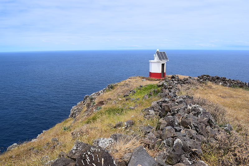
Also known as: Farol da Ponta Norte
Farol de Ponta Norte is a lighthouse in the northernmost point of the island of Sal, Cape Verde. It is located near the headland Ponta Norte. The original lighthouse was a 13 metres high cast iron tower, constructed in 1897. This was replaced with a masonry tower around 1940, which is now in ruins. The current light is on a 5 metres metal tower.[4]
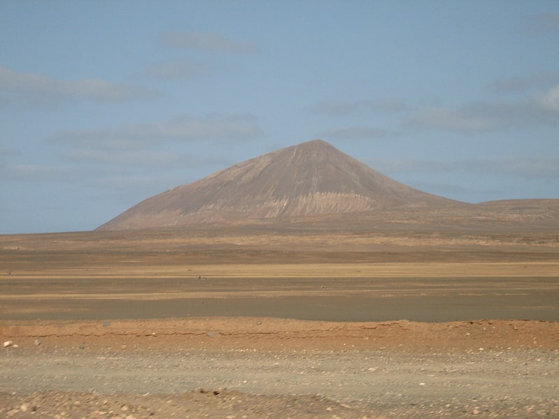
Cagarral
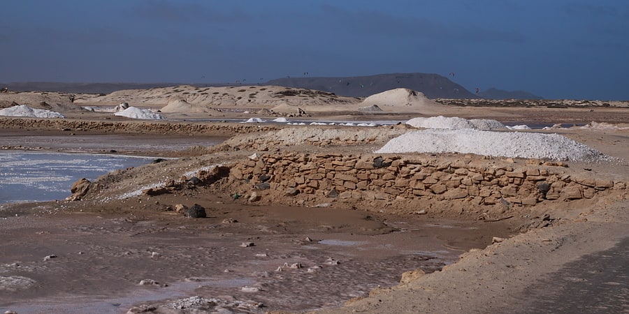
Mountain. Cagarral is a mountain in the northeastern part of the island of Sal in Cape Verde. It is located near the east coast, 2 km northeast of Pedra de Lume and 6 km east of the island capital Espargos. To its east is the headland Ponta Trás de Cagarral. Together with the mountain and the saltpans to the west, it is a protected area as a protected landscape.[5]
Ponta do Sinó Lighthouse
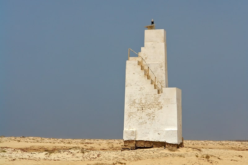
Also known as: Farol da Ponta do Sinó
Lighthouse. Farol da Ponta do Sinó is a lighthouse near Ponta do Sinó, the southernmost point of the island of Sal, Cape Verde. It is around 2 km southwest of the center of Santa Maria. The tower is quadrangular and is 9 meters tall and is made out of concrete, it has an outer staircase and features a lantern. All of the exterior are painted in white. The lighthouse was built in 1892. In early 2013, a second building with the same style was constructed and was finished before 2014 and became activated as the lighthouse moved to its new location.[6]
Monte Grande
Highest peak on the island of Sal. Monte Grande is a mountain in the northern part of the island of Sal in Cape Verde. It is situated 8 km northeast of the island capital Espargos. At 406 m elevation, it is the highest point of the island. It is a protected landscape because of its geological value; the protected area covers 1,309 ha. There are pillow lava formations on the coast.[7]
Pedra de Lume Lighthouse
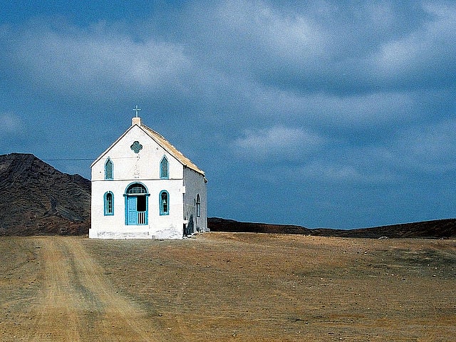
Also known as: Farol de Pedra de Lume
Historical landmark in Pedra de Lume, Cape Verde. Farol de Pedra de Lume is a lighthouse in the eastern point of the island of Sal in northeastern Cape Verde at the small port of Pedra de Lume and 5 km east of the city of Espargos. The chapel was completed in 1853, the lighthouse was completed in 1855.[8]
Serra Negra
Hill in Cape Verde. Serra Negra is a hill in the southeastern part of the island of Sal in Cape Verde. Its maximum elevation is 104 m, the highest point in southern Sal. It stretches for about 2.5 km along the east coast of the island, between the headland Ponta da Fragata in the south and the Ponta do Morrinho Vermelho in the north. The nearest settlement is Murdeira, to the west. The mountain forms part of a protected area as a nature reserve, important as nesting area for seabirds and turtles. The nature reserve covers 3.31 km2 of land and 22.96 km2 of ocean.[9]