Discover 4 hidden attractions, cool sights, and unusual things to do in Chã das Caldeiras (Cape Verde). Don't miss out on these must-see attractions: Pico do Fogo, Bordeira, and Fogo Volcanic Important Bird Area. Also, be sure to include Monte Velha in your itinerary.
Below, you can find the list of the most amazing places you should visit in Chã das Caldeiras (São Filipe).
Table of Contents
Pico do Fogo
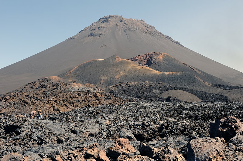
Peak in Cape Verde. Pico do Fogo pronounced is the highest peak of Cape Verde and West Africa, rising to 2,829 metres above sea level. It is an active stratovolcano lying on the island of Fogo. The main cone last erupted in 1680, causing mass emigration from the island. A subsidiary vent erupted in 1995. The only deadly eruption was in 1847 when earthquakes killed several people.
Fogo (the word means "fire" in Portuguese) is a hotspot volcanic island. Its most recent eruptions occurred in 1951, 1995 and 2014. It is the youngest and most active volcano in the Cape Verde Islands, a short chain of volcanic islands that generally are younger at the western end, formed as the African Plate moved towards the east over the hotspot.
Fogo consists of a single volcano, so the island is nearly round and about 25 kilometers (16 mi) in diameter. The large summit caldera (about 10 kilometers in the north–south direction and 7 kilometers in the east–west direction) is not located in the center of the island, but rather towards its northeastern corner. The caldera is bounded by steep near-vertical fault scarps on the north, west, and south sides but is breached to the east where lava can flow to the coast. North-northeast-trending eruptive fissures opened along the western flank of Pico, which formed inside the caldera between about 1500 and 1760. The last eruption from the top was in 1769. The current topography of Fogo, with the caldera open to the sea on the east side, results from the sliding of the east flank of the volcano towards the ocean.
The mountain's slopes are used to grow coffee, while its lava is used as building material. Near its peak is a caldera and a small village, Chã das Caldeiras, is inside this caldera. The crater rim, which reaches 2,700 m elevation, is known as Bordeira.[1]
Bordeira
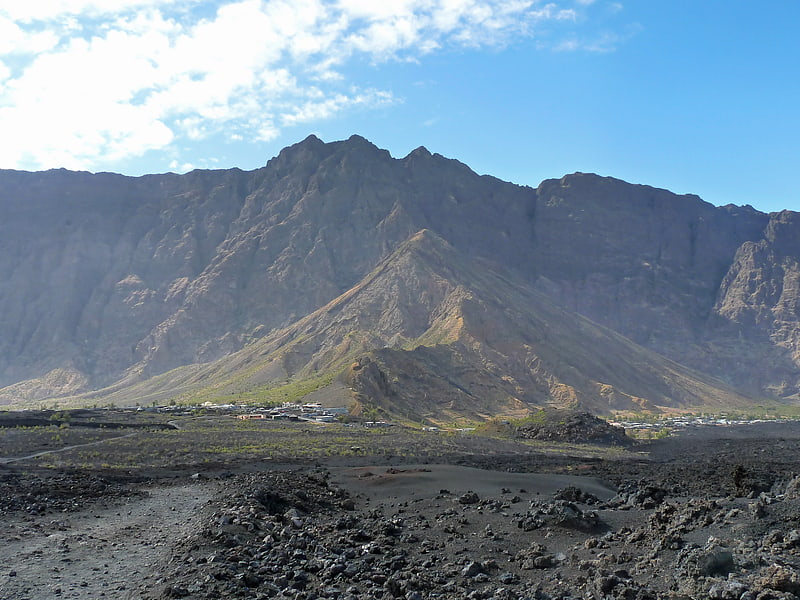
Mountain. Bordeira is a semicircular mountain in the middle of the island Fogo. It is a crater rim, up to 1 km high, formed by a prehistoric collapse of the volcano Pico do Fogo. At a maximum elevation of 2,692 metres, it is the second highest point in the nation behind Pico do Fogo. The name literally means the "border". It forms part of Fogo Natural Park. Opening to the east, it effectively protects the northern, western and southern part of the island against lava flows from the volcano. The settlement Chã das Caldeiras lies at the foot of Bordeira, in the caldera. The east side of the Bordeira cliff is much steeper than the west side.[2]
Fogo Volcanic Important Bird Area
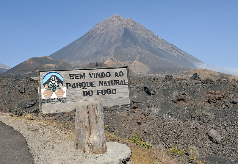
National park in Cape Verde. Fogo Natural Park, on the island of Fogo, is one of ten "natural parks" in the country of Cape Verde. The protected area is 84.69 km2, which is 17.8% of the total area of the island. 50% of the park lies within the municipality Santa Catarina do Fogo, 28% in municipality of Mosteiros and 22% in São Filipe. The natural park is situated in the interior of the island, and covers the volcano Pico do Fogo, its crater and crater rim and the forest of Monte Velha. The volcano is active; the most recent eruption was in 2014-15.[3]
Monte Velha
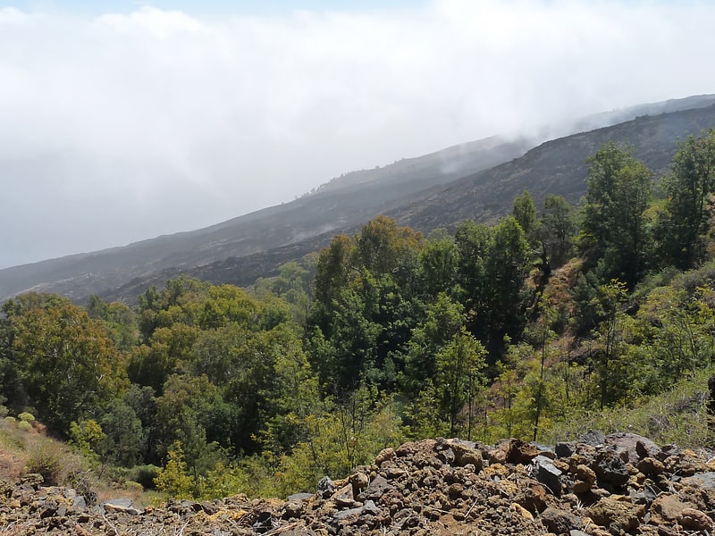
Peak in Cape Verde. Monte Velha is a peak in the northeastern part of the island of Fogo in Cape Verde. Its elevation is 1,482 m. It is a subpeak of the Pico do Fogo volcano, located at the northeastern end of the crater rim. It lies within the municipality of Mosteiros, 4 km southwest of the city centre. Its forest is a protected area, part of the larger Fogo Natural Park.
Due to the exposure of northeast winds, Monte Velha is the most humid part of the island. The annual precipitation shows much variation: in the period 1990-2000 it ranged between 214 and 1,481 mm.[4]