Discover 6 hidden attractions, cool sights, and unusual things to do in Mount Adams Wilderness (United States). Don't miss out on these must-see attractions: Mount Adams, Adams Glacier, and Avalanche Glacier. Also, be sure to include Lyman Glacier in your itinerary.
Below, you can find the list of the most amazing places you should visit in Mount Adams Wilderness (Washington).
Table of Contents
Mount Adams
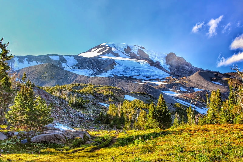
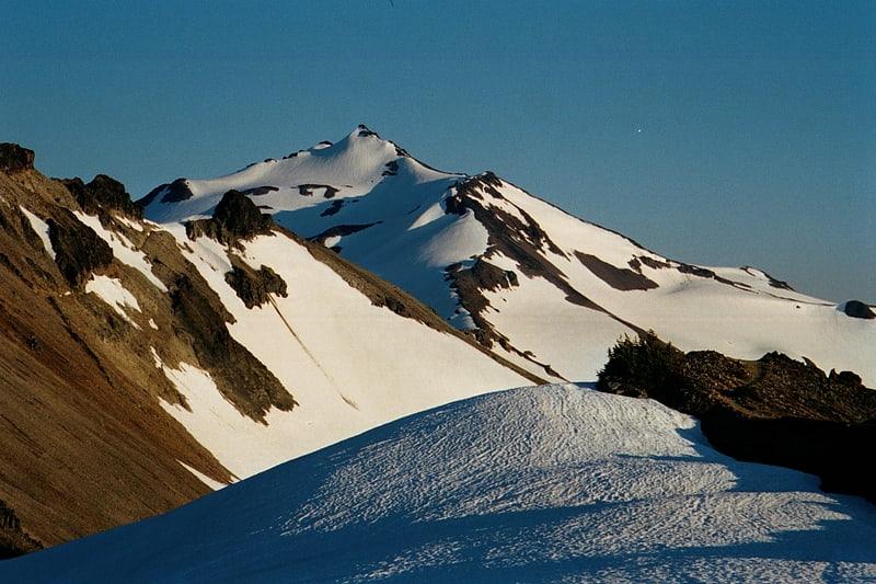
Mountain in Washington State. Mount Adams, known by some Native American tribes as Pahto or Klickitat, is a potentially active stratovolcano in the Cascade Range. Although Adams has not erupted in more than 1,000 years, it is not considered extinct. It is the second-highest mountain in Washington, after Mount Rainier.
Adams, named for President John Adams, is a member of the Cascade Volcanic Arc, and is one of the arc's largest volcanoes, located in a remote wilderness approximately 34 miles (55 km) east of Mount St. Helens. The Mount Adams Wilderness consists of the upper and western part of the volcano's cone. The eastern side of the mountain is designated as part of the territory of the Yakama Nation.
Adams' asymmetrical and broad body rises 1.5 miles (2.4 km) above the Cascade crest. Its nearly flat summit was formed as a result of cone-building eruptions from separated vents. The Pacific Crest Trail traverses the western flank of the mountain.[1]
Adams Glacier
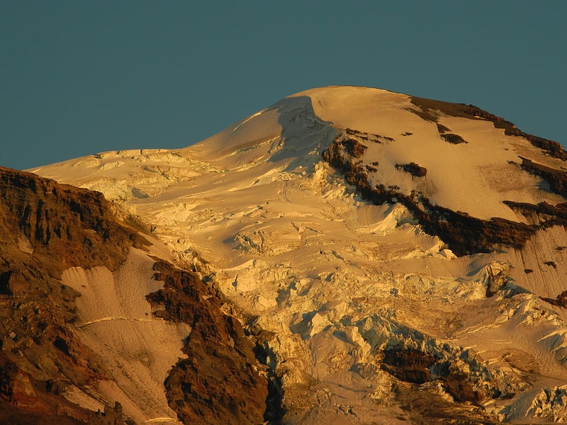
Glacier in Washington State. Adams Glacier is situated on the northwest flank of Mount Adams, a 12,281-foot stratovolcano in the U.S. state of Washington. Much of it becomes the source of Adams Creek, a tributary of the Cispus River. It is the largest glacier on Mount Adams. It flows down from the summit ice cap at over 12,000 feet for over 2.5 miles to a terminus near 7,000 feet.
Between 11,800 and 9,200 feet (3,600 and 2,800 m), the glacier flows through a steep icefall that provides challenging climbing through a maze of seracs. The first ascent of the glacier was by Fred Beckey, Dave Lind, and Robert Mulhall in July 1945.
Below 8,400 feet (2,600 m), the glacier spreads into a broad sheet with five separate tongues of ice extending out to termini between large moraines. On its easternmost tongue, it ends at a glacial tarn, or small ice-choked lake above High Camp.
In 1904, the area was approximately 6.93 km2 and in 2021 the area was 2.2 km2 representing an area loss of 68%.
In 1901, when Mount Adams was being mapped and its glaciers named by Harry Fielding Reid, Reid's companion and guide, Claude Ewing Rusk, wanted to name the glacier Reid Glacier in honor of Reid; however, Reid insisted that it should be named something else because he thought it improper to place his own name on the map that he was making and the Mazamas were trying to name a glacier on Mount Hood after him. This eventually persuaded Rusk and he conceded to name the glacier Adams Glacier.[2]
Avalanche Glacier
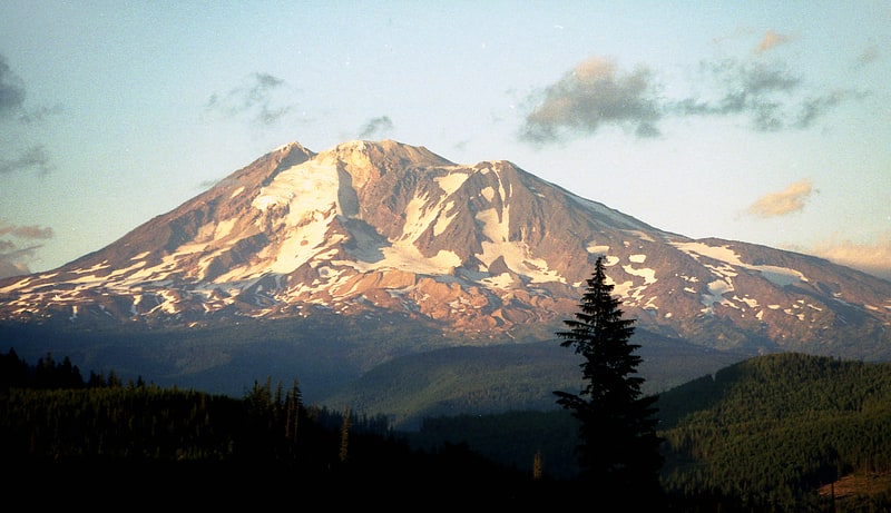
Avalanche Glacier is located on the west to southwest slopes of Mount Adams a stratovolcano in the Gifford Pinchot National Forest in the U.S. state of Washington. The glacier descends from the White Salmon Glacier at 10,200 ft to a terminus near 7,600 ft. Avalanche Glacier has been in a general state of retreat for over 100 years and lost 59 percent of its surface area between 1904 and 2006.[3]
Lyman Glacier
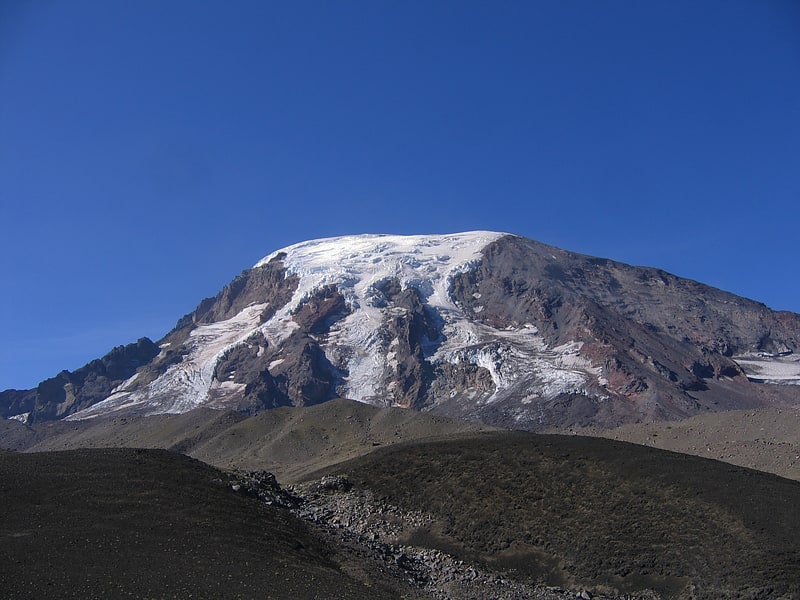
Glacier in Washington State. Lyman Glacier is located on the north slopes of Mount Adams a stratovolcano in Gifford Pinchot National Forest in the U.S. state of Washington. The glacier is also within the Yakama Indian Reservation and descends from near the summit of Mount Adams at approximately 11,400 ft to a terminus near 7,800 ft. Below 9,000 ft the glacier splits into three distinct lobes. Lyman Glacier has been in a general state of retreat for over 100 years and lost 34 percent of its surface area between 1904 and 2006.
Lyman Glacier was named after William Denison Lyman by Claude Ewing Rusk because Lyman was one of the first to describe some of Mount Adams' features and history.[4]
Pinnacle Glacier

Glacier in Washington State. Pinnacle Glacier is located on the west slopes of Mount Adams a stratovolcano in Gifford Pinchot National Forest in the U.S. state of Washington. The glacier descends from approximately 10,000 ft to a terminus near 7,200 ft. Pinnacle Glacier lost 7 percent of its surface area between 1904 and 2006.
Pinnacle Glacier was named by Harry Fielding Reid during his survey of Mount Adams' glaciers with C. E. Rusk in 1901.[5]
Gifford Pinchot National Forest
National park in Lewis County, Washington. Gifford Pinchot National Forest is a National Forest located in southern Washington, USA, managed by the United States Forest Service. With an area of 1.32 million acres, it extends 116 km along the western slopes of Cascade Range from Mount Rainier National Park to the Columbia River. The forest straddles the crest of the South Cascades of Washington State, spread out over broad, old growth forests, high mountain meadows, several glaciers, and numerous volcanic peaks. The forest's highest point is at 12,276 ft. at the top of Mount Adams, the second tallest volcano in the state after Rainier. Often found abbreviated GPNF on maps and in texts, it includes the 110,000-acre Mount St. Helens National Volcanic Monument, established by Congress in 1982.[6]