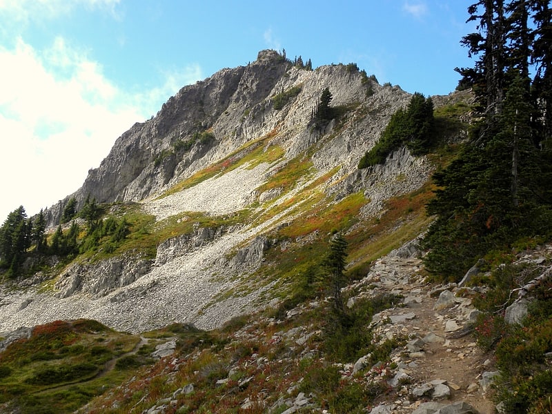
Discover 35 hidden attractions, cool sights, and unusual things to do in Mount Rainier National Park (United States). Don't miss out on these must-see attractions: Mount Rainier, Spray Falls, and Narada Falls. Also, be sure to include Christine Falls in your itinerary.
Below, you can find the list of the most amazing places you should visit in Mount Rainier National Park (Washington).
Table of Contents
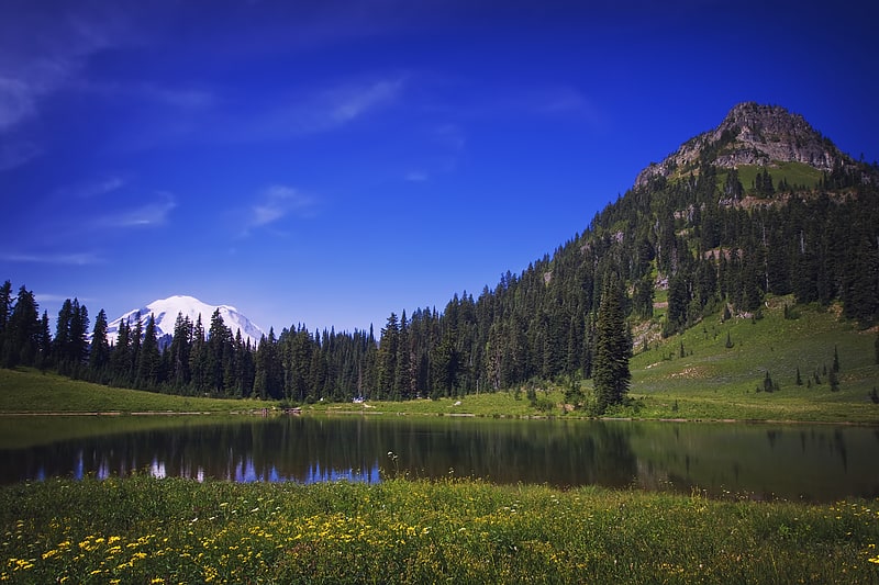
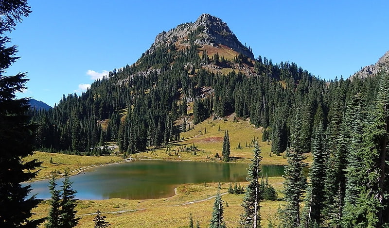
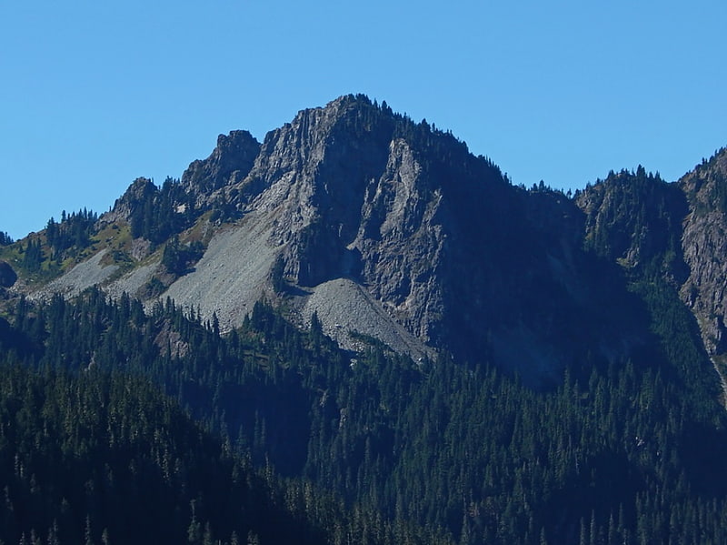
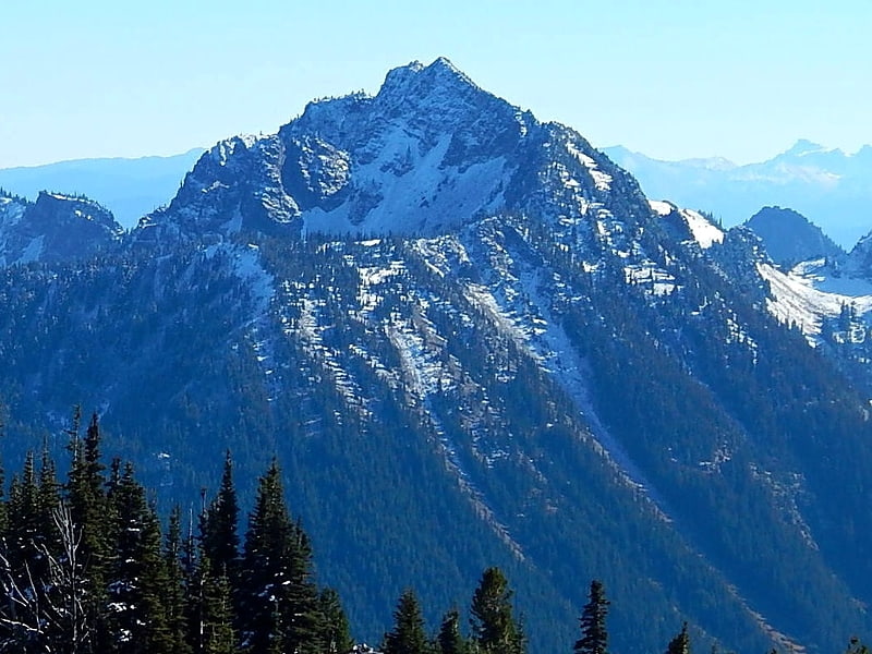
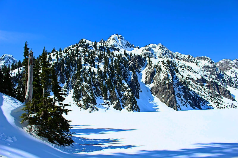
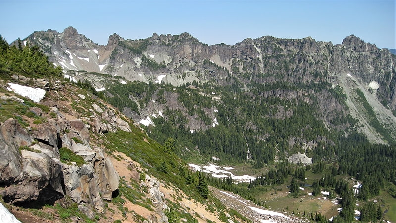
Mount Rainier
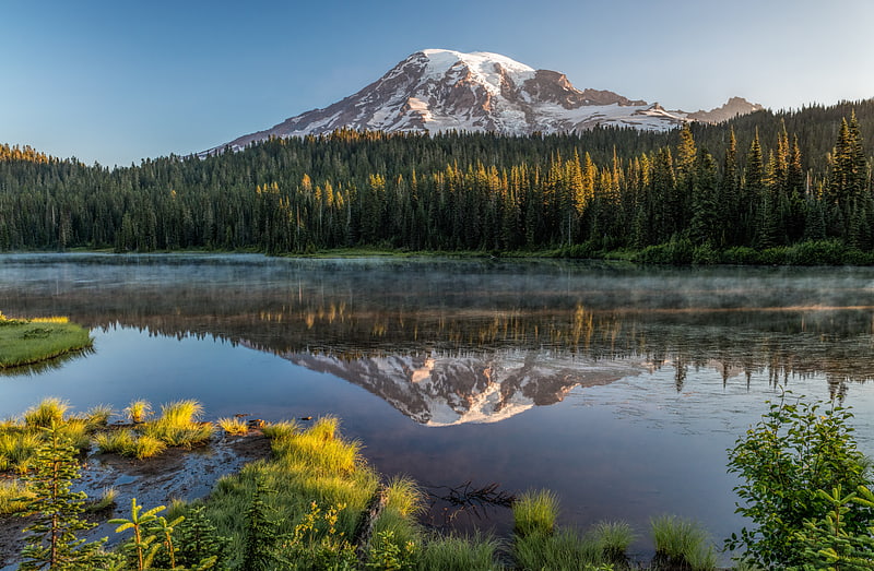
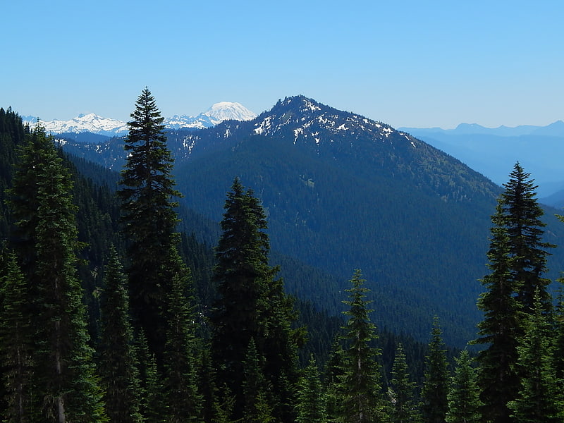
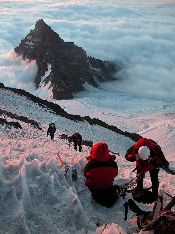
Huge active volcano and hiking destination. Mount Rainier, also known as Tahoma, Tacoma, Tacobet, or təqʷubəʔ, is a large active stratovolcano in the Cascade Range of the Pacific Northwest, located in Mount Rainier National Park about 59 miles south-southeast of Seattle. With a summit elevation of 14,411 ft, it is the highest mountain in the U.S. state of Washington and the Cascade Range, the most topographically prominent mountain in the contiguous United States, and the tallest in the Cascade Volcanic Arc.
Due to its high probability of eruption in the near future, Mount Rainier is considered one of the most dangerous volcanoes in the world, and it is on the Decade Volcano list. The large amount of glacial ice means that Mount Rainier could produce massive lahars which could threaten the entire Puyallup River valley. According to the United States Geological Survey, "about 80,000 people and their homes are at risk in Mount Rainier's lahar-hazard zones."[1]
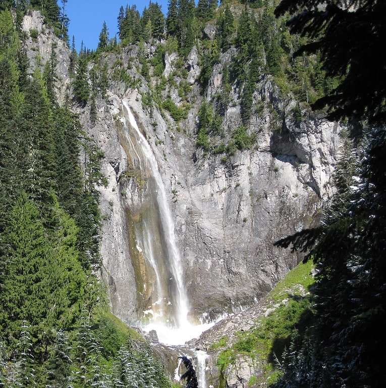
Spray Falls
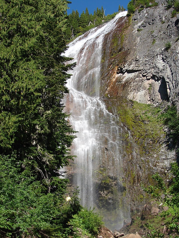
Waterfall in Washington State. Spray Falls is a waterfall in the Mount Rainier National Park in Pierce County, Washington. The falls are fed by Spray Creek, which is a tributary of the Puyallup River. The falls drop about 354 feet into a talus slope in a vailed horsetail form about 100 feet wide.[2]
Narada Falls
Rumbling waterfall with 2 distinct tiers. Narada Falls is a waterfall in Mount Rainier National Park, in the U.S. state of Washington. It is said to be the most popular, because the Mount Rainier Highway crosses the falls between its two tiers.
The waterfall drops 188 feet (57 m) in two tiers of 168 feet (51 m) and 20 feet (6.1 m). The upper tier is a horsetail that falls in several strands down a nearly sheer cliff, into a canyon that is perpendicular to it. The lower tier is a much smaller plunge. During the winter, the upper falls freezes and becomes a sheer 150 feet (46 m) of icicles, which attracts many ice climbers.
The falls was named by Frederick Gordon Plummer in 1893 after the branch name of the Narada Theosophical Society of Tacoma. This branch was called Narada, a Sanskrit name, Name of son of Lord Brahma, the greatest devotee of Lord Vishnu. A variant name is Neradah, and a common mistake is Nevada.
Although there is little documentation supporting it, there is widespread belief among the Hindu community that the Falls shares its name with Narada, a Vedic sage who plays a prominent role in a number of Hinduism's earliest texts, for a reason. Much like the sage, the Falls travels different realms during its course from its origin.[3]
Address: Paradise Rd, Mount Rainier National Park
Christine Falls
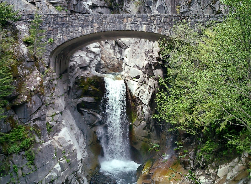
Towering waterfalls in Mt. Rainier Park. Christine Falls is a waterfall on Van Trump Creek in Pierce County, Washington. The falls are 69 feet feet high and are best known for the Christine Falls Bridge spanning the lower drop. The upper drop is 32 feet high and is almost impossible to film in tandem with the oft-photographed 37-foot lower tier. The lower tier is probably one of the most commonly photographed locations in the Mount Rainier area.
The falls were named in honor of Christine Van Trump, the daughter of P. B. Van Trump. In 1889 Christine, then nine years old, accompanied her father on an ascent of Mount Rainier, as far as her strength would allow. She made it to the 10,000-foot (3,000 m) level, even though she had a crippling nervous disorder.[4]
Tipsoo Lake
Lake in Washington State. Tipsoo Lake, at an elevation of 5,298 feet above sea level, is an alpine lake within the Northern Cascade Range near the summit of Chinook Pass in Pierce County, Washington.
The area is popular with photographers as the shores and surrounding area abound with the vibrant yellow, orange and purple colors of huckleberry, lupine, Indian paintbrush, and Partridgefoot. There are several hiking trails near the lake that vary in degrees of difficulty and that have views of Mount Rainier, Yakima Peak, and the surrounding landscape.[5]
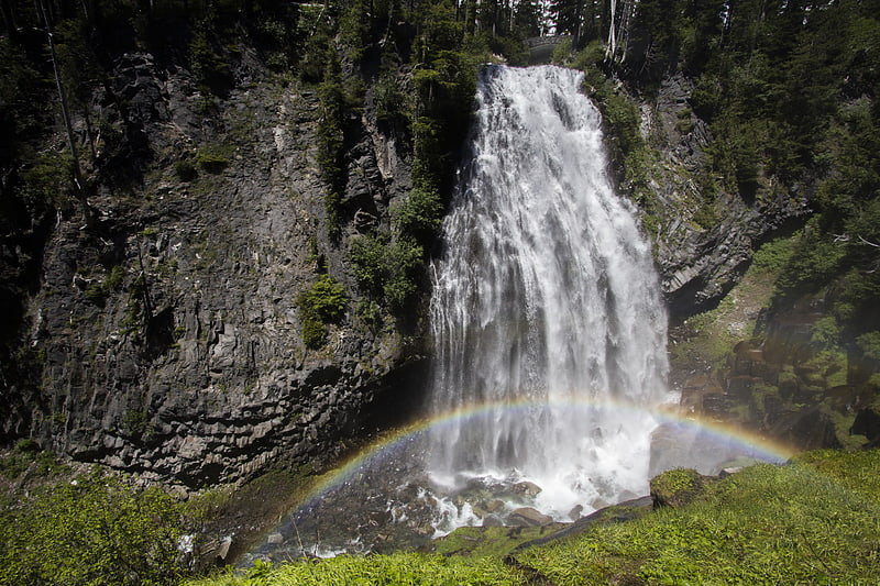
Comet Falls
Waterfall in Washington State. Comet Falls is a tall waterfall located on Van Trump Creek in Pierce County, Washington. The falls are thought to be the best in the Mount Rainier region.[6]
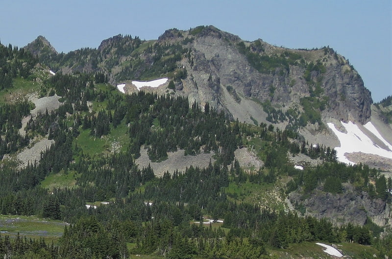
Dege Peak
Summit in Washington State. Dege Peak is a 7,006-foot summit located in Pierce County of Washington state. It is part of the Sourdough Mountains in Mount Rainier National Park. It was named in 1932 for James Henry Dege, a prominent Tacoma businessman and Captain of the First Regiment National Guard of Washington. His mother was a descendant of President Zachary Taylor.
The peak is a popular hiking destination with views of the Emmons Glacier, Winthrop Glacier, Inter Glacier, Fryingpan Glacier, Little Tahoma Peak, and views in all directions because the trail is above tree line. The trail starts at the Sunrise Historic District. Access is limited by snowpack closing the Sunrise Road much of the year. July, August, and September are the months when the Sunrise Road is seasonally open for vehicle traffic.
Antler Peak is its nearest higher neighbor, 1.03 mi (1.66 km) to the west. Precipitation runoff from Dege Peak drains into the White River.[7]
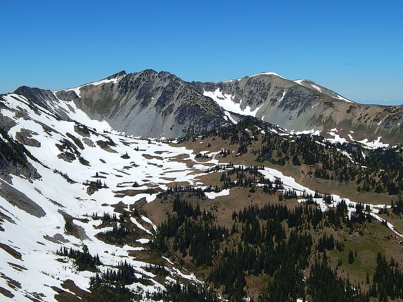
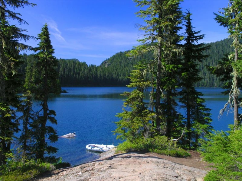
Eunice Lake
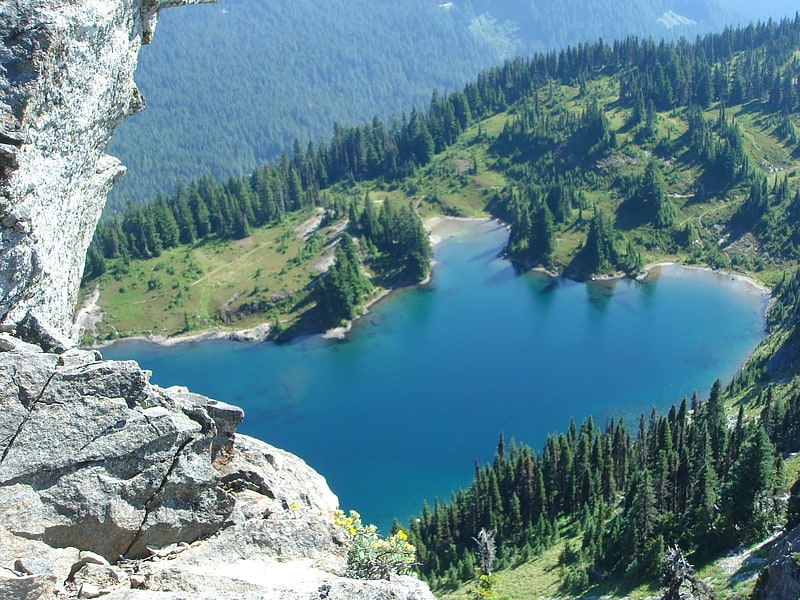
Glacial lake in Washington State. Eunice Lake is a glacial lake located in Pierce County, Washington and in the northwest part of Mount Rainier National Park. The lake was named after Eunice Sargent Roth by her husband Andy Roth who grew up in Washogal and was active in the forest service for many years. The lake is a popular area for hiking.[8]
Mount Fremont
Mount Fremont is a 7,214-foot-elevation mountain summit located in Mount Rainier National Park in Pierce County of Washington state. Mount Fremont is a minor peak at the southwest corner of the Sourdough Mountains which are a subset of the Cascade Range. It also the juncture for a small ridge of peaks of similar size running to the northeast. Mount Fremont is situated northwest of the Sunrise Historic District, with a popular trail leading to the Mount Fremont Fire Lookout. However, this trail does not reach the true summit which is 0.25 mi north of Frozen Lake. Peak 7317, also known as Mount Fremont North, located 0.31 mi west-northwest along the ridge is its nearest higher neighbor. Access is limited by snowpack closing the Sunrise Road much of the year. July, August, and September are typically the months when the Sunrise Road is seasonally open for vehicle traffic. Precipitation runoff from Mount Fremont drains into the White River.[9]
Shriner Peak
Shriner Peak is a 5,834-foot-elevation mountain summit located in Mount Rainier National Park in Pierce County of Washington state. It is part of the Cascade Range and is situated south of Cayuse Pass, southwest of Seymour Peak, and southeast of Double Peak. A four mile trail leads from Highway 123 to the Shriner Peak Fire Lookout at the top of the mountain. Precipitation runoff from Shriner Peak drains into tributaries of the Cowlitz River.[10]
Deadwood Peak
Deadwood Peak is a 6,280-foot-elevation mountain summit located on the eastern border of Mount Rainier National Park. It is also situated on the shared border of Pierce County and Yakima County in Washington state. Deadwood Peak is set on the crest of the Cascade Range, immediately north of Yakima Peak and Chinook Pass, with the Pacific Crest Trail traversing its east slope. Its nearest higher peak is Naches Peak, 0.59 mi to the southeast. Deadwood Peak takes its name from Deadwood Lakes and Deadwood Creek to its northwest, and their names came from the large number of downed trees in the area. From Chinook Pass, a short scramble up the south side leads to the summit with unobstructed views of Mount Rainier.[11]
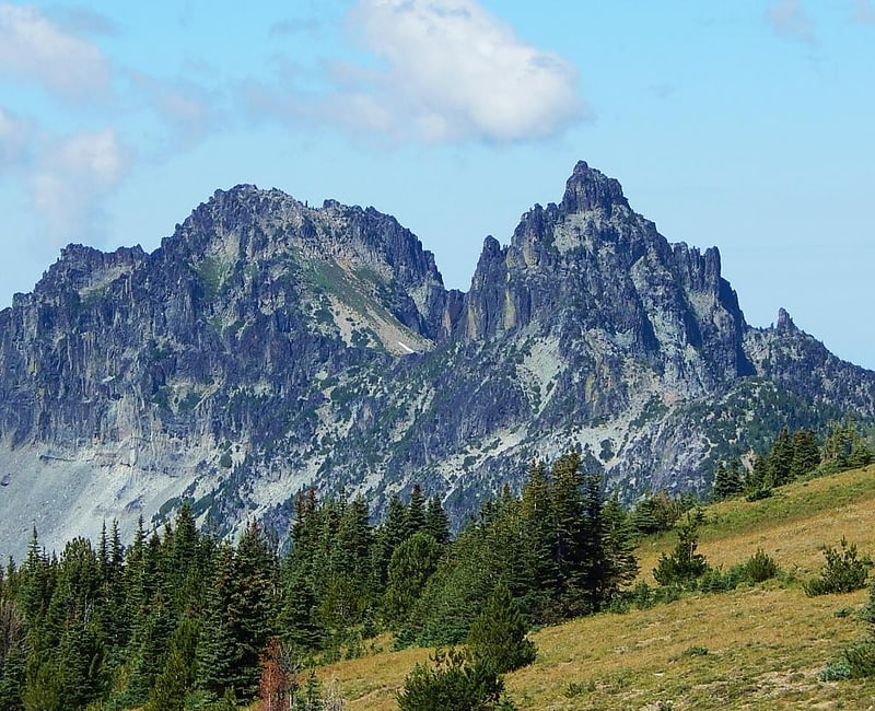
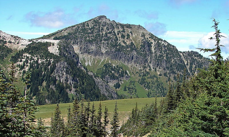
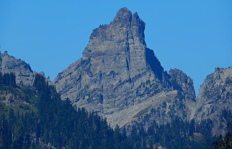
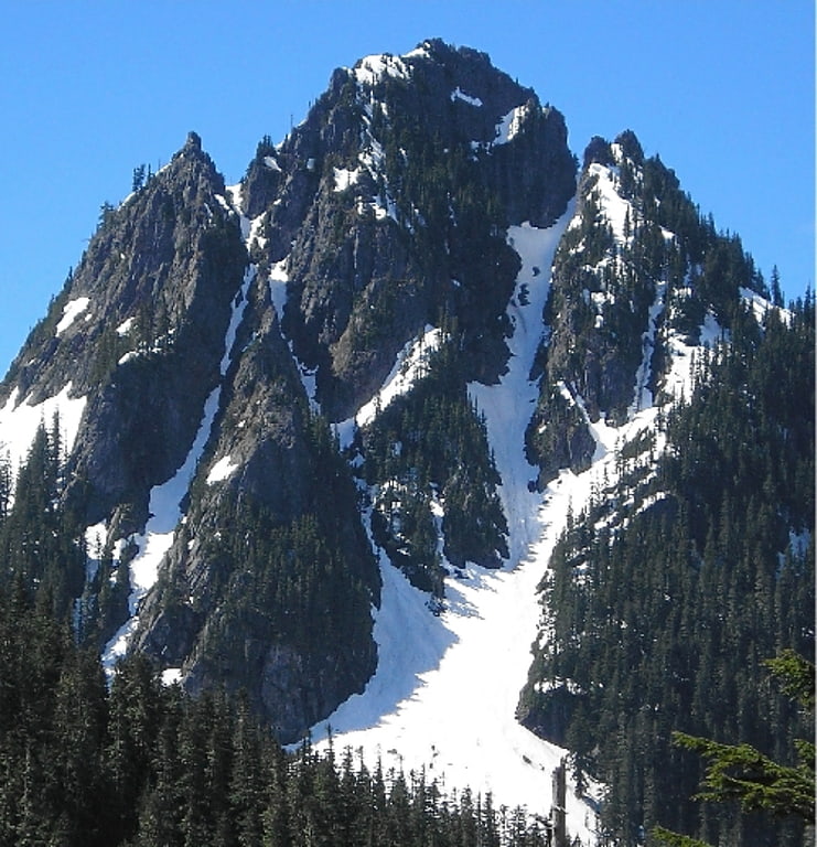
Unicorn Peak
Geographical feature. Unicorn Peak is the highest point in the Tatoosh Range which is a sub-range of the Cascade Range. It's located in Mount Rainier National Park, south of Mount Rainier. The descriptive name is for the mountain's resemblance to the head and horn of a unicorn. The name was officially adopted in 1913 by the U.S. Board on Geographic Names. Precipitation runoff from the mountain's small glaciers, such as Unicorn Glacier, drains into tributaries of the Cowlitz River.[12]
Sluiskin Mountain
Summit in Washington State. Sluiskin Mountain is a prominent pair of summits located in Mount Rainier National Park in Pierce County of Washington state. It is situated northwest of Burroughs Mountain and is part of the Cascade Range. The higher rocky peak is known as The Chief, and the second peak to the west is known as The Squaw. West of The Squaw are pinnacles called The Papooses. Sluiskin was the native American guide who assisted with the first successful ascent of Mount Rainier by Hazard Stevens and P. B. Van Trump in 1870. Sluiskin Falls within the park also honors him.[13]
Three Way Peak
Three Way Peak is a 6,796 feet summit located on the eastern border of Mount Rainier National Park. It is also on the shared border of Pierce County and Yakima County in Washington state. Three Way Peak is situated 0.42 mi north of Cupalo Rock on the crest of the Cascade Range. Its nearest higher peak is Crystal Mountain, 0.56 mi to the northwest. Chinook Peak is 0.8 mile to the southwest. Precipitation runoff from Three Way Peak drains into tributaries of the White River and Naches River.[14]
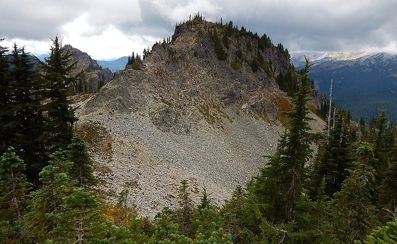
Pinnacle Peak
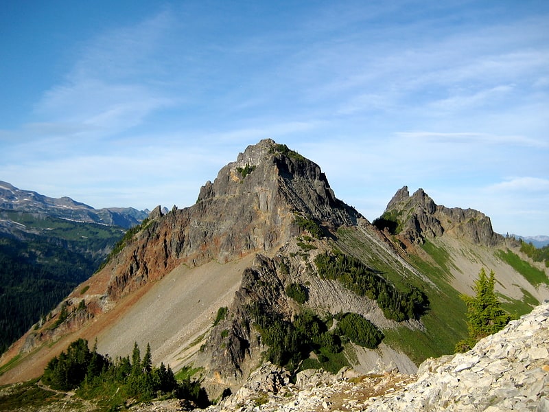
Peak in Washington State. Pinnacle Peak is a 6,562 ft peak located in Mount Rainier National Park in Lewis County, Washington. It is the second highest peak in the Tatoosh Range. There are two other Washington summits with the same name: Pinnacle Peak near Enumclaw, Washington, roughly 30 miles to the northwest, and Pinnacle Peak in North Cascades State Park.
The trail to the saddle and summit has views of Rainier. Some scrambling and rock climbing is needed to attain the summit. The Castle is situated 0.2 miles (0.32 km) to the east.[15]
Foss Peak
Summit in Washington State. Foss Peak is a 6,524-foot-elevation summit in the Tatoosh Range which is a sub-range of the Cascade Range. It is located south of Mount Rainier within Mount Rainier National Park, in Lewis County of Washington state. The peak is named for Thea Foss who founded the Foss Maritime Company with her husband in 1889. The peak also has an alternate name, Manatee Mountain. The nearest higher neighbor is West Unicorn Peak, 0.79 miles to the southeast. Precipitation runoff from the mountain drains into tributaries of the Cowlitz River.[16]
Yakima Peak
Yakima Peak is a 6,226-ft summit located on the eastern border of Mount Rainier National Park. It is also on the shared border of Pierce County and Yakima County in Washington state. Yakima Peak is situated northwest of Tipsoo Lake and west of Chinook Pass on the crest of the Cascade Range. Its nearest higher neighbor is Deadwood Peak, 0.59 mi to the north. The name Yakima Peak honors the Yakima Tribe of eastern Washington state. From Chinook Pass, a short scramble up a gully on the north side leads to a flat summit with unobstructed views of Mount Rainier and Naches Peak.[17]
Chutla Peak
Chutla Peak is a summit on the crest of the Tatoosh Range which is a sub-range of the Cascade Range. It's located south of Mount Rainier within Mount Rainier National Park. The mountain's name "Chutla" derives from Chinook Jargon which means "rock". Precipitation runoff on the peak drains into the Nisqually River.[18]
Tamanos Mountain
Tamanos Mountain is a 6,790-foot summit located in Mount Rainier National Park in Pierce County of Washington state. It is part of the Cascade Range. Tamanos Mountain is situated west of Governors Ridge and northeast of the Cowlitz Chimneys, all of which can be seen from the Sunrise Historic District. The name tamanos derives from Chinook Jargon and has the meaning of guardian spirit. The normal climbing access is from the Owyhigh Lakes Trail, and from the lakes scramble up the south slope to the summit.[19]
Snow Lake
Lake in Washington State. Snow Lake is a lake in Lewis County, Washington. It is within Mount Rainier National Park. It is in a glacial cirque below Unicorn Peak, in the Tatoosh Range. It also has a hiking trail, spanning about seven miles.[20]
Mowich Lake
Scenic lake with camping and hikes. Mowich Lake is a lake located in the northwestern corner of Mount Rainier National Park in Washington state at an elevation of 4,929 feet. The name "Mowich" derives from the Chinook jargon word for deer.
Access to the lake is provided by a 17 miles (27 km) long unpaved road which opens to vehicles in mid June to early July. Mowich Lake is also a busy campground during the summer with 30 walk-in tent camping spots. Bathrooms, tables, and trash bins are provided.
From the Mowich campground, hikers can reach the Wonderland Trail, Eunice Lake, Tolmie Peak, Spray Park, and Spray Falls. Old-growth trees, waterfalls, creeks, cliffs, and wildflower meadows are also located in and around the area.
Fishing is generally poor at Mowich Lake because the area is not stocked with fish and no habitat is provided for natural spawning.
This body of water was named Crater Lake in 1883 by the geologist Bailey Willis under the belief that it was formed in a volcanic crater, however I. C. Russell later wrote that the land was shaped instead by ice erosion. Willis concurred. Correspondents to the U.S. Board on Geographic Names (BGN) proposed Mowich to avoid ambiguity with the well-known Crater Lake to the south in Oregon. Mowich Lake was designated the official name by the BGN in 1919. The name of its outflow Crater Creek remained unchanged.[21]
Fay Peak
Summit in Washington State. Fay Peak is a double-summit mountain located in Mount Rainier National Park, in Pierce County of Washington state. It is part of the Cascade Range, and lies 7 mi northwest of the summit of Mount Rainier. The 6,492-foot elevation summit of Fay Peak lies a quarter-mile west of the highest point, East Fay Peak, 6,520+ ft. Echo Rock is its nearest higher neighbor, 2.7 mi to the southeast. Precipitation runoff from Fay Peak is drained by Cataract Creek on the east side of the mountain, and the west side drains into Mowich Lake and Mowich River.[22]
Chinook Peak
Chinook Peak is a 6,904 feet summit located on the eastern border of Mount Rainier National Park. It is also on the shared border of Pierce County and Yakima County in Washington state. Chinook Peak is situated north of Chinook Pass on the crest of the Cascade Range. Its nearest higher peak is Crystal Mountain, 1.31 mi to the north. Crystal Peak lies 0.75 mi to the northwest, and Cupalo Rock is 1.0 mi to the east-northeast. Precipitation runoff from Chinook Peak drains into tributaries of the White River and Yakima River.[23]
Old Desolate
Summit in Washington State. Old Desolate is a 7,137 feet multi-summit, ridge-like mountain located in Mount Rainier National Park, in Pierce County of Washington state. It is part of the Cascade Range, and lies 5 mi due north of the summit of Mount Rainier. The Wonderland Trail provides an approach to this mountain, and the summit offers views of Sluiskin Mountain and Mount Rainier. Burroughs Mountain is its nearest higher neighbor, 2.37 mi to the southeast. Precipitation runoff from Old Desolate drains east into the West Fork White River, or west into the Carbon River.[24]
Mother Mountain
Summit in Washington State. Mother Mountain is a 6,480+ ft multi-summit, 3-mile long ridge-like mountain located in Mount Rainier National Park, in Pierce County of Washington state. It is part of the Cascade Range, and lies 7 mi northwest of the summit of Mount Rainier. The Wonderland Trail provides one approach option to this mountain, and the summit offers views of Mount Rainier. East Fay Peak is its nearest higher neighbor, 0.42 mi to the south. Precipitation runoff from Mother Mountain is drained by Cataract Creek on the south side of the mountain, and Ipsut Creek drains the north side of it, and both are tributaries of the Carbon River. The west side drains into Mowich Lake, and thence Mowich River.[25]
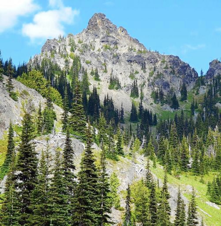
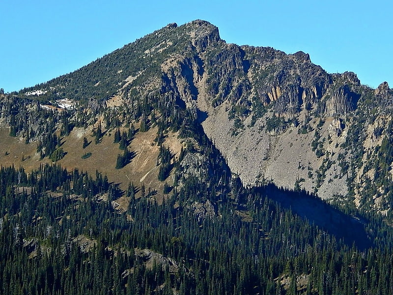
Plummer Peak
Summit in Washington State. Plummer Peak is a summit located in Mount Rainier National Park in Lewis County, Washington. With an elevation of 6,374 feet it is the seventh highest peak in the Tatoosh Range. It was named for Fred G. Plummer, a Forest Service cartographer who taught geography in Tacoma Public Schools.
Hiking to the summit requires a mix of hillwalking and scrambling. The area is also used for skiing, though avalanches present a danger; in 1988, skier Pamela Benton Lee died after being buried by an avalanche on Plummer Peak.
From the peak, views of Mount Rainier, the town of Packwood, the Goat Rocks, Mount St. Helens, and Mount Adams are visible. A small tarn is located on the side of the summit. A col called "The Saddle" creates a walkable ridge connecting Plummer Peak to its neighbor, Pinnacle Peak.[26]
Stevens Peak
Mountain in Washington State. Stevens Peak is a 6,560-foot mountain summit in the Tatoosh Range which is a sub-range of the Cascade Range. It's located in Mount Rainier National Park, one mile east of Unicorn Peak. The name honors Hazard Stevens who made the first documented ascent of Mount Rainier along with P. B. Van Trump on August 17, 1870. The mountain's name was officially adopted in 1913. Precipitation runoff from the mountain drains into tributaries of the Cowlitz River.[27]
Ingraham Glacier
Glacier in Washington State. Ingraham Glacier is on the south-eastern flank of Mount Rainier, in the U.S. state of Washington. The glacier is named for the Mount Rainier enthusiast Edward Sturgis Ingraham. From the summit ice cap, Ingraham Glacier flows east between Gibraltar Rock, and Disappointment Cleaver and south of Little Tahoma Peak, which divides it from the much larger Emmons Glacier to the north. Descending southeast, it approaches the east flank of Cowlitz Glacier and the two glaciers nearly join at 6,700 ft. Meltwater from the glacier drains into the Cowlitz River.[28]
Skyscraper Mountain
Summit in Washington State. Skyscraper Mountain is a 7,078 feet summit located in Mount Rainier National Park in Pierce County of Washington state. It is part of the Cascade Range. Skyscraper Mountain is situated northwest of the Sunrise Historic District, from which a four-mile hike leads to the mountain, mostly on the Wonderland Trail. However, the trail does not reach the summit, but it is still a walk up to the top from Skyscraper Pass. The summit provides views of Burroughs Mountain, Sluiskin Mountain, and Mount Rainier. Mount Fremont is its nearest higher peak, 1.1 mi to the east. Access is limited by snowpack closing the Sunrise Road much of the year. July, August, and September are typically the months when the Sunrise Road is seasonally open for vehicle traffic. Precipitation runoff from Skyscraper Mountain drains into tributaries of the White River.[29]
Palisades Peak
Palisades Peak is a 7,040 feet summit located in Mount Rainier National Park in Pierce County of Washington state. It is part of the Sourdough Mountains, a subset of the Cascade Range, and is situated 0.6 mile north of Marcus Peak. The peak's descriptive name stems from the resemblance of its columnar basalt cliffs to a palisade. Access is via Palisades Lakes Trail which starts at Sunrise Point. Access to Sunrise Point is limited due to snowpack closing the Sunrise Road much of the year. July, August, and September are typically the months when the Sunrise Road is seasonally open for vehicle traffic. Precipitation runoff from Palisades Peak drains into the White River.[30]
Denman Peak
Denman Peak is a small 6,006 ft summit in the Tatoosh Range which is a sub-range of the Cascade Range. It's located south of Mount Rainier within Mount Rainier National Park. Denman Peak is situated east of Lane Peak and west of Pinnacle Peak.
Formerly known as That Peak, in 1931 The Mountaineers named it for their lawyer, Asahel Holmes Denman of Tacoma, following twenty years of work in the interests of the organization.
Precipitation runoff on the south side of the peak drains into tributaries of the Cowlitz River, whereas the north side drains into tributaries of the Nisqually River.[31]
Buell Peak
Summit in Washington State. Buell Peak is a small 5,756 ft summit located in Mount Rainier National Park in Pierce County of Washington state. It is part of the Cascade Range and is situated 1.5 miles southwest of Cayuse Pass and 0.53 mile east-southeast of Barrier Peak, which is its nearest higher peak. The normal climbing access is from the Owyhigh Lakes Trail. The peak's name honors John Latimore Buell who arrived in Orting, Washington in 1890 and went into the hardware business.[32]
Cowlitz Chimneys
Cowlitz Chimneys are a group of four rhyolite towers located in Mount Rainier National Park in Pierce County of Washington state. As part of the Cascade Range, the Cowlitz Chimneys are situated southwest of Tamanos Mountain and east of Banshee Peak, all of which are visible from the Sunrise Historic District. The Sarvant Glacier is set on the north aspect of these remnants of a volcanic plug. Cowlitz is the name of several geographical features in Mount Rainier National Park, as well as the state of Washington. The name appeared as early as the Lewis and Clark journals of 1805 when it was written as "Cowliskee" and has the Chinook Jargon meaning of "capturing the medicine spirit".
- Main (South) Cowlitz Chimney - 7,605 ft
- Central Cowlitz Chimney - 7,421 ft
- North Cowlitz Chimney - 7,015 ft
- Third Cowlitz Chimney - 6,640+ ft
Banshee Peak
Banshee Peak is a 7,400+ ft summit located in Mount Rainier National Park in Pierce County of Washington state. As part of the Cascade Range, Banshee Peak is situated west of the Cowlitz Chimneys and east of Panhandle Gap, with the Sarvant Glacier set below its north cliff. Banshee Peak is a high remnant of bedded Ohanapecosh Formation lava flows. Access is from Panhandle Gap via the Wonderland Trail. The broad summit has alpine tundra similar to that found on Burroughs Mountain. The Sunrise Historic District provides a viewpoint from which to see Banshee Peak when weather permits. The road to Sunrise is only open seasonally in the summer due to closure from snowpack.[34]
Lane Peak
Lane Peak is a mountain summit in the U.S. state of Washington, on the crest of the Tatoosh Range, which is a sub-range of the Cascade Range. It is located south of Mount Rainier within Mount Rainier National Park.
Lane Peak honors United States Secretary of the Interior Franklin Knight Lane, who presided over the establishment of the National Park Service in 1917. Precipitation runoff on the south side of the peak drains into tributaries of the Cowlitz River, whereas the north side drains into tributaries of the Nisqually River.[35]