Discover 11 hidden attractions, cool sights, and unusual things to do in Gifford Pinchot National Forest (United States). Don't miss out on these must-see attractions: Panther Creek Falls, Takhlakh Lake, and Silver Star Mountain. Also, be sure to include Olallie Lake in your itinerary.
Below, you can find the list of the most amazing places you should visit in Gifford Pinchot National Forest (Washington).
Table of Contents
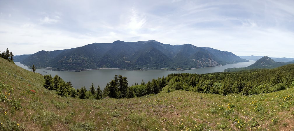
Panther Creek Falls
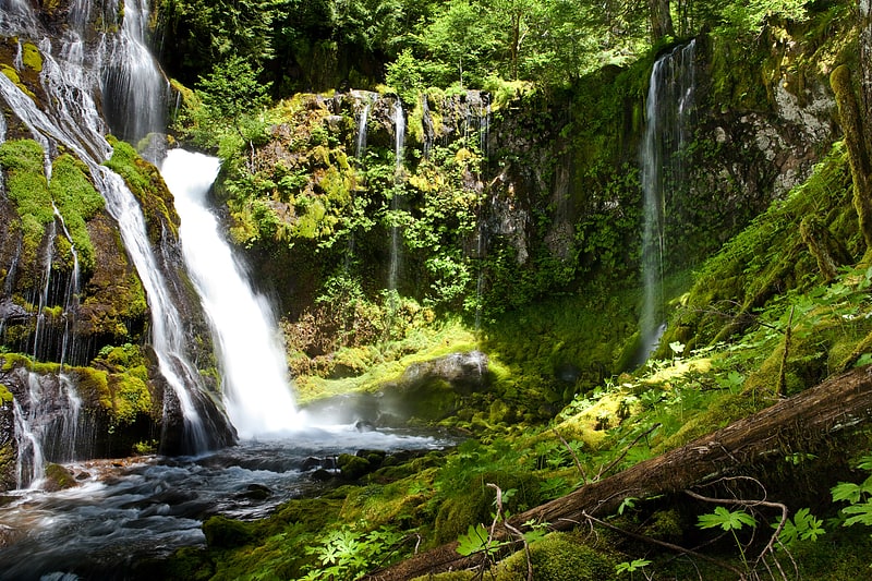
Waterfall in Washington State. Panther Creek Falls is a 130-foot waterfall on Panther Creek in the Wind River Valley in Skamania County, Washington. The waterfall consists of two drops, with the largest at a height of 102 feet. The waterfall is perennial.[1]
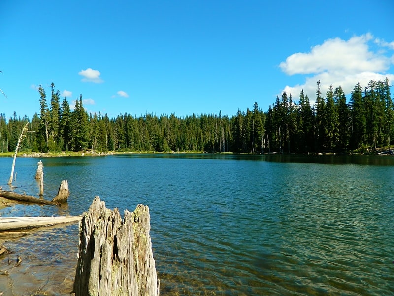
Takhlakh Lake
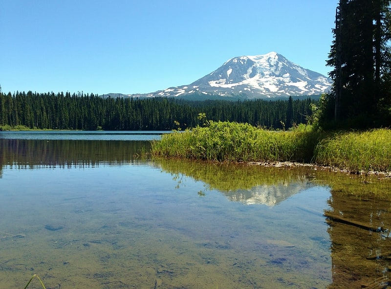
Lake in Washington State. Takhlakh Lake is a lake situated 7.3 miles northwest of Mount Adams in the U.S. state of Washington. It is fed by a few small unnamed inflow creeks originating near Takh Takh Meadows, tributary to the Cispus River. A popular 53-site campground on the west side of the lake brings summer and early fall campers as well as hikers hiking the Takhlakh Loop Trail and the Takh Takh Meadows Trail, and nearby trails in the Mount Adams Wilderness. A day use area offers a picnic area and provides a boat ramp as well. The lake is one of the five lakes, all within a seven-mile radius, in the Midway High Lakes Area. It is managed by the Gifford Pinchot National Forest.[2]
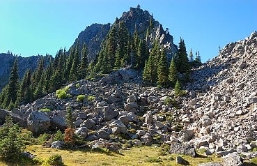
Silver Star Mountain
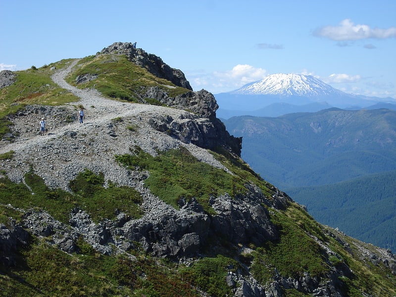
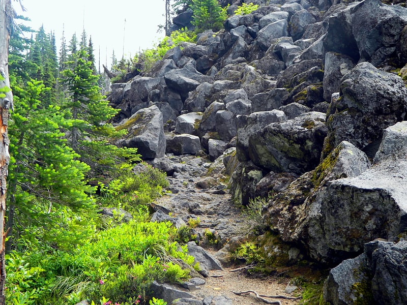
Mountain in Washington State. Silver Star Mountain is a recently uplifted ridge of older Western Cascades volcanic rock, underlain by a granitic pluton of similar Western Cascades age, located in the Cascade Range in the U.S. state of Washington. Consisting of late Eocene to Oligocene epoch rock, it lies within the Gifford Pinchot National Forest. Silver Star is composed of three lithologic units, including the large Silver Star Granodiorite unit.
Silver Star Mountain and the surrounding area, in contrast to the rest of the local backcountry, has a ridge-like appearance, creating a striking skyline similar to mountains further north in the Cascade Range. The area lacks trees, and comprises steep cliffs, talus slopes, and meadows filled with wildflowers. The mountain can be hiked and has been noted for its trails by local mountaineers.[3]
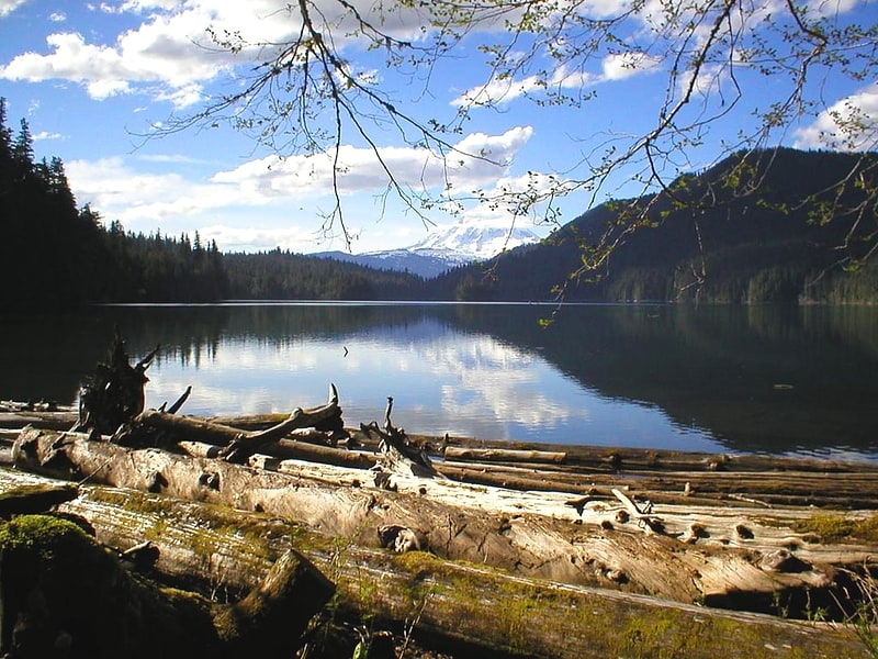
Olallie Lake
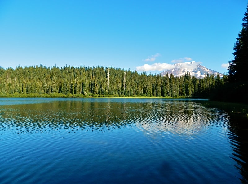
Alpine lake in Washington State. Olallie Lake is an alpine lake and one of several in the area fed by streams coming off the glaciers from nearby Mount Adams. A small, but popular Olallie Lake Campground offers scenic camping as well as non-motorized boating and fishing experiences. It is located at 4,200 feet elevation in the Gifford Pinchot National Forest, in Washington state.[4]
Horseshoe Lake
Lake in Washington State. Horseshoe Lake is a lake situated in the east side of the Midway High Lakes Area below Mount Adams' northwest flank. The lake is popular for camping, quiet boating, and hiking and biking on a trail halfway around the lake. Other activities include scenic viewing and fishing. The lake offers an eleven-site campground, administered by the Gifford Pinchot National Forest in the State of Washington.[5]
Midway High Lakes Area
Lake in Washington. Midway High Lakes Area, also known as High Lakes Area is a United States Forest Service designated area located in Washington’s Cascade Mountains. It lies on a high plateau on Mount Adams' northwestern flank. It is between the Goat Rocks on the north and Mount Hood to the south and contains Takhlakh Lake along with several other lakes. The area offers five scenic high elevation lakes all within a seven mile radius. It is administered by the Gifford Pinchot National Forest. While even the most visited areas at Mount Adams pale in comparison to nearby St. Helens or Rainier, it is by its own standards one of the most popular recreational areas around Mount Adams. Some of the lakes offers photogenic views of Mount Adams from across the lake.[6]
Packwood Lake
Lake in Washington State. Packwood Lake is a freshwater lake in the Gifford Pinchot National Forest in the Cascade Mountains of Washington. It is located near the town of Packwood and is a popular day hiking and overnight camping area. The southern half of the lake lies within the Goat Rocks Wilderness area.
The lake was named after William Packwood, an early settler.[7]
Indian Heaven
Volcanic field in Washington. Indian Heaven is a volcanic field in Skamania County in the state of Washington, in the United States. Midway between Mount St. Helens and Mount Adams, the field dates from the Pleistocene to the early Holocene epoch. It trends north to south and is dominated by six small shield volcanoes; these shields are topped by small spatter and cinder cones, and the field includes a number of subglacial volcanoes and tuyas. The northernmost peak in the field is Sawtooth Mountain and the southernmost is Red Mountain; its highest point is Lemei Rock at an elevation of 5,925 feet.
Indian Heaven features both polygenetic and monogenetic volcanic activity; many of its volcanoes have only erupted once before coming extinct, while others have erupted several times. Approximately 50 eruptive centers lie within the Indian Heaven field, which also has approximately 40 lava flows. The field's eruptive output totals 14 to 19 cubic miles (58 to 79 km3), with sporadic activity taking place for the past 700,000 years. The last volcanic activity in the field produced a large cinder cone, Big Lava Bed, as well as a voluminous lava and scoria flows about 9,000 years ago. Future activity is possible, though the Volcano Hazards Program directed by the United States Geological Survey considers Indian Heaven's volcanic threat level to be low.
The volcanic field is surrounded by the Indian Heaven Wilderness, a protected wilderness area within the Gifford Pinchot National Forest, supporting diverse flora and fauna. The local area has been inhabited by Native American populations for about 10,000 years, and the name Indian Heaven derives from the indigenous name for the vicinity. A popular recreation destination, the wilderness offers a number of trails, as well as more than 150 lakes for fishing, swimming, and boating.[8]
Dog Mountain
Mountain in Washington State. Dog Mountain rises above the north side of the Columbia River Gorge in the U.S. state of Washington. The base of the mountain is in Skamania County along Washington State Route 14, about 9 miles east of Stevenson and 53 miles east of Vancouver. From its base at 150 feet, it climbs steeply to an elevation of 2,948 feet.
The mountain is the site of a popular hiking trail that begins on the north side of Route 14 at milepost 53. The 6-mile (9.7 km) trail winds through heavy forest to meadows and the site of a former fire lookout. After climbing steeply for about the first half mile (0.8 km), the trail splits into two forks that meet again at the summit. The lookout was built in 1931 and reconstructed in 1952 to watch for fires across the river in Oregon's Mount Hood National Forest. Outmoded by surveillance from roads and airplanes, the fire lookout was dismantled in 1967.
Attractions include views of the Columbia Gorge, Mount Hood, Mount St. Helens, Wind Mountain and wildflowers, especially in May. Flowering plants along the trail include chocolate lily, woodland star, fairy slipper, hookspur violet, yellow fawn lily, balsamroot, and Columbia kittentails. Hazards include poison oak, rattlesnakes, scorpions, and steep slopes. The trail's difficulty caused one writer to describe it as "a grueling hike", while another said that Dog Mountain might better be called "Dogged Mountain or possibly Doggone Mountain", and recommended good boots for descending its steep pitches. A fatality occurred on the mountain in 2003, when a hiker lost her footing and fell 500 feet (150 m).
The trail is open year-round to hikers and to dogs on leashes, although in winter the upper portions may be snow covered at times. It cannot be used by people on horses or mountain bikes, and it is not suitable for wheelchairs. The permits fees, of 1-2 dollars, are to start the spring of 2018 to hike the trail and parking at the bottom requires a Northwest Forest Pass. The permit fee is waived if you ride the shuttle bus. Passes are available from a wide variety of vendors in Oregon and Washington.[9]
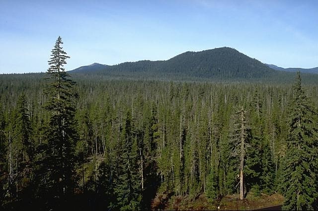
Trout Creek Hill
Shield volcano in Washington State. Trout Creek Hill is a small Pleistocene basaltic shield volcano in Washington, United States. Located in Skamania County, Trout Creek Hill rises to an elevation of 2,946 feet. It is part of the Cascade Volcanic Arc, located in the Marble Mountain-Trout Creek Hill volcanic field.
Trout Creek Hill produced a lava flow about 340,000 years ago that traveled 20 km (12 mi) southeast, which dammed the Columbia River for a short period of time. A shield volcano, it has two cinder cones atop it. The nearby area is forested and hosts the Wind River Experimental Forest, and it can be hiked.[10]
Big Lava Bed
Geographical feature. The Big Lava Bed, located in the Gifford Pinchot National Forest in the southwestern area of the State of Washington, originated from a 500-foot-deep crater in the northern center of the bed. The Big Lava Bed is the youngest feature of the Indian Heaven volcanic field. The 0.9-cubic kilometer lava flow erupted from the cinder cone about 8200 years ago. The lava flow traveled 13 km from the source crater. Lodgepole pine, alder, and other pioneer plants struggle to grow, seen sparsely growing between and amid towering rock piles, caves, and strange lava formations. Access into the interior of the lava bed is difficult, since there are no roads or trails crossing the lava field. Explorers who wish to venture deep within the lava flow are advised to choose their route carefully. Compasses are not always reliable, since local magnetic influences affect their magnetic performance in the vast expanse of rock.[11]