Discover 9 hidden attractions, cool sights, and unusual things to do in Cascade Locks (United States). Don't miss out on these must-see attractions: Oneonta Gorge, Horsetail Falls, and Punch Bowl Falls. Also, be sure to include Bonneville Dam in your itinerary.
Below, you can find the list of the most amazing places you should visit in Cascade Locks (Oregon).
Table of Contents
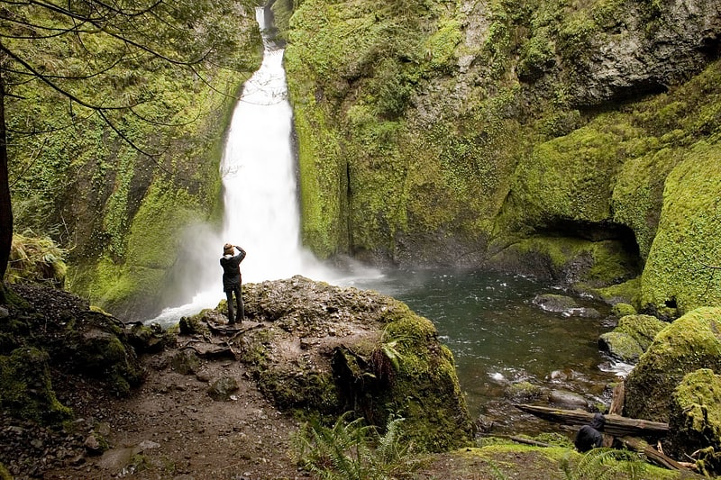
Oneonta Gorge
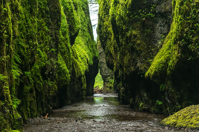
Waterfall. Oneonta Gorge is a scenic gorge located in the Columbia River Gorge area of the American state of Oregon. The U.S. Forest Service has designated it as a botanical area because of the unique aquatic and woodland plants that grow there. Exposed walls of 25-million-year-old basalt are home to a wide variety of ferns, mosses, hepatics, and lichens, many of which grow only in the Columbia River Gorge. Oneonta Gorge with its 50 species of wildflowers, flowering shrubs and trees has been described as "one of the true dramatic chasms in the state." The Oneonta Gorge Creek Bridge is listed on the National Register of Historic Places.
There are four major waterfalls on Oneonta Creek as it runs through the gorge. Middle Oneonta Falls can be seen clearly from a footpath and is very often mistaken for the upper or lower falls. The lower gorge (a slot canyon) has been preserved as a natural habitat, so there is no boardwalk or footpath through it as such. Thus, Lower Oneonta Falls can only be seen by walking upstream from the creek's outlet at the Historic Columbia River Highway. To get to a vantage point where the entire lower falls is visible may require wading through water that in some places can be shoulders-deep, depending on the season and the relative amount of snow melt. The upper falls are about a mile upstream from the middle falls and require scrambling up the creek or climbing down a canyon wall to view. The fourth falls which is "Triple falls" can be viewed from several vantage points on the upper trails in the canyon.
The trail has issues due to natural as well as human impacts. In the late 1990s, the stream was partially occluded when three large boulders (the size of "pickup trucks") tumbled into the stream. Subsequently, a log jam has formed in the midst of the slot canyon. This has created a hazard for hikers, which led to a fatality in 2011.
As of November 2020, trails providing access to the waterfalls remain closed due to damage from the 2017 Eagle Creek Fire.
The Oneonta Gorge was first photographed by Carleton Eugene Watkins, a native of Oneonta, New York, who had traveled west in 1851 during the time of the California Gold Rush. Watkins named the Oneonta Falls after his hometown.[1]
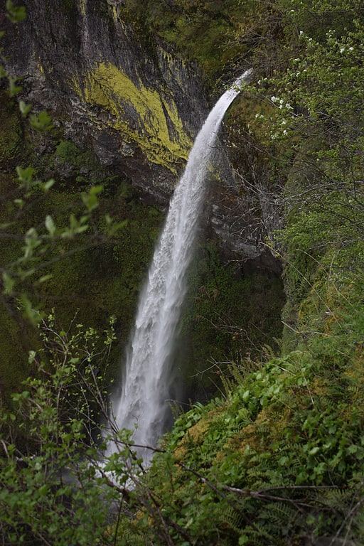
Horsetail Falls
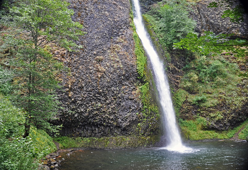
Waterfall in Oregon. Horsetail Falls is a waterfall along the Columbia River Gorge in the U.S. state of Oregon.
The waterfall is easily accessed, in contrast to its near neighbor Oneonta Falls, as it is right next to the Historic Columbia River Highway. The shape of the falls and the rounded rockface over which it flows cause it to resemble a horse's tail.
There are actually two waterfalls along the creek. The upper falls, called Upper Horsetail Falls or Ponytail Falls, can be accessed from a footpath.[2]
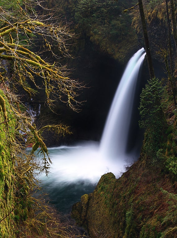
Punch Bowl Falls
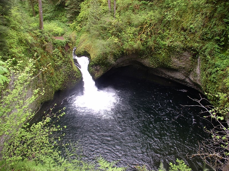
Waterfall in Oregon. Punch Bowl Falls is a waterfall on Eagle Creek in the Columbia River Gorge National Scenic Area, Oregon, United States. Eagle Creek drains into the Columbia River, with its outlet on the Columbia River Gorge in Multnomah County.
The falls is 35 feet (11 m) tall and 10 feet (3.0 m) wide. Eagle Creek cuts through a narrow channel and shoots powerfully into a large bowl that resembles a punchbowl. This waterfall was responsible for the waterfall classification type of punchbowl.
These falls are not to be confused with another set of falls with the same name, found in Jasper National Park, Alberta, Canada near Miette Hot Springs.[3]
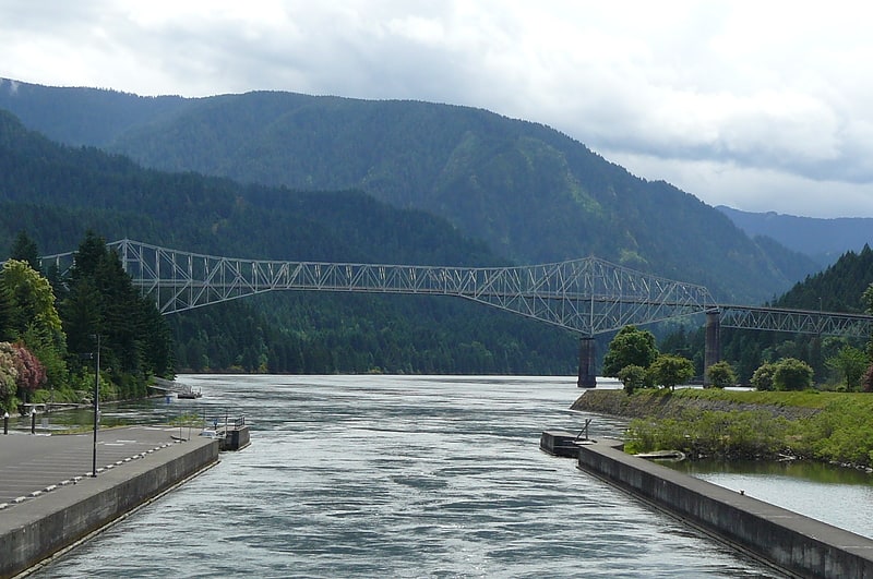
Bonneville Dam
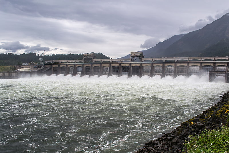
Bonneville Lock and Dam consists of several run-of-the-river dam structures that together complete a span of the Columbia River between the U.S. states of Oregon and Washington at River Mile 146.1. The dam is located 40 miles east of Portland, Oregon, in the Columbia River Gorge. The primary functions of Bonneville Lock and Dam are electrical power generation and river navigation. The dam was built and is managed by the United States Army Corps of Engineers. At the time of its construction in the 1930s it was the largest water impoundment project of its type in the nation, able to withstand flooding on an unprecedented scale. Electrical power generated at Bonneville is distributed by the Bonneville Power Administration. Bonneville Lock and Dam is named for Army Capt. Benjamin Bonneville, an early explorer credited with charting much of the Oregon Trail. The Bonneville Dam Historic District was designated a National Historic Landmark District in 1987.[4]
Wahclella Falls
Waterfall in Oregon. Wahclella Falls is a waterfall along Tanner Creek, a tributary of the Columbia River, Multnomah County, Oregon, United States. It enters the river within the Columbia River Gorge.[5]
Metlako Falls
Waterfall in Oregon. Metlako Falls is a waterfall on Eagle Creek in the Columbia River Gorge National Scenic Area in Hood River County, Oregon, United States. It is the furthest downstream of the major waterfalls on Eagle Creek. Like upstream Punch Bowl Falls, Metlako is also in the form of a punchbowl. The falls is 31 meters tall, though people have measured it anywhere from 30 to 46 m tall. It is the upstream limit for salmon spawning in Eagle Creek.[6]
Cascade Locks and Canal
Park in Cascade Locks, Oregon. The Cascade Locks and Canal was a navigation project on the Columbia River between the U.S. states of Oregon and Washington, completed in 1896. It allowed the steamboats of the Columbia River to bypass the Cascades Rapids, and thereby opened a passage from the lower parts of the river as far as The Dalles. The locks were submerged and rendered obsolete in 1938, when the Bonneville Dam was constructed, along with a new set of locks, a short way downstream.[7]
Eagle Creek waterfalls

River. Eagle Creek is a tributary of the Columbia River in Multnomah and Hood River counties in the U.S. state of Oregon. It cuts through a narrow canyon in its 3,200 feet descent to the Columbia River Gorge and is known for its concentration of 13 waterfalls in about 5 miles distance. Eight major falls are on Eagle Creek and the East Fork Eagle Creek itself, while five are on its tributaries.
The highest falls of Eagle Creek is Twister Falls, which is a unique cascade of 140 feet (43 m). The highest tributary waterfall is Wauna Falls which has a total drop of 150 feet (46 m) with the highest of 50 feet (15 m).
The waterfalls are described with most downstream (northerly) first and proceeding upstream along Eagle Creek.[8]
Elowah Falls
Waterfall in Oregon. Elowah Falls, also called McCord Creek Falls, is a 213-foot waterfall on the Columbia River Gorge, Multnomah County, Oregon, United States. Elowah Falls is one of several waterfalls along McCord Creek. The Creek and the waterfall are within the limits of the John B. Yeon State Scenic Corridor.
The name of the waterfall carried the name of the creek that forms it: McCord Falls. In 1915 the Mazamas successfully had the falls renamed to Elowah. The meaning of the term is unknown.[9]