Discover 9 hidden attractions, cool sights, and unusual things to do in Leyte (Philippines). Don't miss out on these must-see attractions: Lake Danao, MacArthur Landing Memorial National Park, and Cabalian Volcano. Also, be sure to include Hinunangan in your itinerary.
Below, you can find the list of the most amazing places you should visit in Leyte (Leyte).
Table of Contents
Lake Danao
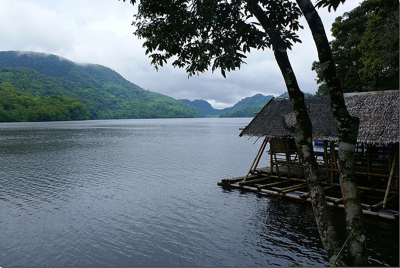
Protected area with scenic forest views. Lake Danao is a guitar-shaped lake on the island of Leyte in the Philippines.
The lake is covering an area of 148 hectares (370 acres). It is situated in the 2,193 hectares (5,420 acres) Lake Danao Natural Park, which also includes the Amandiwin mountain range. The lake is 18 kilometres (11 mi) northeast of Ormoc, half an hour drive along the San Pablo - Tongonan and Milagro - Lake Danao roads.
It was originally named Lake Imelda and was declared a national park on June 2, 1972 by virtue of presidential memorandum issued by then President Ferdinand Marcos. Later it was renamed and declared as Lake Danao National Park on February 3, 1998 through Proclamation No. 1155 and is now protected by Republic Act No. 7586 otherwise known as the National Integrated Protected Area System (NIPAS) Act of 1992. The lake supplies potable water to at least seven towns in Eastern Leyte including Tacloban as well as the source of irrigation for ricelands in some municipalities like Dagami, Burauen, Pastrana and Tabontabon.
At 650 metres (2,130 ft) above sea level, Lake Danao lies on an altitude similar to Tagaytay, making the area cooler than the average Philippine temperature.[1]
MacArthur Landing Memorial National Park
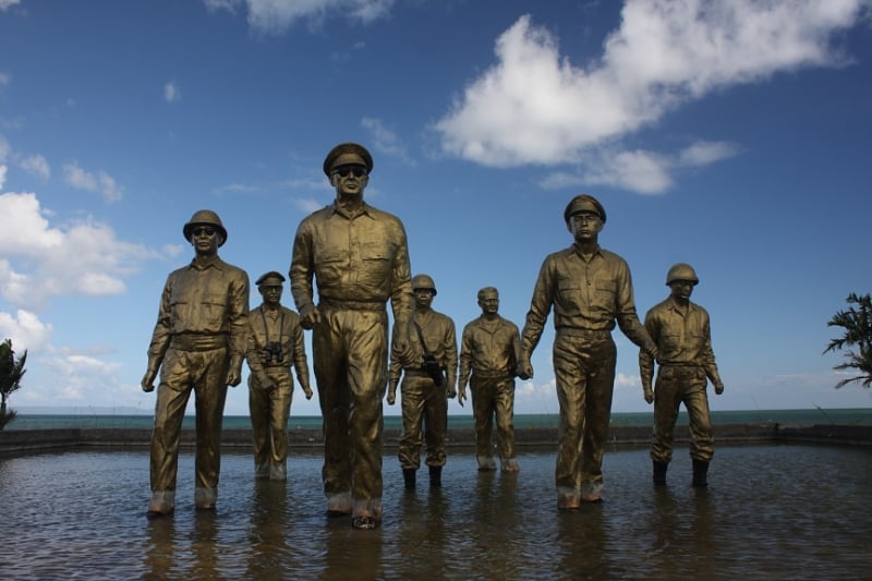
War memorial in Palo, Leyte, Philippines. The MacArthur Leyte Landing Memorial National Park is a protected area of the Philippines that commemorates the historic landing of General Douglas MacArthur in Leyte Gulf at the start of the campaign to recapture and liberate the Philippines from Japanese occupation on 20 October 1944. This event led to the largest naval battle of World War II and Japan's eventual defeat and surrender after almost three years. The war memorial is located in the municipality of Palo on Leyte island in Eastern Visayas and is one of the region's major tourist attractions. It was declared a national park on 12 July 1977 through Letter of Instructions No. 572 signed by President Ferdinand Marcos.[2]
Cabalian Volcano
Volcanic mountain with trails and a lake. Cabalian Volcano is an active stratovolcano located in the province of Southern Leyte in the Philippines.[3]
Hinunangan
Municipality in the Philippines. Hinunangan, officially the Municipality of Hinunangan, is a 3rd class municipality in the province of Southern Leyte, Philippines. According to the 2020 census, it has a population of 29,149 people.
Hinunangan is known as the "Rice Granary of the Province" for its vast plain land that is entirely planted with rice. Hinunangan has great potential for tourism because of its beautiful sand beaches and islands. The town is also a producer of rattan and wood-based furnitures, abaca handicrafts items, pineapple, vegetables, other forest products, and bamboo furnitures. It has a potential for mineral water and root crops processing and copper mining.
Hinunangan is also known as a major gateway in Leyte because of its near proximity to Tacloban City. The opening of Abuyog–Silago Road cuts travel time from Tacloban by half from the previous 6 hours to less than 3 hours. It is also the place in Southern Leyte with the most immigrants from Europe and North America.
It has a lot of touristic places, such as Tahusan, Talisay or the twin islands (known as Cabugan Grande and Cabugan Chico as Pigafetta stated in his account during their travel with Magellan). There are also hotels, inns, a public market and beach resorts.[4]
Babatngon
Municipality in the Philippines. Babatngon, officially the Municipality of Babatngon, is a 4th class municipality in the province of Leyte, Philippines. According to the 2020 census, it has a population of 28,823 people.
Babatngon is located in the northern part of the island of Leyte, along the shore of Carigara Bay. It is situated on a small plain set in a semicircle of mountain ranges and nestles in the northern mouth of the San Juanico Strait, which separates Samar from Leyte. Boats coming in or going out of Tacloban City have to pass by it through the pilot station of Canaway, one of the islets along the strait. It is 33 kilometres (21 mi) north-west of Tacloban City and about 10 kilometres (6.2 mi) north of the town of San Miguel. Small coconut covered islets fringe its coast along San Juanico Strait, the most important of which are Rizal, Magsaigad, Tabigue, almost all of which extend from east to west.[5]
San Juan
Municipality in Leyte, Philippines. San Juan, officially the Municipality of San Juan, is a 5th class municipality in the province of Southern Leyte, Philippines. According to the 2020 census, it has a population of 14,912 people.
It was formerly known as Cabali-an.
The Kabalian language, a Visayan language distinct from Waray-Waray and Cebuano, is spoken in San Juan.[6]
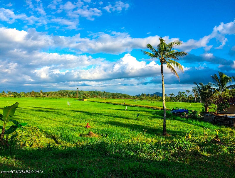
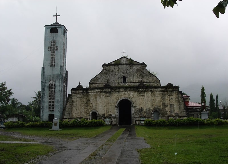
Dagami
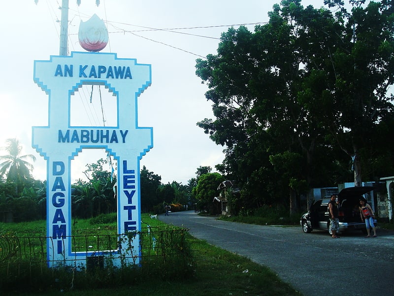
Municipality in Leyte, Philippines. Dagami, officially the Municipality of Dagami, is a 3rd class municipality in the province of Leyte, Philippines. According to the 2020 census, it has a population of 36,178 people.
Waray-Waray is the language spoken by the residents called Dagamin-on.
It is classified as a third class municipality and mere dependent on agriculture such as coconut, rice and corn farming. The employment rate is 63% of the total population workforce in the municipality. Its total land area of 161.5 square kilometers, equivalent to 16,165 hectares. More than half of its plains on the eastern side is cultivated for rice and corn farming while the western side is planted with coconut trees. Coconut production is a major source of income.Tubâ and copra - the white raw material from the coconut where coconut oil is extracted.
The town of Dagami is famous for its local delicacies called binagól (a distinct dessert made from sweetened large mashed taro called talian packed inside a leaf-covered coconut shell), and morón (a kind of sweetened rice cake, optionally added with peanuts or chocolate wrapped inside a banana leaf) and sagmani.
The town of Dagami, Leyte celebrates its feast every 27 May, to honor the town's patron, St. Joseph. They also celebrate this along with their festival, the Dinagamihan Festival[7]
Silago
Municipality in Leyte, Philippines. Silago, officially the Municipality of Silago, is a 4th class municipality in the province of Southern Leyte, Philippines. According to the 2020 census, it has a population of 13,116 people. It used to be barrio of Hinunangan until Executive Order No. 326 dated May 17, 1951 separated it from the mother town. The town has an ebony beach with unique black sand.[8]
Saint Bernard
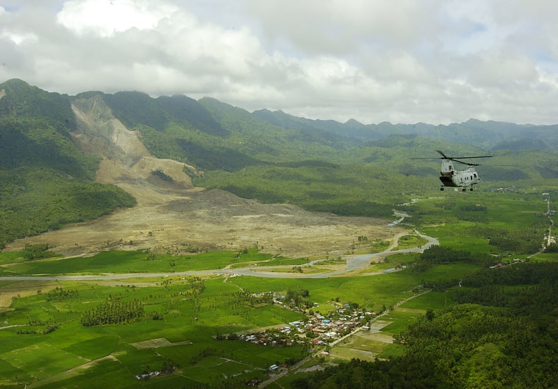
Municipality in Leyte, Philippines. Saint Bernard, officially the Municipality of Saint Bernard, is a 4th class municipality in the province of Southern Leyte, Philippines. According to the 2020 census, it has a population of 28,414 people. [9]