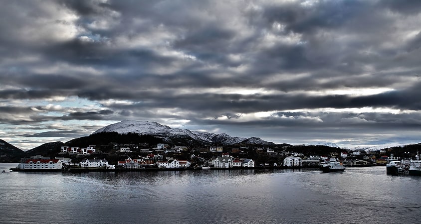
Discover 10 hidden attractions, cool sights, and unusual things to do in Kristiansund (Norway). Don't miss out on these must-see attractions: Kvernberget, Kirkelandet Church, and Sørsundbrua. Also, be sure to include Grip fyr in your itinerary.
Below, you can find the list of the most amazing places you should visit in Kristiansund (Møre og Romsdal).
Table of Contents
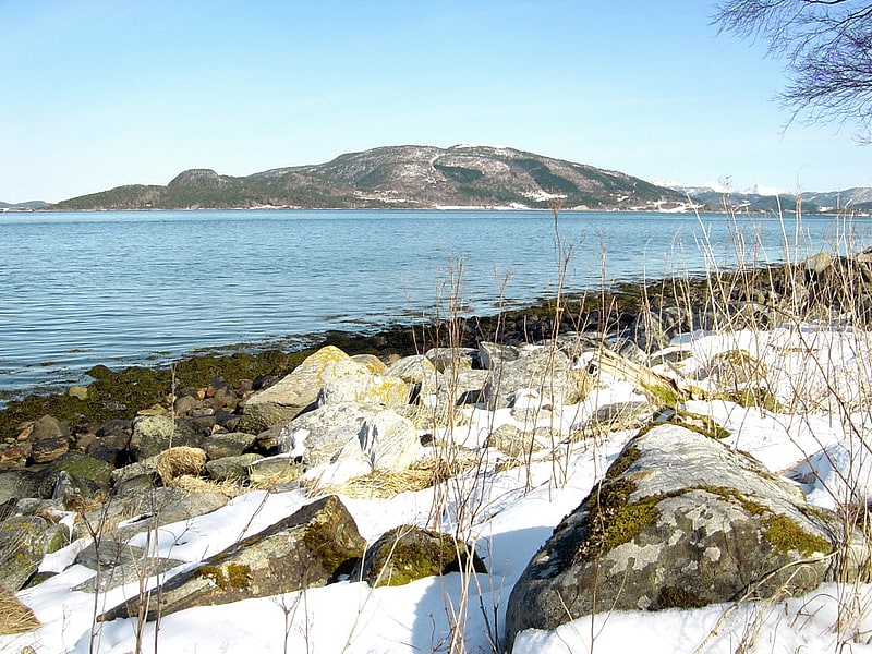
Kvernberget
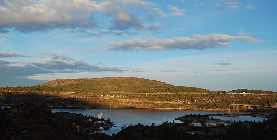
Kvernberget is a barren mountain formation with a maximum elevation of 205 metres. The mountain is located on the island of Nordlandet on the western edge of the town of Kristiansund in Kristiansund Municipality in Møre og Romsdal county, Norway. Kristiansund Airport, Kvernberget, which sits nearby, takes its name from the mountain.
For a number of years, Kvernberget and the surrounding area have been popular for hiking and simple mountaineering activities, and the summit is Kristiansund's most popular hiking destination. From the summit, much of the Nordmøre district of Møre og Romsdal county may be seen in fair weather. A drinking water reservoir is located inside the mountain.[1]
Kirkelandet Church
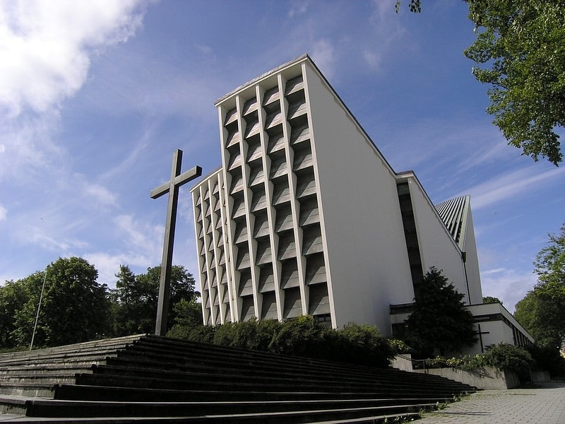
Also known as: Kirkelandet kirke
Kirkelandet Church is a parish church of the Church of Norway in Kristiansund Municipality in Møre og Romsdal county, Norway. It is located on the island of Kirkelandet in the town of Kristiansund. It is the church for the Kristiansund parish which is part of the Ytre Nordmøre prosti in the Diocese of Møre. The white, concrete church was built in a modern, rectangular style in 1964 by the architect Odd Østbye. The church seats about 550 people.
The church is also the seat of the Ytre Nordmøre prosti (deanery), and Gerd Anne Aarset is the Dean who is seated here. Tormod Sikkeland is the pastor of the congregation.[2]
Address: Langveien 41, 6509 Kristiansund
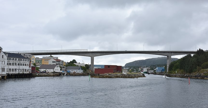
Sørsundbrua
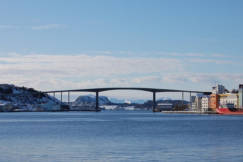
Cantilever bridge. The Sørsund Bridge is a bridge that crosses the Sørsundet strait between the islands of Kirkelandet and Innlandet in the town of Kristiansund which is in Kristiansund Municipality, Møre og Romsdal county, Norway. The 408-metre-long bridge has 19 spans, with a main span of 100 metres. The bridge opened in 1963 and it carries County Road 420.[3]
Address: fra Kirkelandet, 6500 Kristiansund
Grip fyr
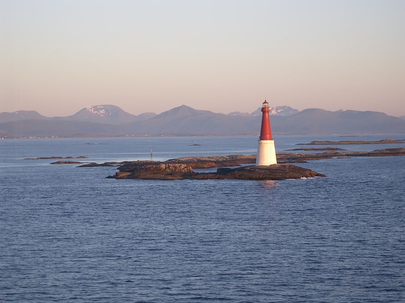
Lighthouse in Norway. The Grip Lighthouse is located in the Grip archipelago in the municipality of Kristiansund in Møre og Romsdal county, Norway. The lighthouse was built between 1885 and 1888 on the 7-metre high islet of Bratthårskollen, north of Gripholmen.[4]
Address: Grip �, Kristiansund
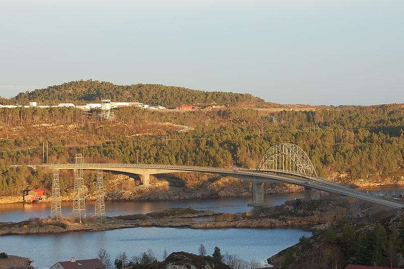
Nordsundbrua
Bridge. The Nordsund Bridge is a bridge that crosses the Nordsundet strait between the islands of Nordlandet and Gomalandet in the town of Kristiansund which is in Kristiansund Municipality, Møre og Romsdal county, Norway. The bridge is 333 metres long, and the maximum clearance to the sea is 28 metres. The bridge carries Norwegian National Road 70.
The current bridge replaced an older bridge that was opened on 20 December 1936. The old bridge was a steel arch bridge that was 304 metres (997 ft) long and had a main span of 80 metres (260 ft).[5]
Address: fra Nordlandet, 6500 Kristiansund
Innlandet
Island in Norway. Innlandet is a county in Norway. It was created on 1 January 2020 with the merger of the old counties of Oppland and Hedmark. The new county has an area of 52,113 square kilometres, making it the second largest county in Norway after Troms og Finnmark county.
The county name translates to "The Inland" which reflects that the county is the only landlocked county in Norway. The county covers approximately 17% of the total area of the mainland area of Norway. It stretches from the Viken county and the Oslo region in the south to Trøndelag county in the north. In the northwest, the county borders Møre og Romsdal and the Vestland county in the west. To the east the county borders the Swedish counties of Värmland and Dalarna.
The northern and western areas of the county are dominated by the mountainous areas Rondane, Dovrefjell and Jotunheimen. The Galdhøpiggen mountain is located within the Innlandet part of Jotunheimen and at 2,469 m (8,100 ft) it is the tallest mountain in Norway. The eastern and southern areas of the county are mainly made up of forests and agricultural land. Mjøsa, Norway's largest lake, is located in the southern end of Innlandet, and Glomma the longest river in Norway also flows through the county.
Agriculture and forestry are two important industries in the county with approximately 20% of Norway's agricultural production and about 40% of timber.
The 1994 Winter Olympics were held at Lillehammer, the second-largest city in Innlandet county.[6]
Omsund Bridge
Also known as: Omsundbrua
Cantilever bridge. The Omsund Bridge is a bridge that crosses the strait Omsundet between the islands of Frei and Nordlandet in Kristiansund Municipality in Møre og Romsdal county, Norway. The link is actually made up of two bridges: The main bridge crosses form Nordlandet to the islet of Rensvikholmen and then the smaller Rensviksundet bridge completes the crossing to Frei.
Prior to the merger of Kristiansund and Frei municipalities on 1 January 2008, the bridges crossed the border between the two municipalities. The original bridge was in use from 1940 until 1981. The second bridge is currently in use, and a third bridge has been proposed. The bridges lies just south of the Kristiansund Airport, Kvernberget.[7]
Viadukten

Bridge
Address: Wilhelm Dalls vei 25, Kristiansund
Sundbåten
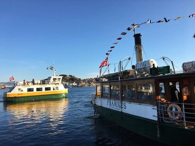
Boat or ferry, Transport
Address: Kongens Plass 1, 6509 Kristiansund
Aspøya
Island in Norway. Aspøya is an artificial island in Tingvoll Municipality in Møre og Romsdal county, Norway. It is located between the Freifjorden and the Tingvollfjorden. The European route E39 highway crosses Aspøya and connects it to the nearby island of Bergsøya to the west by the Bergsøysund Bridge–part of the Krifast bridge and tunnel system which connects the town of Kristansund to the mainland. To the east, the E39 highway connects it to the Straumsnes peninsula in Tingvoll.
The highest point on the 20-square-kilometre (7.7 sq mi) island is the 372-metre (1,220 ft) mountain Vettafjellet. The artificial island was once a peninsula that was connected to the mainland by the narrow, 150-metre (490 ft) wide Nålsundeidet isthmus. In 1905, the isthmus was excavated to provide an 8-metre (26 ft) wide canal through which boats can travel. The completion of the canal, therefore, made Aspøya into an island.[8]