Discover 10 hidden attractions, cool sights, and unusual things to do in Jostedalsbreen National Park (Norway). Don't miss out on these must-see attractions: Lodalskåpa, Briksdalsbreen, and Austerdalsbreen. Also, be sure to include Brenibba in your itinerary.
Below, you can find the list of the most amazing places you should visit in Jostedalsbreen National Park (Sogn og Fjordane).
Table of Contents
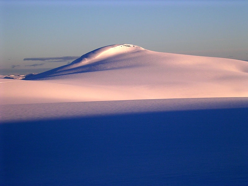
Lodalskåpa
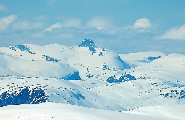
Nunatak in Norway. Lodalskåpa is the highest nunatak on the Norwegian glacier Jostedalsbreen. It is located on the border between the municipalities of Stryn and Luster in Vestland county, Norway, within Jostedalsbreen National Park.
The 2,083-metre (6,834 ft) tall Lodalskåpa is located 3 kilometres (1.9 mi) north of Brenibba and 15 kilometres (9.3 mi) northeast of Høgste Breakulen mountain. The lakes Austdalsvatnet and Styggevatnet lie about 10 kilometres (6.2 mi) to the east.
The first ascent may have happened in 1820 by Gottfried Bohr. The easiest route to climb Lodalskåpa starts in the village of Bødalen in Stryn, then going up Brattebakken mountain to the Bohr glacier (Norwegian: Bohrsbreen). Around the southern summit to the col, then scrambling to the main summit, approximately one rope length.[1]
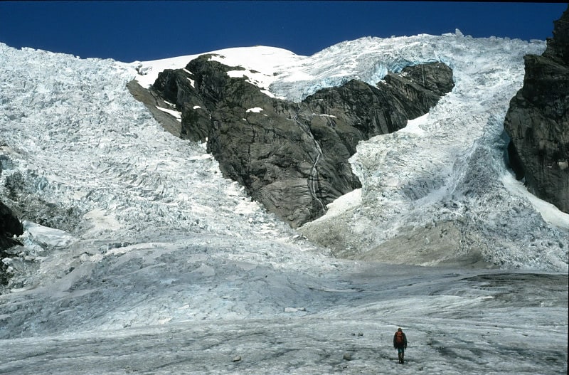
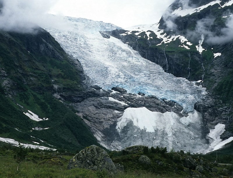
Briksdalsbreen
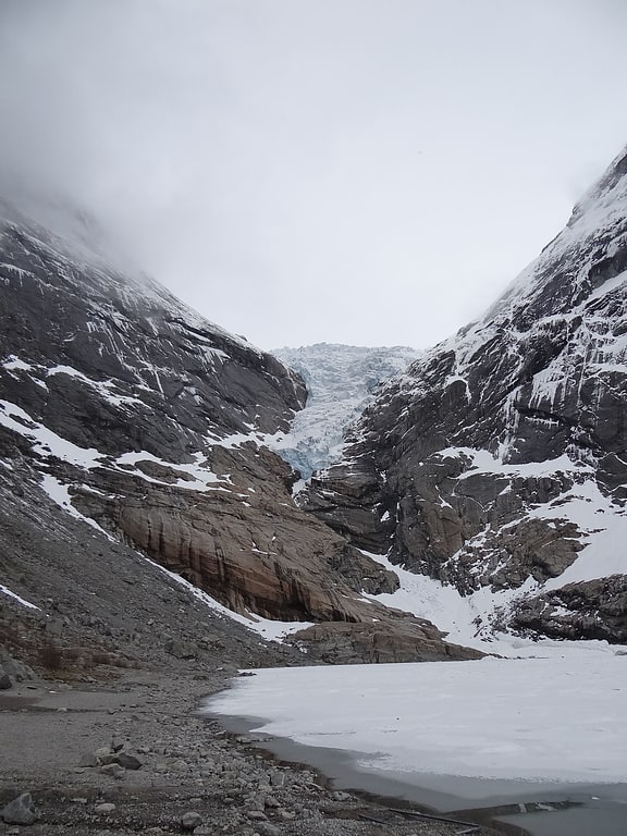
Glacier reached by a scenic hike. Briksdalsbreen is one of the most accessible and best known arms of the Jostedalsbreen glacier. Briksdalsbreen is located in the municipality of Stryn in Vestland county, Norway. The glacier lies on the north side of the Jostedalsbreen, in Briksdalen which is located at the end of the Oldedalen valley, about 25 kilometres south of the village of Olden. It is located inside Jostedalsbreen National Park. Briksdalsbreen terminates in a small glacial lake, Briksdalsbrevatnet, which lies 346 metres above sea level.
The size of Briksdalsbreen depends not only on temperature, but is also strongly affected by precipitation. Measurements since 1900 show small changes in the first decades, with advances in the glacier front in 1910 and 1929. In the period from 1934 to 1951 the glacier receded by 800 metres (2,600 ft), exposing the glacial lake. In the period from 1967 until 1997 the glacier expanded by 465 metres (1,526 ft) and covered the whole lake, with the glacier front ending at the lake outlet. The glacier attracted international attention in the 1990s, as it was growing at a time when other European glaciers were in decline.
After the year 2000, the glacier once again receded. In 2004 it had receded to 230 metres (750 ft) behind the lake outlet and in 2007 the glacier front was on dry land behind the lake. In this regard, its position approximated the situation in the 1960s. However, glaciologists speculate that the size of the glacier was at its smallest since the 13th century.
In 2008, the glacier front had only receded by 12 metres (39 ft) since the 2007 measurement. The slower melting is explained by the glacier being completely on dry land. The winter of 2007–2008 saw an increase in glacier mass, which was expected to move the glacier front forward around 2010. This was confirmed in the fall of 2010, when measurements showed that the glacier had advanced 8 metres (26 ft) over the last year This was however in comparison with the 2009 measurements, which saw the glacier being the most receded since measurements started in 1900.
As the winter of 2009–2010 saw little snow and the summer temperature in 2010 was 2.5 to 3 °C (4.5 to 5.4 °F) above average, Professor Atle Nesje predicts that further strong receding will be seen in 2013. As Briksdalsbreen is now very narrow at some stretches, it is possible that it will temporarily disconnect from the larger Jostedalsbreen.[2]
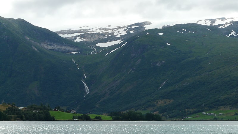
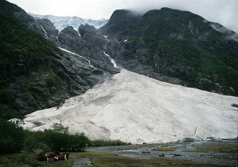
Austerdalsbreen
Glacier in Norway. Austerdalsbreen is a glacier in the municipality of Luster in Vestland, Norway. It is a side branch of the Jostedalsbreen glacier, and is included in the Jostedalsbreen National Park. The glacier is fed by the three steep glaciers Odinbreen, Torbreen and Lokebreen. The lower, flat part of the glacier displays a characteristic fishbone or lobster tail pattern.[3]
Brenibba
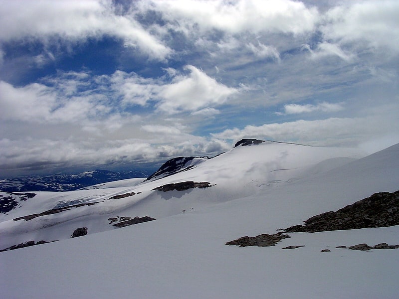
Nunatak in Norway. Brenibba is a nunatak protruding from the north end of the Jostedalsbreen glacier in the Breheimen mountain range. It is located in the municipality of Luster in Vestland county, Norway. Brenibba is 2.5 kilometres south of Lodalskåpa and 12 kilometres northeast of Høgste Breakulen. It is part of the Jostedalsbreen National Park. The lakes Austdalsvatnet and Styggevatnet are located 11 kilometres west of Brenibba.[4]
Snønipa
Mountain in Norway. Snønipa is a mountain in Vestland county, Norway. The 1,827-metre tall mountain lies on the border of the municipalities of Sunnfjord and Gloppen. It forms a nunatak of the Myklebustbreen glacier.[5]
Breheimen
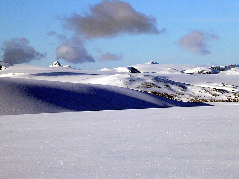
Mountain range. Breheimen is a mountain range in the Innlandet and Vestland counties in Norway. The area lies west of the Jotunheimen mountain range. The mountain range lies to the northwest of the Sognefjellsvegen road, north of the Sognefjorden, south of the Nordfjorden and Norwegian National Road 15, and east of Norwegian National Road 5 and European route E39. The mountain range includes Jostedalsbreen National Park and Breheimen National Park.
The name Breheimen means "home of the glaciers", since it has many glaciers, including Norway's largest glacier, Jostedalsbreen. Other glaciers in the range include Harbardsbreen and Spørteggbreen. Some of the major mountains in the area include Skåla, Lodalskåpa, Høgste Breakulen, Tverrådalskyrkja, Hestbreapiggan, and Brenibba. The region is home to several large lakes such as Austdalsvatnet and Styggevatnet.[6]
Myklebustbreen

Glacier in Norway. Myklebustbreen or Snønipbreen is the seventh largest glacier in mainland Norway. It is located in the municipalities of Nordfjord, Gloppen, and Stryn in Vestland county. Its highest point is located just below the nunatak Snønipa, with an altitude of 1,827 metres. The lowest point on the glacier is at an elevation of 890 metres above sea level.
The villages of Byrkjelo and Egge both lie on the European route E39 highway which runs north and south, about 7 kilometres (4.3 mi) east of Myklebustbreen. The Oldedalen valley lies to the east of the glacier. The glacier also lies northwest of the large Jostedalsbreen glacier, and both are part of Jostedalsbreen National Park. Jostedalsbreen and Myklebustbreen are separated by the Stardalen valley.[7]
Grovabreen
Glacier in Norway. The Grovabreen glacier is located in Vestland county, Norway. It covers an area of about 20 square kilometres in Sunnfjord Municipality in the Sunnfjord region. The highest point on the glacier sits at an elevation of 1,636 metres above sea level. The glacier is part of Jostedalsbreen National Park, just south of the lake Jølstravatnet. The village of Skei lies about 8 kilometres north of the glacier and the village of Haukedalen lies about 9 kilometres southwest of the glacier. The Jostefonn glacier lies about 5 kilometres to the south of this glacier; both are located at the north end of the Gaularfjellet mountains.[8]
Bøyabreen
Glacier in Norway. Bøyabreen is a glacier in the Fjærland area of Sogndal Municipality in Vestland county, Norway. It is located inside Jostedalsbreen National Park, and it is a side branch of the large Jostedalsbreen glacier.[9]
Supphellebreen
Glacier in Norway. Supphellebreen is a glacier in the Fjærland area of Sogndal Municipality in Vestland county, Norway. It is located about 10 kilometres north of the village of Fjærland.
It is located inside Jostedalsbreen National Park. It is a side branch of the main Jostedalsbreen glacier. The glacier is split into an upper and a lower part, with a non-glaciated area between. The glacier reaches down to an elevation of 60 metres (200 ft) above sea level, the lowest glacier level in southern Norway. The Bøyabreen glacier lies just northwest of Supphellebreen.[10]