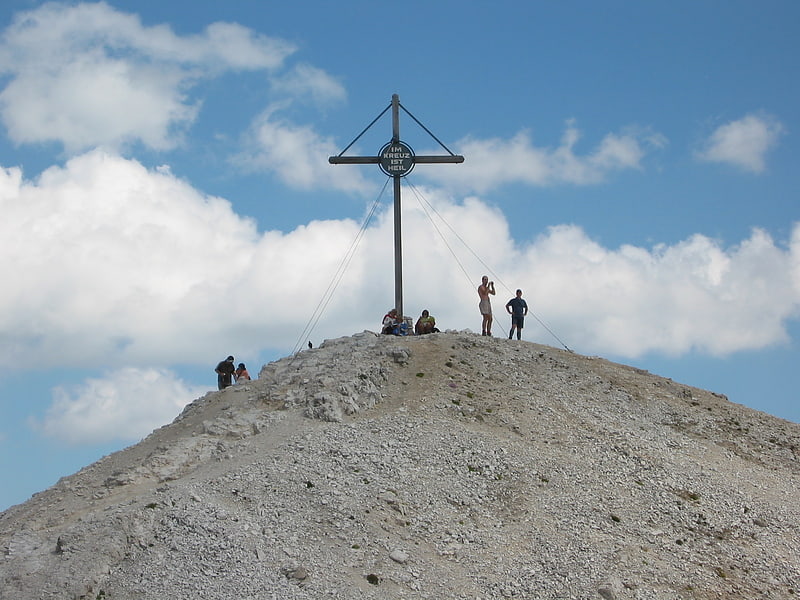
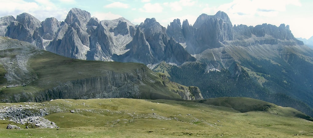
Discover 35 hidden attractions, cool sights, and unusual things to do in Dolomites (Italy). Don't miss out on these must-see attractions: Marmolada, Monte Piana, and Pizes de Cir. Also, be sure to include Toblacher See in your itinerary.
Below, you can find the list of the most amazing places you should visit in Dolomites (Veneto).
Table of Contents
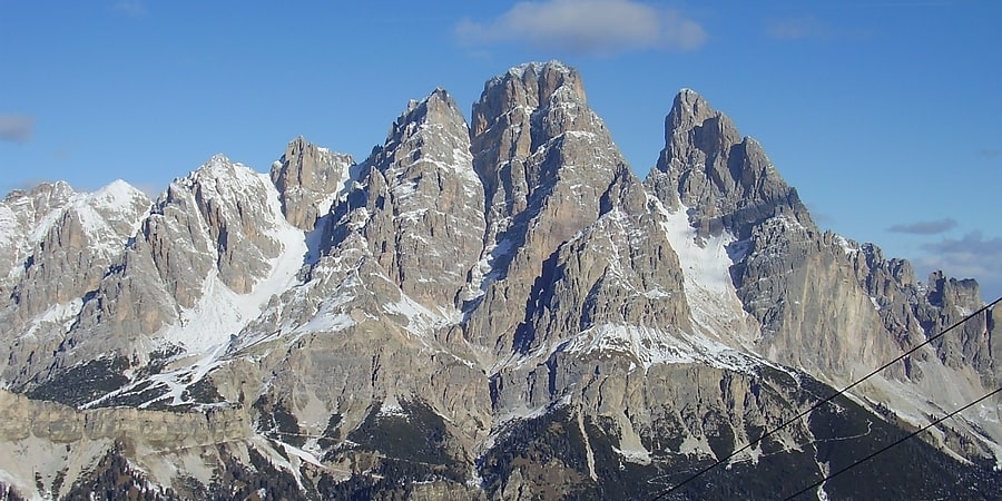
Marmolada
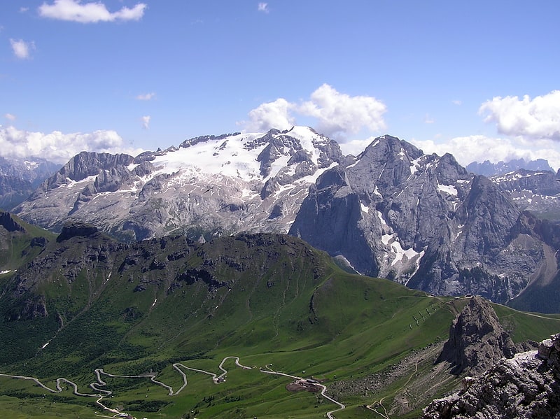
Prominent peak with a ski resort. Marmolada is a mountain in northeastern Italy and the highest mountain of the Dolomites. It lies between the borders of Trentino and Veneto. The Marmolada is an ultra-prominent peak.[1]
Monte Piana
Mountain in Italy. Monte Piana is a 2,324-metre tall mountain in the Sexten Dolomites and located on the border between the provinces of South Tyrol and Belluno. The smaller Northern summit of the mountain is named Monte Piano.
During the so-called "White War" in World War I the mountain was hotly contested between the Austrian and Italian Armies. The Austrians had occupied the Northern summit Monte Piano, while the Southern summit Monte Piana was in Italian hands. Today many remnants of the fierce fighting can still be found on both summits.[2]
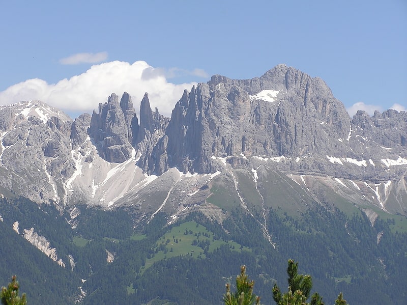
Pizes de Cir
Also known as: Gruppo del Cir
Mountain range in Italy. The Pizes de Cir is a mountain range in South Tyrol, Italy. They are part of the Dolomites, north of Gardena Pass. The highest peak of this mountain range is the Gran Cir with an elevation of 2592 meters.[3]
Toblacher See
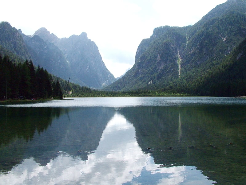
Also known as: Lago di Dobbiaco
Lake in Italy. The Toblacher See is a lake in the municipality of Toblach in South Tyrol, Italy.[4]
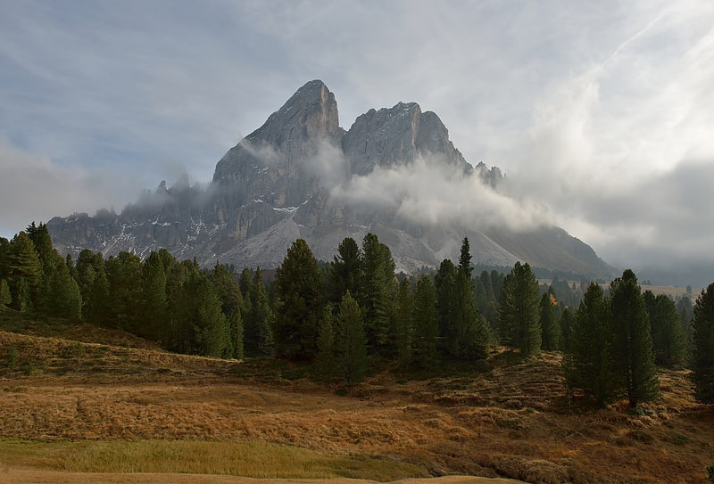
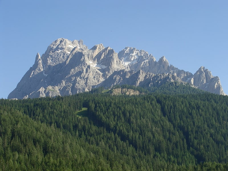
Schlern
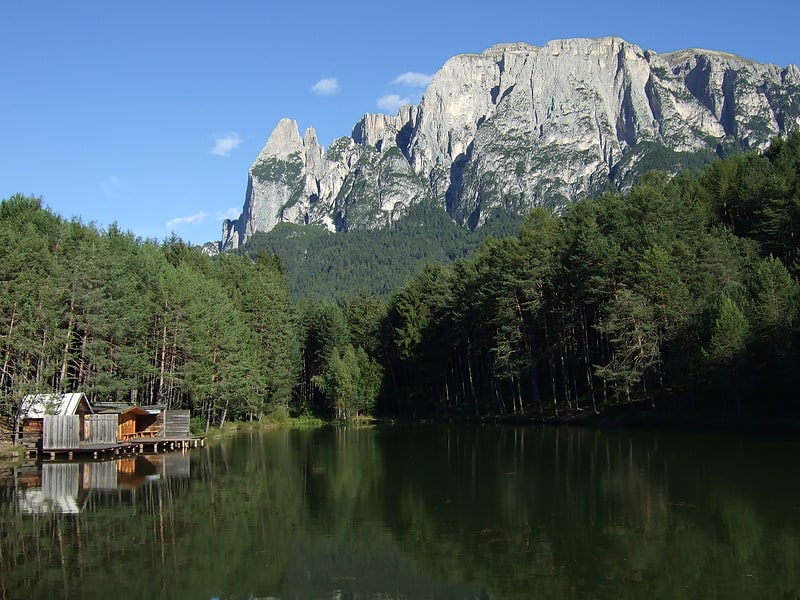
Mountain in Italy. The Schlern is a mountain of the Dolomites in South Tyrol, Italy. The peak at the north west end of the mountain was first ascended in July 1880 by Johann Santner. It is named the Santner Spitze in his honour.
The Schlern dominates the villages of Seis am Schlern and Völs am Schlern, and the summit can be reached following the circular route marked with the number 1 from both villages.
At 1,700 metres (5,577 ft), there is the Schlernboden inn and on the summit plateau is the Schlernhaus inn 2,457 metres (8,061 ft), both open from 1 June to 15 October. The highest summit is the Petz with 2,564 metres (8,412 ft).
The Schlern is sung of in the Bozner Bergsteigerlied as one of South Tyrol's landmarks. Its characteristic profile appears on the Der Schlern - Zeitschrift für Südtiroler Landeskunde (Magazine for South Tyrolean Regional Studies) and the logo pressed into Loacker's wafer biscuits.[5]
Antelao
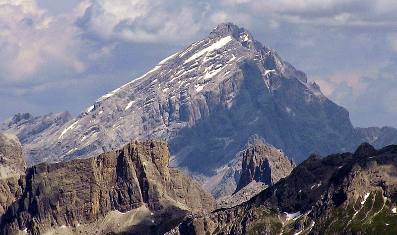
Mountain in Italy. Monte Antelao is the highest mountain in the eastern Dolomites in northeastern Italy, southeast of the town of Cortina d'Ampezzo, in the region of Cadore. The Monte Antelao is an ultra-prominent peak.
It is known as the "King of the Dolomites" (- Marmolada, the highest of all the Dolomites, is the "Queen" although composed mostly of limestones). As the highest pinnacle of the eastern Dolomites, the Antelao is not part of a closed massif or a high plateau, but a single, mighty rock pyramid. Like many Dolomite peaks, Antelao is steep, rocky, and pointed; it also sits close to the edge of the Dolomite uplift and so has dramatic drops to the nearby valleys. When the weather is good, Monte Antelao is clearly visible from Trieste on the Adriatic Sea.
The summit was reached for the first time in 1850 by the hunter Matteo Ossi from San Vito, who then accompanied the mountaineer Paul Grohmann to the summit in 1863.
The easiest route is from the north, known as the "Laste", a steep, narrow ridge. It involves a good deal of exposure, and a few short technical sections, such as a chimney, protected by cables. There is a refuge, the Rifugio Galassi, which is located below the Forcella Piccola in the upper Val d'Oten.[6]
Sorapiss
Mountain. Sorapiss, also referred to as Sorapis or Punta Sorapiss, is a mountain in the Dolomites within the Veneto region of northern Italy. Situated in the comune of Cortina d'Ampezzo, it has an elevation of 3,205 metres. In its vicinity is a mountain pass of the same name, as well as Sorapiss Lake, at the foot of the mountain. The mountain range is part of the "Natural Park of the Ampezzo Dolomites".[7]
Sass de Stria
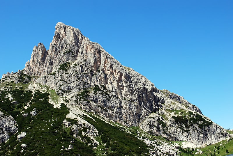
Mountain in Italy. Sass de Stria is a mountain of the Veneto, Italy. It has an elevation of 2,477 meters. During the First World War, the mountain and surrounding area was the scene of fighting between Italy and Austria-Hungary.[8]
Rosengartenspitze
Also known as: Cima Catinaccio
Mountain in Italy. The Rosengartenspitze is a mountain in the Dolomites in South Tyrol, Italy.[9]
Cima Brenta
Mountain in Italy. Cima Brenta is the highest mountain in the Brenta group, a subgroup of the Rhaetian Alps in the Italian Region of Trentino-Alto Adige, with a reported height of 3,150 metres. The mountain rises imposingly up between the rock towers and pinnacles of the central Brenta Group. A sharp ridge connects the mountain on its southern side to the Spallone die Massodi. The northern ridge steeply descends towards Bocca del Tuckett. Towards north west a slender couloir descends all the way from the top towards the Vedretta di Brenta Inferiore, the mountain's 'lower' glacier. Large shouldering formations extend towards the west, culminating in the Cima Mandrone and the Punti di Campiglio, and northwest, culminating in the Cima Massari. Above these formations a glacier, the Vedretta di Brenta Superiore, the 'upper' glacier descends the mountain, being cut off by a vertical precipice over the Vedretta di Brenta Inferiore. On the eastern side the mountain rises up with an imposing 700-meter high vertical rock face with on its left side a distinct orange-like color. Above this lies a horizontal ledge, the Cengia Garbari, on which the Via delle Bocchette Alte proceeds. The actual mountain has two summits that are some 250 meters apart, of which the eastern top reaches the highest altitude. The glaciers, vedrette, have been shrinking steadily over the last decades as a result of climate change. The historical name Cima Brenta was not always as evident as it is today. The toponymy of these parts was largely established by Nepomuceno Bolognini. The mountain, somehow, became a place where nationalistic sentiments were demonstrated. In 1889 the Austro-Hungarian authorities decided to rename the mountain to Kaiser Franz Josef-Spitze. The name never caught on -not even in German literature. When the occasion occurred to raise a large yellow-black imperial flag on the summit, fully visible from Val Rendena as well as from Molveno, local guide Giuseppe 'Bepaccia' Zeni and some companions climbed the mountain to take it down. In 1912, on the other hand, the Italian flag was hoisted by irredentists on Cima Brenta, deliberately just before the first snow fall, so that the flag remained visible until the next summer. Around 1953 electricity company SISM, predecessor of ENEL proposed to build a cable car trajectory from Molveno to the top of Cima Brenta. The plans were abandoned and in 1967 the mountain became protected as part of the Parco Naturale Adamello-Brenta.[10]
Campanile Basso
Mountain in Italy. Campanile Basso is a mountain in the Brenta group, a subgroup of the Rhaetian Alps in the Italian Region of Trentino-Alto Adige, with a height of. It is of a slender, almost fully vertical shape on all sides, rising 300 metres straight up. The mountain is named for its similarity in shape to a belltower and it being low compared to the neighboring Campanile Alto and Brenta Alta. The German alpinist Karl Schulz introduced in 1884 the name Guglia di Brenta, a name widely used until World War I and especially enduring in German literature, but considered inappropriate by locals and Italian climbers. Geologically, Campanile Basso is entirely formed of Triassic sedimentary rock, dense and compact dolomite. Due to its inaccessible appearance it was long left untouched during the alpine exploration of the Eastern Alps. Around the turn of the century a competitive race for the first ascent started, which took inspiration from the emerging nationalistic feelings in the region, as much as from the ascent of rock climbing as a sport. Most of the illustrious forebears of modern rock climbing climbed this mountain during the first half of the Twentieth century.[11]
Peitlerkofel
Also known as: Sass de Putia
Mountain in Italy. The Peitlerkofel is a mountain of the Dolomites in South Tyrol, Italy. A solitary mountain, it stands between Val Badia to the east and the Villnöß valley to the west, in the very north of the Dolomites. It boasts two distinct summits, the Grosser Peitler and the Kleiner Peitler, which are divided by a deep ridge.
It is a fairly popular mountain to climb, with the normal and easiest route being from the south. On a fine day it is common to have hundreds of people on the mountain at once. The first documented ascent occurred on June 25, 1885, although it is expected that local hunters probably reached the summit long before then.[12]
Cimon della Pala
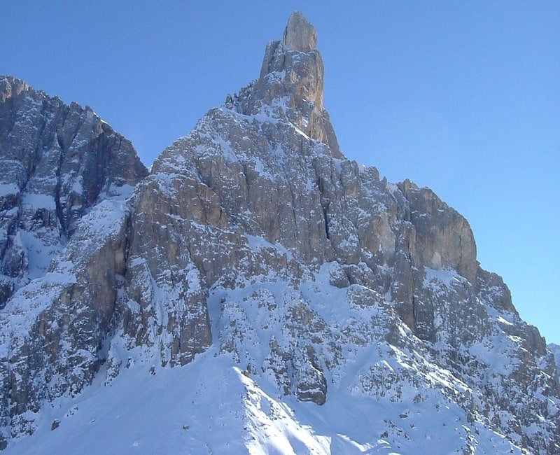
Peak in Italy. Cimon della Pala, sometimes called Cimone and The Matterhorn of the Dolomites, is the best-known peak of the Pale di San Martino group, in the Dolomites, northern Italy. Although it is not the highest peak of the group, the Cima Vezzana being a few metres higher, its slender point, which can be seen from the Rolle Pass, dominates the landscape.[13]
Cima Undici
Mountain in Italy. The Cima Undici - Elferkofel is a mountain in the Sexten Dolomites in South Tyrol, Italy.[14]
Address: Cima Undici, Dolomites
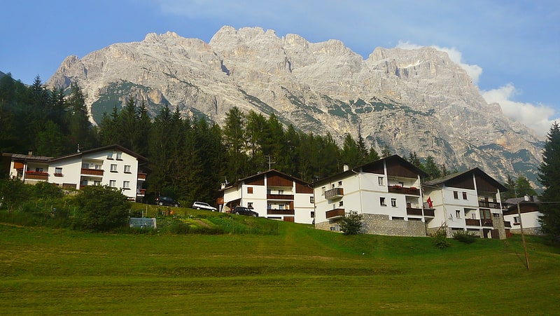
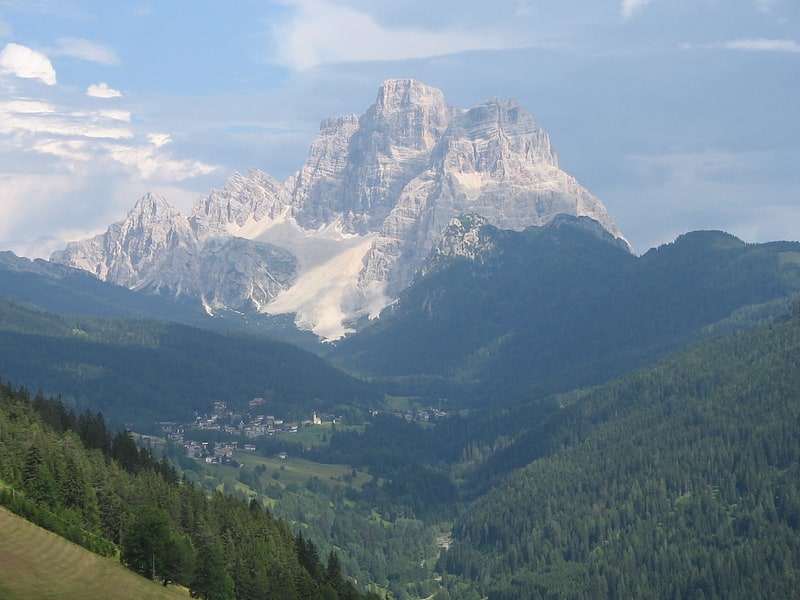
Monte Civetta
Mountain in Italy. Monte Civetta is a prominent and major mountain of the Dolomites, in the Province of Belluno in northern Italy. Its north-west face can be viewed from the Taibon Agordino valley, and is classed as one of the symbols of the Dolomites.
The mountain is thought to have been first climbed by Simeone di Silvestro in 1855, which, if true, makes it the first major Dolomite peak to be climbed. The north-western face, with its 1,000-metre-high cliff, was first climbed in 1925 by Emil Solleder and Gustl Lettenbauer. It is historically considered the first "sixth grade" in six-tier scale of alpinistic difficulties proposed by Willo Welzenbach (corresponding to 5.9). Thirty years later UIAA used this as a basis for its grading system.
The famed Svan mountain climber Mikhail Khergiani died in a climbing accident on Monte Civetta in 1969.[15]
Address: 5 place Henri IV, Dolomites
Cima Tosa
Mountain in Italy. Cima Tosa is a mountain in the Brenta group, a subgroup of the Rhaetian Alps in the Italian Region of Trentino-Alto Adige, with a reported height of 3,136 metres. it is the second highest peak of the Brenta group in the southern limestone Alps after the Cima Brenta.
The height of the summit marked on the IGM maps is 3173 m, which would make it the highest peak in the Brenta Dolomites. An electronic measurement campaign in 2015 determined the new height. The change could be linked to the partial melting of the ice cap that covers it. Being the second highest peak of the Brenta group also changed Cima Tosa's prominence making its prominence 589 m above the Bocca di Brenta.
The mountain rises above Val Rendena with its 800-metre (2,600 ft) vertical north face with a steep couloir called Canalone della Tosa dividing it from its ante-peak, Crozzon di Brenta. The summit is topped by a snow cupola above the rock face, almost like a shaven head, hence the name Cima Tosa (Iocal dialect: Shaven Summit). The south-eastern side descends in a series of snowy terraces and vertical rock pillars.[16]
Dürrenstein
Also known as: Picco di Vallandro
Mountain in Italy. The Dürrenstein is a mountain in the Dolomites in South Tyrol, Italy.[17]
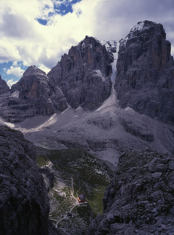
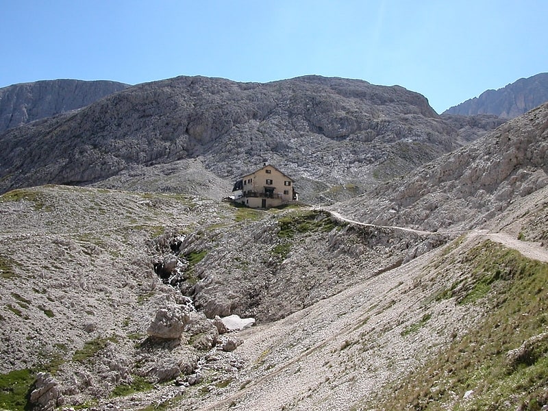
Rifugio Città di Fiume
The Città di Fiume refuge is an alpine refuge in the Dolomites located in the municipality of Borca di Cadore, towards the end of the Fiorentina valley, at an elevation of 1,917 m a.s.l. It is located along the slopes of the Puina col, dominated to the south by Mount Pelmo.
Seekofel
Also known as: Croda del Becco
Mountain in Italy. The Seekofel is a mountain in the Dolomites on the border between South Tyrol and the Province of Belluno, Italy.[18]
Rifugio Vajolet
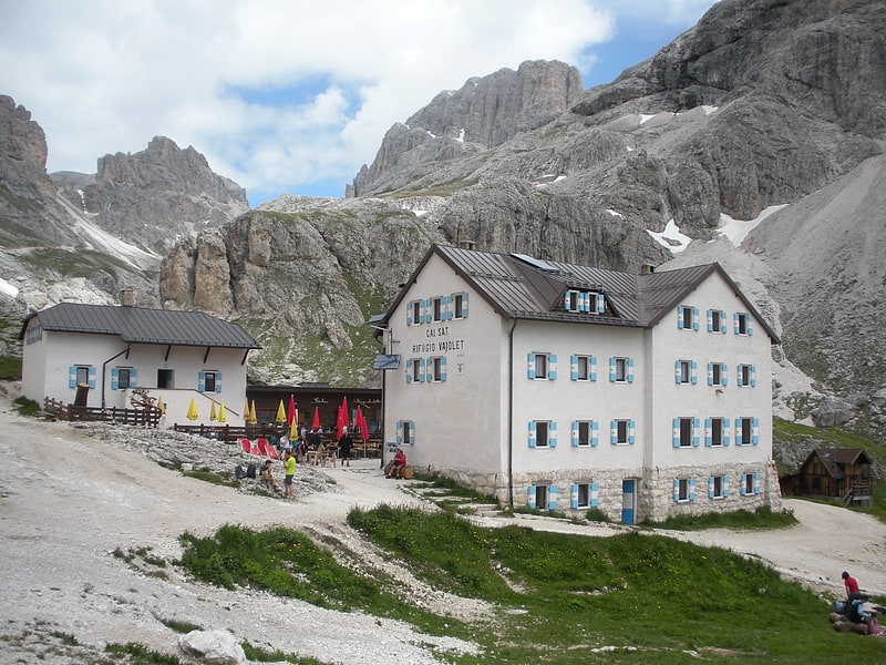
The Vajolet hut is an alpine hut located in the Catinaccio group in the Dolomites, in the municipal area of Vigo di Fassa, at an altitude of 2,243 meters.
Address: Località Vajolet, Dolomites
Cristallo Mountain
Also known as: Gruppo del Cristallo
Mountain in Italy. Cristallo is a mountain massif in the Italian Dolomites, northeast of Cortina d'Ampezzo, in the province of Belluno, Veneto, northern Italy. It is a long, indented ridge with four summits higher than 3,000 metres. The mountain range is part of the "Natural Park of the Ampezzo Dolomites".
In the north of the Cristallo group is the 1,530 m high mountain pass "Cimabanche" (in German: "Im Gemärk" also "Gemärk Pass", in Ladin: "Sorabances"), in the south the mountain pass Tre Croci (1,809 m, in Ladin: "Son Zuógo").[19]
Monte Pelmo
Also known as: Pelmo
Mountain in Italy. Monte Pelmo is a mountain of the Dolomites, in the province of Belluno, Northeastern Italy.
The mountain resembles a giant block which stands isolated from other peaks, so can be seen clearly from the neighbouring valleys and from nearby mountains such as Antelao and Monte Civetta.
Monte Pelmo was one of the first major Dolomite peaks to be climbed, by Englishman John Ball, who later became president of the UK's Alpine Club, in 1857. He set out with a chamois hunter from the Boitevalley towards Monte Pelmo. Over the long ledge named after Ball, which the chamois hunters refused to cross, Ball got into the large cirque, through which he climbed over the small Pelmo glacier to below the summit structure.
West of the summit lies a secondary peak, Pelmetto (meaning "Little Pelmo" in Italian), at 2,990m high, which has a 1,100-metre (3,609 ft) high north face.
So there are only a few possibilities for climbing. The best known (and easiest) ascent leads over the south-east flank. The route of the first climbers still offers a rewarding but long and strenuous mountain tour in the second degree of difficulty. Problems can be found with the above-mentioned, exposed ball band. Climbing skills and surefootedness are necessary. The ascent of Monte Pelmo should also be carried out in safe weather and without snow.
On some rocks on its western side people can admire dinosaurs prints (Sign "Orme di Dinosauri"). These are the traces of at least three dinosaurs that are approx. 220 million years old. From the path to the tracks you walk steeply uphill for about half an hour.
This mountain is surnamed "God's armchair" because its shape looks like an armchair.[20]
Cima dei Preti
Mountain in Italy. Cima dei Preti is a mountain in the Carnic Prealps, the highest peak of the Friulian Dolomites, Italy. It is located at the boundaries between the provinces of Pordenone and Belluno.[21]
Sass Rigais
Mountain in Italy. Sass Rigais is a mountain of the northwestern Dolomites in South Tyrol, northern Italy. Along with the nearby Furchetta, which is exactly the same height and only 600m away, it is the highest peak of the Geisler group. Sass Rigais offers hikers one of few Dolomites' three-thousanders the entire crossing from one side of the mountain to the other. The Via ferrata Villnössersteig is categorized between a B and C difficulty and the trail Sass Rigais steig is rated C. A crucifix is located at the summit.[22]
Rifugio Passo Principe - Grasleitenpasshütte
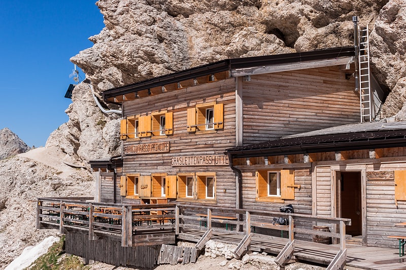
Passo Principe hut is an alpine hut located in the Catinaccio Group in the Dolomites, in the municipal area of San Giovanni di Fassa, at an altitude of 2,601 meters.
Address: Localita Rifugio di Vajolet, Dolomites
Rifugio Rosetta "Giovanni Pedrotti"
The Giovanni Pedrotti Refuge is located on the Rosetta Plateau in the Pale di San Martino Mountains at an elevation of 2,581 meters above sea level.
Address: Località Rosetta, Dolomites
Brenta
Mountain range in Italy. The Brenta Group or Brenta Dolomites is a mountain range, and a subrange of the Rhaetian Alps in the Southern Limestone Alps mountain group. They are located in the Province of Trentino, in northeastern Italy. It is the only dolomitic group west of the Adige River. Therefore, geographically, they have not always been considered a part of the Dolomites mountain ranges. Geologically, however, they definitely are - and therefore sometimes called the "Western Dolomites". As part of the Dolomites, the Brenta Group has been officially recognized as UNESCO World Heritage Site under the World Heritage Convention.[23]
Address: Comune di Tre Ville, Dolomites
Üćia de Senes - Sennes Hütte - Rifugio Sennes
The Sennes hut is an alpine mountain hut located in South Tyrol, in the Dolomite area of the Fanes - Sennes - Braies Nature Park, below the peaks of the col de Lasta and is situated at an altitude of 2 126 m.
The hut, run by the Palfrader family, has 60 seats and is open in both the winter and summer seasons.
A base for both summer and winter excursions to nearby peaks, the hut also retains a point of historical interest in a now decommissioned mountain airstrip that lies directly in front of the structure: it is a grassy runway about 400 meters long and 40 meters wide built in 1968 by the Tridentine Engineer Pioneer Corps perhaps on an earlier track used by the Austrians during the Great War.
Rifugio Antermoia
The Antermoia refuge, run by the Società Alpinisti Tridentini, is one of several alpine refuges in the Catinaccio group in the Fassa Valley catchment area. It is located in the Vallone d'Antermoia, a few hundred meters from the lake of the same name, a stopover place on the Via Alpina Yellow Trail.
Tofana di Rozes
Mountain. Tofana di Rozes is a mountain of the Dolomites in the Province of Belluno, Veneto, Italy. Located west of the resort of Cortina d'Ampezzo, the mountain's giant three-edged pyramid shape and its vertical south face, above the Falzarego Pass, makes it the most popular peak in the Tofane group, and one of the most popular in the Dolomites.[24]
Furchetta
Mountain in Italy. The Furchetta is a mountain of the Geisler group in the Dolomites in South Tyrol, Italy.
The Furchetta mountain is in the group of Odle and has been named after the great rift that divides it in two. The starting point of the mountain is in the Refuge Florence, which is reached in about 20 minutes from the mountain station of the gondola Santa Cristina Col Raiser.[25]
Rifugio Fanes
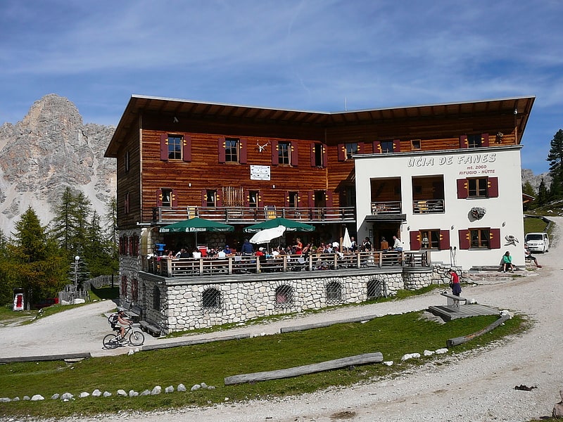
The Fanes hut is a mountain hut located in the Fanes - Sennes and Braies Nature Park in South Tyrol, at 2,062 m above sea level in the Fanes Piccolo alpine pasture, along the old military road from the Pederü hut to Cortina d'Ampezzo. The refuge is located in the municipal territory of Marebbe.
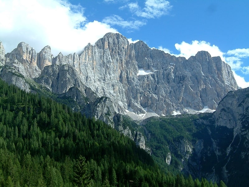
Rosengarten group
Also known as: Gruppo del Catinaccio
Massif in Italy. The Rosengarten group is a massif in the Dolomites of northern Italy. It is located between the Tierser Tal and Eggental in South Tyrol and the Fassa Valley in Trentino.
One peculiarity of the Rosengarten is the pink shade, owing to the presence of the mineral dolomite, which takes in the sunset and "glows", as celebrated in the Bozner Bergsteigerlied. Meaning "Rose garden" in German, the name refers to the legend of King Laurin and his Rose Garden, a traditional story explaining the outer appearance of the mountain range.[26]
Monte Agnèr
Also known as: Monte Agner
Mountain in Italy. Monte Agnèr is a mountain of the Dolomites located near the village of Taibon Agordino in Belluno, northeast Italy. It lies in the Pala group and is known locally as Il Pizzòn, meaning Great Peak. The mountain has several sub-peaks, Lastei d'Agnèr at 2,861m, Spiz d'Agnèr Sud at 2,652m, Torre Armena at 2,652m and Spiz d'Agnèr Nord at 2,545m. It was first climbed in 1875 by Cesare Tomé, accompanied by guides Tomaso Dal Col and Martino Gnech.[27]
Croda da Lago
Mountain in Italy. Croda da Lago is a small mountain chain in the central Dolomites in Veneto, northern Italy, just east of the Giau Pass. The highest peak of the group, the Cima d'Ambrizzola has an elevation of 2,715 metres. The range is very popular with hikers and mountain cyclists.[28]