Discover 11 hidden attractions, cool sights, and unusual things to do in Mojave National Preserve (United States). Don't miss out on these must-see attractions: Lake Tuendae, Mojave Memorial Cross, and Cima volcanic field. Also, be sure to include Clark Mountain in your itinerary.
Below, you can find the list of the most amazing places you should visit in Mojave National Preserve (California).
Table of Contents
Lake Tuendae
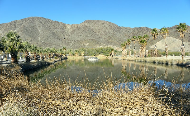
Pond in California. Lake Tuendae is an artificial pond at the Desert Studies Center in Zzyzx, California. It is inhabited by introduced mudhens as well as the endangered Mohave tui chub.[1]
Address: Desert Studies Center, Mojave National Preserve
Mojave Memorial Cross
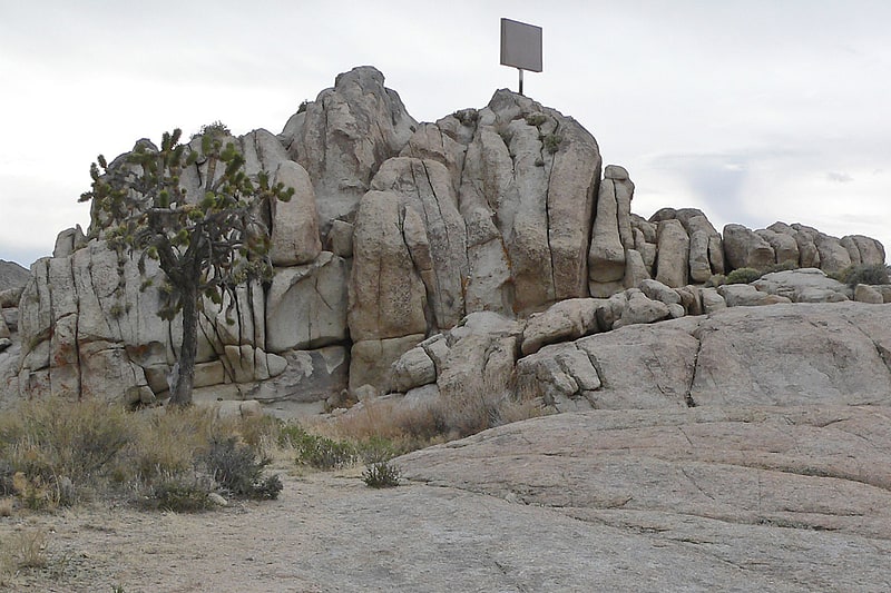
Historical landmark in San Bernardino County, California. The Mojave Memorial Cross, officially known as the White Cross World War I Memorial, is a cross formerly on public land in the Mojave desert in San Bernardino County, California that was at the center of the Salazar v. Buono legal case before the U.S. Supreme Court. The original cross was erected in 1934 to honor those killed in war.
The cross stands on Sunrise Rock, a granite outcropping adjacent to Cima Road about 12 miles (19 km) south of Interstate 15, and 6 miles (9.7 km) north of Cima, California; the trailhead leading to Teutonia Peak is on the opposite side of the road, 1,300 feet (400 m) north of the monument. The area is a saddle between Cima Dome and the Ivanpah Mountains, both of which are part of the Mojave National Preserve.[2]
Cima volcanic field
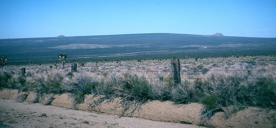
Cima volcanic field is a volcanic field in San Bernardino County, California, close to the border with Nevada. The volcanic field covers a surface area of 600 square kilometres within the Mojave National Preserve west of the Cima Dome and consists of about 40 volcanic cones with about 60 lava flows. The volcanic cones range from simple cones over multi-cratered mountains to eroded hills, and lava flows are up to 9.1 kilometres long. At least one lava tube exists in the field and can be visited.
Volcanic activity in the field commenced in the Late Miocene and after a pause between 3 and 1 million years ago continued into the latest Pleistocene. The youngest cone is known as the Black Tank cone and formed about 15,000 years before present, although it is possible that it was formed through two separate eruption events; formerly it was considered to be of historical age.[3]
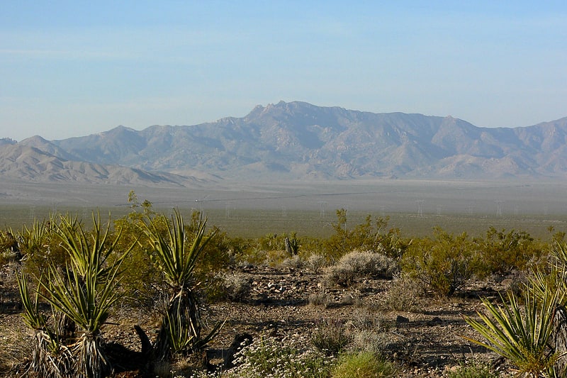
Clark Mountain
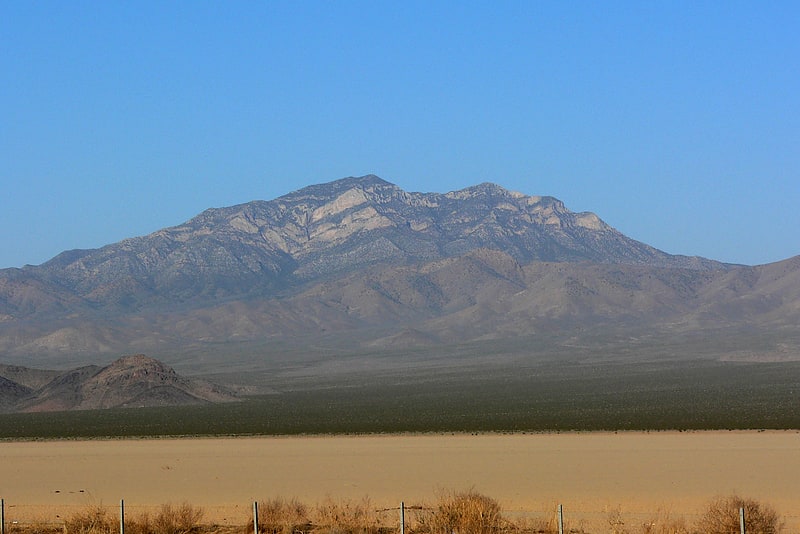
Mountain in California. Clark Mountain is a mountain located in the Clark Mountain Range in the Mojave National Preserve, close to the California-Nevada border.[4]
Mitchell Caverns
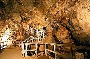
Tourist attraction in San Bernardino County, California. Mitchell Caverns, within the Mitchell Caverns Natural Preserve, is three solution limestone caves, only two of which are open to the public, located on the east side of the Providence Mountains at an elevation of 4,300 feet, within the Providence Mountains State Recreation Area. It is located in the Mojave Desert, in San Bernardino County, California.[5]
Marl Mountains
Mountain range in California. The Marl Mountains are located in the Mojave National Preserve in eastern California in the United States, northeast of the Kelso Mountains. The Marl Mountains lie just east of Kelbaker Road, which connects the town of Baker with the small community of Kelso, California.
Like the Beale Mountains to the east, the range is one of the smallest mountain ranges in the nation, and is only about four miles long.
The Marl Mountains are often visited by travelers on the historic Mojave Road wagon trail, which passes Marl Spring on the east side of the mountains. Marl Spring was an important source of water to travelers crossing the dry Mojave Desert. The cistern at Marl Spring is still often full of water today, although the water should be treated by a water filter before drinking it.[6]
Soda Lake
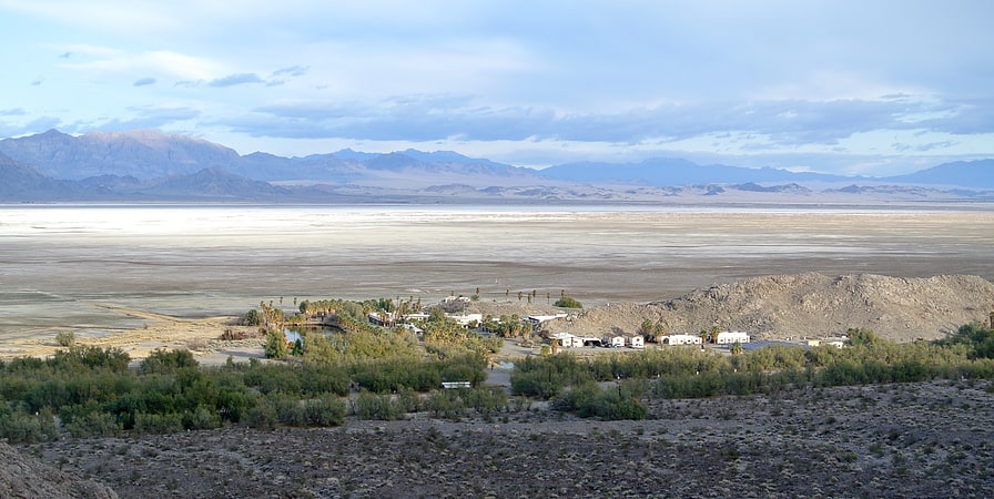
Dry lake in California. Soda Lake is a dry lake at the terminus of the Mojave River in the Mojave Desert of San Bernardino County, California. The lake has standing water during wet periods, and water can be found beneath the surface.
Soda Lake along with Silver Lake are what remains of the large, perennial, Holocene Lake Mojave. The waters of the lake, now with no outlet, evaporate and leave alkaline evaporites of sodium carbonate and sodium bicarbonate.
Soda Lake is located on the southern side of Interstate 15, and can be seen at the Zzyzx Road interchange and the Oat Ditch bridge, as well as the Soda Lake bridge (signed as the Mojave River) looking south from the city of Baker.[7]
Piute Range
Mountain range in California. The Piute Range is located in the Mojave Desert, primarily in northeast San Bernardino County, California, United States, with a north portion in Nevada. Most of the range is the eastern border of the Mojave National Preserve, a National Park Service natural area and park.[8]
New York Mountains
Mountain range in California. The New York Mountains are a small mountain range found in northeastern San Bernardino County in California, USA. The range's northeastern area lies in southeastern Nevada. The range lies just south of the small community of Ivanpah, and north of the Lanfair Valley. The mountains are part of the mountain ranges, cones, mountains, and landforms in the Mojave National Preserve. The mountains reach an elevation of 7,533 feet, and run in a mostly southwest-northeasterly direction between the Providence Mountains and the McCullough Range approximately five miles into Nevada and border the northwest corner of the Piute Valley of Nevada-California.
The New York Mountains are part of the southeast border of the Great Basin Divide. The Piute Wash Watershed empties eastward into the Colorado River.[9]
Providence Mountains
Mountain range in California. The Providence Mountains are found in the eastern Mojave Desert of San Bernardino County, California, U.S. The range reaches an elevation of 7,162 feet at Edgar Peak and is home to the Mitchell Caverns Natural Preserve in the Providence Mountains State Recreation Area, and the Mojave National Preserve.[10]
Kelso Mountains
Mountain range in California. The Kelso Mountains are located just north of the small community of Kelso and the Kelso Dunes, in the Mojave National Preserve in southeastern California. The town of Baker, near Interstate 15, lies approximately 18 miles to the northwest of the mountain range. Kelso Peak, at 4,764 feet, is the principal peak of the range. Like most of the Mojave Desert, the range is characterized by little rainfall, and usually receives less than 5–6 inches of precipitation in a normal year.[11]