Discover 11 hidden attractions, cool sights, and unusual things to do in Mount Hood National Forest (United States). Don't miss out on these must-see attractions: Mirror Lake, Little Crater Lake, and Olallie Scenic Area. Also, be sure to include Silcox Hut in your itinerary.
Below, you can find the list of the most amazing places you should visit in Mount Hood National Forest (Oregon).
Table of Contents
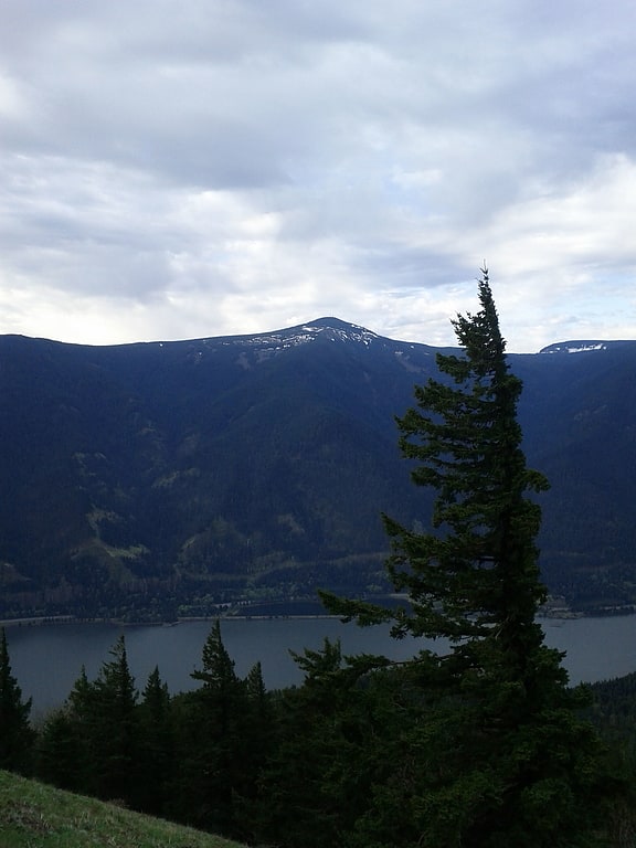
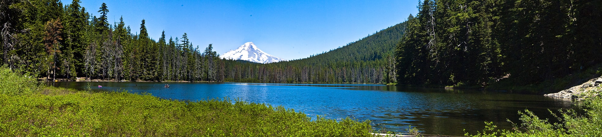
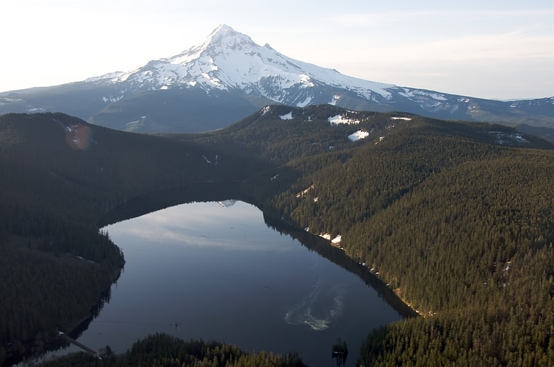
Mirror Lake
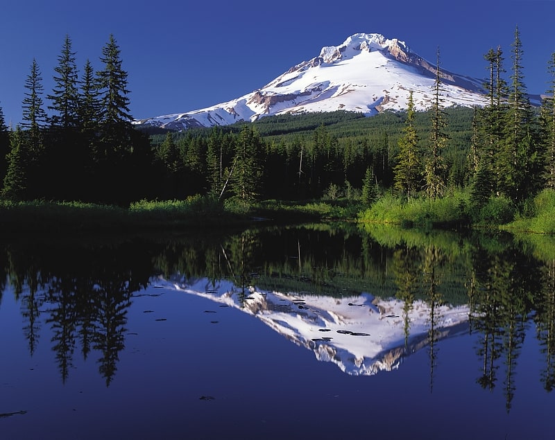
Lake in Oregon. Mirror Lake is a mountain lake in Clackamas County of the U.S. state of Oregon. It is located at the foot of Tom Dick and Harry Mountain in a natural catchment formed by a toe of the mountain, 11.4 kilometres southwest of Mount Hood, and 3.1 kilometres WSW of Government Camp within Mount Hood National Forest.
It is among the most popular day hikes in the Mount Hood area, and a popular Nordic skiing destination. Its 800-foot (240 m) elevation gain in 1.4 miles (2.3 km) is considered an easy hike.[1]
Little Crater Lake
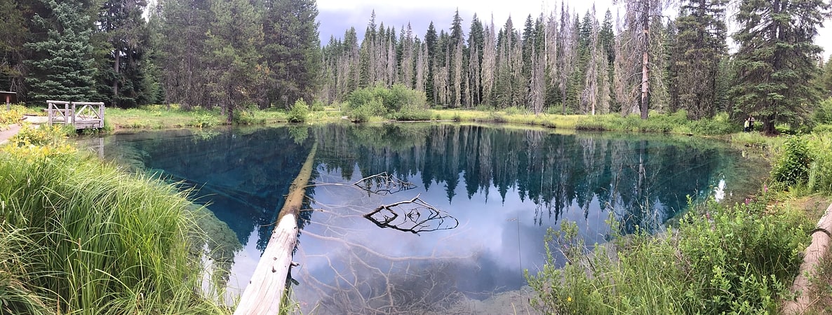
Lake in Oregon. Little Crater Lake is a spring-fed lake in the Mount Hood National Forest in Clackamas County, Oregon, United States. It is named after Crater Lake, also in Oregon.[2]
Olallie Scenic Area
Olallie Scenic Area is a United States Forest Service designated scenic area located in Oregon's Cascade Range. It is between Mount Hood on the north and Mount Jefferson to the south and contains Olallie Lake along with several smaller lakes. The name Olallie is Chinook Jargon for berry.[3]
Silcox Hut
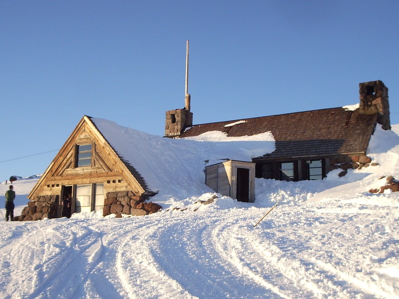
Lodge in Government Camp, Oregon. The Silcox Hut is a small rustic mid-mountain lodge located at 6,950 feet elevation on Mount Hood, Oregon, United States. It is approximately 1,000 feet vertical above Timberline Lodge and roughly one mile distance directly up the mountain.
Silcox Hut was built by the WPA and finished in 1939. It was named after Ferdinand Silcox, the fifth Chief of the Forest Service, 1933–1939. The hut was the upper terminal of the original Magic Mile chairlift and housed the lift's upper bullwheel in what is now the guest sleeping quarters. It was also intended as a warming hut and starting point for climbers. After the chairlift was relocated in 1962, it was abandoned and became derelict due to vandalism and fierce mountain weather.
In 1966, the Portland State University Outdoor Program leased the Hut. The students of the Program made a few improvements to the hut including repairs to the fireplace hearth and new window shutters. Program Alumni consider this lease the first action taken to save Silcox Hut. There was discussion between the US Forest Service and Timberline Lodge to burn down the hut because of its condition. Even though the Program enjoyed access to the mountain provided by Silcox Hut, they could not counter the seemingly constant vandalism and had to relinquish the lease.
Silcox Hut was added to the National Register of Historic Places in 1985. In the same year, the Friends of Silcox Hut was created as a non-profit organization. The initial restoration proposal was made by climbing enthusiasts and guides, and it was their intention to operate the facility.
Over the course of the late 1980s and early 1990s, The Friends of Silcox Hut renovated and reopened Silcox to the public in 1993. Although they intended it partially as an overnight hostel and restaurant for climbers, it is now rented out to groups of up to 24 for overnight lodging and hearty meals by RLK, the operators of Timberline Lodge. It is available for group day use such as weddings and anniversaries.
The Friends of Silcox received several awards for its restoration, including the People's Choice Award and the Craftsmanship Award from the Portland AIA Awards Program in 1993.
The Friends of Silcox Hut carries on as a non-profit maintenance and special projects group to protect the integrity of the restoration. Its board is entirely made up of architects and craftsmen and others deeply involved in the original restoration. Lifetime and annual memberships are available with all proceeds supporting restoration efforts.
Recent special projects included a snow tunnel for the south entrance engineered to withstand 25 feet of compacted snow.[4]
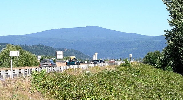
Mount Defiance
Peak in Oregon. Mount Defiance is a peak near the Columbia River Gorge in the US state of Oregon. It rises to an elevation of 5,010 feet in the Mark O. Hatfield Wilderness on the Mount Hood National Forest. The peak is in Hood River County, Oregon. The route up the mountain is often considered one of the hardest climbs in the Gorge; the trail gains 5,000 feet in 6 miles from the Starvation Creek Trailhead.
Mount Defiance is composed chiefly of lava flows. The base is basalt from an old shield volcano, and it is capped by andesite.[5]
Sherrard Point
Volcano in Oregon. Larch Mountain is an extinct volcano near Portland, Oregon. The name is misleading, as no western larch can be found there. It received that name when early lumbermen sold the noble fir wood as larch. The peak can be reached between May and November on paved Larch Mountain Road, 16 miles east of Corbett, Oregon, although the road is closed during the winter and spring months. The road leading to Larch Mountain from the Historic Columbia River Highway is 14 miles long, which closed at milepost 10 from Nov. through late May or early June due to snow.[6]
Tom Dick and Harry Mountain
Mountain in Oregon. Tom Dick and Harry Mountain is a two-mile-long volcanic mountain in Clackamas County in the U.S. state of Oregon. It is located 7.2 miles southwest of Mount Hood, 1.9 miles west-southwest of Government Camp between the Zigzag River and Still Creek, south of Zigzag Mountain. Because of its proximity to Mount Hood, it is considered a foothill.
The mountain is named for its three distinct peaks along the summit, forming the cirque that is now part of the Mount Hood Skibowl ski resort. The highest peak has an elevation of 5,070 feet (1,545 m). The name was in use as early as 1897, according to Elijah "Lige" Coalman, the namesake of Coalman Glacier. The mountain has also been called "Tom Dick Mountain" in the past, although the Board on Geographic Names officially decided in favor of including "Harry" in 1969 making it a play on phrase "Tom, Dick and Harry." It has frequently been noted on lists of unusual place names.
Mirror Lake, a popular hiking destination, is located on the north side of the mountain.
Both Tom Dick and Harry Mountain and Zigzag Mountain are capped by Pliocene andesite and basalt.[7]
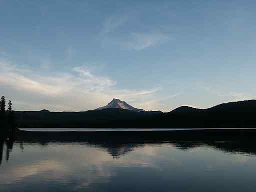
Timothy Lake
Lake in Oregon. Timothy Lake is a lake about 50 miles southeast of Portland, Oregon, United States. It is in proximity to Clear Lake and an impoundment of the Oak Grove Fork Clackamas River.
The compacted-earth Timothy Lake Dam was built by Portland General Electric in 1956 to regulate seasonal water flow to Lake Harriet downstream. The dam, 110 feet high and impounding 81,000 acre-feet, does not generate any hydroelectric power itself. In the summer, the lake is a very popular destination for camping, boating, hiking, horseback riding, and mountain biking.[8]
Frog Lake
Lake in Oregon. Frog Lake is a 10-acre lake in Wasco County, Oregon, located south of Mount Hood off U.S. Route 26 between Government Camp and Maupin. The lake is primarily used for recreational purposes, such as camping, boating, fishing, and swimming.
The lake is the source of Frog Creek, a tributary of Clear Creek, a tributary of the White River.[9]
Bagby Hot Springs
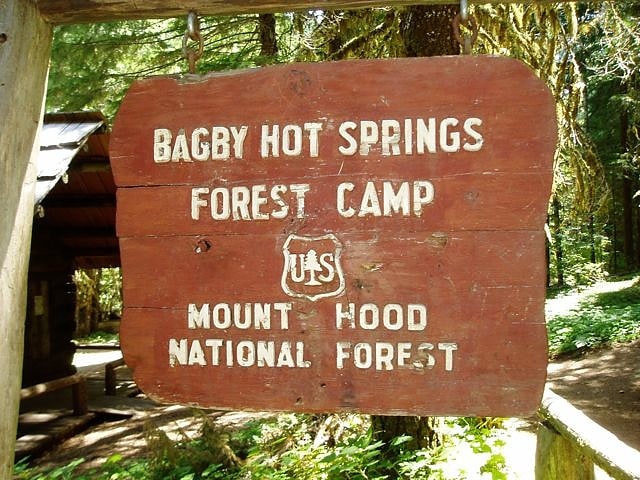
Spring in Oregon. The Bagby Hot Springs are natural hot springs located in the Mount Hood National Forest about 67 miles southeast of Portland, Oregon, United States and about 98 miles east of Salem, Oregon. The springs are within the Cascade Mountains in a heavily forested area at elevation 2280 ft. The springs are just outside the boundary of Bull of the Woods Wilderness area.[10]
Bull Run Lake
Reservoir in Oregon. Bull Run Lake is a reservoir, an impoundment of the Bull Run River in the U.S. state of Oregon. Providing part of the primary drinking water supply for Portland, Oregon, it rates highly as an oligotrophic lake, a very clean source of water. As of 1925, noted geographer Lewis A. McArthur described the lake as one of the two most important in the state, supplying the drinking water for a third of the state's population.
The lake basin receives more than 110 inches (2,800 mm) of rain annually due to its location in the Cascade Range, about 9 miles (14 km) west of Mount Hood. Public access to the area has been controlled since June 17, 1892, with the creation of the Bull Run Reserve by President Benjamin Harrison. Water from the reservoir first flowed into the Portland water system on January 2, 1895. President Theodore Roosevelt restricted entry to all but government agents and water company employees and banned stock grazing on April 28, 1904.
In 1915 a new timber and rock fill dam raised the lake level about 10 feet (3.0 m). At least two series of efforts were made between 1917 and 1925 to decrease lake seepage. In 1961 additional areas of seepage were sealed with clay, and the outlet dam was remodeled to contain gates at elevations of 3,147 feet (959 m) and 3,158 feet (963 m).
In 1994, concerns of outflow water temperature and its effect on fish populations led to regular careful measurements of the lake's thermocline characteristics and the inlet water temperature. Concrete pier blocks were installed to minimize the effect of water temperature shock on downstream aquatic life.[11]