Discover 18 hidden attractions, cool sights, and unusual things to do in Tanzania. Don't miss out on these must-see attractions: House of Wonders (Stone Town), Olduvai Gorge (Ngorongoro Conservation Area) or Serengeti volcanic grasslands (Serengeti National Park).
Below, you can find the list of the most amazing places you should visit in Tanzania.
Table of Contents
House of Wonders, Stone Town
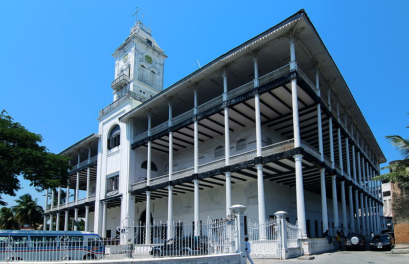
Museum in Zanzibar, Tanzania. The House of Wonders or Palace of Wonders is a landmark building in Stone Town, Zanzibar. It is the largest and tallest building of Stone Town and occupies a prominent place facing the Forodhani Gardens on the old town's seafront in Mizingani Road. It is located between the Old Fort and the Palace Museum. It is one of six palaces built by Barghash bin Said, second Sultan of Zanzibar, and it is said to be located on the site of the 17th-century palace of Zanzibari queen Fatuma. The House of Wonders housed the Museum of History and Culture of Zanzibar and the Swahili Coast.[1]
Address: Mizingani Road on the seafront, Stone Town
Olduvai Gorge, Ngorongoro Conservation Area
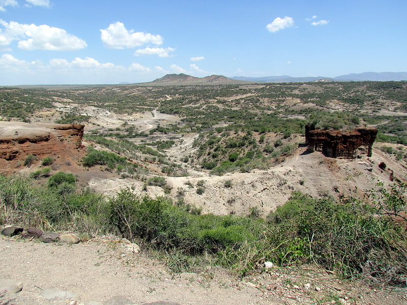
Site known for early human remains. The Olduvai Gorge or Oldupai Gorge in Tanzania is one of the most important paleoanthropological localities in the world; the many sites exposed by the gorge have proven invaluable in furthering understanding of early human evolution. A steep-sided ravine in the Great Rift Valley that stretches across East Africa, it is about 48 km long, and is located in the eastern Serengeti Plains within the Ngorongoro Conservation Area in the Olbalbal ward located in Ngorongoro District of Arusha Region, about 45 kilometres from Laetoli, another important archaeological locality of early human occupation. The British/Kenyan paleoanthropologist-archeologist team of Mary and Louis Leakey established excavation and research programs at Olduvai Gorge that achieved great advances in human knowledge and are world-renowned.
The gorge takes its name from the Maasai word oldupai which means "the place of the wild sisal" as the East African wild sisal (Sansevieria ehrenbergii) grows abundantly throughout the gorge area. Twenty-five kilometers downstream of Lake Ndutu and Lake Masek, the gorge cuts into Pleistocene lake bed sediments up to a depth of 90 m. A side gorge, originating from Lemagrut Mountain, joins the main gorge 8 km from the mouth. This side gorge follows the shoreline of a prehistoric lake, rich in fossils and early hominin sites. Periodic flows of volcanic ash from Olmoti and Kerimasi helped to ensure preservation of the fossils in the gorge.
The locality is significant in showing the increasing developmental and social complexities in the earliest humans, or hominins, largely revealed in the production and use of stone tools. Prior to tools, evidence of scavenging and hunting can be noted—highlighted by the presence of gnaw marks that predate cut marks—and of the ratio of meat versus plant material in the early hominin diet. The collecting of tools and animal remains in a centralised area is evidence of developing social interaction and communal activity. All these factors indicate an increase in cognitive capacities at the beginning of the period of hominids transitioning to hominin—that is, to human—form and behaviour.
Homo habilis, probably the first early human species, occupied Olduvai Gorge approximately 1.9 million years ago (mya); then came a contemporary australopithecine, Paranthropus boisei, 1.8 mya, followed by Homo erectus, 1.2 mya. Our species Homo sapiens, which is estimated to have emerged roughly 300,000 years ago, is thought to have occupied sites in the gorge by 17,000 years ago.[2]
Serengeti volcanic grasslands, Serengeti National Park
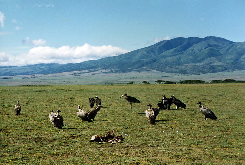
The Serengeti volcanic grasslands is a tropical grassland ecoregion of Tanzania. The Serengeti volcanic grasslands are distinctive grasslands growing on deposits of volcanic ash in northern Tanzania. It includes the eastern portion of Serengeti National Park and areas south and east of the Ngorongoro Highlands.[3]
Darajani Market, Stone Town
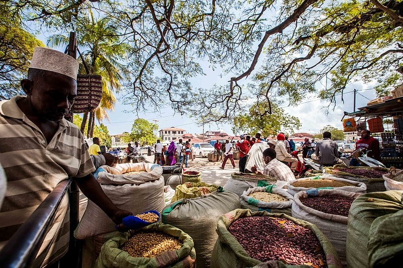
Market in Zanzibar, Tanzania. The Darajani Market is the main bazaar in Stone Town, Zanzibar. It is also known as Estella Market and informally as Marikiti Kuu. The market is located in Darajani Road, in the surroundings of the Anglican Cathedral of Christ.
The main structure of the market was built in 1904 by Bomanjee Maneckjee, for Sultan Ali bin Hamud. It was later extended and restored.
Darajani Bazaar is mainly a food market (seafood, meat, fruits, grains, spices), but there are also shops selling a number of different goods, from consumer electronics to clothing.[4]
Address: Market St, Stone Town
Forodhani Gardens, Stone Town
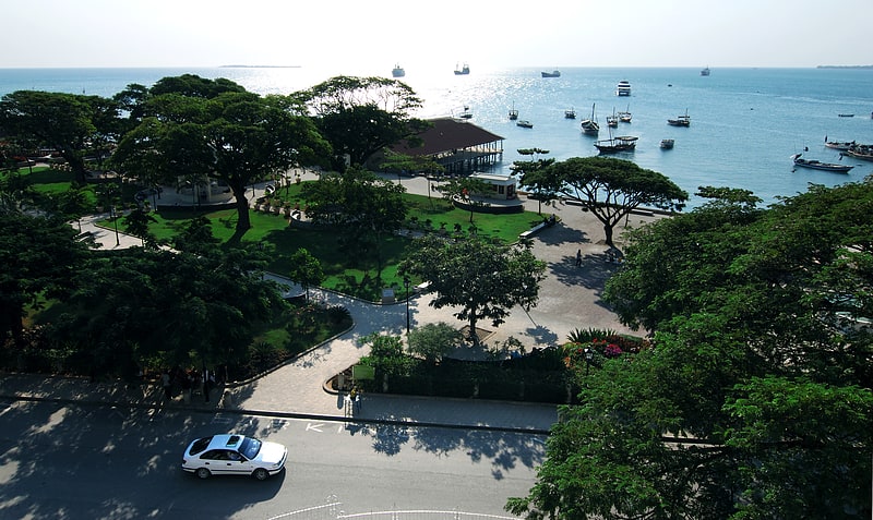
The Forodhani Gardens is a small park in the historical city of Stone Town, Zanzibar, Tanzania. The gardens are located along the main seawalk of Stone Town, just in front of the most famous buildings of Stone Town, i.e. the House of Wonders and the Old Fort.
The Gardens are especially busy after sunset, when tourists and local alike gather in a popular food street market in the main square, to have dinner enjoying Swahili and Zanzibari cuisine delicacies such as grilled seafood, samoosas, cassava and sweet potatoes.
On July 31, 2009, a ground-breaking ceremony was held by the Aga Khan to introduce a revitalized park. It was rehabilitated by Aga Khan Trust for Culture at a cost of $3 million from the initial estimates of $2.4 million. The facelift involved the restoration of pedestrian walkways, landscape, infrastructure upgrading, incorporating lighting, sewerage drainage and civic amenities, and the rehabilitation of the seawall fronting the park.[5]
Address: On the Waterfront, Stone Town
Laetoli, Ngorongoro Conservation Area
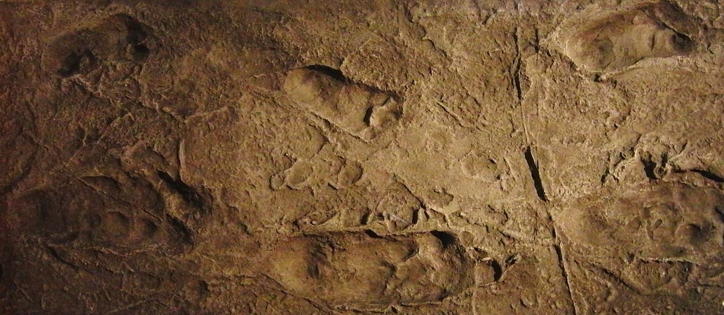
Laetoli is a pre-historic site in located in Enduleni ward of Ngorongoro District in Arusha Region, Tanzania. The site is dated to the Plio-Pleistocene and famous for its hominin footprints, preserved in volcanic ash. The site of the Laetoli footprints is located 45 km south of Olduvai gorge. The location and tracks were discovered by archaeologist Mary Leakey and her team in 1976, and were excavated by 1978. Based on analysis of the footfall impressions "The Laetoli Footprints" provided convincing evidence for the theory of bipedalism in Pliocene hominins and received significant recognition by scientists and the public. Since 1998, paleontological expeditions have continued under the leadership of Amandus Kwekason of the National Museum of Tanzania and Terry Harrison of New York University, leading to the recovery of more than a dozen new hominin finds, as well as a comprehensive reconstruction of the paleoecology.
Dated to 3.7 million years ago, they were the oldest known evidence of hominin bipedalism at that time. Subsequently, older Ardipithecus ramidus fossils were found with features that suggest bipedalism. With the footprints there were other discoveries excavated at Laetoli including hominin and animal skeletal remains. Analysis of the footprints and skeletal structure showed clear evidence that bipedalism preceded enlarged brains in hominins. At a species level, the identity of the hominins who made the trace is difficult to construe precisely; Australopithecus afarensis is the species most commonly proposed.[6]
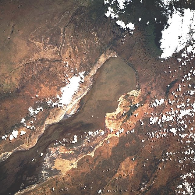
Lake Eyasi, Ngorongoro Conservation Area
Also known as: Ziwa Eyasi
Lake in Tanzania. Lake Eyasi is a lake located in Karatu District of Arusha Region in north Tanzania. Lake Eyasi is the largest body of water in Arusha region. It is a seasonal shallow endorheic salt lake on the floor of the Great Rift Valley at the base of the Serengeti Plateau, just south of the Serengeti National Park and immediately southwest of the Ngorongoro Crater in the Crater Highlands of Tanzania. The lake is elongated, orientated southwest to northeast, and lies in the Eyasi-Wembere branch of the Great Rift Valley.
The principal inflow is the Sibiti River, which enters the southwestern end. The river may continue to flow somewhat year round, at least in wetter years; the other inflows are all seasonal. The second largest inflow is the Baray, at the northeast. The water carried by the Baray has increased in recent years due to deforestation of the Crater Highlands. The southwest flank of Mount Oldeani, one of the Ngorongoro volcanos, drains directly into the northeast end of the lake. Flow from the Budahaya / Udahaya River, which drains into the Yaeda Swamp to the southeast of the lake, was once second, but has decreased due to water diversion in the Mbulu Highlands. Water flow from the Serengeti is minor; the largest stream is the Sayu.
Seasonal water level fluctuations in the lake are dramatic, though the northwestern shore is constrained by the cliffs of the Serengeti Plateau. During the dry season the lake may dry up almost entirely, especially in drier years, so that Datooga herders and Hadza foragers will cross the lake on foot, but in El Niño years it may flood its banks and attract hippopotamus from the Serengeti. It is a seasonal stop for migrating flamingos. The lake supports minor local fishing in wet years, but more often catfish and lungfish are taken from the streams and springs that feed the lake. Even during wet periods, lake depths typically remain less than one metre.
The Hadza are the indigenous inhabitants of the lake. They are found along most of the perimeter, though camps are few along most of the Serengeti, which is Maasai territory. The Datooga inhabit the Yaeda Valley to the southeast, the Isanzu the south, and the Sukuma across the Sibiti River in the southwest. The Iraqw traditionally lived on the other side of Yaeda, but have come in increasing numbers to the Baray, which is now the primary onion-growing region of East Africa.
Mumba Cave is an archaeological site that is located by the shores of Lake Eyasi. The site has yielded a number of Middle Stone Age and Late Stone Age artifacts.[7]
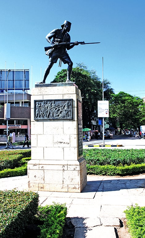
Askari Monument, Dar es Salaam
Also known as: Sanamu ya Askari
Historical landmark in Dar es Salaam, Tanzania. The Askari Monument or Dar es Salaam African Memorial in Kivukoni Ward in Ilala District of Dar es Salaam, Tanzania, is a memorial to the askari who fought in the British campaign against the German Army in East Africa in World War I. It was unveiled in 1927. The monument is located at the centre of a roundabout on Samora Avenue at the perpendicular junction to Maktaba Street and Azikiwe Street, a place that reportedly also marks the exact centre of downtown Dar es Salaam.
The monument was erected in honour of the King's African Rifles and the Carrier Corps. The main feature of the monument is "The Askari", a bronze sculpture of an African soldier. It was realised in the United Kingdom by British sculptor James Alexander Stevenson, who worked for Westminster's Morris Bronze Founders. Stevenson signed the statue with his pseudonym "Myrander". Before being sent to Dar es Salaam, the statue was exhibited at the Royal Academy, receiving critical praise. The soldier has a rifle with bayonet pointed towards the Dar es Salaam harbour. The statue stands on a stone pedestal. On the narrow sides of the pedestal are plaques with a dedication in Swahili (Arabic and Latin script) and English; on the wide sides of the pedestal are two pictorial plaques showing fighting African soldiers and the Carrier Corps. The English inscription includes "If you fight for your country even if you die your sons will remember your name".
In the place where the Askari Monument is located, there used to be another statue, namely that of German explorer and army major Hermann Wissmann, governor of German East Africa in the late 19th century. This former statue, unveiled in 1911, represented Wissmann standing, one hand on his hip and one on his sword, looking towards the harbour; at his feet, an African soldier covering a dead lion with a German flag. When the British entered Dar es Salaam in 1916, they removed this statue along with those of Karl Peters and Otto von Bismarck.
The monument in Dar es Salaam belongs to a group of three Askari Monuments that were unveiled in the same year in what was then British East Africa; the other two are at Mombasa and Nairobi. A separate Dar es Salaam British and Indian Memorial, commemorating by name more than 1,500 British and Indian officers and men who died in East Africa during and after January 1917 and who have no known grave, is now in Dar Es Salaam War Cemetery.[8]
Tourism in Tanzania, Serengeti National Park
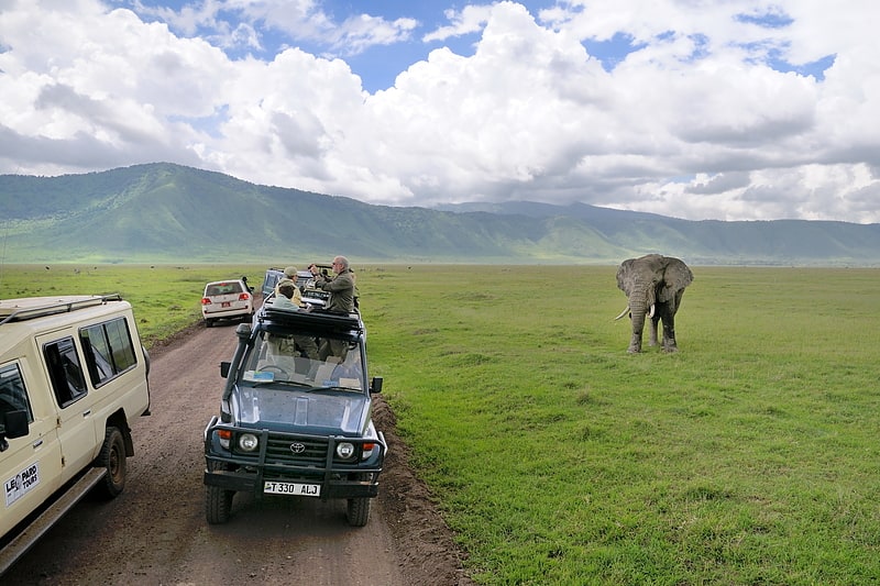
Also known as: Vivutio vya Tanzania
Tanzania is a country with many tourist attractions. Approximately 38 percent of Tanzania's land area is set aside in protected areas for conservation. There are 17 national parks, 29 game reserves, 40 controlled conservation areas and marine parks. Tanzania is also home to Mount Kilimanjaro, the highest point in Africa.
Travel and tourism contributed 17.5 percent of Tanzania's gross domestic product in 2016 and employed 11.0 percent of the country's labour force (1,189,300 jobs) in 2013. The sector is growing rapidly, rising from US$1.74 billion in 2004 to US$4.48 billion in 2013. In 2016, 1,284,279 tourists arrived at Tanzania's borders compared to 590,000 in 2005.
In 2019, the Tanzanian tourism sector generated USD 2.6 billion in revenues with 1.5 million tourist arrivals.
In 2020, due to Covid-19, travel receipts declined to USD 1,06 billion and the number of international tourist arrivals declined to 616,491.
In October 2021, the Ministry of Natural Resources and Tourism of Tanzania has been granted TZS 90 billion for the financial year 2021-2022, part of the IMF loan for emergency financial assistance to support Tanzania’s efforts in responding to the Covid-19 pandemic.[9]
St. Joseph's Cathedral, Dar es Salaam
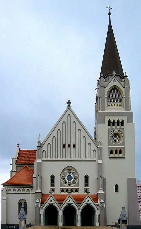
Also known as: Kanisa la Mtakatifu Joseph
Cathedral in Dar es Salaam, Tanzania. The Saint Joseph's Metropolitan Cathedral is a Roman Catholic cathedral in Dar es Salaam, Tanzania. It is a Gothic church located in Sokoine Drive, facing the harbour, close to the White Fathers' House. It was built by the Germans between 1897 and 1902 and consecrated as a Catholic church in 1905. The cathedral is the seat of the Dar es Salaam archdiocese. One of the most notable features of the church are the stained-glass windows behind the altar.[10]
Address: Sokoine Dr, Dar es Salaam
Azania Front Lutheran Church, Dar es Salaam
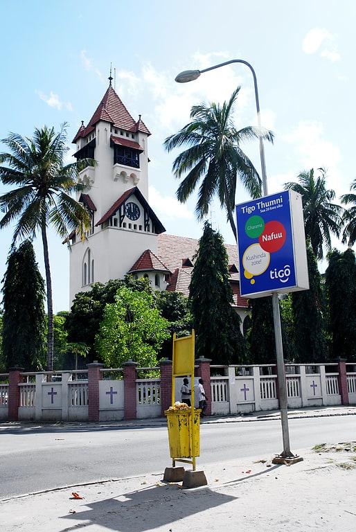
Also known as: Kanisa Kuu la Azania Front
Cathedral in Dar es Salaam, Tanzania. The Azania Front Lutheran Church is a Lutheran church in Dar es Salaam, Tanzania, serving as a cathedral for the local diocese. It is among the most well-known landmarks and tourist attractions of the city. It is in the city center, close to the ocean, facing the harbour. It was built by the German missionaries in 1898, in the Bavarian style of the time, with a red-tiled roof, tiled canopies over the windows and bright white walls.[11]
Address: Kivukoni Rd, Dar es Salaam
Serengeti, Serengeti National Park
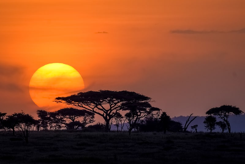
Regional park in Tanzania. The Serengeti ecosystem is a geographical region in Africa, spanning northern Tanzania. The protected area within the region includes approximately 30,000 km2 of land, including the Serengeti National Park and several game reserves. The Serengeti hosts the second largest terrestrial mammal migration in the world, which helps secure it as one of the Seven Natural Wonders of Africa, and as one of the ten natural travel wonders of the world.
The Serengeti is also renowned for its large lion population and is one of the best places to observe prides in their natural environment. Approximately 70 large mammal and 500 bird species are found there. This high diversity is a function of diverse habitats, including riverine forests, swamps, kopjes, grasslands, and woodlands. Blue wildebeest, gazelles, zebras, and buffalos are some of the commonly found large mammals in the region.
The Serengeti also contains the Serengeti District of Tanzania. There has been controversy about a proposal to build a road through the Serengeti.
The name "Serengeti" is often said to be derived from the word "seringit" in the Maasai language, Maa, meaning "endless plains". However, this etymology does not appear in Maa dictionaries.[12]
Mount Kilimanjaro climbing routes, Mount Kilimanjaro
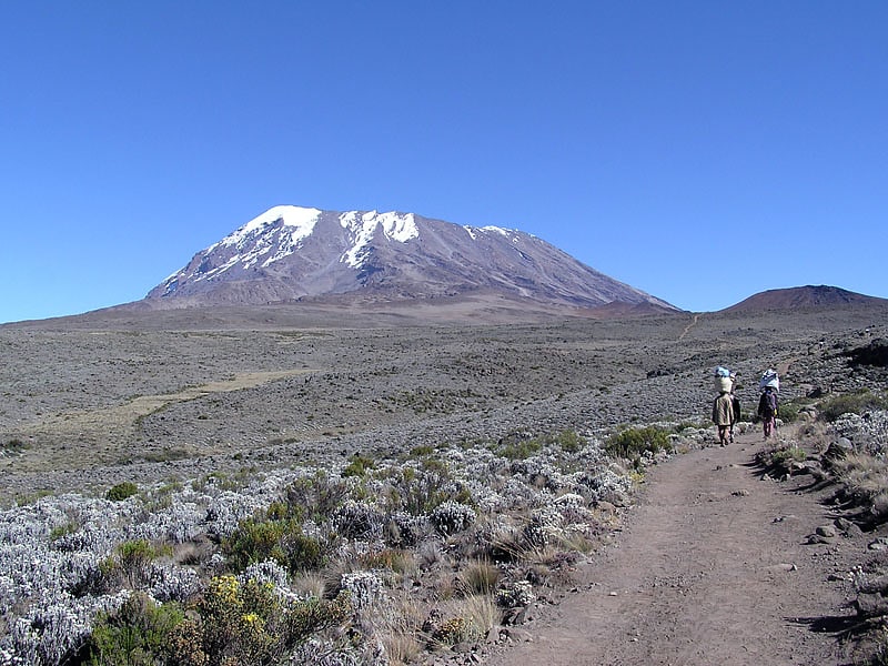
There are several routes by which to reach Kibo, or Uhuru Peak, the highest summit of Mount Kilimanjaro, namely: Marangu, Rongai, Lemosho, Shira, Umbwe and Machame.
Being one of the most popular mountains in the world, roughly 50,000 trekkers every year try to reach the summit of Mt Kilimanjaro. According to research published by the Climb Kilimanjaro Guide, the average summit success rate across all climbers and routes is 65%. However, summit success rate heavily depends upon what route is climbed as routes vary considerably in terms of acclimatization profile and duration of climb.[13]
Furtwängler Glacier, Mount Kilimanjaro
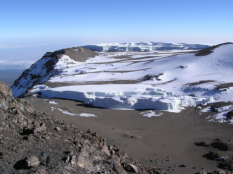
Glacier in Tanzania. Furtwangler Glacier is located near the summit of Mount Kilimanjaro in Tanzania. The glacier is named after Walter Furtwängler who, along with Siegfried König, were the fourth party to ascend to the summit of Kilimanjaro in 1912.
The glacier is a small remnant of an ice cap that once crowned the summit of Kilimanjaro. Almost 85 percent of the ice cover disappeared from October 1912 to June 2011. At the current rate, most of the ice will disappear by 2040 and "it is highly unlikely that any ice body will remain after 2060".
Furtwängler Glacier is ephemeral, existing continuously only since about 1650 CE, which corresponds with very high levels in Kenya's Lake Naivasha and the beginning of the Maunder Minimum. Between measurements in 1976 and 2000, the area of this glacier was cut almost in half, from 113,000 square metres (1,220,000 sq ft) to 60,000 square metres (650,000 sq ft). By 2018 the size shrank to 11,000 square metres (120,000 sq ft).
During fieldwork conducted early in 2006, scientists discovered a large hole near the center of the glacier. This hole, extending through the 6 metres (20 feet) remaining thickness of the glacier to the underlying rock, split the glacier in two by 2007.[14]
Credner Glacier, Mount Kilimanjaro
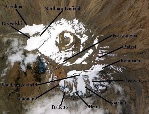
Glacier in Tanzania. Credner Glacier is on Mount Kilimanjaro in Tanzania, on the northwest slope of the peak and is a remnant of an icecap which once crowned the top of Mount Kilimanjaro. The glacier is situated at an elevation of between 5,800 and 5,500 metres. Credner Glacier is one of the largest glaciers on the mountain and descends from the Northern Ice Field. Credner is rapidly retreating due to its high exposure point on the northwest slope of Mount Kilimanjaro. A report published in 2013 indicated that in another decade the glacier may no longer exist.[15]
Kizimkazi Mosque, Unguja
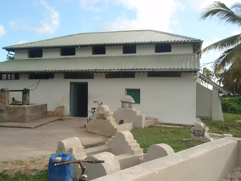
Mosque in Dimbani, Tanzania. The Kizimkazi Mosque is a mosque situated on the southern tip of the island of Zanzibar in Tanzania and is one of the oldest Islamic buildings on the East African coast. Despite its name, it is located in Dimbani, not Kizimkazi, which is 3 miles away. According to a preserved kufic inscription, it was built in 1107 by settlers from Shiraz. Although the inscription and certain coral-carved decorative elements date from the period of construction, the majority of the present structure was rebuilt in the 18th century.[16]
Matemwe, Unguja
Village in Unguja, Tanzania. Matemwe is a village on the north-eastern coast of Unguja, the main island of the Zanzibar Archipelago, between Mwangaseni and Kigomani. Its economy is mostly based on seaweed farming and fishing. The village is the seat of an education project aimed at providing computer literacy to the population of the area, as well as the Dada cooperative that is intended to create job opportunities for Zanzibari women involving them in the processing and preparation of handmade cosmetics and food products such as jam, mustard and sweets that are sold in Stone Town.
There is a charity school in Matemwe, Tamani Foundation, which provides the local students with great education. The facilities includes a nursery school, the only one in Matemwe, and an adult education, where English, Math and Computer skills are being taught.
The main purpose of coming to Matemwe is the beach, which is the longest beach in Zanzibar. The beach is affected by the tide, so check tide schedules before visiting the beach. If you are staying there, however, that is not a problem as the tide is high two times every 24 hours. The beach is very quiet and you will not be harassed by many papasis (beach boys).
Internationally, Matemwe is especially known for its relatively unspoiled white sand beaches with few and expensive touristic structures, which makes for an exclusive vacation destination. The village is fronted by a lagoon and coral reef, as well as the small atoll of Mnemba, which is a particularly appreciated place for snorkeling and scuba diving. Fish species that can be easily spotted in the area include giant trevallies, trumpetfishes, anthiases, groupers and snappers.[17]
Kiwengwa, Unguja
Village in Unguja, Tanzania. Kiwengwa is a village on the Tanzanian island of Unguja, part of Zanzibar. It is located on the northeast coast between the villages of Pongwe and Pwani Mchangani. It is also connected by road to Kinyasini, which lies eight kilometres to the west.[18]