Discover 11 hidden attractions, cool sights, and unusual things to do in Posets–Maladeta Natural Park (Spain). Don't miss out on these must-see attractions: Pico Maldito, Pico Posets, and Maladeta. Also, be sure to include Pic de Vallibierna in your itinerary.
Below, you can find the list of the most amazing places you should visit in Posets–Maladeta Natural Park (Aragon).
Table of Contents
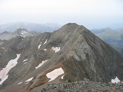
Pico Maldito
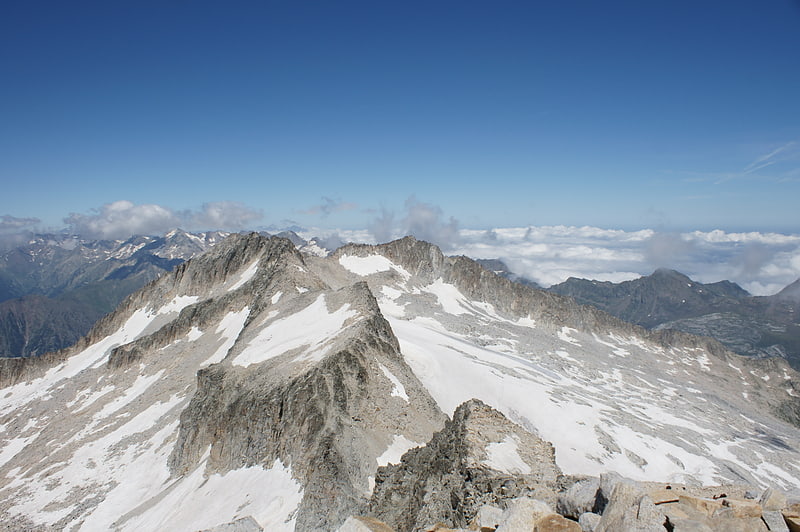
Peak in Spain. Pico Maldito is the fourth highest peak in the Pyrenees, with an altitude of 3350 meters above sea level.
It is located in the Posets-Maladeta Natural Park, in the municipality of Benasque, province of Huesca, Aragon, Spain. It is part of the Macizo de la Maladeta, located in the Benasque Valley area, is made up of Paleozoic soils of a granite nature and Mesozoic materials.[1]
Pico Posets
Peak in Spain. Pico Posets or Punta de Llardana is the second highest peak of the Pyrenees, after Aneto. It is located in the Spanish province of Huesca and is 3,369 metres high.[2]
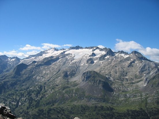
Maladeta
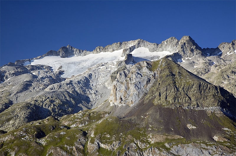
Prominent peak with climbing site. Maladeta is a mountain in the Pyrenees, close to the highest peak in the range, Aneto. It is located in the Natural Park of Posets-Maladeta in the town of Benasque in Province of Huesca, Aragon, Spain. Its northern slope contains the 91-acre Maladeta Glacier, which is divided into the 15-acre Western Maladeta and the 77-acre Eastern Maladeta.
Maladeta was previously considered to be highest peak in the area, and attempts to reach its summit took priority over the other peaks in the range. The first successful ascent of the peak was made by Johann Jacob Friedrich Wilhelm Parrot with guide Pierre Barrau in 1817.[3]
Pic de Vallibierna
Also known as: Pico de Vallibierna
Summit in Spain. The Pic de Vallibierna, culminating at 3,067 m, together with the tuc Culebras 3,062 m forms a massif located south of the massif de la Maladeta, in the Spanish Pyrenees. The crest separating both summits is nicknamed the horse step.[4]
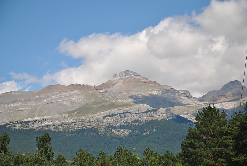
Espadas Peak
Also known as: Pico Espadas
Mountain in Spain. The Espadas Peak is a mountain on the Spanish side of the Pyrenees, in Grist, Sahún municipality, in the north of Ribagorza comarca, Aragon. This mountain is one of the highest in the Pyrenees.
This peak is located close to Pico Posets in an area of many high summits.[5]
Collarada
Mountain in Spain. Collarada peak is a mountain in the western Pyrenees of Huesca, situated on the northeastern Aragon near the towns of Villanúa and Canfranc. The peak is 2,886 meters AMSL high, being the highest summit in the Jacetania comarca of Aragon.
A great view of this mountain can be obtained from Larres, a village that gained life again after its castle dated 14th century got restored by the "Amigos del Serrablo".[6]
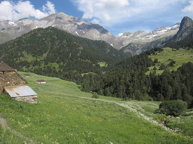
Macizo de la Maladeta
Mountain range in Spain. Macizo de la Maladeta is the highest mountain range and the first glacial massif in the Pyrenees. It is located in the Spanish province of Huesca. To the north is the head of the Benasque Valley, and to the south the Vallibierna Valley descends.[7]
Port de Venasque
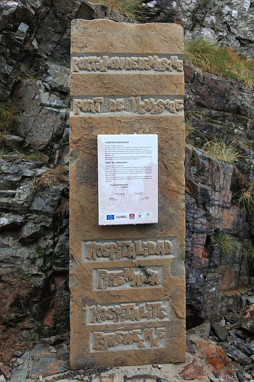
The Port de Venasque is a mountain pass in the Pyrenees. It lies on the border between France and Spain and is a popular border crossing point for mountaineers and walkers. It can be reached in about two to three hours from the Hospice de France, South of Bagnères-de-Luchon in France.[8]
Refuge Angel Orus - El Forcau
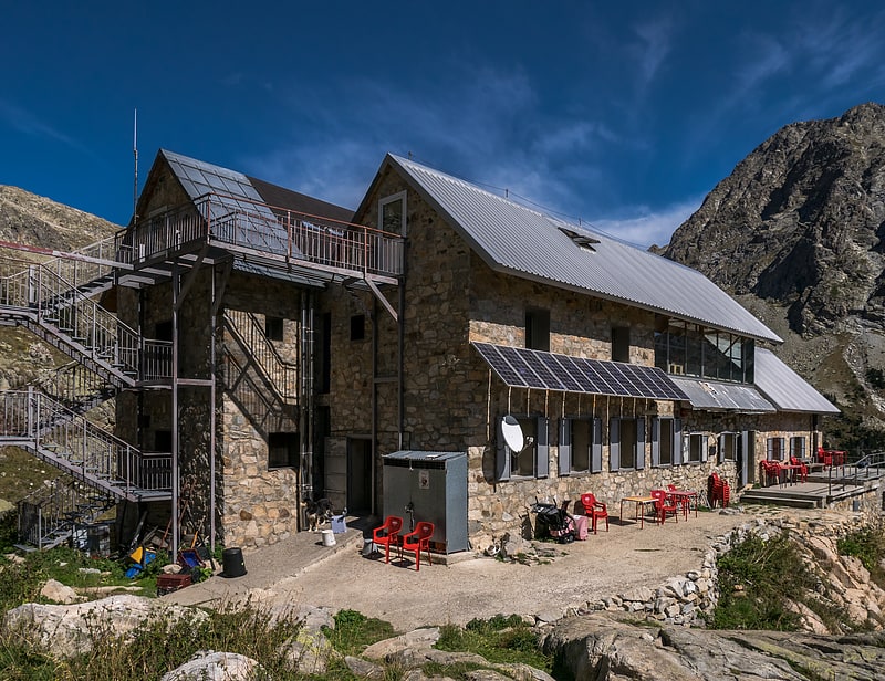
The Angel Orús or El Forcau refuge is located in the valley of the Aigüeta de Eriste, at the foot of the Agujas del Forcau, at 2,148 m of altitude.
Administratively it is located within the municipality of Sahún, in the region of Ribagorza, in the province of Huesca in the Autonomous Community of Aragon.
Refugio de Estos
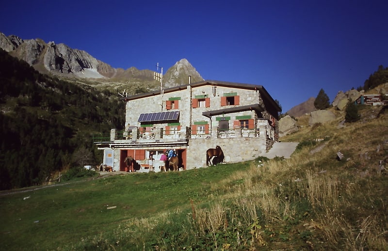
The refuge of Estós is located in the valley of Estós, in the middle of the natural park of Posets-Maladeta in Spain, at 1,859 m of altitude.
Administratively it is located within the municipality of Benasque, in the region of La Ribagorza, in the province of Huesca in the Autonomous Community of Aragon.
It is a mountain refuge kept all year round with 120 beds in bunk beds. It has running water, outdoor showers and toilets, hot water, bar and dining room service, blankets, heating, fireplace, cooking facilities, lockers, ski lockers and rest shoes. It also offers telephone and telecommunications system for emergencies.
Refugio de la Renclusa
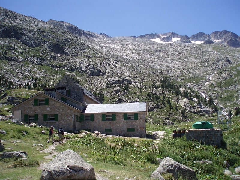
Lodging in Spain. The Renclusa refuge is located in the Spanish Pyrenees at the foot of the massif de la Maladeta, at 2,140 m high, in the Ésera valley. It is the starting point for excursions to the summit of la Maladeta, of the monts Maudits and the Aneto. It lies in the commune of Benasque, north-east of Huesca province, Aragon.[9]