Discover 20 hidden attractions, cool sights, and unusual things to do in Majorca (Spain). Don't miss out on these must-see attractions: Cuevas del Drach, Castle of Amer, and Castle of Capdepera. Also, be sure to include Coves dels Hams in your itinerary.
Below, you can find the list of the most amazing places you should visit in Majorca (Balearic Islands).
Table of Contents
Cuevas del Drach
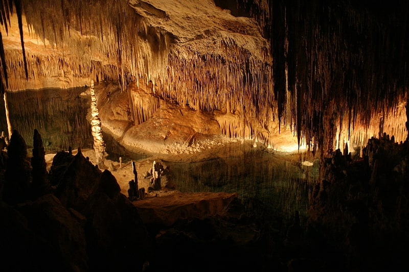
Tour of interconnected underground caves. The Caves of Drach are four great caves that are located in the island of Majorca, Balearic Islands, Spain, extending to a depth of 25 m and reaching approximately 4 km in length. They are in the municipality of Manacor, near the locality of Porto Cristo. They were first mentioned in a letter dated 1338. The four caves, called Black Cave, White Cave, Cave of Luis Salvador, and Cave of the French, are connected to each other.
The caves have formed by water being forced through the entrance from the Mediterranean Sea, and some researchers think the formation may date back to the Miocene Epoch. There is an underground lake situated in the caves called Martel Lake, which is about 115 m in length and 30 m in width, and its depth varies between four and twelve meters. It is named after the French explorer and scientist Édouard-Alfred Martel, considered the founding father of speleology, who was invited to explore the cave 1896. While German cave explorer, M.F. Will, had mapped the White and Black cave in 1880, Martel found two more caves, as well as the underground lake.
The caves are open to the public for a fee, and are one of the main tourist attractions on Mallorca. The visit typically ends with a classical music concert, performed by a small orchestra of musicians on a fleet of small row boats.
The caves are such an integral part of the tourism industry, that its closure, even if temporary, is seen by the locals as a bad sign for the economy.[1]
Address: Ctra. Cuevas s/n, 07680 Porto Cristo
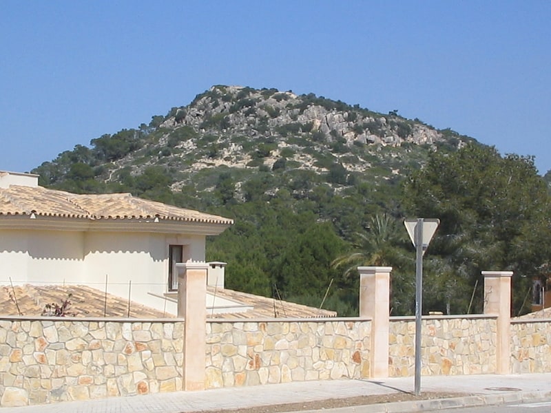
Castle of Amer
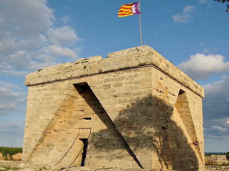
Castle in Spain. The Castle of la Punta de Amer is a 17th century fortification located in Sant Lorenzo des Cardessar on the island of Mallorca. The sandstone structure was built in the late 17th century, and is now a protected site.[2]
Address: Landzunge links vom Sandstrand bei Sa Coma, 07560 Sa Coma
Castle of Capdepera
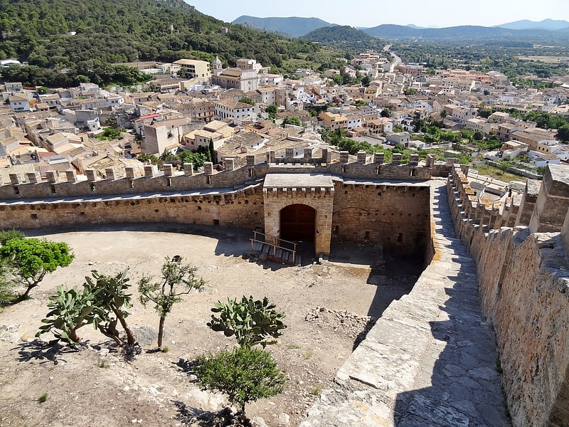
Also known as: Castillo de Capdepera
Castle in Spain. The Castle of Capdepera is a walled fortress located in the Spanish municipality of Capdepera, on the island of Majorca. It is one of the largest castles on the island. Its construction began in 310, but in the fourteenth century it was rebuilt on the remains of a Muslim village.[3]
Address: Calle de Castell, 07580 Capdepera
Coves dels Hams
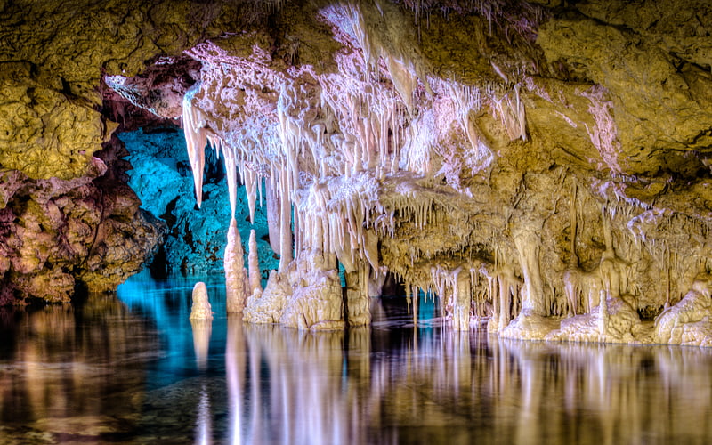
Also known as: Cuevas dels Hams
Caves with light and music shows. The Coves dels Hams are a Solutional cave system on the east coast of the Spanish Balearic Island of Mallorca. The caves are in the municipality of Manacor, about 1 km to the west of the town of Porto Cristo.
Alongside the larger Coves dels Drach ("Cavern of the Dragon"), the Coves Dels Hams contribute to the cavernous tourist attractions in the eastern region of the island.[4]
Address: Ctra. Ma-4020 Manacor _ Porto Cristo Km.11, 07680 Porto Cristo
S'Amarador
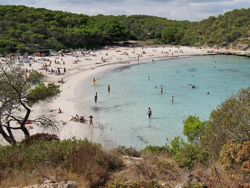
Beach
Address: Parc Natural de Mondragó, 07650 Santanyí
Jungle Parc
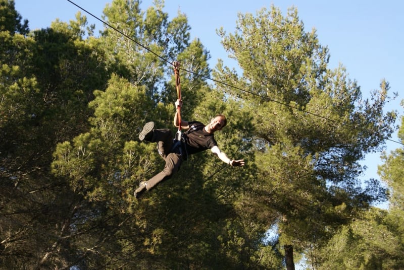
Amusement park, Theme park, Adventure park, Tours, Outdoor activities
Address: Avenida Jaime I, 40A, 07180 Santa Ponsa
Cala Mondragó
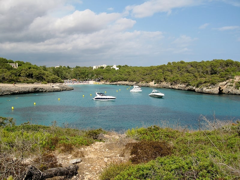
Beach, Park, Outdoor activities
Address: Parc Natural de Mondragó, 07650 Santanyí
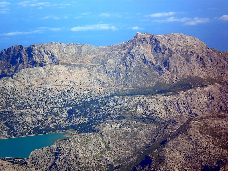
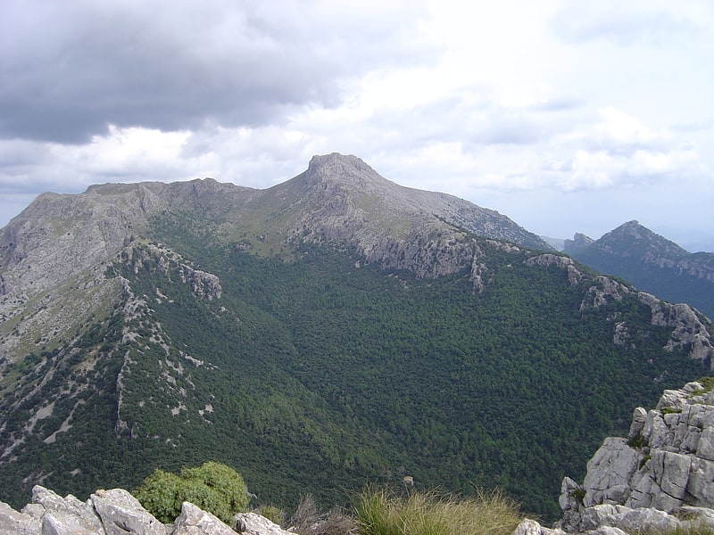
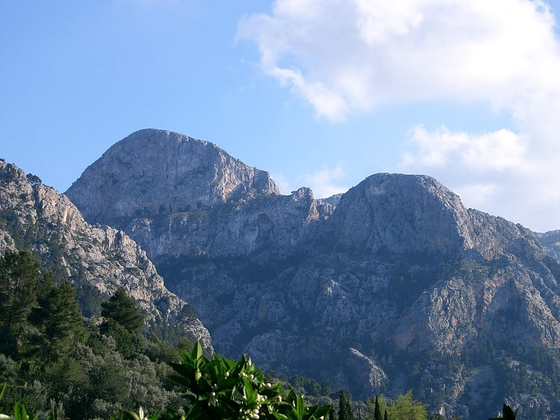
Puig Major
Peak in Spain. Puig Major is the highest peak on the Spanish island of Majorca. With an elevation of 1,436 m above sea level. It is situated in the Serra de Tramuntana mountains. As the mountain is located in a military zone, the neighbouring peak Puig de Massanella is considered the highest accessible summit on the island.[5]
Cala Romàntica
Beach, Park, Outdoor activities
Address: Passeig Voramar, 76, 07689 Manacor
Platja de Son Bauló
Beach
Address: Son Bauló, 07458 C'an Picafort
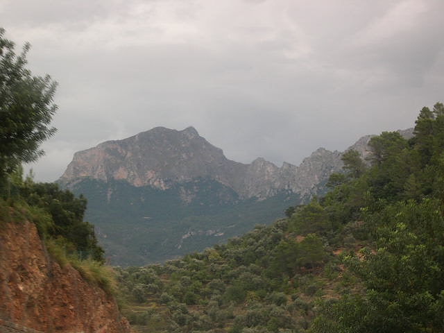
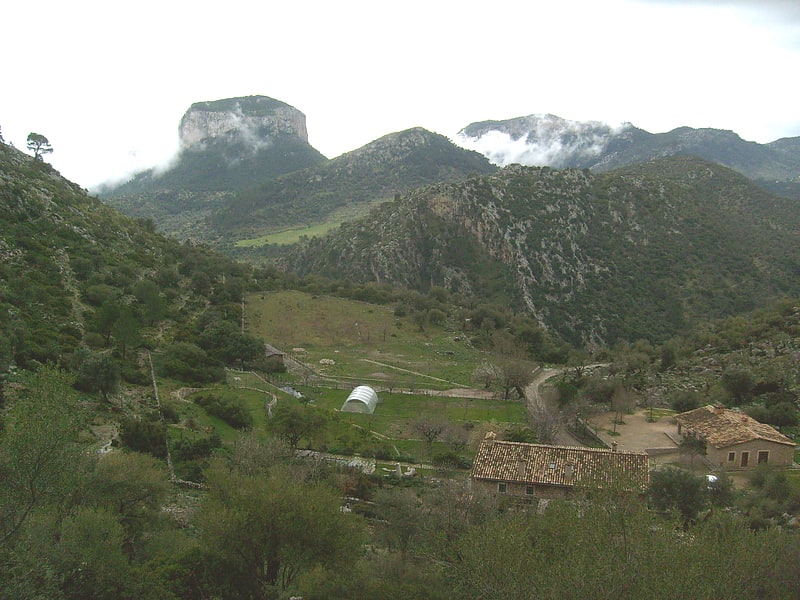
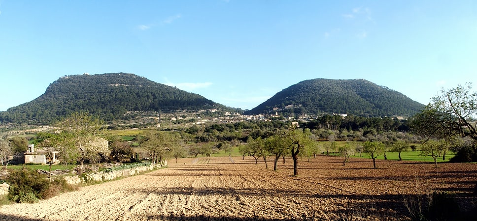
Serra de Tramuntana
Also known as: Sierra de Tramontana
Mountain range in Spain. The Serra de Tramuntana is a mountain range running southwest–northeast which forms the northern backbone of the Spanish island of Mallorca. It is also the name given to the comarca of the same area. On 27 June 2011, the Tramuntana Range was awarded World Heritage Status by UNESCO as an area of great physical and cultural significance.[6]
Puig de Sant Miquel
Mountain. Puig de Sant Miquel is a 661-metre mountain in the Serra de Tramuntana of Majorca. It is included in the municipality of Alaró of the autonomous community of the Balearic Islands. The Puig de Sant Miquel is located between s'Alcadena and the Finca Solleric, near the old path to Orient.[7]
Spiral bridge
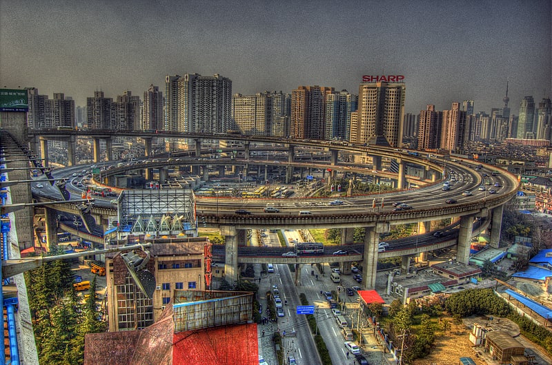
A spiral bridge, loop bridge, helix bridge, or pigtail bridge is a road bridge which loops over its own road, allowing the road to climb rapidly. This is useful in steep terrain, or where the approach road to a bridge would terminate too far from the bridge's end. The shape of the bridge forms a helix, not a spiral.
Many multi-storey car parks feature such a design as this.[8]
Puig de Massanella
Also known as: Masanella
Scenic mountain with hiking trails. Puig de Massanella is the second highest peak on the Spanish island of Mallorca. It is situated in the Serra de Tramuntana mountains. It is the highest peak on the island whose summit is accessible, as its higher neighbour Puig Major has a military-run antenna complex on the summit. It is a very popular mountain to climb. There is a walking route to the summit from the south, various scrambling routes from a high col to the north, marked with small cairns and red dots painted on rocks, and an easy scrambling route which starts slightly lower down on the south west side of the col. The summit is unusual in having a deep pit which appears to have been formed by limestone dissolution which was said to have been used for storing snow in the past. There are several ruins on a col near the summit which used to be snow houses.[9]
Palmanova beach
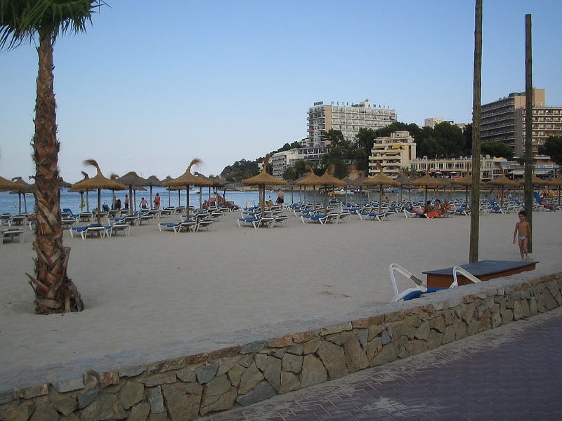
Palma Nova Beach is seven kilometers from Calvià, situated between Punta Nadala and es Carregador, on the Spanish Balearic island of Majorca. Besides Palmanova beach, other names by which the beach is known include "Playa de Palma Nova", and "Platja de Palma Nova". The Palma Nova sea front has three beaches: Torrenova, Es Carregador, and Palma Nova. The beach has had an extension of 500 meters and has needed an artificial regeneration to achieve the current aspect of fine and white sand, as well as its dimensions.[10]
Es Pontàs
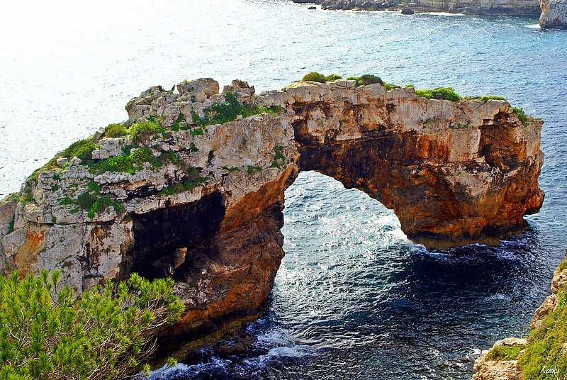
Es Pontàs is a natural arch in the southeastern part of the island of Mallorca. The arch is located on the coastline between the Cala Santanyí and Cala Llombards in the municipality of Santanyí.[11]
Puig de sa Morisca Archaeological Park
Also known as: Parque arqueológico Puig de sa Morisca
Archaeological museum in Santa Ponsa, Spain. The Puig de sa Morisca Archaeological Park is located in Santa Ponsa in the municipality of Calvià on the island of Majorca, part of the Spanish autonomous community of the Balearic Islands. Puig de sa Morisca is a hill, preserved in 2002 as an archaeological park. The park is 35 hectares in size and open to the public. The park contains more than 15 sites and nine architectural elements that are ethnologically interesting. One of these sites, the Son Ferrer tomb, was excavated from 2000 through 2009, a joint project of the University of the Balearic Islands, University of Barcelona, and University of Valencia. In addition, it includes Balearic flora found within a 10 km radius.[12]
Els Cornadors
Mountain range in Spain. Els Cornadors is a mountain range in Majorca in the municipality of Sóller.
3,136-ft. island mountain with corner-shaped twin peaks & dramatic landscape.[13]
Aljub de la Font Santa
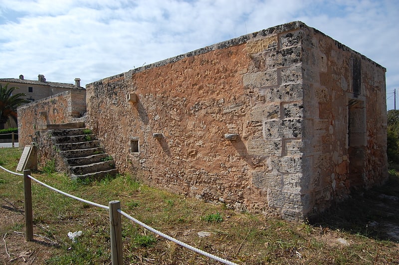
Aljub de la Font Santa is an historic building, housing a rainwater storage well, in the municipality of Campos, Majorca. It was built in 1671–1673, during the restoration of the adjacent Church of Saint Joan de la Font Santa, by remodelling the bathing room of a house known as Ca's Donat.
It used a double filter system and delivered water to external and internal wash basins, as well as drinking troughs for animals.
It had a capacity of 400,000 litres (88,000 imp gal) and was in use until the late nineteenth century.[14]
Address: Majorca, Campos
Puig de Randa
Mountain in Spain. Puig de Randa is a mountain in the island of Majorca, Balearic Islands, Spain. It is included in the municipal territory of Algaida, and, on its top, is home to the Sanctuary of Cura.
The Puig de Randa is the place where Ramon Llull went to do penance after his conversion.[15]