Discover 4 hidden attractions, cool sights, and unusual things to do in Sierra y Cañones de Guara Natural Park (Spain). Don't miss out on these must-see attractions: Dolmen Losa de la Mora, Salto de Roldán, and Peña Falconera. Also, be sure to include Sierra de Guara in your itinerary.
Below, you can find the list of the most amazing places you should visit in Sierra y Cañones de Guara Natural Park (Aragon).
Table of Contents
Dolmen Losa de la Mora
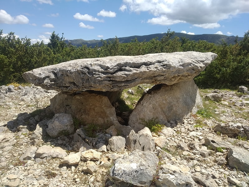
The dolmen Losa de la Mora or of Rodellar is a well-preserved dolmen located in Rodellar, in the municipality of Bierge, in the Sierra de Guara. It is at an altitude of 1020 masl.
It dates from Neolithic, from circa 3000 BC. It consists of three orthostats covered by a large slab, which gives the dolmen its name. The rocks that form it come from the Tozal de Llastras, a place located about 500 m. far. The dolmen is surrounded by numerous stones belonging to the mound that covered it, with a diameter of dispersion of about 12 meters. It was excavated by the archaeologist Martín Almagro Basch in 1935 and 1936, finding stone axes, flint tools and skeletal remains of various individuals.[1]
Salto de Roldán
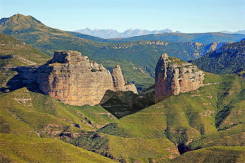
Salto de Roldán is a rock formation about 25 km north of Huesca in High Aragon, northern Spain, in the foothills of the central Pyrenees. It lies in the westernmost part of Sierra y Cañones de Guara Natural Park. It consists of several large outcrops of almost bare rock standing clear of the surrounding landscape.[2]
Peña Falconera
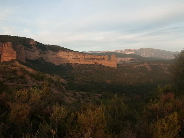
Also known as: Peña Alconera
Rock formation in Spain. The Peña Falconera or Huevo de Morrano is a rock formation near the village of Morrano, northwest of Somontano de Barbastro, Province of Huesca.
This rock formation is composed of a monolith with a mixture of sand and conglomerate somewhat eroded. It is located in the Parque de la Sierra y Cañones de Guara, a few meters from the river Alcanadre and close to the "fountain de la Tamara", is also near the pine forest of Morrano where pine are that are the most southerly of all the natural park and the Alto Aragon too.[3]
Sierra de Guara
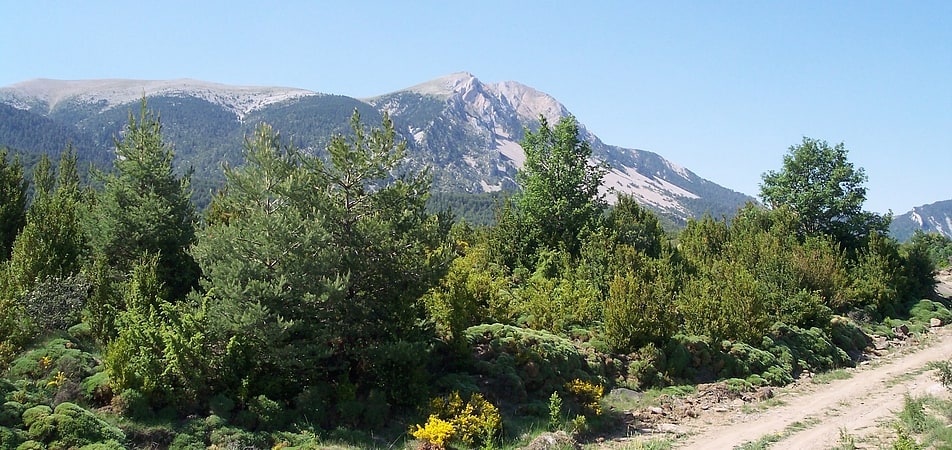
Mountain ridge for hikes and climbing. The Sierra de Guara is a mountain massif in the province of Huesca, the most northerly province in the autonomous community of Aragon, Spain. Its highest point is Tozal de Guara.
It lies around 25 km northeast of the city of Huesca itself. Much of the massif is now included within the Sierra y Cañones de Guara Natural Park which extends 43 km from west to east and 25 km north to south. The Park includes, in addition to the Sierra de Guara itself, much of the Sierra de Gabardiella in the west and the Sierra de Arangol, Sierra de Balced, Sierra de Sebil and Sierra de Rufás in the east.[4]