Discover 11 hidden attractions, cool sights, and unusual things to do in Mount Whitney (United States). Don't miss out on these must-see attractions: East Face, Mount Carillon, and Mount Muir. Also, be sure to include Mount Hitchcock in your itinerary.
Below, you can find the list of the most amazing places you should visit in Mount Whitney (California).
Table of Contents
East Face
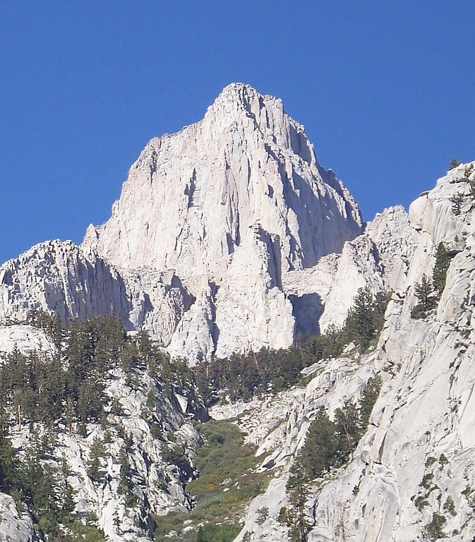
The East Face of Mount Whitney is a technical alpine rock climbing route and is featured in Fifty Classic Climbs of North America. Mount Whitney is the highest peak in the contiguous United States.
The first ascent was on August 16, 1931, by Robert L. M. Underhill of the Appalachian Mountain Club, and Sierra Club climbers Norman Clyde, Jules Eichorn, and Glen Dawson. By the standards of climbing in California at that time, the route was considered very exposed, especially the famous Fresh Air Traverse. Steve Roper called this route "one of the classic routes of the Sierra, partly because of its spectacular location and partly because it was the first really big wall to be climbed in the range". Porcella & Burns wrote that "the climb heralded a new standard of technical competence in Californian rock climbing". Underhill himself commented that "the beauty of the climb lies chiefly in its unexpected possibility, up the apparent precipice, and in the intimate contact it affords with the features that lend Mount Whitney its real impressiveness".[1]
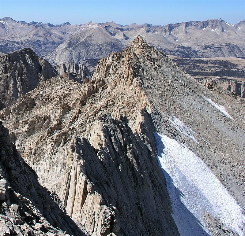
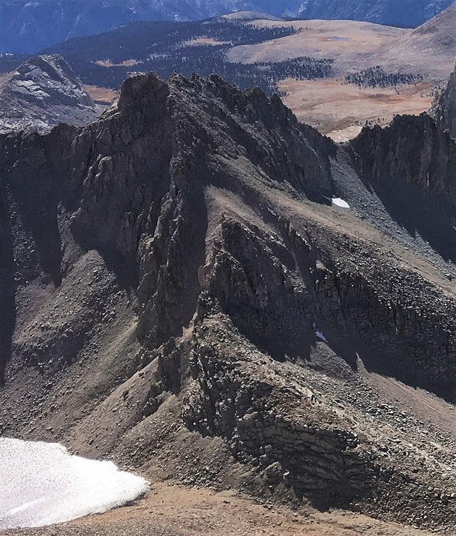
Mount Carillon
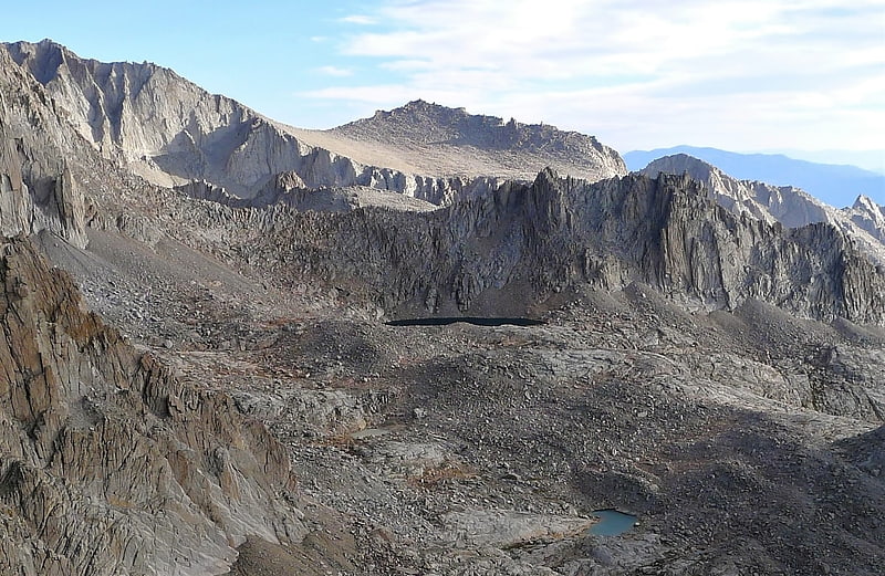
Mount Carillon is a 13,553-foot-elevation mountain summit located on the crest of the Sierra Nevada mountain range in California. It is situated on the common border of Tulare County with Inyo County, as well as the shared boundary of Sequoia National Park and John Muir Wilderness. It is set above the south shore of Tulainyo Lake, 12.5 miles west of the community of Lone Pine, 1.25 mile northeast of Mount Whitney, and 0.7 mile east-northeast of Mount Russell, the nearest higher neighbor. Topographic relief is significant as it rises approximately 5,180 feet above Whitney Portal in approximately two miles. Carillon has subpeaks, unofficially called "The Cleaver", 0.4 mile to the northeast, and "Impala", on the southeast ridge.[2]
Mount Muir
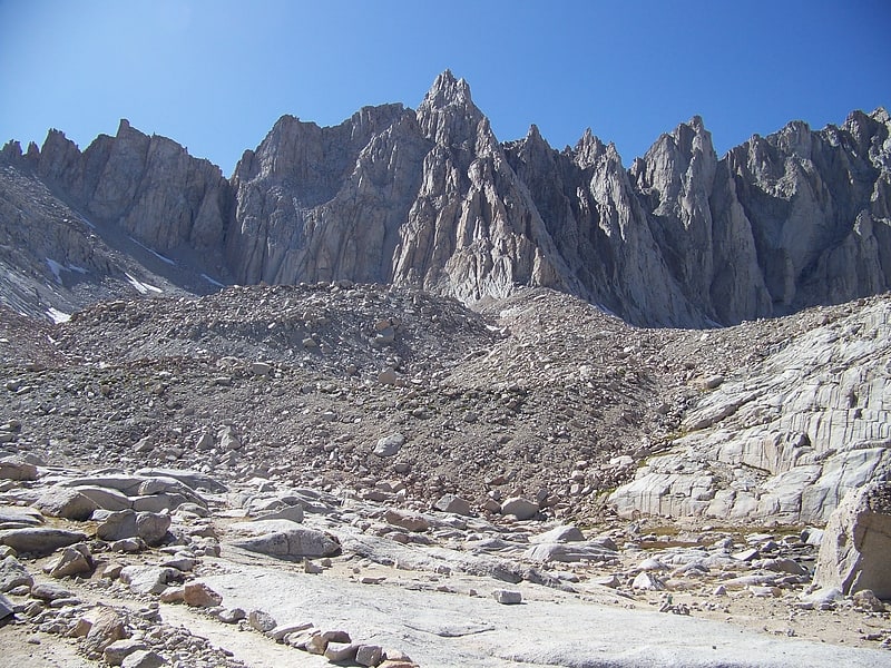
Peak in California. Mount Muir is a peak in the Sierra Nevada of California, 0.95 miles south of Mount Whitney. This 14,018-foot peak is named in honor of Scottish-born John Muir, a famous geologist, conservationist and founder of the Sierra Club. The southernmost section of the John Muir Trail contours along the west side of Mount Muir near its summit and ends on the summit of Mount Whitney.[3]
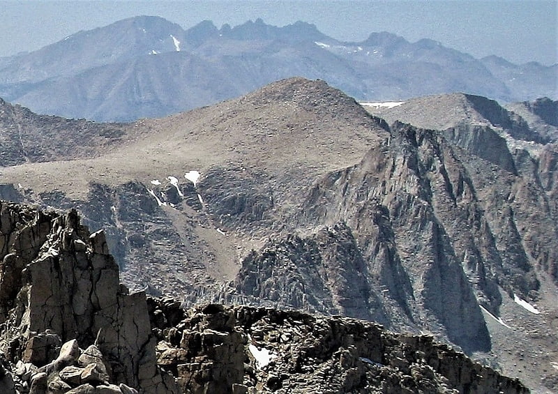
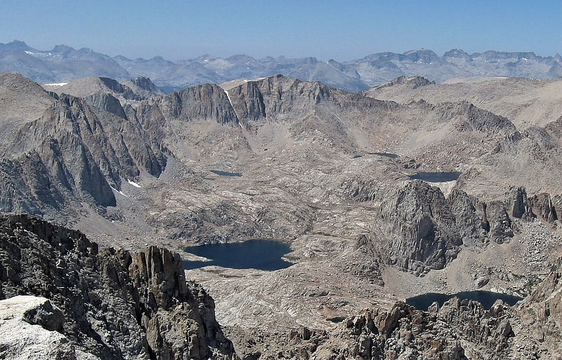
Mount Hitchcock
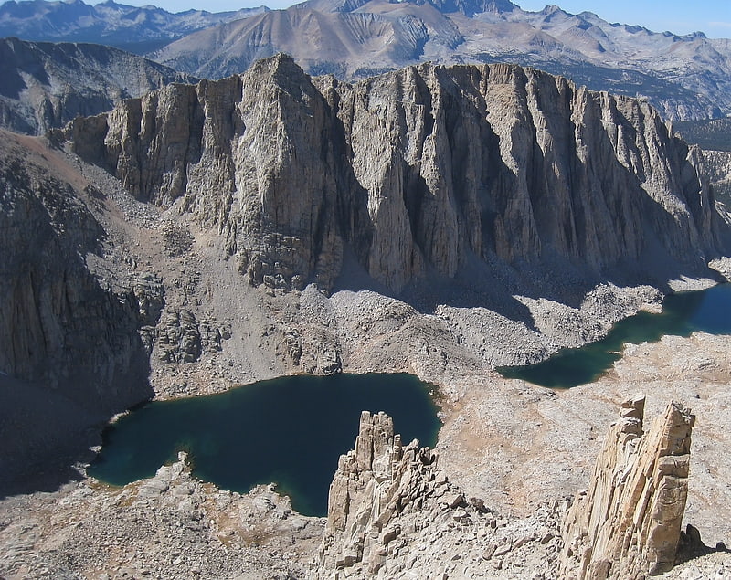
Mount Hitchcock is a 13,186-foot-elevation mountain summit located west of the crest of the Sierra Nevada mountain range in Tulare County, California. It is situated in Sequoia National Park, and is two miles south-southwest of Mount Whitney, 1.3 mile southwest of Mount Muir, and 1.1 mile west of Trail Crest. Topographic relief is significant as it rises approximately 1,500 feet above Hitchcock Lakes in less than one-half mile. Mt. Hitchcock ranks as the 112th highest summit in California.[4]
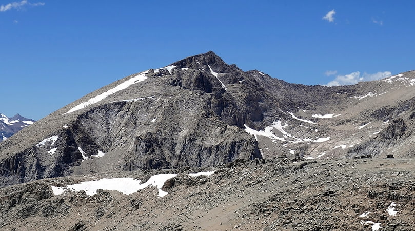
Mount Randy Morgenson
Mount Randy Morgenson is a 13,927-foot-elevation mountain summit located along the crest of the Sierra Nevada mountain range in Tulare County, California. It is situated in Sequoia National Park, one mile north-northwest of Mount Whitney, 0.85 mile east of Mount Hale, and one-half mile west of Mount Russell, the nearest higher neighbor. The John Muir Trail traverses to the south of the mountain, providing an approach option. Mt. Morgenson ranks as the 20th-highest summit in California. Topographic relief is significant as the northwest aspect rises 2,200 feet above Wales Lake in less than one mile.[5]
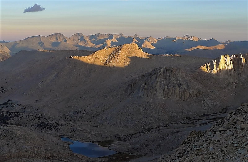
Mount Pickering
Mount Pickering is a 13,474-foot-elevation mountain summit located just west of the crest of the Sierra Nevada mountain range in Tulare County, California. It is situated in Sequoia National Park, and is 3.1 miles south of Mount Whitney, 1.2 mile southeast of Mount Chamberlin, and one mile south of Mount Newcomb. Mt. Pickering ranks as the 65th highest summit in California. Topographic relief is significant as it rises nearly 2,000 feet above Sky Blue Lake in approximately one mile. This mountain's name was proposed by the Sierra Club and officially adopted in 1940 by the U.S. Board on Geographic Names to honor American astronomer Edward Charles Pickering. The immediate area has other geographical features named for astronomers, including Mount Newcomb, Mount Langley, Mount Young, and Mount Hale. The first ascent of the summit was made July 16, 1936, by Chester Versteeg, Tyler Van Degrift, and Oliver Kehrlein.[6]
Joe Devel Peak
Joe Devel Peak is a 13,327-foot-elevation mountain summit located just west of the crest of the Sierra Nevada mountain range in Tulare County, California. Set in Sequoia National Park, it is situated 4.35 miles south of Mount Whitney, 1.5 miles southeast of Mount Chamberlin, and 0.87 mile south of Mount Pickering, the nearest higher neighbor. Joe Devel Peak ranks as the 88th-highest summit in California, and the southernmost 4,000-meter peak in the contiguous United States. Topographic relief is significant as the southwest aspect rises over 3,300 feet above Rock Creek in approximately two miles. The Pacific Crest Trail traverses to the south and west of the mountain, providing an approach option. This mountain's name was proposed by Owen L. Williams of the Sierra Club in 1937, and officially adopted by the U.S. Board on Geographic Names, to commemorate Joseph Devel, one of the members of the Wheeler Survey who made the first ascent of this summit on September 20, 1875.[7]
Mount Young
Mount Young is a 13,176-foot-elevation mountain summit located west of the crest of the Sierra Nevada mountain range in Tulare County, California. It is situated in Sequoia National Park, and is two miles west of Mount Whitney, one mile northwest of Guitar Lake, and one mile southwest of Mount Hale, the nearest higher neighbor. The John Muir Trail traverses below the south and west aspects of the mountain, providing access. Topographic relief is significant as the southwest aspect rises 2,300 feet above Whitney Creek in approximately one mile. Mt. Young ranks as the 117th highest summit in California.[8]
Mount Versteeg
Mount Versteeg is a 13,471-foot-elevation mountain summit located on the crest of the Sierra Nevada mountain range in California. It is situated on the common border of Tulare County with Inyo County, as well as the shared boundary of Sequoia National Park and John Muir Wilderness. It is 15 miles west-northwest of the community of Lone Pine, one mile southeast of Mount Tyndall, one mile southwest of Mount Williamson, and 0.68 mile northwest of Trojan Peak, the nearest higher neighbor. Mt. Versteeg ranks as the 66th highest peak in California. Topographic relief is significant as it rises approximately 950 feet above Lake Helen of Troy in approximately 0.2 mile.[9]
Mount Newcomb
Mount Newcomb is a 13,422-foot-elevation mountain summit located just west of the crest of the Sierra Nevada mountain range in Tulare County, California. It is situated in Sequoia National Park, and is 2.8 miles south of Mount Whitney, 1.1 mile northeast of Mount Chamberlin, and 3.5 miles west of Mount Corcoran. Mt. Newcomb ranks as the 70th highest summit in California. Topographic relief is significant as it rises 2,083 feet above the second Crabtree Lake in approximately one mile. This mountain's name was officially adopted in 1940 by the U.S. Board on Geographic Names to honor American astronomer Simon Newcomb. The first ascent of the summit was made August 22, 1936, by Max Eckenburg and Bob Rumohr.[10]
Smithsonian Institution Shelter
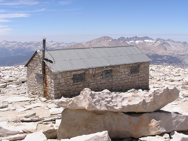
Shelter in Inyo County, California. The Smithsonian Institution Shelter, also known as the Mount Whitney Summit Shelter and the Mount Whitney Hut, was built in 1909 on the summit plateau of Mount Whitney, in the Sierra Nevada within Sequoia National Park, in California. It is the highest permanent building in the Contiguous United States.[11]