Discover 15 hidden attractions, cool sights, and unusual things to do in Mont Blanc (Italy). Don't miss out on these must-see attractions: Cosmiques Hut, Refuge des Grands Mulets, and Gonella Hut. Also, be sure to include Dôme du Goûter in your itinerary.
Below, you can find the list of the most amazing places you should visit in Mont Blanc (Aosta Valley).
Table of Contents
Cosmiques Hut
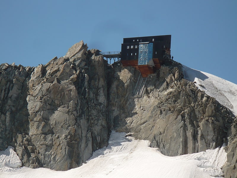
Also known as: Refuge des Cosmiques
Accommodation. The Cosmiques Hut is a mountain hut in the Mont Blanc massif in the French Alps at an altitude of 3,613 m. It is a large structure capable of accommodating 148 mountaineers. It was constructed in 1990 on a rock promontory situated between the Col du Midi and the base of the Cosmiques Arête which descends southwards from the Aiguille du Midi. It gives access to a number of classic alpine mountaineering routes, and has proved to be extremely popular with mountaineers, so much so that in the summer months prior booking a few days beforehand is essential in order to secure a bed. The Hut is wardened between mid-February and mid-October. In winter the nearby Abri Simond Hut is left unlocked, although this has no cooking facilities, heating or water.[1]
Refuge des Grands Mulets
Mountain cabin in Chamonix, France. The Grands Mulets Hut is a mountain refuge in the Mont Blanc massif in the French Alps at an altitude of 3,051 m. It is owned by the Club Alpin Francais. The hut is located on a pyramidal rock island, at the junction of two streams of the Bossons Glacier on the north side of Mont Blanc. If the state of the glacier is not too severe, the hut is wardened in summer and can be used as an alternative route of ascent to the summit of Mont Blanc, following the original historic route by the first ascensionists. Nowadays the hut is used more frequently by ski-mountaineers in spring, or as a more sheltered and alternative route of descent from Mont Blanc than the much more popular Goûter route, though route-finding can be difficult in fog and requires prior knowledge of the crevassed state of the Bossons glacier below the hut.
The first Grands Mulets hut was built in 1853, then replaced in 1896. The current refuge was built in 1960 and inaugurated on August 7 by Maurice Herzog.[2]
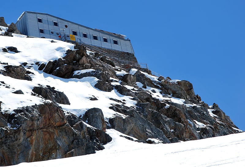
Gonella Hut
Also known as: Rifugio Francesco Gonella
Mountain cabin in Italy. The Gonella Hut is a high altitude mountain hut in the Aosta Valley in the Mont Blanc massif area of the Alps. It lies at an altitude of 3071 metres, above Val Veny near Courmayeur in Italy. The refuge is located on the Italian 'normal route' to Mont Blanc.[3]
Dôme du Goûter
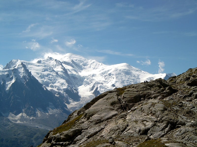
Mountain in Europe. The Dôme du Goûter is a mountain in the Mont Blanc massif. It is a shoulder of Mont Blanc, whose summit lies two kilometres to the south-east. The Dôme is traversed on ascents of Mont Blanc via the Bosses route.
The summit of the Dôme is marked as lying entirely within France on the French Institut Géographique National (IGN) map, although on Italian Istituto Geografico Militare (IGM) map the summit appears to lie on the frontier between France and Italy. In June 2015, Italian Prime Minister Matteo Renzi expressed repeated claims on the territory. The Swiss National Map, which covers the massif at 1:50'000 scale, shows both disputed areas around Mont Blanc and Dôme du Goûter in a neutral way, after previously following the French interpretation of the border until 2018.[4]
Aiguille de Bionnassay
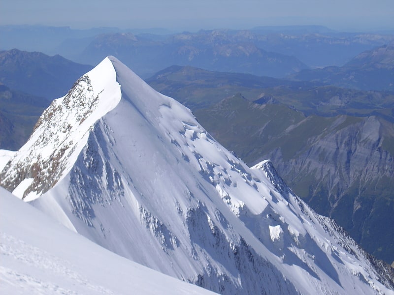
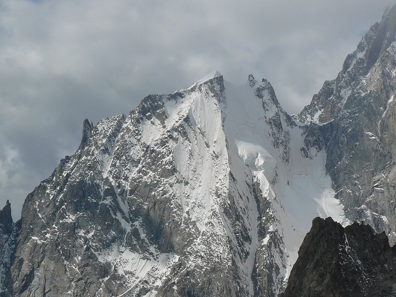
Mountain in Europe. The Aiguille de Bionnassay is a mountain in the Mont Blanc massif of the Alps in France and Italy. It has been described as "one of the most attractive satellite peaks of Mont Blanc", and is located on its western side. The mountain's south and east ridges form the frontier between the two countries, and its summit is a knife-edge crest of snow and ice. Reaching it via any route provides a "splendid and serious snow and ice climb".[5]
Mont Maudit
Also known as: Monte Maudit
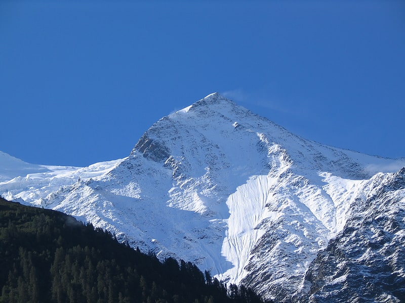
Mountain in Europe. Mont Maudit is a mountain in the Mont Blanc massif in France and Italy. The French name literally means "Cursed Mountain". Until the end of the 18th century, Mont Blanc and its satellite peaks were collectively known in French as the Montagne Maudite.[6]
Mont Blanc du Tacul
Mountain in France. Mont Blanc du Tacul is a mountain in the Mont Blanc massif of the French Alps situated midway between the Aiguille du Midi and Mont Blanc.
The official first ascent of Mont Blanc du Tacul was by a guideless party comprising Charles Hudson, Edward John Stevenson, Christopher and James Grenville Smith, E. S. Kennedy, Charles Ainslie and G. C. Joad on 8 August 1855. However, Courmayeur guides may have already ascended the peak during their attempts in 1854 and 1855 to force a way up Mont Blanc from the Italian side.[7]
Mont Blanc de Courmayeur
Also known as: Monte Bianco di Courmayeur
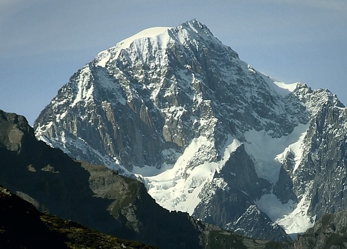
Scenic Alps peak with hiking trails. Mont Blanc de Courmayeur is a point on the south-east ridge of Mont Blanc that forms the peak of the massive south-east face of the mountain. It is connected to the main summit via the Col Major.
Despite its minimal topographic prominence, it appears as the second-highest peak in the Alps on the official list of Alpine four-thousanders of the Union Internationale des Associations d'Alpinisme (UIAA) for its impressive appearance and its importance for mountaineering.
The peak can be reached from the main summit over the Bosses ridge. The ascents over the south-east / Peuterey and south / Brouillard ridges are very challenging.
The summit of Mont Blanc de Courmayeur is marked as lying entirely within Italy on the Italian Istituto Geografico Militare (IGM) map, while on the French Institut Géographique National (IGN) map the summit lies on the border between France and Italy. A demarcation agreement, signed on 7 March 1861, defines the local border between France and Italy. Currently this act and the attached maps (showing the border on the top of Mont Blanc, 4810 m) are legally valid for both the French and Italian governments.[8]
Aiguille Blanche de Peuterey
Mont Blanc peak with extreme climbing. The Aiguille Blanche de Peuterey is a mountain of the Mont Blanc massif in Italy. It is considered the most difficult and serious of the alpine 4000-m mountains to climb.
There are three tops to the mountain:
- Pointe Güssfeldt (4,112 m)
- Pointe Seymour King (4,107 m)
- Pointe Jones (4,104 m)
The three tops are named after Paul Güssfeldt, Henry Seymour King and Humphrey Owen Jones.[9]
Aiguille du Goûter
Mountain in France. Aiguille du Goûter is a mountain in the Mont Blanc massif of Haute-Savoie, France.[10]
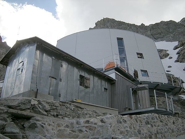
Durier Hut
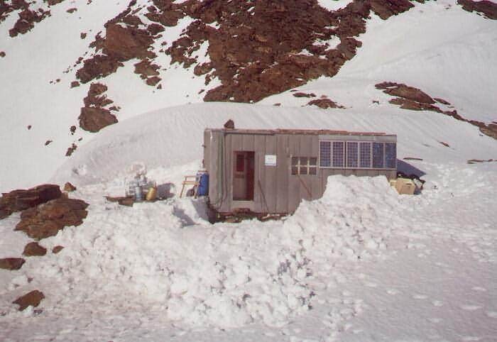
Also known as: Rifugio Durier
Lodging in France. The Durier Hut is a mountain hut in the Mont Blanc massif of the Alps. It is located in Haute-Savoie department of France on the French/Italian border at an altitude of 3358 m.[11]
Grand Capucin
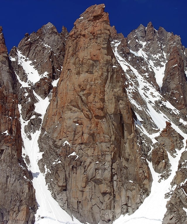
Rock pinnacle in France. The Grand Capucin is a rock pinnacle located underneath Mont Blanc du Tacul in the Mont Blanc Massif in Haute-Savoie, France.[12]
Aiguille Noire de Peuterey
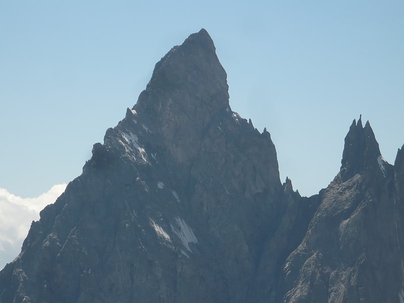
Famous peak first climbed in 1930. The Aiguille Noire de Peuterey is a mountain of the Mont Blanc massif in Italy, forming part of the Peuterey ridge to the summit of Mont Blanc with its higher neighbour, the Aiguille Blanche de Peuterey.
The best-known route on the mountain is the south ridge (TD), first climbed by Karl Brendelet and Hermann Schaller, on 26 and 27 August 1930; it remains one of the great classic rock routes in the massif.
The first ascent of the complete Peuterey ridge including the Aiguille Noire de Peuterey (the Intégrale) was on 28–31 July 1934 by Adolf Göttner, Ludwig Schmaderer and Ferdinand Krobath. On 21 August 2010 23-year-old Chloé Graftiaux, a leading Belgian sport climber, fell to her death on the mountain.[13]
Grand Pilier d'Angle
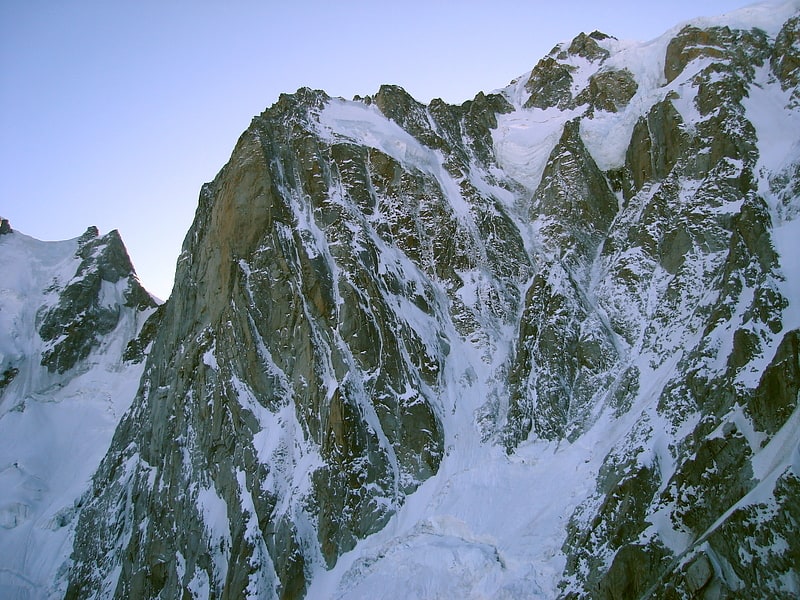
Buttress on the side of Mont Blanc. The Grand Pilier d'Angle is a buttress on the southern side of Mont Blanc in the Mont Blanc massif in the Aosta Valley, Italy.
The first ascent from the valley was by James Eccles with guides Michel Payot and Alphonse Payot on 30 July 1877 during an ascent of the Peuterey ridge, although the summit had been visited on 20 August 1822 by F. Clissold with guides J. M. Couttet, M. Bossonney, D. Couttet, P. Favret and J. B. Simond on the descent from their first ascent of Mont Blanc de Courmayeur.
The first ascent of the pillar (the north-east face) itself was by Walter Bonatti and Toni Gobbi on 3 August 1957. Bonatti said after the climb that "the mixed terrain of the face was without doubt the most sombre, the most savage and the most dangerous of any that I have ever encountered in the Alps." The first winter ascent of the Bonatti-Gobbi route was by A. Dworak, J. Kurczab, A. Mróz and T. Piotrowski between 5 and 9 March 1971. The first solo ascent of the route was by Nicolas Jaeger on 3 August 1975.
Other well-known routes on the face include the Cecchinel-Nominé (Walter Cecchinel and Georges Nominé, 17 September 1971; the Boivin-Vallençant of 1975 adds a direct finish to this route) and Divine Providence (Patrick Gabarrou and François Marsigny, 5–7 June 1984). The first solo ascent of this route was by Jean-Christophe Lafaille in 1990, who said, "This route is the most difficult and involving in the whole of the Mont Blanc massif."[14]
Punta Baretti
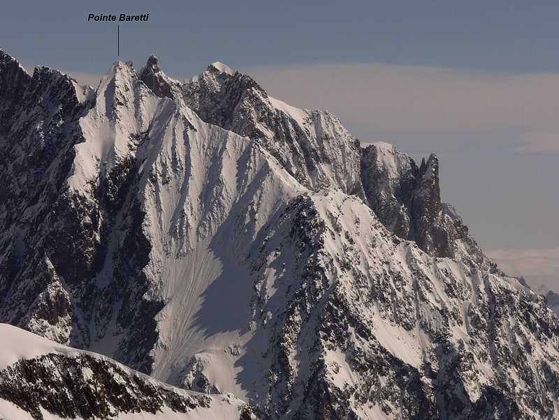
Mountain in Italy. Punta Baretti is a mountain in the Mont Blanc Massif in the Val d'Aosta, Italy.[15]