Discover 35 hidden attractions, cool sights, and unusual things to do in Luxor (Egypt). Don't miss out on these must-see attractions: Karnak, Medinet Habu, and Luxor Temple. Also, be sure to include Mortuary Temple of Hatshepsut in your itinerary.
Below, you can find the list of the most amazing places you should visit in Luxor (Al Uqsur).
Table of Contents
Karnak
Also known as: معبد الكرنك
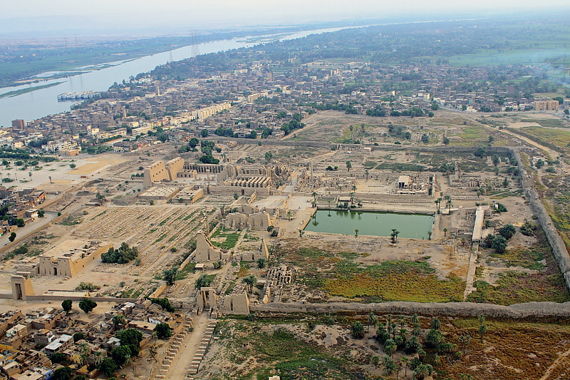
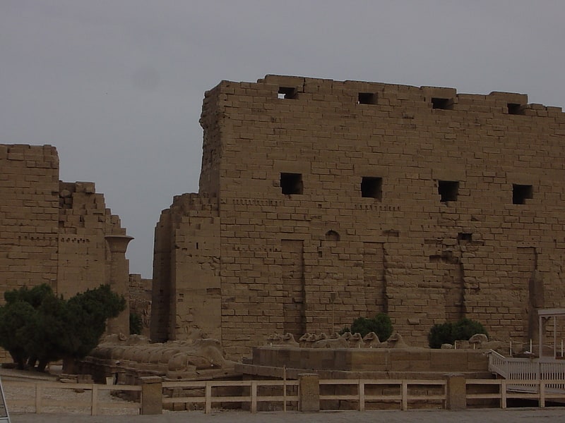
Temple in Luxor, Egypt. The Karnak Temple Complex, commonly known as Karnak, comprises a vast mix of decayed temples, pylons, chapels, and other buildings near Luxor, Egypt. Construction at the complex began during the reign of Senusret I in the Middle Kingdom and continued into the Ptolemaic Kingdom, although most of the extant buildings date from the New Kingdom. The area around Karnak was the ancient Egyptian Ipet-isut and the main place of worship of the 18th Dynastic Theban Triad, with the god Amun as its head. It is part of the monumental city of Thebes, and in 1979 it was inscribed on the UNESCO World Heritage List along with the rest of the city. The Karnak complex gives its name to the nearby, and partly surrounded, modern village of El-Karnak, 2.5 kilometres north of Luxor.[1]
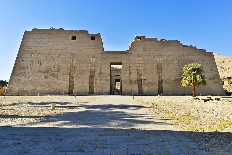
Medinet Habu
Also known as: معبد رمسيس الثالث
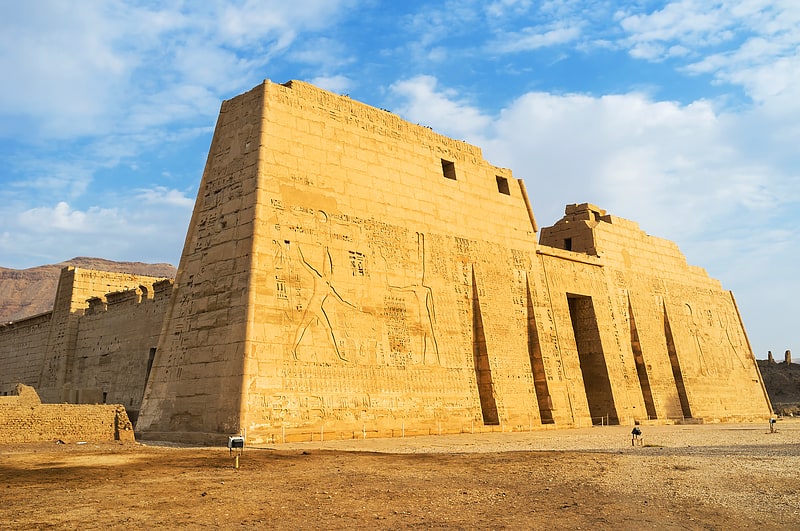
Ancient temple and tomb of Ramesses III. Medinet Habu is an archaeological locality situated near the foot of the Theban Hills on the West Bank of the River Nile opposite the modern city of Luxor, Egypt. Although other structures are located within the area, the location is today associated almost exclusively with the Mortuary Temple of Ramesses III.[2]
Address: Al Bairat, Luxor
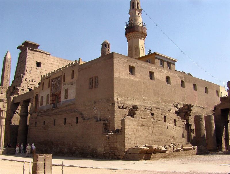
Luxor Temple
Also known as: معبد الأقصر
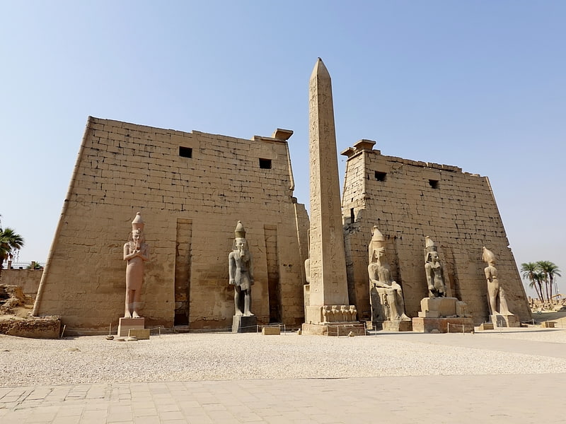
Egyptian temple in Luxor, Egypt. The Luxor Temple is a large Ancient Egyptian temple complex located on the east bank of the Nile River in the city today known as Luxor and was constructed approximately 1400 BCE. In the Egyptian language it was known as ipet resyt, "the southern sanctuary". It was one of the two primary temples on the east bank, the other being Karnak. Unlike the other temples in Thebes, Luxor temple is not dedicated to a cult god or a deified version of the pharaoh in death. Instead, Luxor temple is dedicated to the rejuvenation of kingship; it may have been where many of the pharaohs of Egypt were crowned in reality or conceptually.
To the rear of the temple are chapels built by Amenhotep III of the 18th Dynasty, and Alexander. Other parts of the temple were built by Tutankhamun and Ramesses II. During the Roman era, the temple and its surroundings were a legionary fortress and the home of the Roman government in the area. During the Roman period a chapel inside the Luxor Temple originally dedicated to the goddess Mut was transformed into a Tetrarchy cult chapel and later into a church.
Along with the other archeological sites in Thebes, the Luxor Temple was inscribed on the UNESCO World Heritage List in 1979.[3]
Address: Corniche El Nil St. Luxor, 23512 Luxor
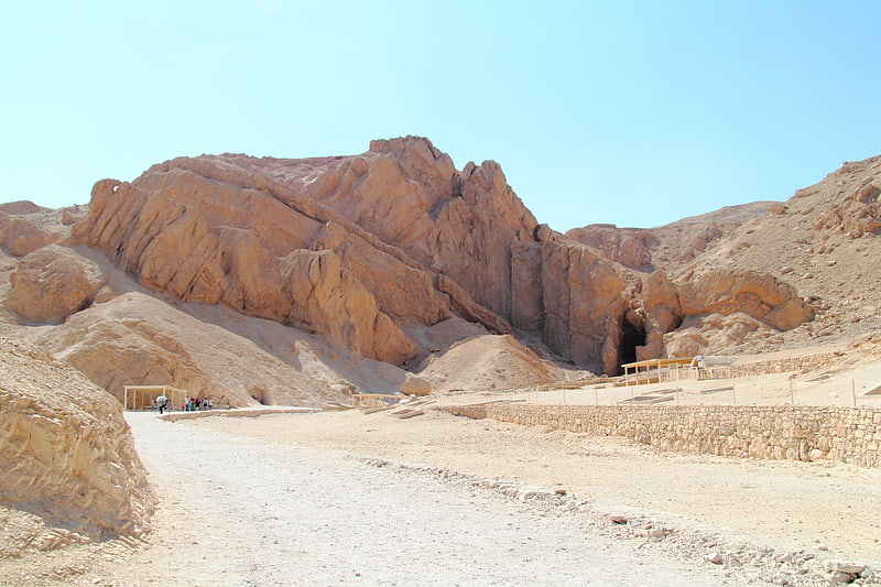
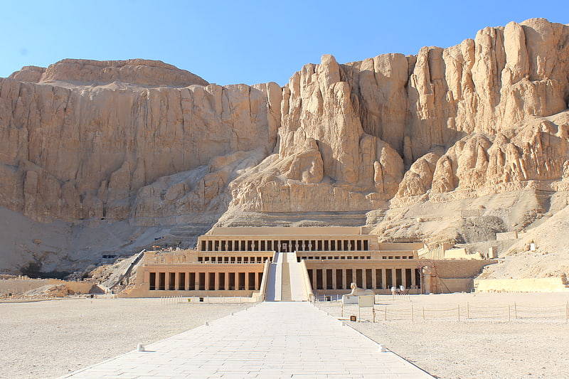
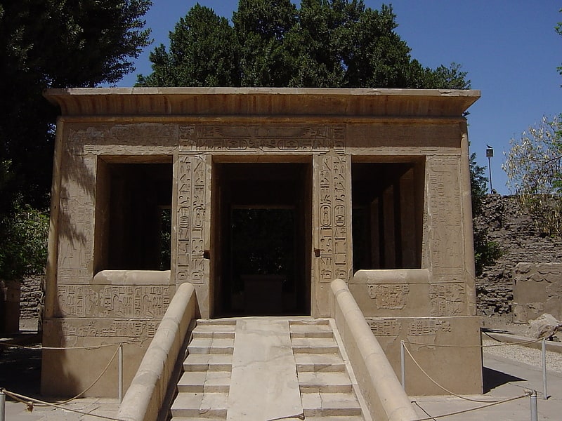
Mortuary Temple of Hatshepsut
Also known as: معبد حتشبسوت
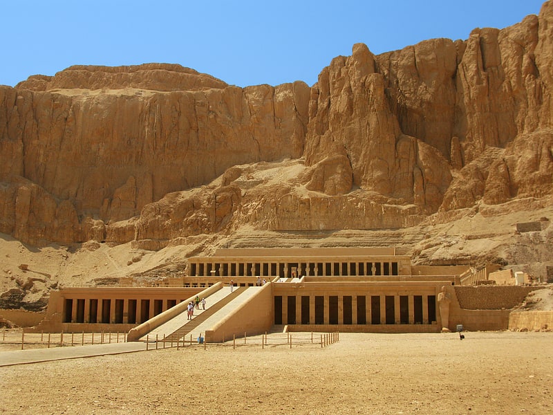
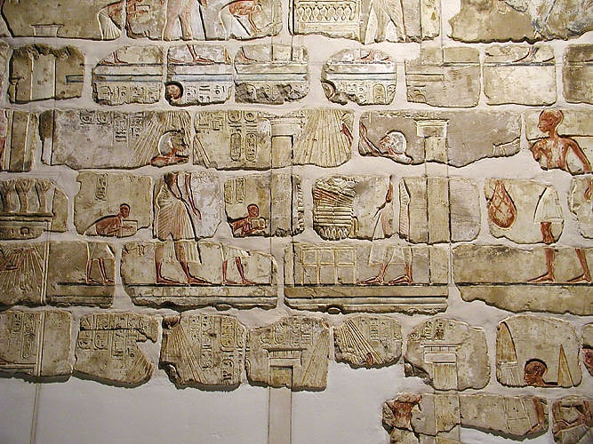
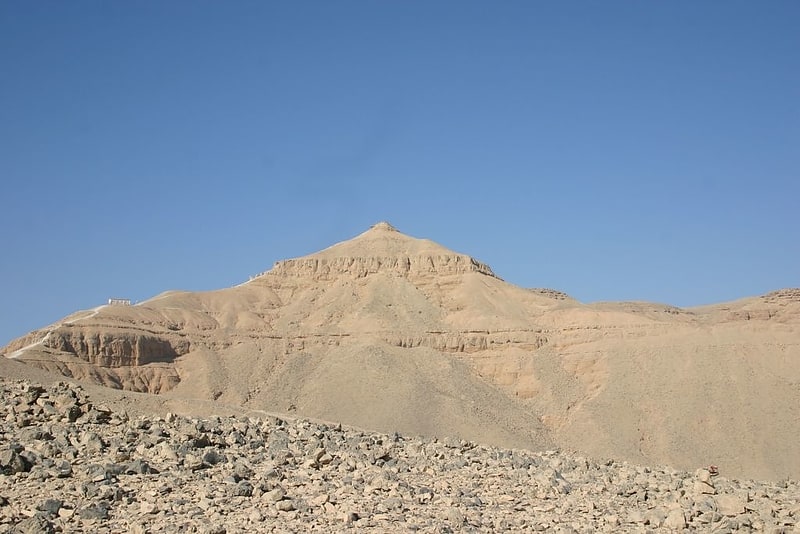
Reconstructed New Kingdom temple. The Temple of Hatshepsut is a mortuary temple built during the reign of Pharaoh Hatshepsut of the Eighteenth Dynasty of Egypt. Located opposite the city of Luxor, it is considered to be a masterpiece of ancient architecture. Its three massive terraces rise above the desert floor and into the cliffs of Deir el-Bahari. Her tomb, KV20, lies inside the same massif capped by El Qurn, a pyramid for her mortuary complex. At the edge of the desert, 1 km east, connected to the complex by a causeway lies the accompanying valley temple. Across the river Nile, the whole structure points towards the monumental Eighth Pylon, Hatshepsut's most recognizable addition to the Temple of Karnak and the site from which the procession of the Beautiful Festival of the Valley departs. The temple's twin functions are identified by its axes: on its main east-west axis, it served to receive the barque of Amun-Re at the climax of the festival, while on its north-south axis it represented the life cycle of the pharaoh from coronation to rebirth.
Construction of the terraced temple took place between Hatshepsut's seventh and twentieth regnal year, during which building plans were repeatedly modified. In its design it was heavily influenced by the Temple of Mentuhotep II of the Eleventh Dynasty built six centuries earlier. In the arrangement of its chambers and sanctuaries, though, the temple is wholly unique. The main axis, normally reserved for the mortuary complex, is occupied instead by the sanctuary of the barque of Amun-Re, with the mortuary cult being displaced south to form the auxiliary axis with the solar cult complex to the north. Separated from the main sanctuary are shrines to Hathor and Anubis which lie on the middle terrace. The porticoes that front the terrace here host the most notable reliefs of the temple. Those of the expedition to the Land of Punt and of the divine birth of Hatshepsut, the backbone of her case to rightfully occupy the throne as a member of the royal family and as godly progeny. Below, the lowest terrace leads to the causeway and out to the valley temple.
The state of the temple has suffered over time. Two decades after Hatshepsut's death, under the direction of Thutmose III, references to her rule were erased, usurped or obliterated. The campaign was intense but brief, quelled after two years when Amenhotep II was enthroned. The reasons behind the proscription remain a mystery. A personal grudge appears unlikely as Thutmose III had waited twenty years to act. Perhaps the concept of a female king was anathema to ancient Egyptian society or a dynastic dispute between the Ahmosid and Thutmosid lineages needed resolving. In the Amarna Period the temple was incurred upon again when Akhenaten ordered the images of Egyptian gods, particularly those of Amun, to be erased. These damages were repaired subsequently under Tutankhamun, Horemheb and Ramesses II. An earthquake in the Third Intermediate Period caused further harm. During the Ptolemaic period the sanctuary of Amun was restructured and a new portico built at its entrance. A Coptic monastery of Saint Phoibammon was built between the 6th and 8th centuries AD and images of Christ were painted over original reliefs. The latest graffito left is dated to c. 1223.
The temple resurfaces in the records of the modern era in 1737 with Richard Pococke, a British traveller, who visited the site. Several visitations followed, though serious excavation was not conducted until the 1850s and 60s under Auguste Mariette. The temple was fully excavated between 1893 and 1906 during an expedition of the Egypt Exploration Fund (EEF) directed by Édouard Naville. Further efforts were carried out by Herbert E. Winlock and the Metropolitan Museum of Art (MMA) from 1911 to 1936, and by Émile Baraize and the Egyptian Antiquities Service (now the Supreme Council of Antiquities (SCA)) from 1925 to 1952. Since 1961, the Polish Centre of Mediterranean Archaeology (PCMA) has carried out extensive consolidation and restoration works throughout the temple.[4]
Address: Kings Valley Rd, Luxor
Valley of the Queens
Also known as: وادي الملكات
Ancient royal tombs and excavation site. The Valley of the Queens is a site in Egypt, where the wives of pharaohs were buried in ancient times. It was known then as Ta-Set-Neferu, meaning "the place of beauty". It was most famous for being the burial site of many wives of Pharaohs. Pharaohs themselves were buried in the Valley of the Kings.
Using the limits described by Christian Leblanc, the Valley of the Queens consists of the main wadi, which contains most of the tombs, along with the Valley of Prince Ahmose, the Valley of the Rope, the Valley of the Three Pits, and the Valley of the Dolmen. The main wadi contains 91 tombs and the subsidiary valleys add another 19 tombs. The burials in the subsidiary valleys all date to the 18th Dynasty.
The reason for choosing the Valley of the Queens as a burial site is not known. The close proximity to the workers' village of Deir el-Medina and the Valley of the Kings may have been a factor. Another consideration could have been the existence of a sacred grotto dedicated to Hathor at the entrance of the Valley. This grotto may have been associated with rejuvenation of the dead.
Along with the Valley of the Kings and nearby Thebes, the Valley of the Queens was inscribed on the UNESCO World Heritage List in 1979.[5]
Address: West Bank of the Nile, Luxor
Deir el-Bahari
Also known as: الدير البحري
Terraced ancient temple ruins. Deir el-Bahari or Dayr al-Bahri is a complex of mortuary temples and tombs located on the west bank of the Nile, opposite the city of Luxor, Egypt. This is a part of the Theban Necropolis.
The first monument built at the site was the mortuary temple of Mentuhotep II of the Eleventh Dynasty. It was constructed during the 21st century BC.
During the Eighteenth Dynasty, Amenhotep I and Hatshepsut also built extensively at the site.[6]
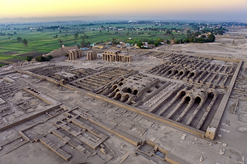
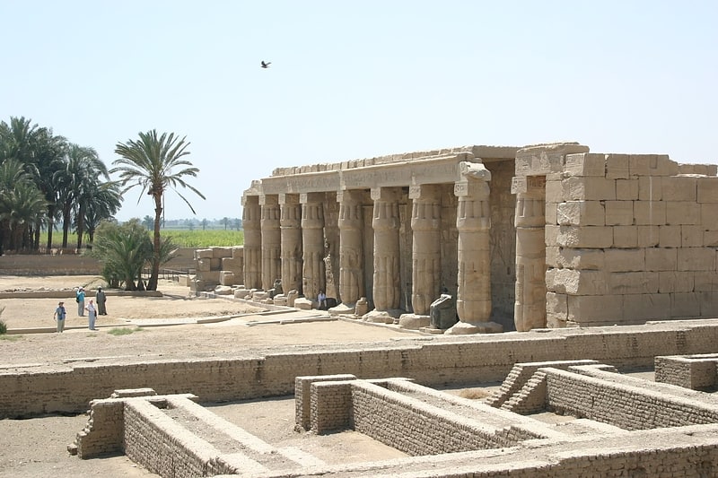
Ramesseum
Also known as: معبد الرامسيوم
Memorial temple to great warrior-king. The Ramesseum is the memorial temple of Pharaoh Ramesses II. It is located in the Theban Necropolis in Upper Egypt, on the west of the River Nile, across from the modern city of Luxor. The name – or at least its French form Rhamesséion – was coined by Jean-François Champollion, who visited the ruins of the site in 1829 and first identified the hieroglyphs making up Ramesses's names and titles on the walls. It was originally called the House of millions of years of Usermaatra-setepenra that unites with Thebes-the-city in the domain of Amon. Usermaatra-setepenra was the prenomen of Ramesses II.[7]
Address: West Bank, Luxor
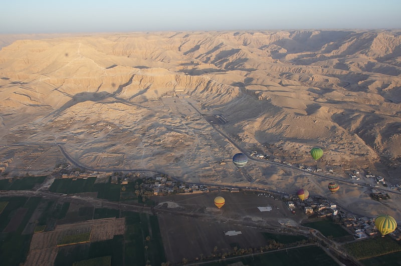
Valley of the Kings
Also known as: وادي الملوك
Pharaohs' tombs and burial chambers. The Valley of the Kings, also known as the Valley of the Gates of the Kings, is a valley in Egypt where, for a period of nearly 500 years from the 16th to 11th century BC, rock-cut tombs were excavated for the pharaohs and powerful nobles of the New Kingdom.
The valley stands on the west bank of the Nile, opposite Thebes (modern Luxor), within the heart of the Theban Necropolis./ The wadi consists of two valleys: the East Valley (where the majority of the royal tombs are situated) and the West Valley (Valley of the Monkeys).
With the 2005 discovery of a new chamber and the 2008 discovery of two further tomb entrances, the valley is known to contain 63 tombs and chambers (ranging in size from KV54, a simple pit, to KV5, a complex tomb with over 120 chambers). It was the principal burial place of the major royal figures of the Egyptian New Kingdom, as well as a number of privileged nobles. The royal tombs are decorated with scenes from Egyptian mythology and give clues as to the beliefs and funerary practices of the period. Almost all of the tombs seem to have been opened and robbed in antiquity, but they still give an idea of the opulence and power of the pharaohs.
This area has been a focus of archaeological and Egyptological exploration since the end of the eighteenth century, and its tombs and burials continue to stimulate research and interest. Since the 1920s, the valley has been famous for the discovery of the tomb of Tutankhamun, and is one of the most famous archaeological sites in the world. In 1979, it became a World Heritage Site, along with the rest of the Theban Necropolis. Exploration, excavation and conservation continues in the valley, and a new tourist centre has recently been opened.[8]
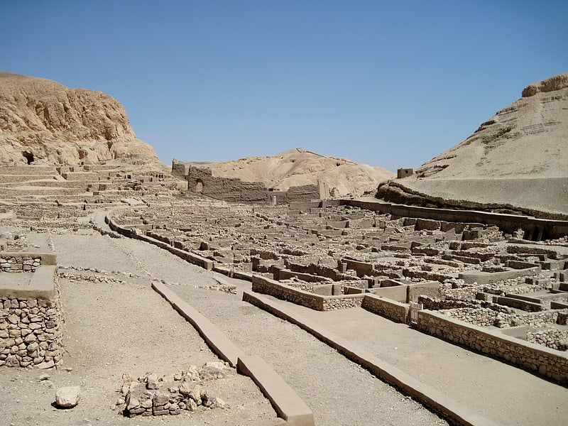
Deir el-Medina
Also known as: دير المدينة
Ancient Egyptian workers' village. Deir el-Medina, or Dayr al-Madīnah, is an ancient Egyptian workmen's village which was home to the artisans who worked on the tombs in the Valley of the Kings during the 18th to 20th Dynasties of the New Kingdom of Egypt The settlement's ancient name was Set maat, and the workmen who lived there were called "Servants in the Place of Truth". During the Christian era, the temple of Hathor was converted into a church from which the Egyptian Arabic name Deir el-Medina is derived.
At the time when the world's press was concentrating on Howard Carter's discovery of the Tomb of Tutankhamun in 1922, a team led by Bernard Bruyère began to excavate the site. This work has resulted in one of the most thoroughly documented accounts of community life in the ancient world that spans almost four hundred years. There is no comparable site in which the organisation, social interactions, working and living conditions of a community can be studied in such detail.
The site is located on the west bank of the Nile, across the river from modern-day Luxor. The village is laid out in a small natural amphitheatre, within easy walking distance of the Valley of the Kings to the north, funerary temples to the east and south-east, with the Valley of the Queens to the west. The village may have been built apart from the wider population in order to preserve secrecy in view of sensitive nature of the work carried out in the tombs.[9]
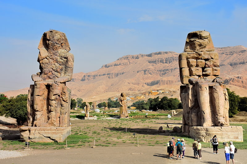
Colossi of Memnon
Also known as: تمثالا ممنون
Huge ancient Egyptian sandstone statues. The Colossi of Memnon are two massive stone statues of the Pharaoh Amenhotep III, which stand at the front of the ruined Mortuary Temple of Amenhotep III, the largest temple in the Theban Necropolis. They have stood since 1350 BCE, and were well known to ancient Greeks and Romans, as well as early modern travelers and Egyptologists. The statues contain 107 Roman-era inscriptions in Greek and Latin, dated to between 20-250CE; many of these inscriptions on the northernmost statue make reference to the Greek mythological king Memnon, whom the statue was then – erroneously – thought to represent.
Scholars have debated how the identification of the northern colossus as "Memnon" is connected to the Greek name for the entire Theban Necropolis as the Memnonium.[10]
Address: Temple of Amenhotep III, Luxor
Abu Haggag Mosque
Also known as: مسجد أبي الحجاج الأقصري
Mosque in a 14th-century temple complex. The Mosque of Abu Haggag is a mosque in Luxor, Egypt. It is integrated into the structure of Luxor Temple, an Ancient Egyptian centre of worship, making it one of the oldest continuously used temples in the world, dating back to the reign of Pharaoh Amenhotep III in the 14th century BC.[11]
Medinet Habu
Also known as: هابو
Medinet Habu is an archaeological locality situated near the foot of the Theban Hills on the West Bank of the River Nile opposite the modern city of Luxor, Egypt. Although other structures are located within the area, the location is today associated almost exclusively with the Mortuary Temple of Ramesses III.[12]
Temple of Amenhotep IV
The Temple of Amenhotep IV was an ancient monument at Karnak in Luxor, Egypt. The structures were used during the New Kingdom, in the first four years of the 18th Dynasty reign of the Egyptian Pharaoh Akhenaten, when he still used the name Amenhotep IV. The edifices may have been constructed at the end of the reign of his father, Amenhotep III, and completed by Akhenaten.[13]
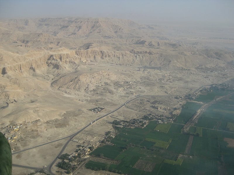
Thebes
Also known as: طيبة
City. Thebes, known to the ancient Egyptians as Waset, was an ancient Egyptian city located along the Nile about 800 kilometers south of the Mediterranean. Its ruins lie within the modern Egyptian city of Luxor. Thebes was the main city of the fourth Upper Egyptian nome and was the capital of Egypt for long periods during the Middle Kingdom and New Kingdom eras. It was close to Nubia and the Eastern Desert, with its valuable mineral resources and trade routes. It was a cult center and the most venerated city during many periods of ancient Egyptian history. The site of Thebes includes areas on both the eastern bank of the Nile, where the temples of Karnak and Luxor stand and where the city was situated; and the western bank, where a necropolis of large private and royal cemeteries and funerary complexes can be found. In 1979, the ruins of ancient Thebes were classified by UNESCO as a World Heritage Site.[14]
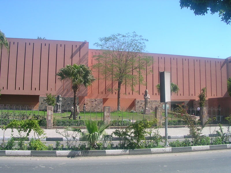
Luxor Museum
Also known as: متحف الأقصر
Museum of pharaonic art and sculpture. Luxor Museum is an archaeological museum in Luxor, Egypt. It stands on the corniche, overlooking the east bank of the River Nile.[15]
Address: Center Corniche Ave, Luxor
Mortuary Temple of Seti I
Historical place in Egypt. The Mortuary Temple of Seti I is the memorial temple of the New Kingdom Pharaoh Seti I. It is located in the Theban Necropolis in Upper Egypt, across the River Nile from the modern city of Luxor. The edifice is situated near the town of Qurna.[16]
Address: Past the road to the Valley of the Kings, towards the village of el-Tarif., Luxor
Dra' Abu el-Naga'
Also known as: ذراع أبو النجا
The necropolis of Draʻ Abu el-Naga' is located on the West Bank of the Nile at Thebes, Egypt, just by the entrance of the dry bay that leads up to Deir el-Bahari and north of the necropolis of el-Assasif. The necropolis is located near the Valley of the Kings.[17]
Karnak Open Air Museum
Museum. Karnak Open Air Museum is an archaeological museum in Luxor, Egypt. It is located in the northwestern corner of the Precinct of Amon-Re at the Karnak complex.
The Open Air Museum contains reconstructions of structures that have been dismantled and buried or hidden inside the massive pylons in the complex. As Karnak became more prominent, pharaohs sought to leave their mark on the temple complex with their own monuments. As successive rulers built their monuments, they dismantled the old ones and utilized the materials in their own designs.
Preventive archaeological excavations before the renovation of Amenhotep II's calcite shrine were observed in this area by the Centre Franco-Égyptien d'Étude des Temples de Karnak (CFEETK), including an urban unit with mudbricks walls of Saito-Persian time. Also discovered during CFEETK excavations were terracotta figures with female representation called "concubines;" such figures are commonly found in levels related to construction and may be votive objects which ensure the sustainability of construction.[18]
MMA 59
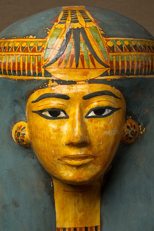
The Theban Tomb known as MMA 59 is located in Deir el-Bahari. It forms part of the Theban Necropolis, situated on the west bank of the Nile opposite Luxor. The tomb is the burial place of the Ancient Egyptian Henuttawy, who dates to the 21st Dynasty and was a Singer of Amun.
Henuttawy was apparently a regular citizen and not related to the royal family. She was buried in the tomb previously carved for a man named Minmose. The lid of the outer coffin was not pegged won according to Winlock. Inside the inner coffin the mummy was covered by a wooden board. Henuttawy is depicted with an elaborate collar and below that a carefully painted bead-net covering. A row of hieroglyphics on the front of the mummy board invoke the goddess Mut. The mummy did not fit the coffin and the feet were damaged when the mummy was forced inside.[19]
Mortuary Temple of Amenhotep III
Also known as: المعبد الجنائزي لأمنحتب الثالث
Historical landmark in Egypt. The Mortuary Temple of Amenhotep III, also known as Kom el-Hettân, was built by the main architect Amenhotep, son of Habu, for the Pharaoh Amenhotep III during the 18th Dynasty in the New Kingdom. The mortuary temple is located on the Western bank of the Nile river, across from the eastern bank city of Luxor. During its time, the Mortuary Temple of Amenhotep III was the largest funerary complex in Thebes that was built. Only parts of the mortuary temple's layout remain, as well as the Colossi of Memnon, which are two large stone statues placed at the entrance measuring 18 meters high. Because the mortuary temple was built relatively close to the river, the annual flooding caused the site to decay at a more rapid rate. New research indicates that a large majority of the destruction on the mortuary temple can be attributed to the effects of an earthquake. It was long speculated that the earthquake occurred around 27 BC; however, investigations into the mortuary temple and surrounding colossi have debunked this time frame and instead have demonstrated it occurred around 1200 BC. Additional earthquakes after the one in 1200 BC have not been ruled out. The Colossi of Memnon and Amenhotep III Temple Project have helped conserve the site as well as possible.[20]
Tomb of Tutankhamun
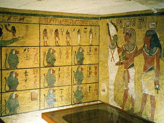
Also known as: مقبرة 62
Historical landmark in Egypt. The tomb of young pharaoh Tutankhamun is located in the Valley of the Kings, near Thebes, Egypt. It is renowned for the wealth of valuable antiquities that it contained. Howard Carter discovered it in 1922 underneath the remains of workmen's huts built during the Ramesside Period; this explains why it was largely spared the desecration and tomb clearances at the end of the 20th Dynasty, although it was robbed and resealed twice in the period after its completion.
The tomb was densely packed with items in great disarray due to its small size, the two robberies, and the apparently hurried nature of its completion. It took eight years to empty due to the state of the tomb and to Carter's meticulous recording technique. The contents were all transported to the Egyptian Museum in Cairo.
Tutankhamun's tomb had been entered at least twice not long after his mummy was buried. The outermost doors were unsealed leading into the shrines enclosing the king's nested coffins, though the inner two shrines remained intact and sealed.[21]
Address: Valley of the Kings, Luxor
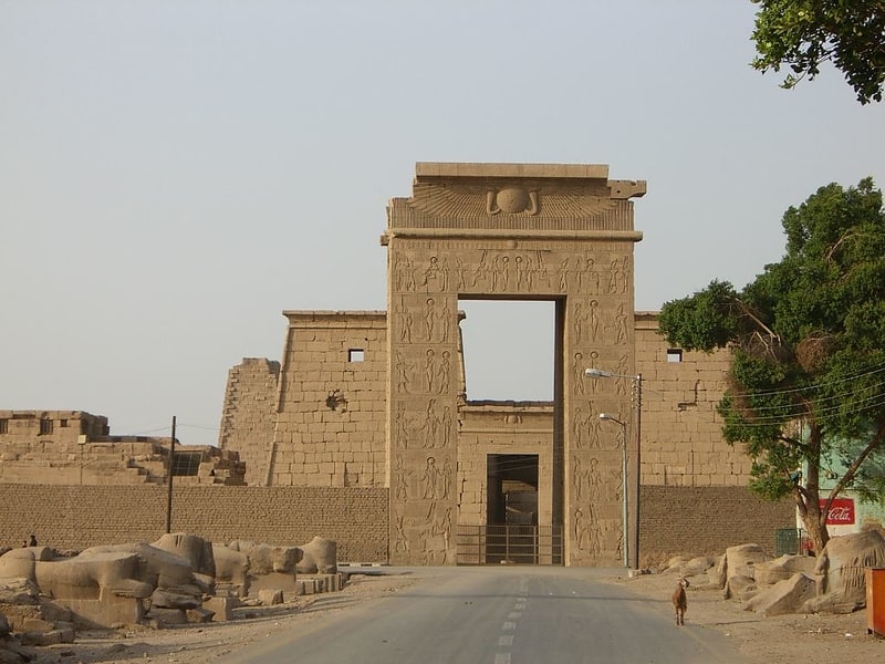
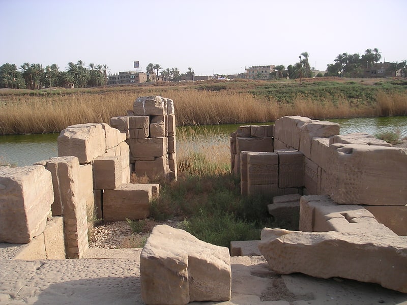
Precinct of Amun-Re
Also known as: فناء آمون-رع
Complex of Ancient Egyptian temples. The Precinct of Amun-Re, located near Luxor, Egypt, is one of the four main temple enclosures that make up the immense Karnak Temple Complex. The precinct is by far the largest of these and the only one that is open to the general public. The temple complex is dedicated to the principal god of the Theban Triad, Amun, in the form of Amun-Re.
The site occupies some 250,000 m² and contains many structures and monuments. The main temple itself, the Temple of Amun, covers some 61 acres. Some parts of the complex are closed or semi-closed, including large parts of the North-South Axis (the 8th, 9th, and 10th pylons), which are under active excavation or restoration. The whole southeast corner is semi-closed. The northwest corner is a museum that requires an additional ticket to visit.
Most of the southwest is an open-air assembling area containing millions of stone fragments, from small to huge, laid out in long rows, awaiting reassembly into their respective monuments. The area is not closed, as the temples of Khons and Opet both lie in this corner and are open to the public, though both are rarely visited, relative to the huge numbers of tourists who come to Karnak. Also found in that area is the Akhenaten Temple Project, in a sealed long building which contains surviving remnants of the dismantled Temple of Amenhotep IV (Akhenaten).[22]
Temple of Khonsu
Egyptian temple in Luxor, Egypt. The Temple of Khonsu is an ancient Egyptian temple. It is located within the large Precinct of Amun-Re at Karnak, in Luxor, Egypt. The edifice is an example of an almost complete New Kingdom temple, and was originally constructed by Ramesses III on the site of an earlier temple. The gateway of this temple is at the end of the avenue of sphinxes that ran to the Luxor Temple. In Ptolemaic times, Ptolemy III Euergetes constructed a great gateway and enclosure wall for the temple; only the gateway now remains. Inscriptions inside the forecourt of the temple were made in the time of Herihor.
The hypostyle hall was erected by Nectanebo I and is not of great size; inside were found two baboons that appear to have been carved in the time of Seti I. It probably belonged to the earlier building on the site.
Numerous blocks with unmatching and inverted decorations can be seen, showing the amount of reconstruction and reuse of material from the surrounding temple complexes, especially in Ptolemaic times.
From 2006 to 2018, the American Research Center in Egypt performed conservation work.[23]
Tombs of the Nobles
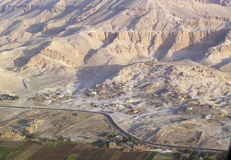
Also known as: قائمة المقابر في مدينة طيبة الجنائزية
The Theban Necropolis is located on the west bank of the Nile, opposite Luxor, in Egypt. As well as the more famous royal tombs located in the Valley of the Kings and the Valley of the Queens, there are numerous other tombs, more commonly referred to as Tombs of the Nobles, the burial places of some of the powerful courtiers and persons of the ancient city.
There are at least 415 cataloged tombs, designated TT for Theban Tomb. There are other tombs whose position has been lost, or for some other reason do not conform to this classification. See for instance the List of MMA Tombs. Theban tombs tended to have clay funerary cones placed over the entrance of the tomb chapels. During the New Kingdom they were inscribed with the title and name of the tomb owner, sometimes with short prayers. Of the 400 recorded sets of cones, only about 80 come from cataloged tombs.
The numbering system was first published Arthur Weigall's 1908 Report on the Tombs of Shêkh Abd’ el Gûrneh and el Assasîf (up to TT 45-100) and then more fulsomely in Alan Gardiner and Arthur Weigall's 1913 A Topographical Catalogue of the Private Tombs of Thebes (TT 1 - 252). This was followed by Reginald Engelbach's A Supplement to the Topographical Catalogue of the Private Tombs of Thebes (TT 253 to 334), extended further in Bernard Bruyère, N. de Garis Davies, Ahmed Fakhry, and later in Bertha Porter's Topographical Bibliography of Ancient Egyptian Hieroglyphic Texts, Reliefs, and Paintings. In their publication, Gardiner and Weigall acknowledged that the numbers do not follow any topographical order, and are due the order in which the tombs were discovered.[24]
Malkata
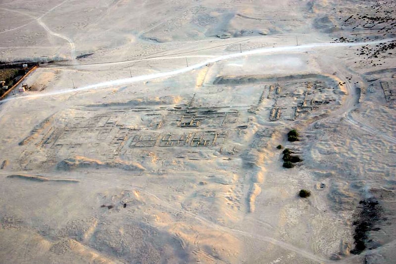
Malkata, is the site of an Ancient Egyptian palace complex built during the New Kingdom, by the 18th Dynasty pharaoh Amenhotep III. It is located on the West Bank of the Nile at Thebes, Upper Egypt, in the desert to the south of Medinet Habu. The site also included a temple dedicated to Amenhotep III's Great Royal Wife, Tiy, which honors Sobek, the crocodile deity.[25]
Great Hypostyle Hall
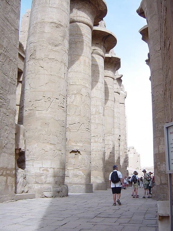
Historical landmark in Luxor, Egypt. The Great Hypostyle Hall is located within the Karnak temple complex, in the Precinct of Amon-Re. It is one of the most visited monuments of Ancient Egypt. The structure was built around the 19th Egyptian Dynasty. Its design was initially instituted by Hatshepsut, at the North-west chapel to Amun in the upper terrace of Deir el-Bahri. The name refers to hypostyle architectural pattern.[26]
Temple of Montu
Also known as: معبد مونتو
The Temple of Montu is an Egyptian temple dedicated to the worship of Montu. The site is located 5 kilometres northeast of Karnak, which is located within Luxor. Medamud was excavated by French archaeologist Fernand Bisson de la Roque from 1925 to the post-war, and revealed many buildings including a temple dedicated to Montu. This temple replaced an ancient sanctuary and consists of an open forum with a tower and enclosing two mounds that housed the chapels of worship. It is thought that the original sanctuary dates to the Old Kingdom. The ruins of the last structure date to the Ptolemy VIII period of the 2nd century BC, although decorations and additions continued to be added centuries later by the Romans. Because of Montu's strong association with raging bulls, the temple was a major center of worship for bulls, containing many statues of bulls for worship and reliefs. Most of these statues are now located in various museums around the world.[27]
Theban Necropolis

Also known as: مدينة طيبة الجنائزية
Historical landmark in Egypt. The Theban Necropolis is a necropolis on the west bank of the Nile, opposite Thebes in Upper Egypt. It was used for ritual burials for much of the Pharaonic period, especially during the New Kingdom.[28]
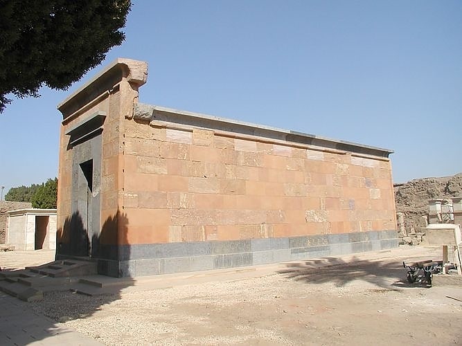
Deir el-Shelwit

Museum in Egypt. Deir el-Shelwit is an ancient Egyptian temple to Isis from the Greco-Roman period. It stands on the West bank of the Nile at Luxor, 1 km from Malkata and about 4 km south of Medinet Habu.
Today all that remains of the temple is its small main building and ruins of the propylon, along with its brick enclosure wall and the well. The temple precinct had an area of 78×58 metres; the temple itself is much smaller, with an area of 13×16 m. Its entrance faces south. The outer walls do not have much decoration but on the inside the reliefs are well preserved. The shrine is surrounded by a corridor from which side chapels and a wabet open; also the stairs lead to the roof from this corridor. On the southern side of the outer wall some stone blocks from earlier buildings had been reused, judging from the reliefs on them most of them appear to be from Medinet Habu.
The propylon is located 60 meters east from the temple, and is lavishly decorated on all sides.
The importance of the Isis temple of Deir el-Shelwit is because Graeco-Roman era religious buildings are rare in this area, and this is the only one not associated with the Theban Triad but with Isis.[29]
TT52
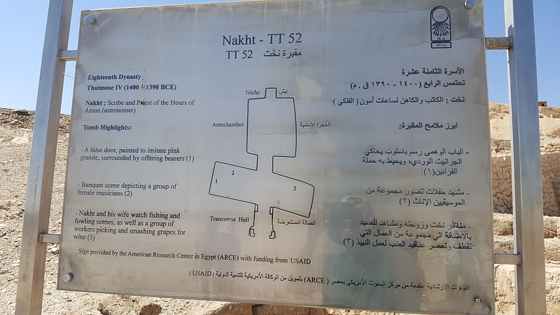
Also known as: مقبرة نخت
The Theban Tomb TT52 is located in Sheikh Abd el-Qurna, part of the Theban Necropolis, on the west bank of the Nile, opposite to Luxor. It is the burial place of Nakht, an ancient Egyptian official who held the position of a scribe and astronomer of Amun, probably during the reign of Thutmose IV during the Eighteenth Dynasty, the first dynasty of the New Kingdom.[30]
Kurna
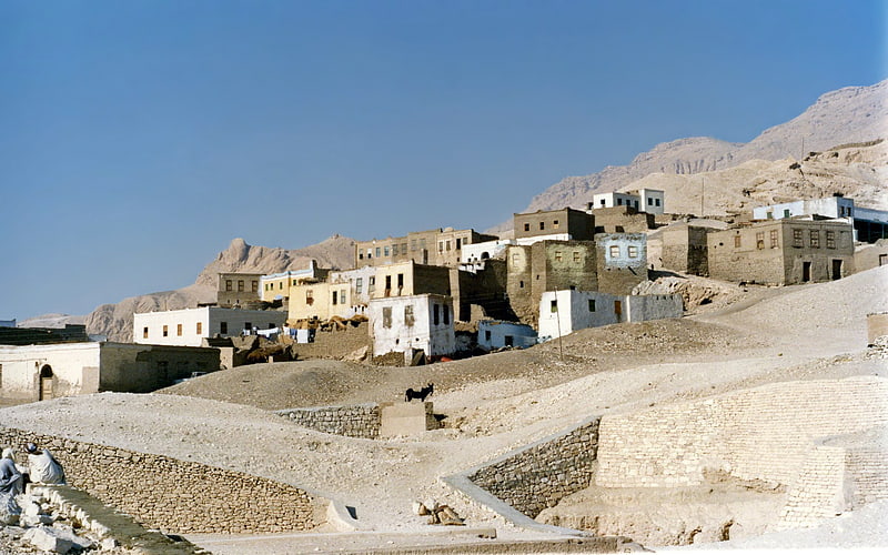
Kurna are various spelling for a group of three closely related villages located on the West Bank of the River Nile opposite the modern city of Luxor in Egypt near the Theban Hills.
New Qurna was designed and built in the late 1940s and early 1950s by Egyptian architect Hassan Fathy to house people living in Qurna which is now uninhabited. New Qurna was added to the 2010 World Monuments Watch List of Most Endangered Sites to bring attention to the site's importance to modern town planning and vernacular architecture due to the loss of much of the original form of the village since it was built.[31]
Temple of Mut
Historical landmark in Luxor, Egypt. The Precinct of Mut is an Ancient Egyptian temple compound located in the present city of Luxor, on the east bank of the Nile in South Karnak. The compound is one of the four key ancient temples that creates the Karnak Temple Complex. It is approximately 325 meters south of the precinct of the god Amun. The precinct itself encompasses approximately 90,000 square meters of the entire area. The Mut Precinct contains at least six temples: the Mut Temple, the Contra Temple, and Temples A, B, C, and D. Surrounding the Mut Temple proper, on three sides, is a sacred lake called the Isheru. To the south of the sacred lake is a vast amount of land currently being excavated by Dr. Betsy Bryan and her team from the Johns Hopkins University in Baltimore, Maryland.
Today, most of the compound is still destroyed, but it is currently being renovated. Surrounding the Mut Temple, the Contra Temple, and Temples A, B, C, and D, is an enclosure wall made of mud brick dating to the 30th Dynasty. The Mut Temple proper was made of mediocre sandstone and it is positioned north and south and is directly aligned with the Precinct of Amun. The Contra Temple, also made of mediocre sandstone, borders the Mut Temple at the south end of it, hence the name, and it possibly dates to the 30th Dynasty with certain alternations made during the Ptolemaic period. The purpose of the Contra Temple is still unclear, however, Fazzini states that it possibly served as a stopping point in a partially columned passage around the Mut Temple. In the northeast corner is the structure known as Temple A and according to Brooklyn Museum's exhibition on the Precinct of Mut, it was also called the "Temple of Millions of Years" and was dedicated to Ramsses II and the god Amun-Ra. Within the temple are two stelae, one referring to Ramsses II's work on Temple A and the other telling of his marriage to Hittite princess. The Brooklyn Museum states that Temple A did not become a part of the Mut Precinct until the 25th Dynasty under the reign of the Kushite king, Taharqa and during which time it became a birthing house, "mammisi", where Ancient Egyptians would celebrate the birth of the god Khonsu, the son of Amun-Ra and Mut.
To the east of the Mut Temple is a ruined building referred to as, Temple B, due to the amount of damage of Temple B, excavations are difficult to undergo. To the west of the sacred lake, Isheru, lies Temple C, a small temple built by Ramsses III, it still retains some military scenes on the outer walls, as well as two headless giants of the king himself before the entrance of the temple. Temple D, or Structure D, was a chapel made during the Ptolemaic period, the front room was dedicated to the goddess Mut and the back room shows evidence of being dedicated to a Ptolemaic ancestor cult. The Brooklyn Museum mentions one other important monument found on the site is the Taharqa gateway that is about 7 yards wide and is oriented south and west, it was built to enlarge the Mut Precinct and opened a new pathway to Temple A. The sacred lake, Isheru, was man made and held religious importance to the cult of the goddess Mut.[32]
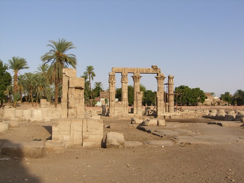
Chapelle Rouge
Also known as: مصلى أحمر
The Red Chapel of Hatshepsut or the Chapelle rouge was a religious shrine in Ancient Egypt.
The chapel was originally constructed as a barque shrine during the reign of Hatshepsut. She was the fifth pharaoh of the Eighteenth Dynasty from approximately 1479 to 1458 BC. It was demolished in antiquity and its parts reused in other projects. However, following its rediscovery in modern time, the Chapel was reconstructed in 1997 using its original materials.
The chapel's original location may have been in the central court of the temple of Amun at Karnak, near Thebes. Alternatively, it might have been situated between the two obelisks of Hatshepsut. It is also thought that Hatshepsut erected several smaller chapels and the Chambers of Hatshepsut behind the chapel.[33]
TT319
Historical landmark in Egypt. The Theban Tomb TT319 is located in Deir el-Bahari, part of the Theban Necropolis, on the west bank of the Nile, opposite to Luxor. The tomb belongs to the king's wife Neferu II, wife of the ancient Egyptian king Mentuhotep II. Neferu was the daughter of Queen Iah and Intef III.
The tomb of Neferu consisted of a chapel paved with slabs of limestone and carved into the rocks of Thebes. This chapel was decorated with scenes in sunken and raised relief. They show the queen with hairdressers, servants and religious scenes. However, today the scenes are only badly preserved. The stones of the chapel were already in ancient times used as quarry. These fragments are now in many museums around the world.
Behind the chapel there was a corridor leading to the burial chamber, which was also decorated. On the walls are painted friezes of burial goods and long funerary texts. In the burial chamber there also stood the sarcophagus of the queen. The chamber was found disturbed, when excavated.
The tomb is located just to the north of the mortuary temple of Mentuhotep II, and is currently under the temple of Hatshepsut. An entrance was left open in this later construction[34]
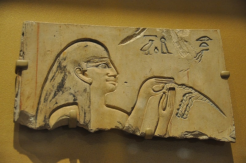
QV44
QV44 is one of several tombs located in the Valley of the Queens intended for the use of Ramesses III's sons. The painted reliefs decorating Khaemwaset E's tomb illustrate his ritual and symbolic journey in the Afterlife as he meets the main gods of that region as well as the genies who guard the gates of the kingdom of Osiris.
QV44 is one of several tombs constructed for the sons of Ramesses III. Others are QV55 (Amun-her-khepeshef), QV53 (Ramesses), QV43 (Seth-her-khopsef, and QV42 (Pareherwenemef). Abitz argues that the princes are identified with the Four sons of Horus and are all real sons of the King. The decorations in these tombs focus more on the King than on his sons.[35]