Discover 7 hidden attractions, cool sights, and unusual things to do in Lost River State Park (United States). Don't miss out on these must-see attractions: Reddish Knob, Elliott Knob, and Stokesville Observatory. Also, be sure to include Ramsey's Draft Wilderness in your itinerary.
Below, you can find the list of the most amazing places you should visit in Lost River State Park (West Virginia).
Table of Contents
Reddish Knob
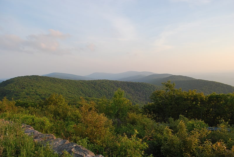
Summit in Virginia. Reddish Knob of Shenandoah Mountain is one of the highest points in Virginia, rising 4,397 feet. A narrow, paved road reaches the summit from Harrisonburg, Virginia.[1]
Address: FR 85, 22843 Mt Solon
Elliott Knob
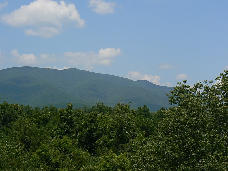
Mountain in Virginia. Elliott Knob is one of the highest mountains in the northern portions of the U.S. state of Virginia. At 4,463 ft, the peak is located on the ridge known as Great North Mountain. A subpeak known simply as "Hogback" is located 0.5 mi to the southwest. A small, naturally growing stand of red spruce trees is on the summit, and the upper slopes also have yellow birch and sugar maple, indicating that the altitude is just high enough to support tree species normally found hundreds of miles to the north. Otherwise oak and hickory trees are the most common types found on the mountain. The mountain is entirely within George Washington and Jefferson National Forests.
The area around the mountain is inhabited by a wide array of fauna including black bears, white-tailed deer and the elusive bobcat.
A primitive jeep trail ascends the mountain from the east but it is also closed to public vehicles. The jeep trail is used by the Forest Service to gain access to a (closed) fire lookout on the summit and is very steep, rising over 2,000 ft (610 m) in less than 2.5 mi (4.0 km). Just 4 mi (6.4 km) to the south of the mountain lies the town of Augusta Springs, Virginia, which is 2,800 ft (850 m) below the summit. The only access for the public is on foot and along with the jeep trail, several other trails can be used to ascend to the top, each averaging 5 mi (8.0 km) in length and climbing up to 2,400 ft (730 m) from the trailheads. A small grassy cove is on the top and there is a spring 0.4 mi (0.64 km) below the summit which flows year round as well as a small man-made pond not far from the spring.
Right beside the base of the fire tower there is a National Geodetic Survey triangulation station disk. The entire firetower structure is enclosed within a fence with barbed wire at the top. However, there is evidence of people gaining entry in the form of holes under the fence and loose sections where the fence can be pulled up high enough for a person to crawl under, since the ground is only covered with grass in that area of the summit.[2]
Stokesville Observatory
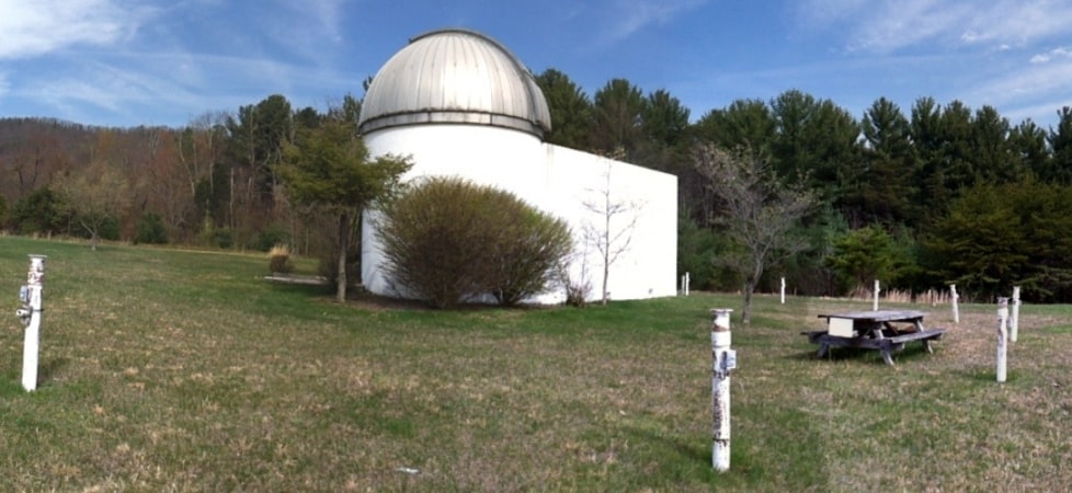
Astronomical observatory. Stokesville Observatory is an astronomical observatory owned by H. D. Riddleberger of Harrisonburg, VA. It is located in Stokesville Campground in Stokesville near Mount Solon, Virginia. The location is adjacent to the George Washington National Forest.
The observatory has one 16-foot-diameter (4.9 m) silo-type room housing a 14-inch Celestron Compustar telescope owned by James Madison University under a powered Ash observatory dome. An adjoining shaped room houses astronomy displays and materials used for instructional classes. The building is surrounded by a circle of 8 powered piers for mounting additional telescopes.[3]
Ramsey's Draft Wilderness
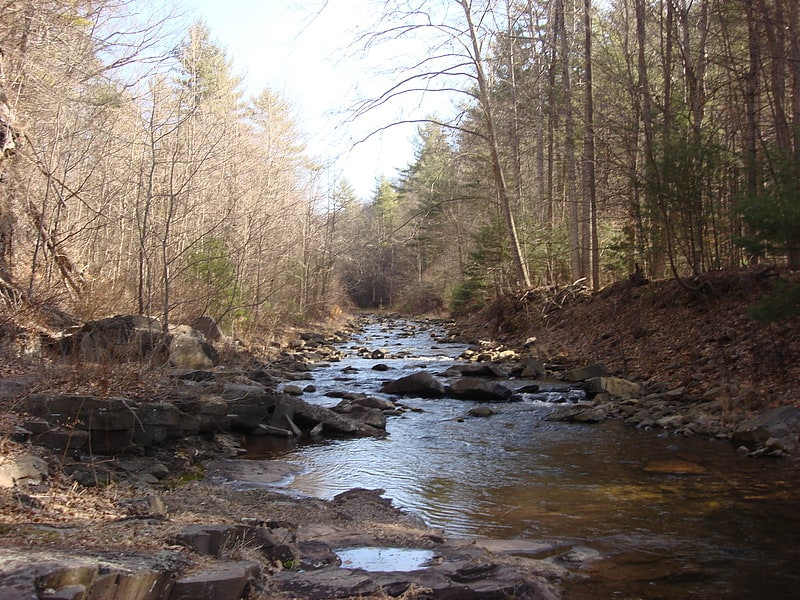
Hiking area in Augusta County, Virginia. Ramsey's Draft Wilderness is a designated wilderness area in the North River Ranger District of the George Washington and Jefferson National Forests of Virginia in the United States. The wilderness area was established in 1984 and comprises 6,518 acres. It is administered by the US Forest Service.[4]
Fort Edward Johnson
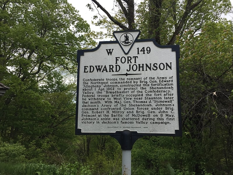
Historical place in Augusta County, Virginia. Fort Edward Johnson was a series of Confederate States of America military breastworks constructed in April 1862 by the four-thousand member brigade known as the "Army of the Northwest". The Army of the Northwest was a remnant of the Confederate Army of the Northwest which had been disbanded in February 1862. The Army of the Northwest was commanded by Colonel Edward "Alleghany" Johnson and had been ordered to secure a major roadway through the Appalachian Mountains known as the Staunton and Parkersburg Turnpike. Johnson ordered the construction of fortifications and breastworks at a high point along the turnpike on top of Shenandoah Mountain, which is in the U.S. state of Virginia, 26 miles west of Staunton.
Though Colonel Johnson had been victorious at the Battle of Camp Allegheny, where Johnson had been given the nickname "Allegheny" and was subsequently officially promoted to General, they suffered significant losses, and other Confederate setbacks in the Western Theater of operations influenced Robert E. Lee to order Johnson to take his forces east to better protect the strategic city of Staunton, as well as the Shenandoah Valley. Johnson moved his forces 40 mi (64 km) east along the Staunton and Parkersburg Turnpike and determined that the low gap along the crest of Shenandoah Mountain where the turnpike passed through would be the best location to build a defensive position to fight off any advancing Union Army forces. Starting on April 5, 1862, members of the Army of the Northwest spent the next two weeks constructing breastworks and cutting down parts of the forest along the western approaches to the fort. The fort was named after the commanding officer on April 6. General Johnson was ordered east to rendezvous with General Thomas "Stonewall" Jackson's army near Staunton on April 19, and the fort was abandoned to the advancing Union forces who occupied the position without a shot being fired. On May 7, 1862, Johnson's resupplied army again advanced west and retook the fort that had been abandoned by the Union forces. Johnson did not linger, by the next day his forces had left the fort and they marched westward to engage their opponents.
Fort Edward Johnson is adjacent to U.S. Route 250 at the mountain pass of the route on top of Shenandoah Mountain and is 26 miles (42 km) west of Staunton, Virginia (38°18′54″N 079°23′12″W). A.50-mile (0.80 km) walkway leading from a parking area through the confederate breastworks provides an interpretive opportunity. The parking area also provides access to the Shenandoah Mountain Trail and Ramsey's Draft Wilderness. The remains of the fort are within George Washington and Jefferson National Forests on the border of Augusta and Highland counties, Virginia.[5]
Old Probst Church
Church in Brandywine, West Virginia. Old Probst Church, also known as Propst Lutheran Church, is a historic Lutheran church located near Brandywine, Pendleton County, West Virginia. It was built about 1887, and is a rectangular frame building with clapboard siding on a cut stone foundation. The church was in use until 1920, then renovated starting in 1968 for use as a community center. The surrounding property includes the site of the first church, built about 1769. A second log church building was removed from the site in 1885, and used as a house, and later a barn.
It was listed on the National Register of Historic Places in 1986.[6]
The Wilderness
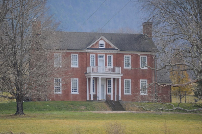
The Wilderness is a historic estate at 13954 Deerfield Road in rural Bath County, Virginia, United States. It consists of more than 1,000 acres of rolling fields and woodlands, most of which lie southeast of Deerfield Road in the northeastern part of the county. In 1771, the Crown conveyed the land to brothers Sampson Mathews and George Mathews. The main house, a seven-bay brick Georgian structure, was built about 1816 for Samuel Blackburn, a prominent local farmer and politician, who was son-in-law to George Mathews. The property also includes a brick carriage house from the same period, a rarity in such a remote rural setting.
The property was listed on the National Register of Historic Places in 2017.[7]