Discover 11 hidden attractions, cool sights, and unusual things to do in Shenandoah National Park (United States). Don't miss out on these must-see attractions: Old Rag Mountain, Hawksbill Mountain, and Rapidan Camp. Also, be sure to include Mary's Rock in your itinerary.
Below, you can find the list of the most amazing places you should visit in Shenandoah National Park (Virginia).
Table of Contents
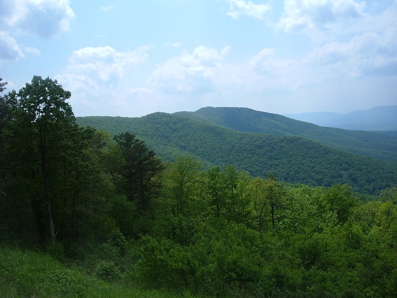
Old Rag Mountain
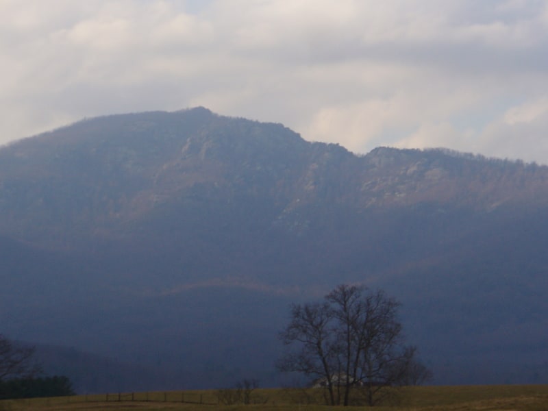
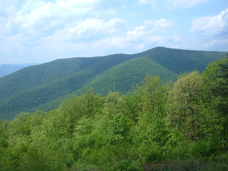
Mountain in Virginia. Old Rag Mountain is a 3,284 feet mountain near Sperryville in Madison County, Virginia. A part of the Blue Ridge Mountains, the peak is located within Shenandoah National Park and is the most popular hiking destination within the park.
In contrast to most mountains of the Blue Ridge, Old Rag has an exposed (rocky) summit.[1]
Address: Shenandoah National Park, Shenandoah National Park
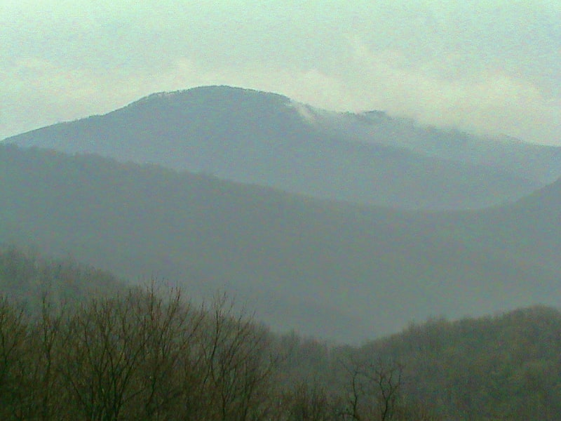
Hawksbill Mountain
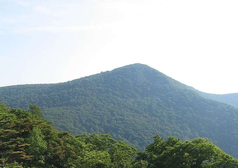
Mountain in Virginia. Hawksbill Mountain is a mountain with an elevation of 4,050 feet. Marking the border between Madison County and Page County in Virginia, the summit of Hawksbill Mountain is the highest point in Shenandoah National Park, as well as the highest point in both Madison and Page counties.
The north face of Hawksbill Peak is a 2,500-foot (760 m) drop into Timber Hollow, which is the largest elevation change in the park. The summit is one of the few places in Shenandoah National Park where one can find balsam fir, a tree more typical of northern New England and southeast Canada.
The National Park Service has constructed a stone observation platform at the summit. Byrd's Nest No. 2, one of a series of shelters built in the park by Senator Harry Byrd, is nearby. Hawksbill peak is also the site of a peregrine falcon restoration project. The summit of Hawksbill Mountain can be reached by a short hike from a trailhead located at the Upper Hawksbill parking area, just off of Skyline Drive in Shenandoah National Park. A number of other hiking trails lead to the summit of Hawksbill, while the Appalachian Trail goes around and about 500 ft (150 m) in elevation below the summit.[2]
Rapidan Camp
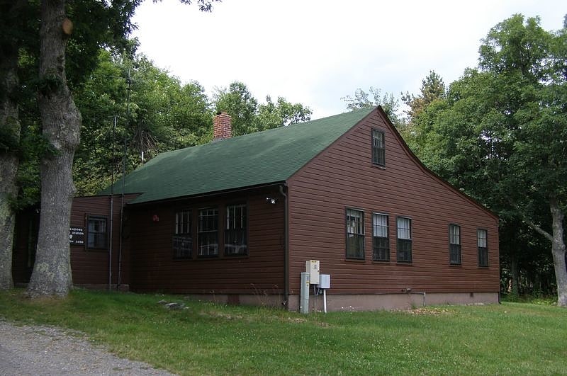
Historical place in Syria, Virginia. Rapidan Camp in Shenandoah National Park in Madison County, Virginia, was built by U.S. President Herbert Hoover and his wife Lou Henry Hoover, and served as their rustic retreat throughout Hoover's administration from 1929 to 1933. The first family's residential cabin was known as the "Brown House" in contrast to their more famous residence, the White House.
Rapidan Camp was precursor of the current presidential retreat, Camp David.[3]
Mary's Rock
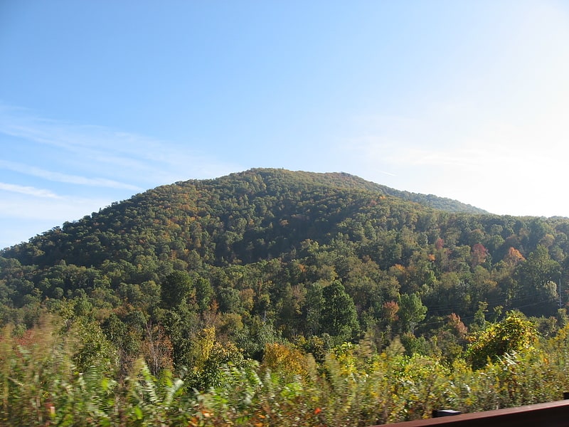
Mountain in Virginia. Mary's Rock, also known as Marys Rock, is a 3,514-foot tall mountain in Shenandoah National Park, Virginia, United States. The peak is just south of the Thornton Gap Entrance of the park, and north of the taller Pinnacle. Mary's Rock is the eighth highest peak in Shenandoah National Park.[4]
Big Meadows Site
The Big Meadows Site is an archaeological site on the National Register of Historic Places near Luray, Virginia. It is located in Shenandoah National Park.[5]
Corbin Cabin
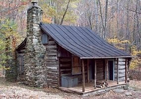
Building in Syria, Virginia. The Corbin Cabin is a log structure built by George T. Corbin in 1909 in the Nicholson Hollow area of what is now Shenandoah National Park. Corbin was forced to vacate the land on which the cabin sits in 1938, when the land was added to Shenandoah National Park. The cabin is unique in that it is one of a small number of buildings located in Nicholson Hollow spared during the creation of the park, and still remains standing despite recent forest fires.
The cabin is maintained by the Potomac Appalachian Trail Club and is accessible within the park by means of Nicholson Hollow Trail.
As the George T. Corbin Cabin, it was added to the National Register of Historic Places in 1989.[6]
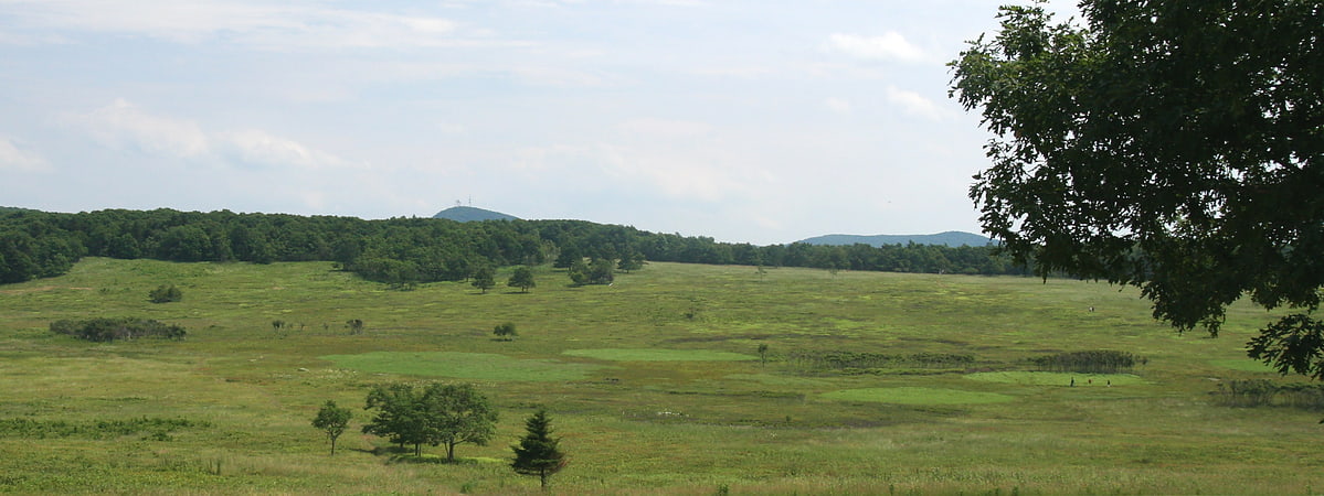
Big Meadows
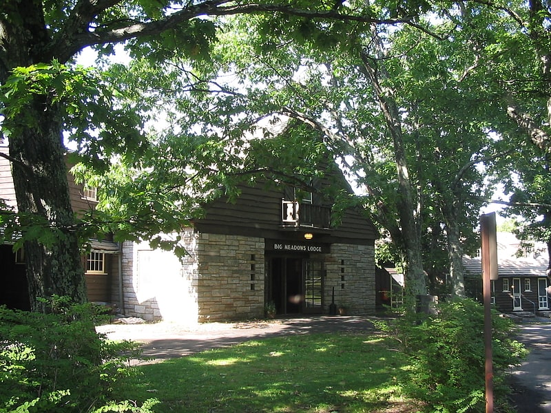
Big Meadows is a recreational area of the Shenandoah National Park in Madison County and Page County, in the US state of Virginia. The meadow is located on the Skyline Drive at Milepost 51 and contains the park's Harry F. Byrd Visitor Center, a lodge, camp store, and camping area. Several hiking trails can be accessed from Big Meadows, including the Mill Prong Trail which leads to Rapidan Camp on the Rapidan River, the fishing retreat of President Herbert Hoover from 1929–1933, which is now restored to its 1930s configuration.
President Roosevelt used Big Meadows in 1935 as the site for dedicating Shenandoah National Park and Skyline Drive. In 1962, during the Ash Wednesday Storm, Big Meadows recorded Virginia's greatest 24-hour snowfall with 33 inches, and the total storm snowfall was 42 inches at Big Meadows. In the Blizzard of 1996, Big Meadows recorded Virginia's greatest storm snowfall accumulation at 47 inches. Big Meadows Site was added to the National Register of Historic Places in 1985.[7]
Knob Mountain
Mountain in Virginia. Knob Mountain is a mountain in Page County, Virginia. It is part of the Blue Ridge Mountains. Its summit lies within Shenandoah National Park at an elevation of 2,671 ft.[8]
Neighbor Mountain
Mountain in Virginia. Neighbor Mountain is a mountain in Page and Rappahannock Counties, Virginia, near the city of Luray. It is part of the Blue Ridge Mountains. Its summit lies in Page County, within Shenandoah National Park.[9]
Pignut Mountain
Mountain in Virginia. Pignut Mountain is a mountain in Rappahannock County, Virginia. It is part of the Blue Ridge Mountains. Its summit lies within Shenandoah National Park.[10]
Gentle Site
The Gentle Site is an archaeological site in Shenandoah National Park, in Madison County, Virginia, United States.
Recorded during the early 1970s as part of a comprehensive survey of the national park, the Gentle Site is distinctive because of the lithic cores that it yielded, many of which were tiny articles of cryptocrystalline smaller than cores from any other site noted by the survey. Shallower than many of the other sites, just 10 centimetres (3.9 in) deep versus the 20 cm or deeper of other survey-recorded sites, it was nevertheless one of the survey's largest sites, yielding more than five thousand artifacts over a surface area of approximately 6,000 square metres (65,000 sq ft).
The site lies near the Big Meadows complex of sites at the headwaters of the Rose River, at the confluence of the juvenile river with a small tributary, Hogcamp Branch; its elevation is approximately 2,200 feet (670 m), but it sits just below the saddle of Fisher's Gap at an elevation of more than 3,000 feet (910 m). Its location along the river, near a set of pools and waterfalls, suggest that it might have been used for catching fish such as the brook trout. Previous surveys had recorded the site, due to the numerous artifacts exposed in the surrounding terrain. The 1970s survey recorded early and late dates from a collection of projectile points found beneath the footpath that traverses the site; most were of a form found in Woodland-period sites postdating AD 1300, while the site also yielded a smaller collection resembling points from Early Archaic sites predating 4500 BC. A small collection of pottery, approximately 25 sherds, also was discovered; most of the pieces were of a form known as the Albemarle series. Overall, the stone artifacts found at Gentle were predominately quartzite, with cryptocrystalline and quartz representing most of the remainder. Most of these artifacts were tiny lithic flakes, many so small that they presumably could have been created only by the resharpening of existing blades made elsewhere, although the site also yielded two scrapers, a chopper that had been used as a basic millstone, and a hand drill.
The period between occupations, with thousands of years separating the earlier Archaic occupiers and the later Woodland tribesmen, is typical of major Virginia sites discovered in the 1970s, at which time there was a significant gap in the knowledge of the ancient hillmen living within the future state's borders. The presence of cryptocrystalline found in the Shenandoah Valley but not in the immediate vicinity of the site, together with numerous projectile points, prompted the surveyors to interpret it as a base camp for hunting and gathering in the mountains; apparently by Valley villagers who would have visited it during the summer and autumn.
In 1985, Gentle was listed on the National Register of Historic Places because of its archaeological value.[11]