Discover 10 hidden attractions, cool sights, and unusual things to do in Getxo (Spain). Don't miss out on these must-see attractions: Vizcaya Bridge, Ereaga, and Arrigunaga. Also, be sure to include Areeta hondartza/Playa de las Arenas in your itinerary.
Below, you can find the list of the most amazing places you should visit in Getxo (Basque Country).
Table of Contents
Vizcaya Bridge
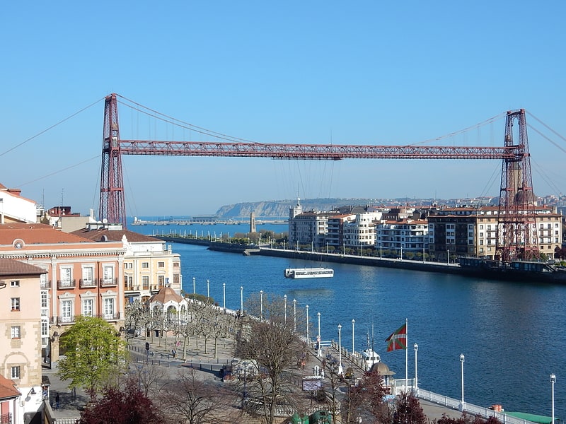
Also known as: Puente de Vizcaya
UNESCO-listed Industrial Revolution icon. The Vizcaya Bridge is a transporter bridge that links the towns of Portugalete and Las Arenas in the Biscay province of Spain, crossing the mouth of the Nervion River.
People in the area, and even the official website, commonly call it the Puente Colgante (literally "hanging bridge", used for suspension bridge in Spanish), although its structure is quite different from a suspension bridge.[1]
Address: Puente de Vizcaya Zubia, Getxo
Ereaga
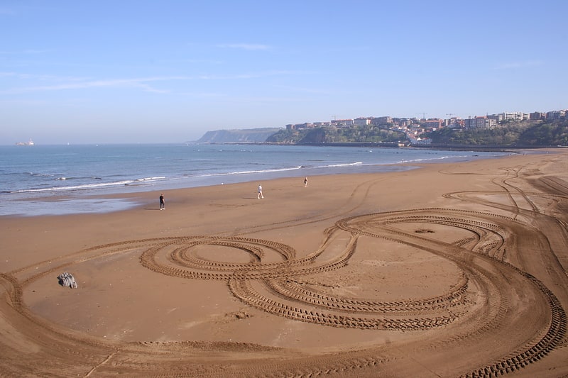
Ereaga beach, located in the Biscayan municipality of Guecho, Basque Country, is an urban beach with dark golden sand.
Arrigunaga
Beach
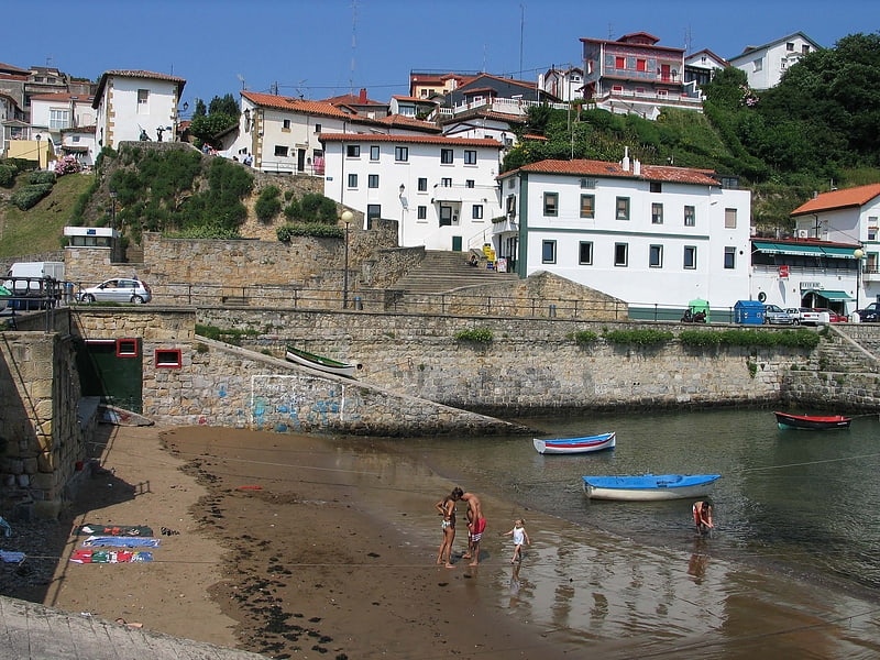
Areeta hondartza/Playa de las Arenas
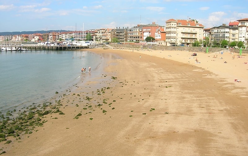
Las Arenas beach, located in the Las Arenas district of the Biscayan municipality of Guecho, Basque Country, is a sandy beach.
It is a 10 minute walk from Areeta metro station (Line 1).
Address: Muelle de las Arenas, 48930 Getxo
Las Arenas
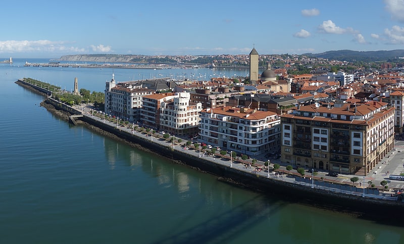
Neighbourhood in Spain. Areeta is a neighbourhood of Getxo. It is an affluent residential area that was built over the sands of a beach where the Gobela Creek died into a diffuse delta at the mouth of the Estuary of Bilbao in the early 20th century.
It is connected to Portugalete at the other side of the firth by the Vizcaya Bridge transporter bridge and offers a marina, a small beach that can unfortunately be polluted, and a monument to Evaristo Churruca, who planned and directed the channelization of the estuary.
The Vizcaya Bridge is now a tourist attraction with visitors able to go by lift to the top of the bridge (from where it was originally operated).[2]
Santurtzi
Also known as: Santurce
Town in Spain. Santurtzi is a port town in the province of Biscay, in the autonomous community of Basque Country, Spain. It is located in the Bilbao Abra bay, near the mouth of the Nervión river, on its left bank, 14 km downriver from Bilbao and forms part of the Greater Bilbao agglomeration. It has a population of 45,853 and a land area of 6.77 km².
The district of Santurce of the city of San Juan, Puerto Rico derives its name from Santurtzi.[3]
Geology of the Iberian Peninsula
Also known as: Geología de la península ibérica
The geology of the Iberian Peninsula consists of the study of the rock formations on the Iberian Peninsula, which includes Spain, Portugal, Andorra, and Gibraltar. The peninsula contains rocks from every geological period from the Ediacaran to the Quaternary, and many types of rock are represented. World-class mineral deposits are also found there.
The core of the Iberian Peninsula consists of a Hercynian cratonic block known as the Iberian Massif. On the northeast this is bounded by The Pyrenean fold belt, and on the southeast it is bounded by the Betic Fold mountain chain. These twofold chains are part of the Alpine belt. To the west, the peninsula is delimited by the continental boundary formed by the opening of the Atlantic Ocean. The Hercynian Fold belt is mostly buried by Mesozoic and Cenozoic cover rocks to the east, but nevertheless outcrops through the Iberian Chain and the Catalan Coastal Ranges.[4]
Uribe-Kostako korridorea
Bridge
Address: Sabino Arana 58, Getxo
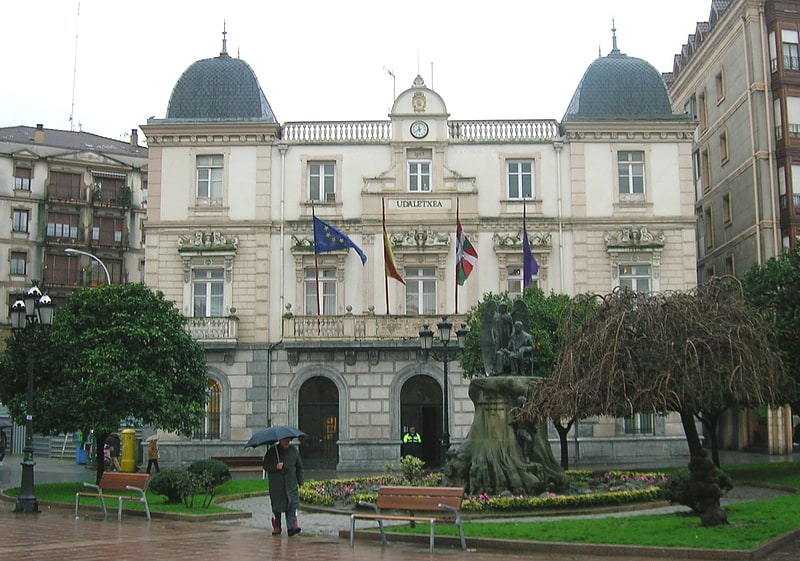
Algorta
Algorta is a locality within the municipality of Getxo, in the province of Biscay, Basque Country, Spain. In 1996, the population of Algorta was 35,600.
The Metro Plaza situated in Telletxe street is considered to be the center of town and commerce. The two most historically important plazas in town are St. Nicholas Plaza and St. Ignacius Plaza.[5]
Neguri
Neighbourhood in Spain. Neguri is an affluent district of Getxo, in Biscay, Basque Country. It is traditionally regarded as the residence of the prosperous Basque industrial bourgeoisie. Its name, coined in the 19th century, means Winter Town in Basque language.
The neighbourhood is serviced by two Bilbao Metro line 1 stations, Neguri and Aiboa.[6]