Discover 11 hidden attractions, cool sights, and unusual things to do in Angeles National Forest (United States). Don't miss out on these must-see attractions: Mount Baldy Zen Center, Echo Mountain, and Pyramid Lake. Also, be sure to include Mount Lukens in your itinerary.
Below, you can find the list of the most amazing places you should visit in Angeles National Forest (California).
Table of Contents
Mount Baldy Zen Center
Monastery in San Bernardino County, California. Mount Baldy Zen Center is a Rinzai Zen monastery of the Nyorai-nyokyo sect, located in the San Gabriel Mountains of the Angeles National Forest region on 4.5 acres and founded in 1971 by Kyozan Joshu Sasaki. The monastery — once a Boy Scout camp — became famous when musician Leonard Cohen joined the community in 1994. The monastery served as residence for Sasaki, and is the training center for monastics in his lineage. Other centers in Sasaki's network, including Rinzai-ji, offer the opportunity to practice Zen to laypeople in the lineage. Sasaki died in 2014 at the age of 107.[1]
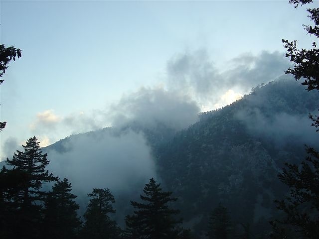
Echo Mountain
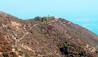
Mountain in California. Echo Mountain is a mountain promontory of the San Gabriel Mountains, in the Angeles National Forest above Altadena, in Los Angeles County, California.[2]
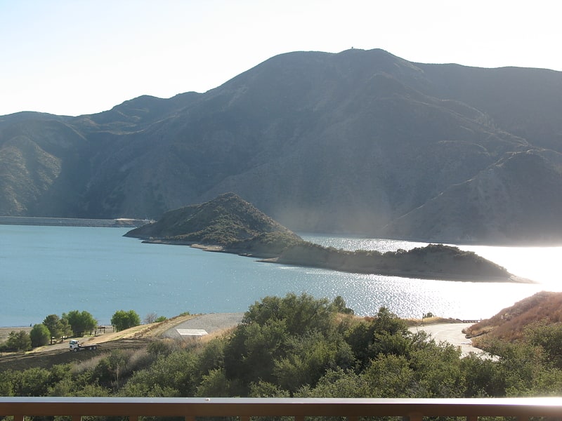
Pyramid Lake
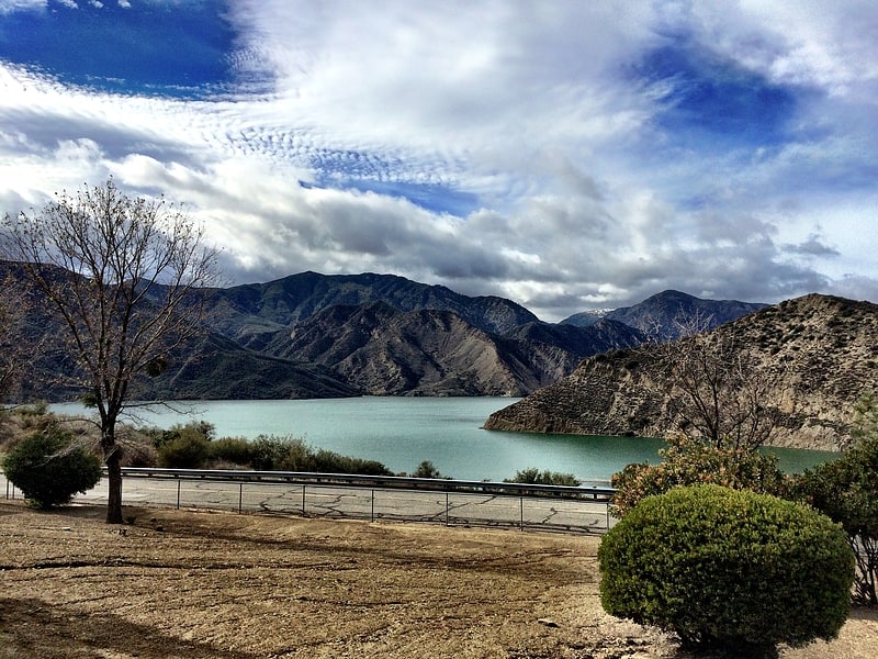
Reservoir in California. Pyramid Lake is a reservoir formed by Pyramid Dam on Piru Creek in the eastern San Emigdio Mountains, near Castaic, Southern California. It is a part of the West Branch California Aqueduct, which is a part of the California State Water Project. Its water is fed by the system after being pumped up from the San Joaquin Valley and through the Tehachapi Mountains.[3]
Mount Lukens
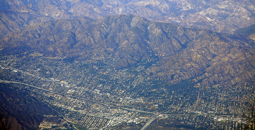
Mountain in California. Mount Lukens is a mountain peak of the San Gabriel Mountains, in Los Angeles County, Southern California.[4]
San Gabriel Peak
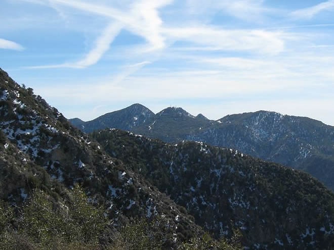
Summit in California. San Gabriel Peak is a summit in the San Gabriel Mountains in the U.S. state of California. It was named by the United States Geological Survey in 1894 and is located in the Angeles National Forest. This peak was first named The Commodore for Commodore Perry Switzer.[5]
Mount Lowe
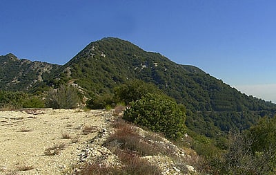
Mountain in California. Mount Lowe is a mountain on the southern fold of the San Gabriel Mountains. Originally named Oak Mountain, it was renamed for Professor Thaddeus S.C. Lowe, who is credited for being the first person to set foot on and plant the American flag at its peak, and who built the Mount Lowe Railway to its foot in 1896. The record of the naming was made official by Andrew McNally, the famous Chicago map printer and summertime resident of Altadena, who promised to print "Mount Lowe" on all his maps. Mt. Lowe was established as an alternate route for the Mount Lowe Railway when attempts to procure rights of way to the more prominent Mount Wilson had failed.
A number of trails stem from it due to the Mount Lowe Tavern which was built at Crystal Springs below the summit and operated from 1895 to 1936. One of the historic trails was the "Mount Lowe Eight" which was a mule ride attraction of the hotel that made a figure eight shaped route starting at the Tavern, ascending the summit of Mt. Lowe, returning to the Tavern, and crisscrossing to a trail that headed down Castle Canyon. From there the trail passed down to the Echo Mountain resort and ascended on the return to the Tavern.
Mount Lowe was the upper terminus of the Alpine Division of the Mount Lowe Railway originally incorporated by Professor Lowe as the Pasadena and Mt. Wilson Railroad Co.
Mt. Lowe is approachable from Echo Mountain or Chaney trail via a fire road which was graded over the old railway right-of-way.[6]
Chantry Flat
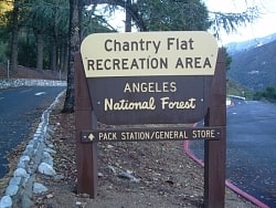
Chantry Flat is a designated "Recreation Area" within the Angeles National Forest, about three miles into Big Santa Anita Canyon, and is closely associated with the towns of Arcadia and Sierra Madre, CA. The flat itself houses a large public picnic area, and is the starting point for several historic trails of the San Gabriel Mountains, including the 28.5-mile Gabrielino Trail. The US Forest Service estimates the road to Chantry as the third busiest entry into the Angeles, next to CA State Highways 2 and 39.[7]
Mount Wilson Observatory
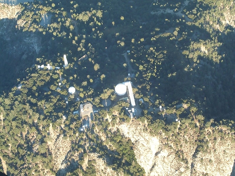
Seminal multi-telescope observatory. The Mount Wilson Observatory is an astronomical observatory in Los Angeles County, California, United States. The MWO is located on Mount Wilson, a 1,740-meter peak in the San Gabriel Mountains near Pasadena, northeast of Los Angeles.
The observatory contains two historically important telescopes: the 100-inch Hooker telescope, which was the largest aperture telescope in the world from its completion in 1917 to 1949, and the 60-inch telescope which was the largest operational telescope in the world when it was completed in 1908. It also contains the Snow solar telescope completed in 1905, the 60 foot solar tower completed in 1908, the 150 foot solar tower completed in 1912, and the CHARA array, built by Georgia State University, which became fully operational in 2004 and was the largest optical interferometer in the world at its completion.
Due to the inversion layer that traps warm air and smog over Los Angeles, Mount Wilson has steadier air than any other location in North America, making it ideal for astronomy and in particular for interferometry. The increasing light pollution due to the growth of greater Los Angeles has limited the ability of the observatory to engage in deep space astronomy, but it remains a productive center, with the CHARA Array continuing important stellar research.
The initial efforts to mount a telescope to Mount Wilson occurred in the 1880s by one of the founders of University of Southern California, Edward Falles Spence, but he died without finishing the funding effort. The observatory was conceived and founded by George Ellery Hale, who had previously built the 1 meter telescope at the Yerkes Observatory, then the world's largest telescope. The Mount Wilson Solar Observatory was first funded by the Carnegie Institution of Washington in 1904, leasing the land from the owners of the Mount Wilson Hotel in 1904. Among the conditions of the lease was that it allow public access.[8]
Address: Mount Wilson Rd, Angeles National Forest
Vista del Lago Visitors Center
Vista del Lago Visitors Center is a visitor center above Pyramid Lake in Los Angeles County, between the communities of Gorman and Castaic, near Interstate 5. It is owned by the California Department of Water Resources.[9]
Address: 35800 Vista Del Lago Road, 93243 Gorman
Big Tujunga Dam
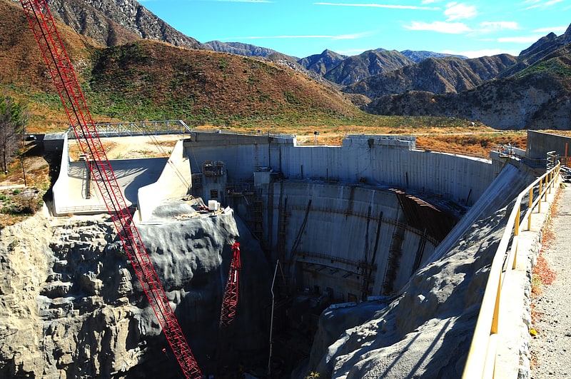
Big Tujunga Dam is a 244-foot-high concrete arch dam in Los Angeles County, California, spanning Big Tujunga Canyon northeast of Sunland, in the foothills of the San Gabriel Mountains. Completed in 1931, it provides flood control and groundwater recharge for the San Fernando Valley.
Its reservoir is called Big Tujunga Reservoir, and collects runoff from a watershed of 82 square miles (210 km2). Although it is located inside the Angeles National Forest, public access to the lake is forbidden. The water is usually kept at a low level, in order to protect against winter floods. The name of the dam is derived from a Tongva village name.[10]
Mount Disappointment
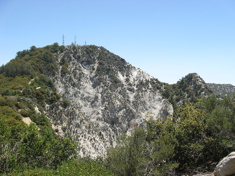
Mountain in California. Mount Disappointment is a mountain in the San Gabriel Mountains in Los Angeles County, California with a summit elevation of 5,963+ feet. It was named "Disappointment" in 1894 when USGS surveyors in the Wheeler Survey sighted it from the Santa Susana Mountains, believing it to be the highest point in the immediate area, decided to use it as their next triangulation point. When they reached the summit, however, they discovered that San Gabriel Peak half a mile to the east was 167 feet higher and it was a disappointment so they moved there instead.
A Nike missile site was located there in 1955 and the summit was flattened to accommodate it. The missile site was abandoned in 1965. The mountain top is now an important telecommunications site for both commercial and government organizations.[11]