Discover 11 hidden attractions, cool sights, and unusual things to do in San Gabriel Mountains National Monument (United States). Don't miss out on these must-see attractions: Devil's Punchbowl, Mount Wilson, and Mount Baden-Powell. Also, be sure to include Mount Harwood in your itinerary.
Below, you can find the list of the most amazing places you should visit in San Gabriel Mountains National Monument (California).
Table of Contents
Devil's Punchbowl
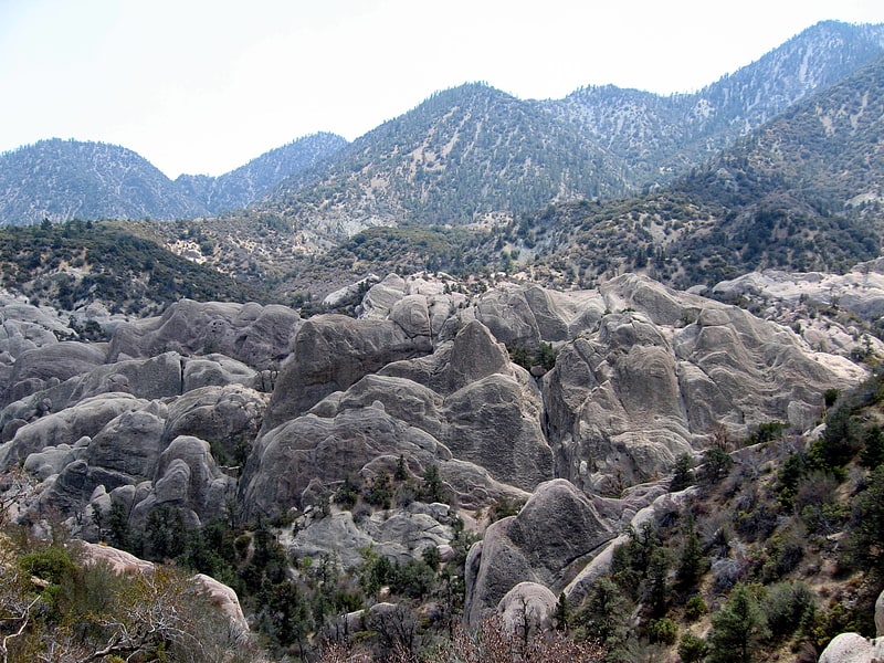
Devil's Punchbowl is a tilted sandstone formation on the northern slopes of the San Gabriel Mountains, in Los Angeles County, California, at an elevation of 4,750 feet.[1]
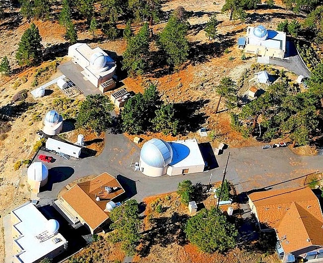
Mount Wilson
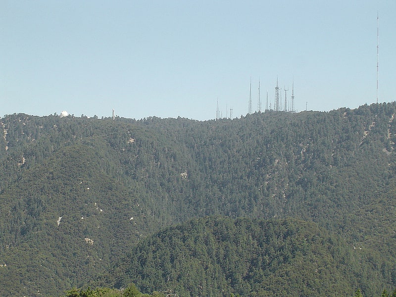
Mount Wilson is a peak in the San Gabriel Mountains, located within the San Gabriel Mountains National Monument and Angeles National Forest in Los Angeles County, California. With only minor topographical prominence the peak is not naturally noticeable from a distance, although it is easily identifiable due to the large number of antennas near its summit. It is a subsidiary peak of nearby San Gabriel Peak.
It is the location of the Mount Wilson Observatory, which is an important astronomical facility in Southern California with historic 60-inch (1,524 mm) and 100-inch (2,540 mm) telescopes, and 60-foot (18.3 m) and 150-foot (45.7 m) solar towers. The newer CHARA Array, run by Georgia State University, is also sited there and does important interferometric stellar research.
The summit is at 5,710 feet (1,740 m). While not the tallest peak in its vicinity, it is high enough in elevation that snow can sometimes interrupt astronomical activities on the mountain. All of the mountains south of the summit are far shorter leading to unobstructed views across the Los Angeles Basin, Orange County, the Inland Empire, and out to Ventura County, San Diego County and the Pacific Ocean. On most days, Santa Catalina Island, some 65 mi (105 km) south, is visible. On clear days, other Channel Islands visible include San Clemente Island at 95 mi (153 km), Santa Barbara Island at 76 mi (122 km), San Nicolas Island at 107 mi (172 km), Santa Cruz Island at 98 mi (158 km) and San Miguel Island at 133 mi (214 km). At an elevation of 5,710 ft (1,740 m), the horizon on the ocean extends 92 mi (148 km).
Mount Wilson is also heavily utilized for relay broadcasting of radio and television for the Greater Los Angeles Area.[2]
Address: Mount Wilson Road, San Gabriel Mountains National Monument
Mount Baden-Powell
Peak in California. Mount Baden-Powell is a peak in the San Gabriel Mountains of California named for the founder of the World Scouting Movement, Robert Baden-Powell, 1st Baron Baden-Powell. It was officially recognized by the USGS at a dedication ceremony in 1931. It was originally known as East Twin or North Baldy.[3]
Mount Harwood
Summit in California. Mount Harwood is the first summit east of Mount San Antonio. The United States Geological Survey recognized the name to honor California educator and conservationist Aurelia Squire Harwood in 1965. Prior to this, the peak now known as Thunder Mountain was also referred to as Mount Harwood. Mount Harwood is located on the East side of the San Gabriel Mountains in the Angeles National Forest near the San Bernardino-Los Angeles county border. In this area of the San Gabriel Mountains the peaks are the highest. Because of the elevation Mount Harwood turns out to be ranked the 4th highest peak in the San Gabriel mountains after Dawson Peak, Mount San Antonio or "Old Baldy" being the highest at 10,064 feet. The only way for hikers or tourists to access Mount Harwood is to take Mt. Baldy Road off I-210. A National Forest Adventure pass/ National Park access pass must be displayed on a vehicle to access Mount Harwood.[4]
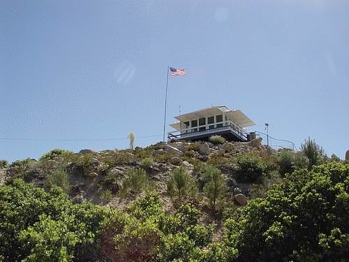
Table Mountain Observatory
Astronomical observatory. Table Mountain Observatory is an astronomical observation facility operated by NASA's Jet Propulsion Laboratory. It is located in Big Pines, California, in Angeles National Forest near Wrightwood, north-northeast of Los Angeles, California, in the United States.
TMO is part of JPL's Table Mountain Facility (TMF). The larger site hosts a number of non-astronomical projects. The site was first used by the Smithsonian Institution in 1924, which conducted atmospheric, solar, and astronomical observations for many years. JPL took over the lease in 1962. The observatory conducts high-precision astrometric observations to support NASA and international spacecraft mission navigation, confirmation and recovery of near-Earth objects such as comets and asteroids that may potentially impact the Earth, and technology development.
The main-belt asteroid 84882 Table Mountain was named in honor of the observatory.[5]
Vetter Mountain
Mountain in California. Vetter Mountain is located in the San Gabriel Mountains and within the Angeles National Forest, Los Angeles County, California. Elevation 5,911 feet feet.
Named by USFS surveyor Don McLain (c. 1933) for Victor P. Vetter (nd.), a dedicated forest ranger and fire dispatcher. Vetter won the USFS Bissell Medal for outstanding work in forest conservation (1930).
The Silver Moccasin Trail crosses the mountain on its eastern slopes.[6]
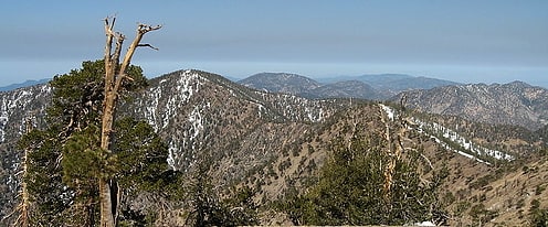
Mount Islip
Peak in California. Mount Islip is a 8,250-foot peak in the Angeles National Forest in California, United States. On a clear day the sharp, high peak provides impressive views of the Mojave Desert, the Los Angeles Basin, Santa Catalina Island, and San Clemente Island.
A trailhead for climbing Mount Islip is located at Islip Saddle, along the Angeles Crest Highway, approximately 53 miles (85 km) northeast of downtown Los Angeles. Another trailhead is at the Crystal Lake Recreation Area, north of Azusa.[7]
Strawberry Peak
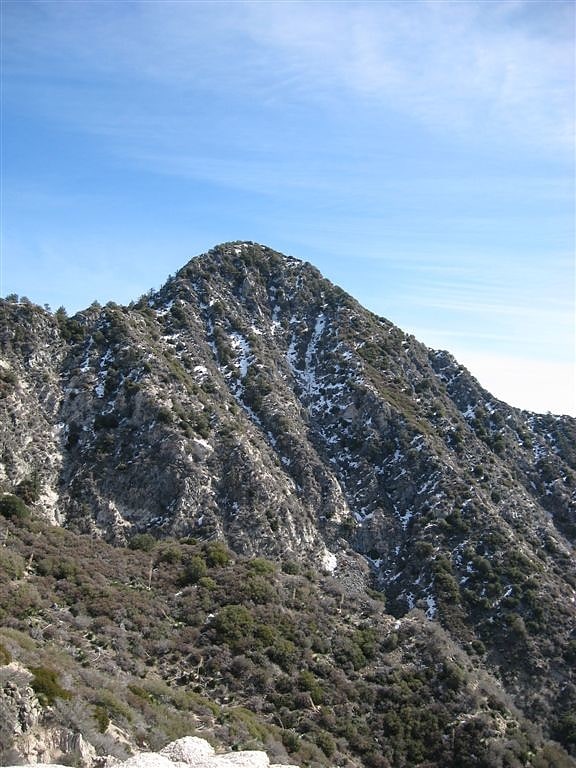
Peak in California. Strawberry Peak is a prominent peak in the San Gabriel Mountains of Los Angeles County, California. It is located about 10 miles north of Pasadena, and 28 miles from Los Angeles, along the Angeles Crest Highway. Strawberry Peak is the tallest of the front range peaks, being three feet higher than nearby San Gabriel Peak. Both can be widely seen from greater Los Angeles and the San Gabriel Valley, and are popular with hikers. Other prominent nearby peaks include Josephine Peak and Mount Wilson. Strawberry Peak was named by mountaineers over a century ago, who felt the peak resembled an enormous upside-down strawberry.
The peak can be ascended on the east side as a 7.2-mile round-trip trail walk using Strawberry Peak Trail, which begins near the Red Box Picnic Area, or from the west as a class 3 scramble from a trailhead near the entrance to the Switzer Picnic Site.
The area was closed to the public as a result of the Station Fire. However, the last closure order expired on May 24, 2014. Remaining fire damage in the area is minimal.
It is especially common to see Rattlesnakes in the area.[8]
Crystal Lake Recreation Area
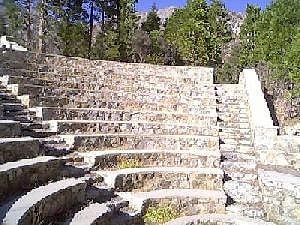
Lake in California. The Crystal Lake Recreation Area is located in the San Gabriel Mountains of Southern California, administered by the San Gabriel Mountains National Monument of the United States Forest Service. The Recreation Area consists of a small lake, an open-air amphitheater, a large public campground containing approximately 120 camp sites grouped into "loops," and a group campground called Deer Flats which consists of approximately 25 camp sites. The Recreation Area contains a United States Forest Service visitor center and a cafe which is open to the public from dawn to dusk except for Tuesdays when the cafe is closed. Within the Recreation Area are 16 hiking and nature trails which are well-maintained by volunteers who work under the direction of the Forest Service. The Recreation Area is located approximately 26 miles north on Hwy. 39 heading out of Azusa, California at the headwaters of the north fork of the San Gabriel River at an elevation approximately 5,539 feet above sea level. Crystal Lake is the only naturally occurring lake in the San Gabriel Mountains.[9]
Mount Burnham
Peak in California. Mount Burnham is one of the highest peaks in the San Gabriel Mountains. It is in the Sheep Mountain Wilderness. It is named for Frederick Russell Burnham the famous American military scout who taught Scoutcraft to Robert Baden-Powell and became one of the inspirations for the founding of the Boy Scouts. Mount Burnham was officially recognized by the USGS at a dedication ceremony in 1951. It was original known as "North Baldy Mountain". The peak is within Los Angeles County, about 16 miles north of Glendora, and 66 miles from Los Angeles. In 1956, Mount Burnham was added to the list of Signature Summits by the Hundred Peaks Section of the Sierra Club.
The 53-mile (85 km) long Silver Moccasin Trail, a Boy Scout trail, connects the mountain with Mount Baden-Powell, Throop Peak and Mount Hawkins. The Pacific Crest Trail follows the same route in this area.
Most of the forest on Mount Burnham and along the trail consist of plants native to the region. The peak is covered by limber pine (Pinus flexilis), lodgepole (P. contorta), sugar pine (P. lambertiana), and Jeffrey pine (P. jeffreyi). Other plants of note include Holodiscus microphyllus, Monardella cinerea, Eriogonum umbellatum, Oreonana vestita, Cycladenia humilis, and the rare, local yellow-flowered Peirson's lupine (Lupinus peirsonii). The area is occasionally visited by bighorn sheep and a rare mountain lion.
Rocks in the area range in age from Pre-Cambrian (probable) igneous and metamorphics to Pre-Cretaceous metamorphics. The Vincent Thrust Fault, the oldest major fault in the range, dating to the Mesozoic, passes through the area.[10]
Cogswell Dam
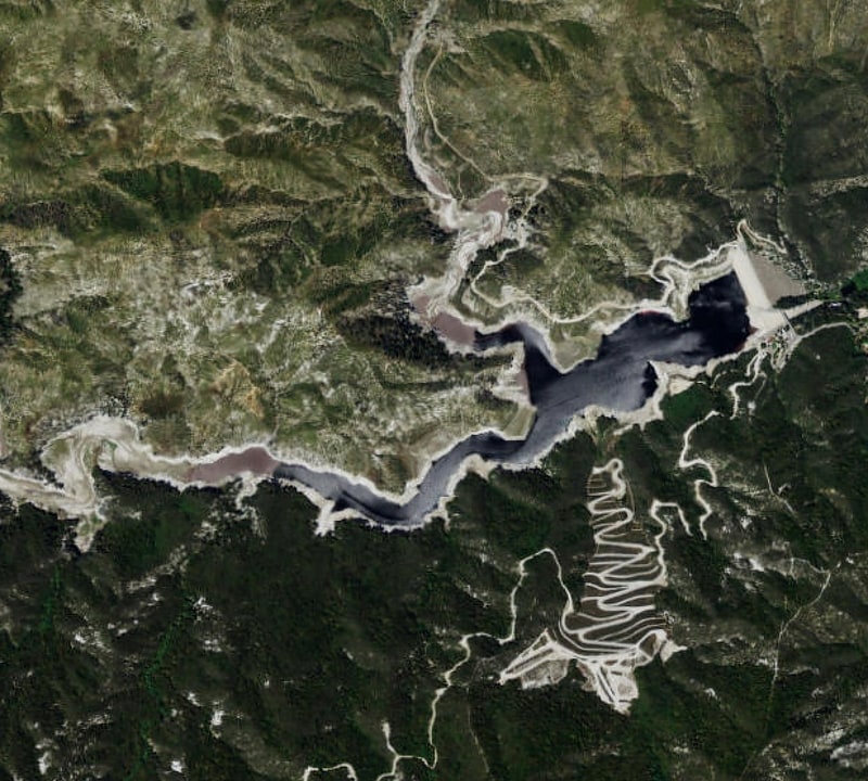
Cogswell Dam is a rockfill dam on the West Fork of the San Gabriel River in Los Angeles County, California. It is located in the San Gabriel Mountains, northeast of Mount Wilson, and within the Angeles National Forest.
It forms Cogswell Reservoir, which has a capacity of 8,969 acre-feet.
The dam serves mainly for flood control in conjunction with San Gabriel Dam and Morris Dam downstream. San Gabriel Dam lies 13 miles downstream.[11]