Discover 11 hidden attractions, cool sights, and unusual things to do in Western Pomerania Lagoon Area National Park (Germany). Don't miss out on these must-see attractions: Kirr, Zingster Strom, and Gänsewerder. Also, be sure to include Bodstedter Bodden in your itinerary.
Below, you can find the list of the most amazing places you should visit in Western Pomerania Lagoon Area National Park (Mecklenburg-West Pomerania).
Table of Contents
Kirr
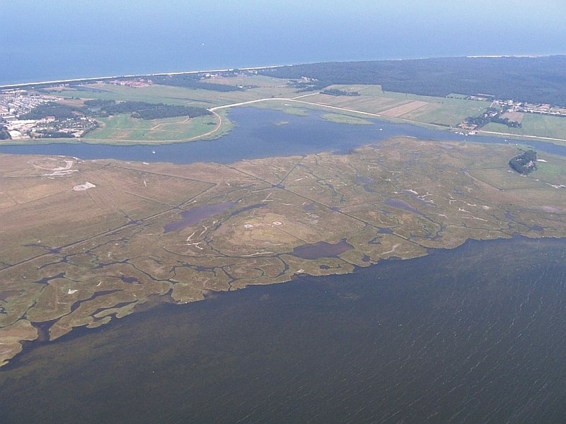
Island in Zingst, Germany. Kirr is an island in the Darss-Zingst Bodden Chain south of the Zingst Peninsula on the German Baltic Sea coast. It is separated from the peninsula by the Zingster Strom. The island is a nature reserve within the Western Pomerania Lagoon Area National Park. It was formerly and is sometimes still called Großer Kirr or Große Kirr. This is to distinguish it from the northwestern part of the island, which was still a separate albeit much smaller island in the Zingster Strom in the second half of the 20th century, that used to be called Kleiner Kirr or Kleine Kirr.[1]
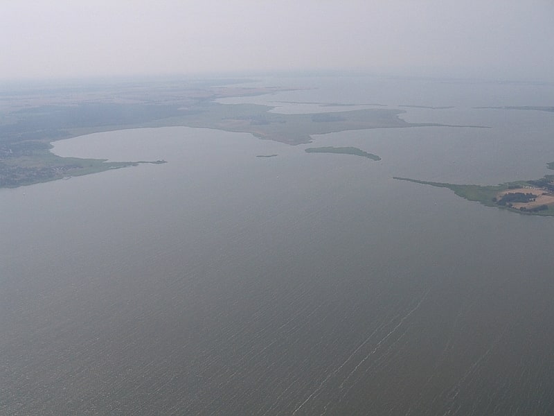
Zingster Strom
The Zingster Strom is a distinctive, river-like arm of the Barther Bodden lagoon, south of the Zingst peninsula on Germany's Baltic Sea coast. It lies between the island of Kirr and the Zingst and runs from east to west in a semi-circular arc, both ends being open to the south. It is less than one hundred metres wide in places and about three kilometres long. Unlike its rather shallow neighbouring waterbodies it is over six metres deep in places. At its northernmost point lies the village of Zingst with its harbour and a water fowl roosting area. Two smaller islands, Brunstwerder and Gänsebrink, are located in the Strom. The Strom used to have direct access to the Baltic via the Alte Stramminke, a former inlet.
54°25′38″N 12°42′55″E[2]
Gänsewerder
Island in Germany. The tiny uninhabited German island of Gänsewerder lies in the Schaproder Bodden, a lagoon on the Baltic Sea coast, 400 metres east of the Gellen Peninsula on Hiddensee. It is part of the Western Pomerania Lagoon Area National Park and is out of bounds to the public. The surface of Gänsewerder is flat, sandy and damp, and only reeds and small plants grow there. There is a small pond in the northeast of the island. The island has an oval shape and slopes along its longer axis from southwest to northeast. It measures about 328 by 155 metres and has an area of some 4 hectares. When the national park was established, Gänsewerder was a coastal nesting area for birds, but is no longer. The island of Fährinsel off Hiddensee, which is inhabited by several species of bird, is managed as one area along with the Gellen and Gänserwerder.[3]
Bodstedter Bodden
The Bodstedter Bodden is a lagoon, of the type known as a bodden, that is part of the Darss-Zingst Bodden Chain and the Western Pomerania Lagoon Area National Park in northeastern Germany. It lies south of the peninsula of Fischland-Darß-Zingst on the coast of Mecklenburg-Vorpommern. The heavily indented, reed fringed shoreline forms a picturesque landscape with the result that the villages near the shore are popular tourist destinations.
The western boundary of the bodden with the Koppelstrom forms the so-called Borner Bülten (Bulte i.e. small swampy, islands of reed). The Koppelstrom is the transition to another lagoon, the Saaler Bodden. To the east the Bodstedter Bodden is separated from the Barther Bodden and Zingster Strom by the Meiningen Narrows. To the south of the bodden is the lake of Redensee and the village of Fuhlendorf. To the northeast, the Prerower Strom, a former estuary, empties into the bodden. The deepest point of the bodden (10 metres in depth) lies just in front of the Meininger Bülten, the small reed islands by Meiningen. The rest of the bodden is only rarely deeper than 3 metres.[4]
Darss-Zingst Bodden Chain
Also known as: Darß-Zingster Boddenkette
Waterbody. The Darss-Zingst Bodden Chain is a waterbody on the Baltic Sea coast northeast of Rostock in Germany. It consists of a string of several lagoons or bodden arranged in an east-west direction that are separated from the open sea by the Fischland-Darß-Zingst peninsula. The surface area of these lagoons is 197 km² and the average water depth is only about two metres.
The individual lagoons of the Darss-Zingst Bodden Chain are the:
- Saaler Bodden
- Bodstedter Bodden
- Barther Bodden and
- Grabow
(listed from west to east; not mentioned here are several smaller stretches of interlinking water).
The salt content of the water rises from west to east, because only at the eastern end of the bodden chain is there a link to the Baltic Sea via the Gellenstrom stream and the small opening between Großer Werder and Kleiner Werder, where the waters are able to mix. There used to be other links to the sea like the Prerowstrom stream to the north (dammed after 1872) and the Permin and Loop by Fischland to the west (dammed in the 14th century). The rivers Recknitz and Barthe discharge into the Darss-Zingst Bodden Chain and, in all, it has catchment area of 1,578 km². On the south shore of the bodden chain lie the towns of Ribnitz-Damgarten and Barth.
The northern part of the Darss-Zingst Bodden Chain belongs to the Western Pomerania Lagoon Area National Park.[5]
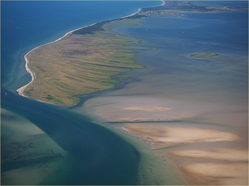
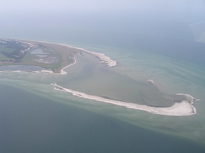
Gellenstrom
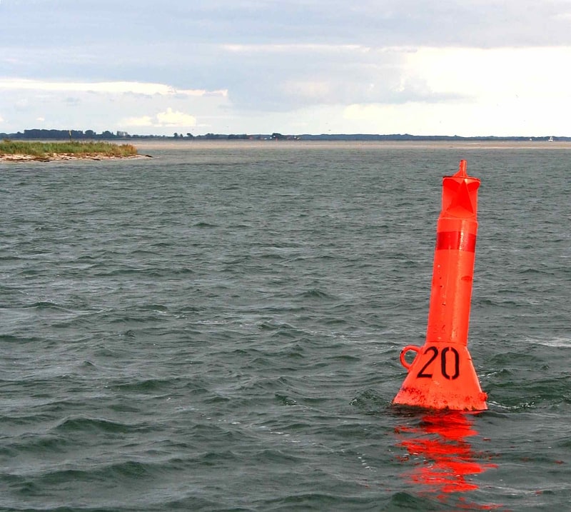
The Gellenstrom is a shipping channel in the Baltic Sea and forms the northwestern access to the ports of Stralsund and Strelasund. It is located in the Baltic Sea west of the peninsula of Gellen which gives it its name and which forms part of the island of Hiddensee. In addition, it is the main route from the Darss-Zingst Bodden Chain to the Baltic.
The Gellenstrom has a guaranteed depth of 3.70 metres and is controlled by the Gellen light which marks its northern approach. The maximum speed limit is 10 kn. To the south is the port of Barhöft, which is also accessible from the Gellenstrom via the Barhöft Creek (Barhöft -Rinne). To the west is the island of Bock, which was formed from sand dredged from the channel.[6]
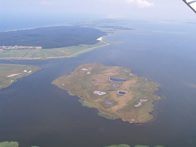
Heuwiese
Island in Ummanz, Germany. Heuwiese is an uninhabited German Baltic Sea island that lies about two kilometres south of Ummanz and west of Germany's largest island, Rügen.
It has a maximum extend of 900 metres (from northwest to southeast) and is about 40 hectares in area. The island, which is over 1 metre high is a bird reserve that lies within the West Pomerania Lagoon Area National Park.
The island is a typical salt grassland (Salzgrasland) of the West Pomeranian lagoon coastline and was formed from zones of sediment accretion that have gradually become exposed, known as windwatts. The resulting areas lie just a few centimetres about sea level (NN) and are flooded from time to time at irregular intervals.
The island received its name from its earlier use as cattle pasture. Since the mid-19th century it has also been known as a bird colony and was officially placed under protection in 1939 as a breeding site for coastal birds. In 2007 about 15 different species bred on Heuwiese (including four species of gull and several species of duck).
One feature are the breeding cormorants on the island that, despite being tree nesters, have built high nests on the ground here.[7]
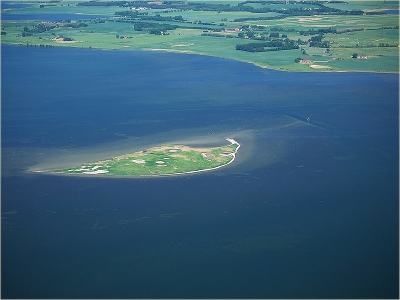
Barther Oie
Island in Zingst, Germany. The uninhabited island of Barther Oie belongs to the German federal state of Mecklenburg-Vorpommern and lies in the lagoon of Barther Bodden, between the town of Barth and the Baltic seaside resort of Zingst.
The Baltic Sea island has an area of about 850 × 800 metres and rises, like its sister island of Kirr, only one metre above sea level. Today the island is a nature reserve in the West Pomeranian Lagoon Area National Park.[8]
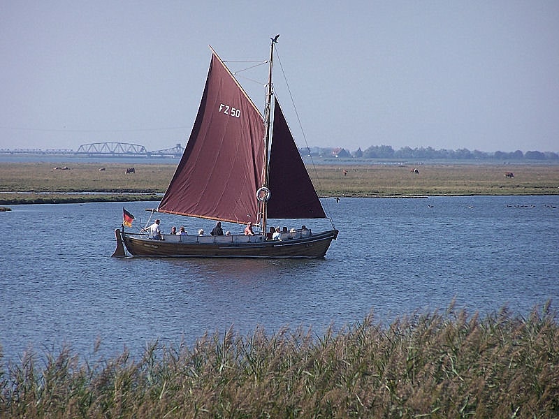
Zingsthof
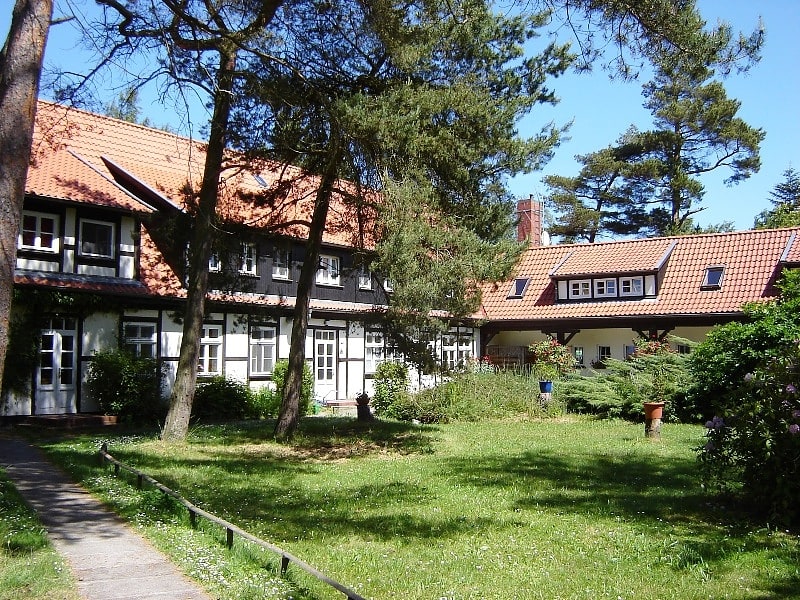
The Zingsthof is a church recreation and retreat home in the seaside resort of Zingst on the peninsula of the same name on the Baltic Sea.
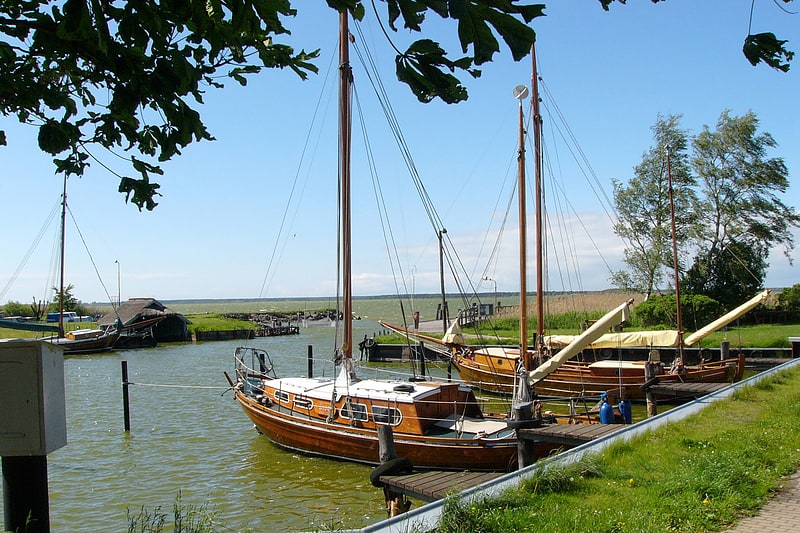
Darß
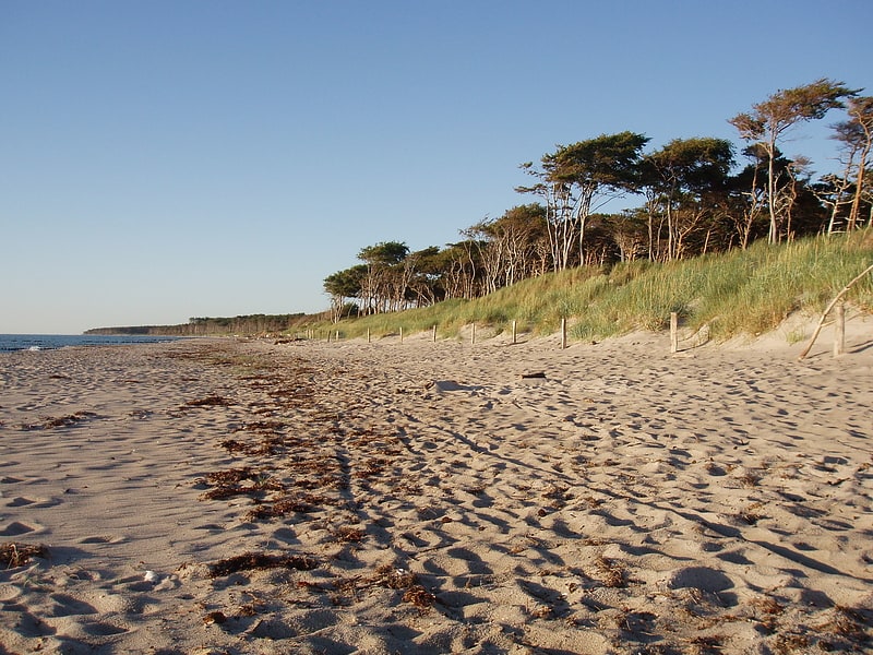
Peninsula in Germany. The Darß or Darss is the middle part of the peninsula of Fischland-Darß-Zingst on the southern shore of the Baltic Sea in the German state of Mecklenburg-Western Pomerania. The peninsula's name is of Slavic origin. There is a large forest in the Darß. In recent times, the name "Darß" has also been used to refer to the entire peninsula.
The Darß is famous for being a resting place for tens of thousands of migrating cranes and geese. Tourism has long been a source of income and has increased since German reunification, but the Darß is still far from being a crowded tourist place.[9]
Fukareksee
Lake Fukarek is a brackish lake now connected to the Baltic Sea at Darßer Ort on the territory of the municipality of Born a. Darß in the district of Vorpommern-Rügen, Mecklenburg-Western Pomerania.
The elongated lake, tapering to the south, has an approximate area of 9.3 hectares with a length of 780 meters and a maximum width of 200 meters. It is located in the protection zone I (core zone) of the National Park Vorpommersche Boddenlandschaft and is not directly accessible. About 150 meters away from its western shore is a viewing platform, which is located on a circular hiking trail.
In "Nationalpark-Info" No. 6 in September 1996 it was proposed to name the hitherto nameless lake after Franz Fukarek in his honor. Fukarek contributed significant natural history findings to the Darß.