Discover 11 hidden attractions, cool sights, and unusual things to do in Umpqua National Forest (United States). Don't miss out on these must-see attractions: Watson Falls, Toketee Falls, and Mount Bailey. Also, be sure to include Diamond Lake in your itinerary.
Below, you can find the list of the most amazing places you should visit in Umpqua National Forest (Oregon).
Table of Contents
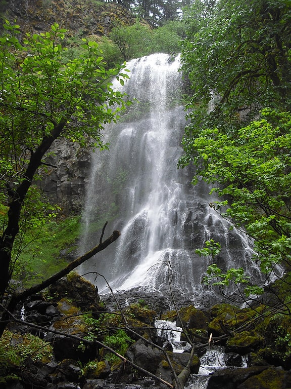
Watson Falls
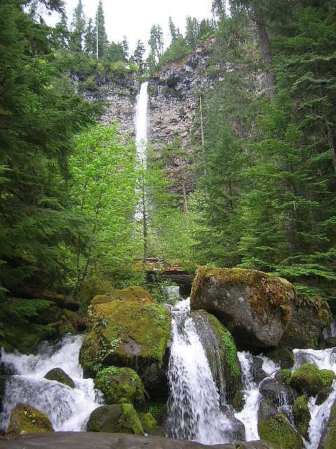
Waterfall in Oregon. Watson Falls is a 272-foot waterfall on Watson Creek, a tributary of the Clearwater River, in Douglas County in the U.S. state of Oregon. It is located at an elevation of 3,353 feet.[1]
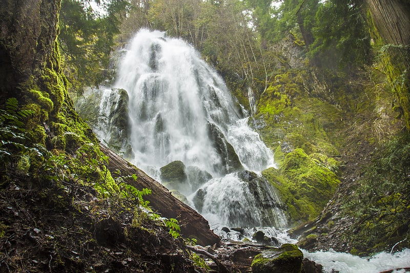
Toketee Falls
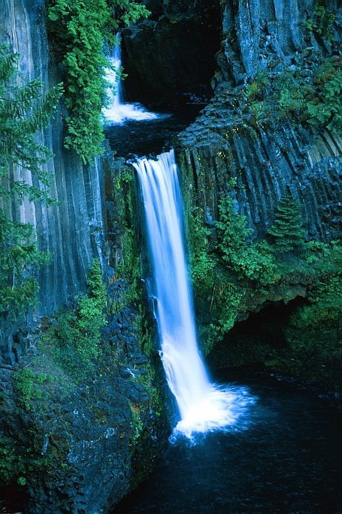
Waterfall in Oregon. Toketee Falls is a waterfall in Douglas County, Oregon, United States, on the North Umpqua River at its confluence with the Clearwater River. It is located approximately 58 miles east of Roseburg near Oregon Route 138.
Toketee (pronounced TOKE-uh-tee), is a Chinook Jargon word meaning "pretty" or "graceful". The falls was officially named by a United States Board on Geographic Names decision in 1916, over alternate names Ireland Falls and Toketie Falls.[2]
Address: Highway 138, Umpqua National Forest
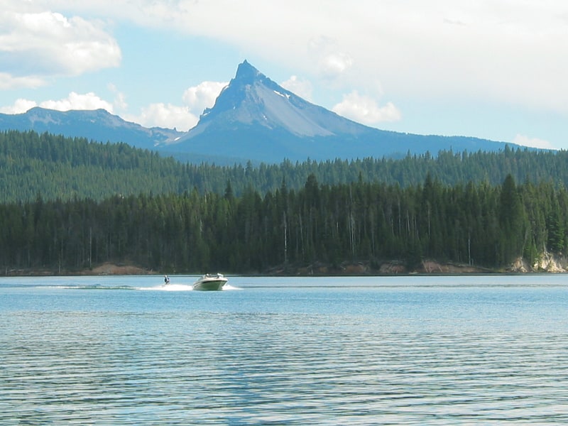
Mount Bailey
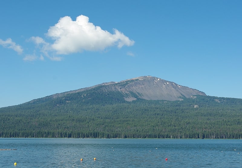
Shield volcano in Oregon. Mount Bailey is a relatively young tephra cone and shield volcano in the Cascade Range, located on the opposite side of Diamond Lake from Mount Thielsen in southern Oregon, United States. Bailey consists of a 2,000-foot -high main cone on top of an old basaltic andesite shield volcano. With a volume of 8 to 9 km3, Mount Bailey is slightly smaller than neighboring Diamond Peak. Mount Bailey is a popular destination for recreational activities. Well known in the Pacific Northwest region as a haven for skiing in the winter months, the mountain's transportation, instead of a conventional chairlift, is provided by snowcats—treaded, tractor-like vehicles that can ascend Bailey's steep, snow-covered slopes and carry skiers to the higher reaches of the mountain. In the summer months, a 5-mile hiking trail gives foot access to Bailey's summit. Mount Bailey is one of Oregon's Matterhorns.
Native Americans are credited with the first ascents of Bailey. Spiritual leaders held feasts and prayer vigils on the summit.[3]
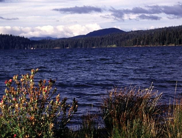
Diamond Lake
Lake in Oregon. Diamond Lake is a natural body of water in the southern part of the U.S. state of Oregon. It lies near the junction of Oregon Route 138 and Oregon Route 230 in the Umpqua National Forest in Douglas County. It is located between Mount Bailey to the west and Mount Thielsen to the east; it is just north of Crater Lake National Park.
The outlet of the lake is at its north end. From there, water flows via Diamond Lake Creek into the North Umpqua River and ultimately to the Pacific Ocean.
Diamond Lake was named for John Diamond, for whom Diamond Peak is also named. He saw the lake in 1852 while on the summit of Diamond Peak. Diamond was a pioneer settler of Coburg, Oregon, and part of a party opening a road between the Middle Fork Willamette River and Idaho as an immigration route.
An adjacent post office named Diamond Lake, Oregon, was established in 1925 and ran until 1956, when it was changed to a summer-only office.
Diamond Lake is the host for the 2019, 2020, and 2021 Major League Fishing Championship. Diamond Lake is also the host for the Tour de Diamond, a cycling event that happens every summer. It is the biggest event in the North American Cycling Organization calendar.[4]
Address: Hwy 138 & Diamond Lake Loop, 97731 Diamond Lake
Cinnamon Butte
Volcano in Oregon. Cinnamon Butte is a group of cinder cone volcanoes and lava domes in the Cascade Range of Oregon. All of the vents are older than approximately 6,845 years as they are all covered in ash from the eruption of Mount Mazama.[5]
Lemolo Lake
Lake in Oregon. Lemolo Lake is a small lake and reservoir in Douglas County, Oregon in the Umpqua National Forest 30 miles north of Crater Lake National Park, on the North Umpqua River. It is part of the Diamond Lake Ranger district and is administered by the United States Forest Service.[6]
Tiller Ranger Station
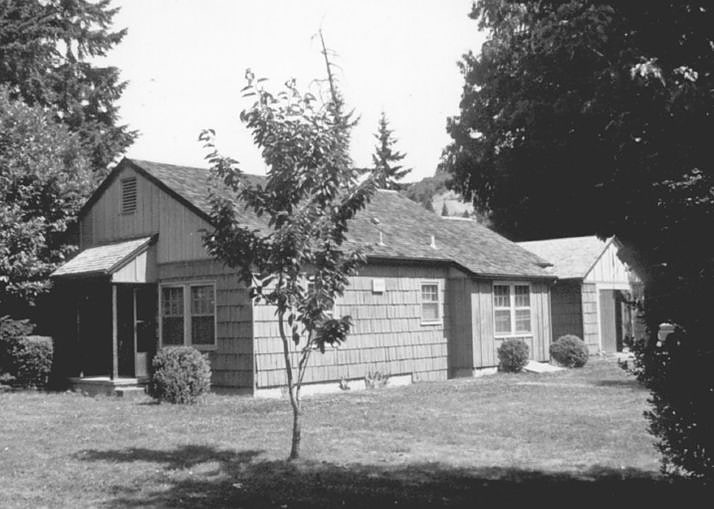
Government office in Tiller, Oregon. The Tiller Ranger Station is a United States Forest Service compound consisting of twenty-seven buildings in Oregon’s Umpqua National Forest. Over the years, it has been the administrative headquarters for five ranger districts. It is located in the small unincorporated community of Tiller, Oregon, United States. The historic structures were built in the rustic style by the Civilian Conservation Corps between 1935 and 1942. Today, the ranger station is the headquarters for the Tiller Ranger District, and is listed on the National Register of Historic Places.[7]
Bohemia Mountain
Mountain in Oregon. Bohemia Mountain is a mountain in the Cascade Range of the U.S. state of Oregon, within the Umpqua National Forest. Its elevation is 5,994 feet. A trail traverses the mountain and leads to the summit. There is a location east of the trail's end where on a clear day one can see Mount Shasta, Mount Hood, and other peaks of the Cascades. Camping is available in the area. An abundance of wildflowers and plants bloom on the mountain from late June to mid-August, which attracts butterflies to the area.[8]
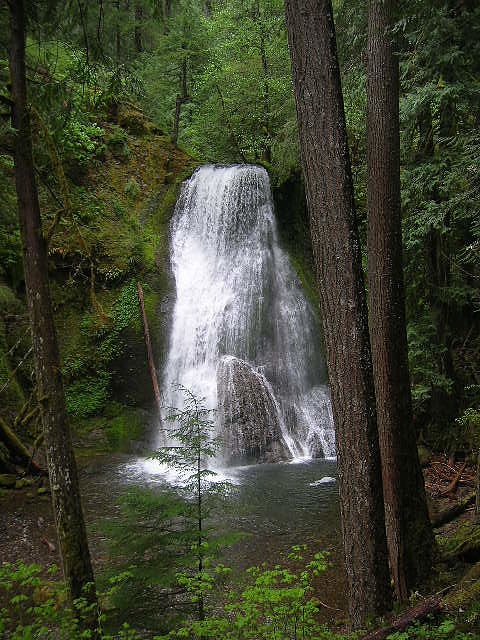
Fall Creek Falls
Park in Douglas County, Oregon. Fall Creek Falls, is a three to four drop waterfall located on the North Umpqua River at the west skirt of the Umpqua National Forest, in Douglas County, in the U.S. state of Oregon. It is located in a privileged natural area where the river creates several waterfalls: Susan Creek Falls, Emile Falls, and Grotto Falls are two to five miles away.[9]
Moon Falls
Hiking area in Lane County, Oregon. Moon Falls, also spelled Moonfalls, is a waterfall located on the west edge of the Umpqua National Forest in Lane County, in the U.S. state of Oregon. It totals 100 feet fall in one wide veiling cascade and is 1.5 miles from Spirit Falls trailhead.[10]
Yakso Falls
Waterfall in Oregon. Yakso Falls is a 70-foot waterfall on Little River, in the Cascade Range east of Roseburg in the U.S. state of Oregon. The waterfall is about 27 miles from the unincorporated community of Glide along Little River Road, which becomes Forest Road 27.
In Chinook jargon, Yakso means "hair of the head". The waterfall is said to resemble the long hair of a woman.
Yakso Falls Trail, 0.7 miles (1.1 km) long, leads from Lake in the Forest Campground in Umpqua National Forest to the waterfall. The trail, open year-round, passes through selectively logged old-growth forest.
Other waterfalls in the vicinity include Hemlock Falls, Middle Hemlock Falls, and Upper Hemlock Falls (also known as Clover Falls), all on nearby Hemlock Creek, a Little River tributary. Additional falls within 5 miles (8.0 km) of Yakso Falls are Tributary Falls on an unnamed tributary of Hemlock Creek; Cedar Creek Falls on Cedar Creek; Flat Rock Falls on the Flat Rock branch of Clover Creek, and Grotto Falls on Emile Creek. Like Hemlock Creek, Cedar, Clover, and Emile creeks are tributaries that enter Little River downstream of Yakso Falls.[11]