Discover 7 hidden attractions, cool sights, and unusual things to do in Fremont–Winema National Forest (United States). Don't miss out on these must-see attractions: Pelican Butte, Lake of the Woods, and Yamsay Mountain. Also, be sure to include Fourmile Lake in your itinerary.
Below, you can find the list of the most amazing places you should visit in Fremont–Winema National Forest (Oregon).
Table of Contents
Pelican Butte
Shield volcano in Oregon. Pelican Butte is a steep-sided dormant shield volcano in the Cascade Range of southern Oregon. It is located 28 miles due south of Crater Lake and 12 miles northeast of Mount McLoughlin, and rises over 3,800 feet directly above the shore of Upper Klamath Lake. Ice age glaciers carved a large cirque into the northeast flank of the mountain, forming a steep bowl which is popular in winter with backcountry skiers and snowmobilers. Several proposals have been made over the last few decades for ski area development on the northeast flanks, but none of the proposals has obtained the regulatory approval from the United States Forest Service necessary to proceed with construction. If the ski area is ever built, its skiable vertical of over 3,800 feet would be the largest in Oregon exceeding the 3,590 feet of Timberline Lodge ski area on Mount Hood.
The land is in the Fremont-Winema National Forest and a Forest Service fire lookout tower was built on the summit in 1935, and upgraded several times over the ensuing decades. It was replaced in 1986 with a modern 40-foot (12 m) steel tower, which remains to this day and is festooned with a large array of microwave and radio antennas. A 5-mile (8.0 km) long dirt road zigzags up the west flanks of the volcano to the summit.[1]
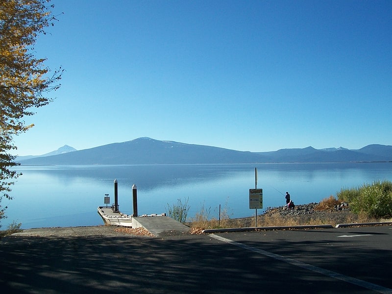
Lake of the Woods
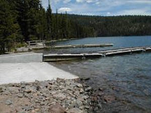
Lake in Oregon. Lake of the Woods is a natural lake near the crest of the Cascade Range in the Fremont–Winema National Forest in southern Oregon in the United States. The lake covers 1,146 acres. It was named by Oliver C. Applegate in 1870. Today, the Oregon Department of Fish and Wildlife manages the lake's fishery. The small unincorporated community of Lake of the Woods is located on the east shore of the lake. Lake of the Woods is one of southern Oregon's most popular outdoor recreation sites.[2]
Address: 14700 Hwy 140 W, 97601 Lake of the Woods
Yamsay Mountain
Shield volcano in Oregon. Yamsay Mountain is a large shield volcano in the Cascade Range of south-central Oregon, located about 35 miles east of Crater Lake on the border between Klamath County and Lake County. It is part of the Cascade Volcanic Arc but is located in a mountain range 30 to 50 miles behind the main Cascade volcanic front. The best known members of this enigmatic arc are the massive shields of Newberry Volcano, about 55 miles farther north in Oregon, and Medicine Lake Volcano, about 80 miles south in Northern California. Yamsay is the highest volcano in the eastern arc, almost 300 feet higher than Newberry and Medicine Lake.
A central part of Klamath mythology, the mountain offers activities such as hiking and horseback riding. Historically, the area around it has been inhabited by Native American tribes and settlers. Until the 1970s, a fire lookout tower sat on the summit of the mountain, and its foundation remains to this day.[3]
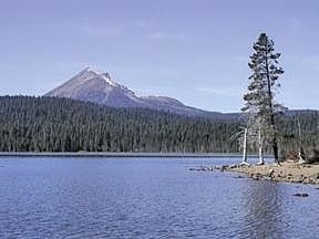
Fourmile Lake
Reservoir in Oregon. Fourmile Lake is a reservoir located 5,748 feet above sea level in Klamath County, Oregon, United States. It is 45 miles northeast of Medford. The lake was created when the 25-foot tall Fourmile Lake Dam was constructed, impounding Fourmile Creek, in the Klamath River watershed. It is located just to the east of Mount McLoughlin, which stands 9,495 feet above sea level. The lake is bordered by Sky Lakes Wilderness, and is in the Winema National Forest.[4]
Address: Or 140, Fremont–Winema National Forest
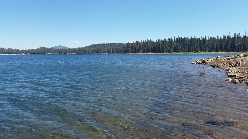
Miller Lake
Lake in Oregon. Miller Lake is a large natural freshwater lake in the Cascade Range in western Klamath County in the U.S. state of Oregon. The lake is in the Winema National Forest, about 14 miles west of Chemult via Miller Lake Road.
Recreation at the lake includes fishing for stocked rainbow and brown trout and kokanee. The lake has been called "one of the best brown trout fisheries in the state". Many brown trout in the lake, which is open for night fishing as well as day fishing, exceed 26 inches (66 cm) in length.
The lake and its drainage system form the sole habitat for the Miller Lake lamprey. The species was nearly exterminated during the 1950s by state wildlife managers, who saw it as a threat to trout populations in the lake. Since its rediscovery in 1992, efforts have been underway to rebuild lamprey populations and reintroduce it to Miller Lake.
Miller Lake is also used for swimming and non-motorized boating. Hiking trails in the vicinity provide access to the Mount Thielsen Wilderness and the Pacific Crest Trail. Digit Point Campground at the lake has 64 individual camping sites with access to picnic tables, potable water, and toilets. Mosquito infestations may require repellent or headnets.[5]
Long Valley
Valley in Utah. The Long Valley of Utah is a 13-mile long valley located in western Kane County. The valley is located in source water regions of waters flowing north, south, and southwest, in the west of the High Plateaus section of the Colorado Plateau; the High Plateaus section also extends into northern Arizona, the region north of the Grand Canyon.
Long Valley is on the east border of Kolob Terrace; the forested Markagunt and Paunsaugunt Plateaus border northwest, and northeast. East is a mountain region water divide, and the south-flowing Kanab Creek in its narrow river valley, (a north tributary to the Colorado River). The northern half of Long Valley and the two plateaus lie in the Dixie National Forest.
Glendale, Utah is located at the south end of the valley, on the East Fork Virgin River. U.S. Route 89 (US&8209;89) follows the East Fork river valley through the south half of Long Valley; the East Fork strikes east, (Stout Canyon, and feeder canyons and streams lie in the valley's northwest), and US&8209;89 exits the valley north-northeast at Long Valley Junction on the water divide-(Great Basin Divide), at the source waters of the north-flowing Sevier River.
The East Fork Virgin River flows due-south, from near the valley center, then just south of Glendale, the river starts its southwesterly course. The sourcewaters are in the valley's northeast terminus region in the Long Valley Junction area.[6]
Lake of the Woods Ranger Station
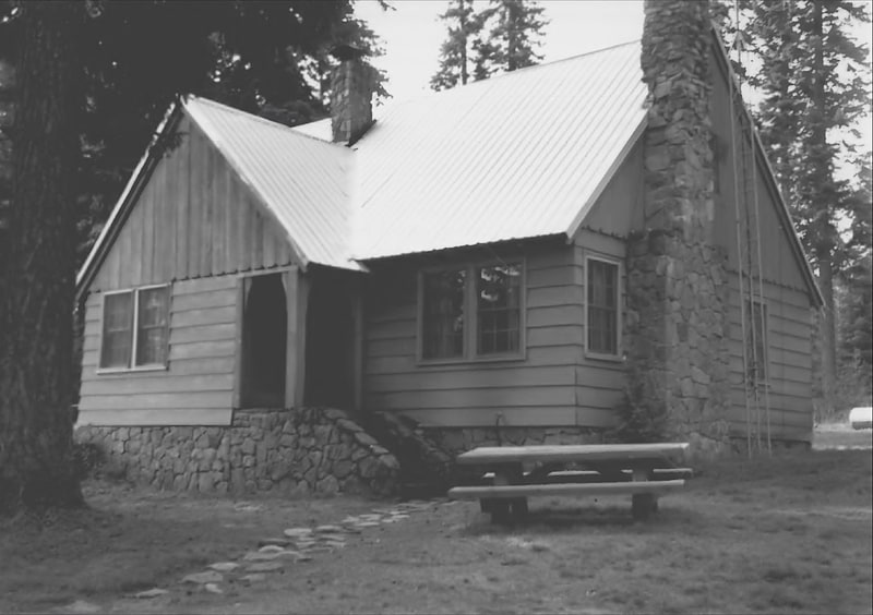
Building in Klamath County, Oregon. The Lake of the Woods Ranger Station is a United States Forest Service compound consisting of eight buildings overlooking Lake of the Woods in the Fremont-Winema National Forests of southern Oregon. All of the ranger station structures were built by the Civilian Conservation Corps between 1937 and 1939. Today, the compound serves as a Forest Service work center, and the old ranger station office is a visitor center. The ranger station is listed on the National Register of Historic Places.[7]