Discover 9 hidden attractions, cool sights, and unusual things to do in Table Mountain National Park (South Africa). Don't miss out on these must-see attractions: Table Mountain, Lion's Head, and Rhodes Memorial. Also, be sure to include Constantiaberg in your itinerary.
Below, you can find the list of the most amazing places you should visit in Table Mountain National Park (Western Cape).
Table of Contents
Table Mountain
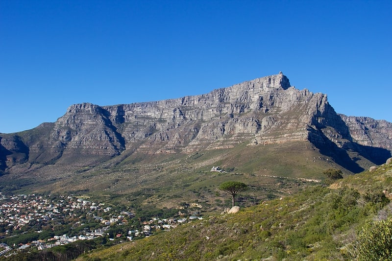
Also known as: Tafelberg
Mountain in South Africa. Table Mountain is a flat-topped mountain forming a prominent landmark overlooking the city of Cape Town in South Africa. It is a significant tourist attraction, with many visitors using the cableway or hiking to the top. Table Mountain National Park is the most visited national park in South Africa, attracting 4.2 million people every year for various activities. The mountain has 8,200 plant species, of which around 80% are fynbos, meaning fine bush. It forms part of the Table Mountain National Park, and part of the lands formerly ranged by Khoe-speaking clans, such as the !Uriǁʼaes. It is home to a large array of mostly endemic fauna and flora.[1]
Address: Table Mountain National Park, Tafelberg Rd, Gardens, 8001 Table Mountain National Park
Lion's Head
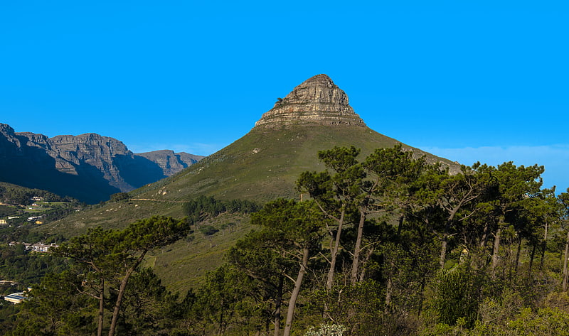
Also known as: Leeukop
Prominent mountain overlooking the city. Lion's Head is a mountain in Cape Town, South Africa, between Table Mountain and Signal Hill. Lion's Head peaks at 669 metres above sea level. The peak forms part of a dramatic backdrop to the city of Cape Town and is part of the Table Mountain National Park.[2]
Rhodes Memorial
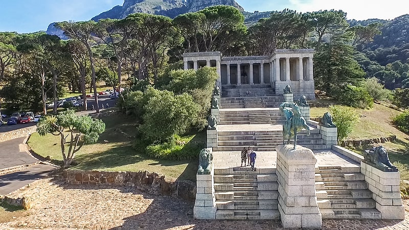
Also known as: Rhodes-gedenkteken
Monument in Cape Town, South Africa. Rhodes Memorial on Devil's Peak in Cape Town, South Africa, is a memorial to English-born, South African politician Cecil John Rhodes. The memorial was designed by the renowned architect, Sir Herbert Baker.[3]
Address: Rhodes Ave, 7700 Cape Town
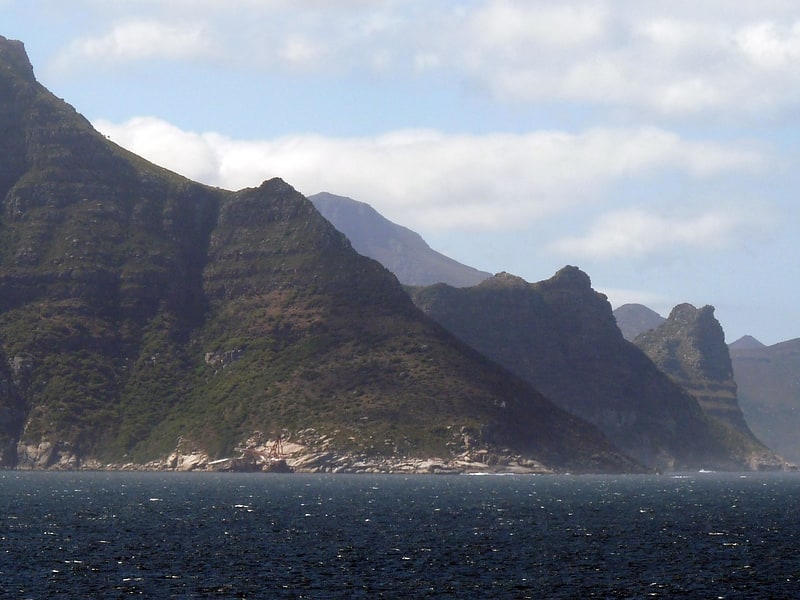
Constantiaberg
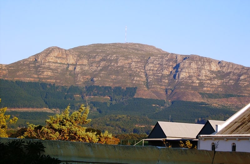
Whaleback mountain in a national park. Constantiaberg is a large, whalebacked mountain that forms part of the mountainous spine of the Cape Peninsula in Table Mountain National Park, Cape Town, South Africa. It lies about 7 km south of Table Mountain, on the southern side of Constantia Nek. The mountain is 927 m high. It is not known who first ascended the peak.
Constantiaberg, Devil's Peak and Table Mountain are the highest mountains in the range that stretches from Table Mountain all the way to Cape Point. The range, made up of resistant sandstones of the Table Mountain Group, dominates the southern suburbs of the city on the verge of the Cape Flats.
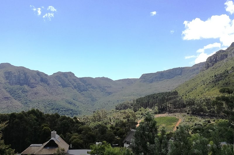
The lower eastern slopes of Constantiaberg are covered by the commercial pine and gum plantations of Tokai forest, and are crisscrossed with hiking trails and gravel roads that are used for harvesting the trees. The forest is popular for walking, running and mountain biking.
The western slopes of the mountain overlook the magnificent scenery of Hout Bay.
A tarred road leads to the summit of Constantiaberg, where an important VHF mast is located 34°03′17.78″S 18°23′10.77″E. The mast is about 100 m high and is visible for perhaps 80 kilometers in any direction. It was constructed in the 1960s and is used to transmit signals for many local television and radio channels, and also to support cellular networks. The South African Weather Service has a radar installation at the summit.
Constantiaberg is home to a variety of bird and plant species. The mountain is covered mainly by fynbos, a botanical biome native to the Western Cape. The specific vegetation type of the mountain is Peninsula Sandstone Fynbos, an endangered vegetation type that is endemic to the city of Cape Town - occurring nowhere else in the world.
Elephant's Eye cave, a popular hiking destination, is the mountain's biggest feature after the mast. This is visible near the southern end of the mountain when viewed from the Cape Flats. Elephant's Eye is so named because the eastern profile of the mountain resembles an elephant (the range that continues toward Cape Point being the trunk).[4]
Address: Burnham Rd, Table Mountain National Park
The Sentinel
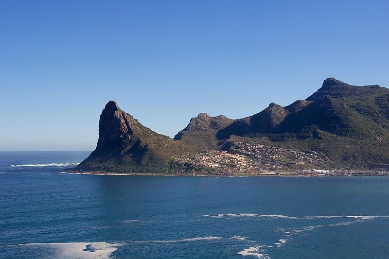
Peak in South Africa. The Sentinel or Hangberg is a peak marking the western end of the mouth of Hout Bay in South Africa. It has a shear cliff dropping towards the sea, and a coastal hiking path is accessible at low tide. It is adjacent to Hout Bay Harbour and the Hangberg settlement, and to the higher Karbonkelberg peak. Just offshore to the south is a colony of Cape fur seals known as Seal Island, and a big wave surf spot known as "Dungeons", which has hosted the Red Bull Big Wave Africa competition.[5]
Table Mountain
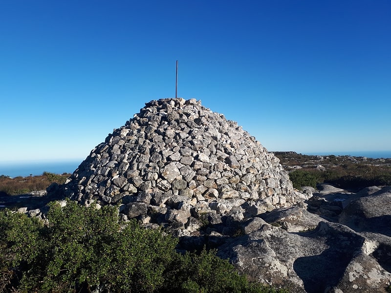
Maclear's Beacon is a triangulation station used in Maclear's arc measurement for Earth's circumference determination.
The beacon is on top of Table Mountain in Cape Town, South Africa. It is situated on the Eastern end on the plateau of the mountain.
The beacon is 1,086 metres (3,563 ft) above sea level. Table Mountain's 19 metres (62 ft) higher than the upper cable car station. The structure consists of man made rock packed in a triangle form, being 5 metres (16 ft) high. It was painted in lamp black colour to make it visible, when light shown on it.
In December 1844, the Astronomer Royal at the Cape, Thomas Maclear, instructed his assistant William Mann to build a beacon in the form of a pile of rocks which would be used to confirm and possibly expand on the existing curvature of the earth data of Nicolas-Louis de Lacaille. This data was in connection with the Cape arc of the meridian. Initially the beacon had no name but in later years it was named after Maclear.
In 1929, the pile of stones collapsed and it was restored in 1979 to commemorate the centenary of Maclear's death.
The beacon is still used by cartographers today. It has become a tourist attraction and hiking trails over the mountain pass next to the beacon. It is also a National Monument.[6]
Karbonkelberg
Peak in South Africa. Karbonkelberg is a small peak forming part of the Table Mountain National Park in Cape Town, South Africa.[7]
Orange Kloof
Orange Kloof is an area of Table Mountain National Park in Cape Town, South Africa.
It is located at the northern end of the Hout Bay valley, just to the west of Cecilia Park. It is a conservation area with highly restricted access, vegetated by indigenous Afro-temperate forest and endangered Peninsula Granite Fynbos.[8]
Fynbos
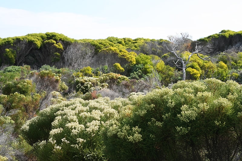
Fynbos is a small belt of natural shrubland or heathland vegetation located in the Western Cape and Eastern Cape provinces of South Africa. This area is predominantly coastal and mountainous, with a Mediterranean climate and rainy winters. The fynbos ecoregion is within the Mediterranean forests, woodlands, and scrub biome. In fields related to biogeography, fynbos is known for its exceptional degree of biodiversity and endemism, consisting about 80% species of the Cape floral kingdom where nearly 6,000 of them are endemic. This land continues to face severe human-caused threats, but due to the many economic uses of the fynbos, conservation efforts are being made to help restore it.[9]