Discover 11 hidden attractions, cool sights, and unusual things to do in Cape Floristic Region (South Africa). Don't miss out on these must-see attractions: De Hoop Nature Reserve, Cederberg, and Cape Winelands Biosphere Reserve. Also, be sure to include Boosmansbos Wilderness Area in your itinerary.
Below, you can find the list of the most amazing places you should visit in Cape Floristic Region (Western Cape).
Table of Contents
De Hoop Nature Reserve
Also known as: De Hoop-natuurreservaat
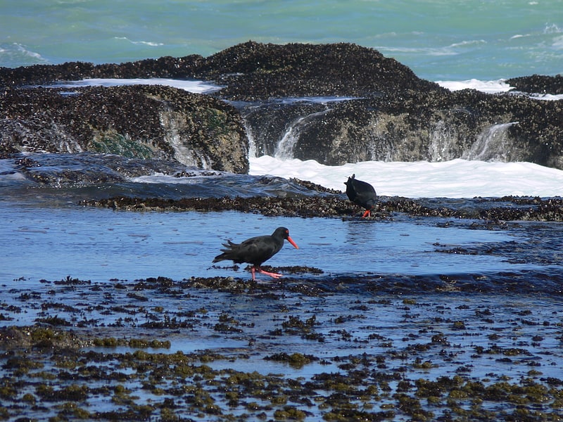
Nature reserve in South Africa. De Hoop Nature Reserve is a nature reserve in the Western Cape Province of South Africa.
It lies three hours from Cape Town in the Overberg region, near Cape Agulhas, the southern tip of Africa. Approximately 340 square kilometres (130 sq mi) in area, it is one of the largest natural areas managed by CapeNature.
De Hoop is one of the components of the "Cape Floral Region Protected Areas" World Heritage Site.
The De Hoop Marine Protected Area extends three nautical miles out to sea from the coastline of the nature reserve.[1]
Cederberg
Also known as: Sederberg
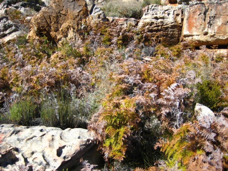
Nature preserve in West Coast DC, South Africa. The Cederberg mountains are located near Clanwilliam, approximately 300 km north of Cape Town, South Africa at about 32°30′S 19°0′E. The mountain range is named after the endangered Clanwilliam cedar, which is a tree endemic to the area. The mountains are noted for dramatic rock formations and San rock art. The Cederberg Wilderness Area is administered by CapeNature.
Cederberg is now the generally accepted spelling for the area, which combines the English (Cedarberg) and Afrikaans (Sederberg) variants.[2]
Cape Winelands Biosphere Reserve
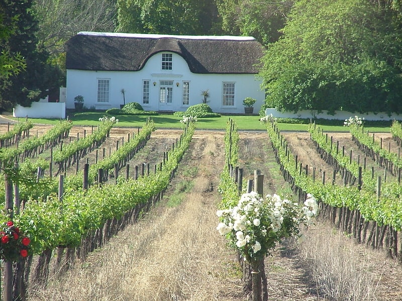
The Cape Winelands Biosphere Reserve is located in the Western Cape Province of South Africa approximately 40 km east of Cape Town. The Biosphere Reserve extends from the Kogelberg Biosphere Reserve in the south, northwards along the Cape Fold Belt Mountain Chain and the adjoining valleys constituting the Cape Winelands. The Biosphere Reserve incorporates key portions of the registered Cape Floral Region Protected Areas World Heritage Site. The Reserve was designated in 2007.[3]
Boosmansbos Wilderness Area
Also known as: Boosmansbos-wildernisgebied
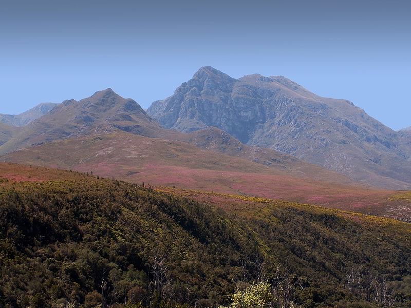
Nature reserve in South Africa. The Boosmansbos Wilderness Area of 142 km2 is situated 20 km north of Heidelberg in the eastern Langeberg mountain chain of the Western Cape Province, South Africa. Boosmansbos, i.e. 'angry man's forest', is named after a resident hermit of the early 19th century who had been known to scare youngsters who visited his apiaries.
The elevation reaches 1,637 m (5,371 ft) at Grootberg peak, located at the center of the wilderness area. The tributaries of the Duiwenhoks River, which drain its southern slopes, tumble along precipitous gorges to 200 m (660 ft) above sea level on the southern perimeter. In the southwest the wilderness area encloses the Grootvadersbosch Nature Reserve of 250 ha (620 acres), the most western natural forest in South Africa.
The wilderness area conserves mountain fynbos and valley forest. Among the special fynbos plants conserved are Erica and everlasting species as well as the rare Langeberg rambling aloe. Important forest tree species occurring in the valleys are sickle-leaved yellowwood, stinkwood and red alder.
The area receives rain in any month of the year, although mid summer and mid winter are the driest, when hot bergwind conditions may occur. 64 km (40 mi) of footpaths allow access to the wilderness, among which a circular 27 km (17 mi) section which can be completed in two days.[4]
Kouga Dam
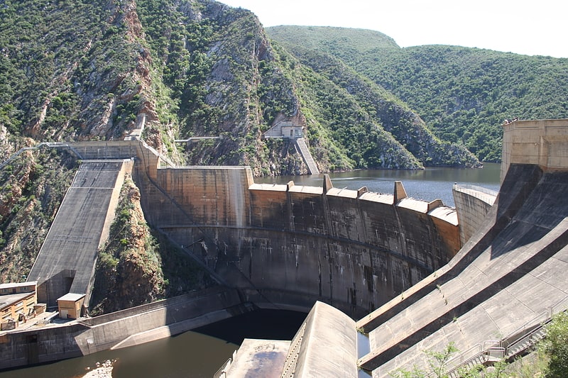
Also known as: Kougadam
The Kouga Dam is an arch dam on the Kouga River about 21 km west of Patensie in Kouga Local Municipality, South Africa. It supplies irrigation water to the Kouga and Gamtoos valleys as well as drinking water to the Port Elizabeth metropolitan area via the Loerie Balancing Dam. It was constructed between 1957 and 1969.
The dam can be accessed by following the R330 and then the R331 from the N2 at Humansdorp. All but the last 8 kilometres (5.0 mi) is tarred road and there is a short tunnel just before the dam wall.
It was named the Paul Sauer Dam after Paul Sauer, but was renamed in 1995.[5]
Du Toits Peak
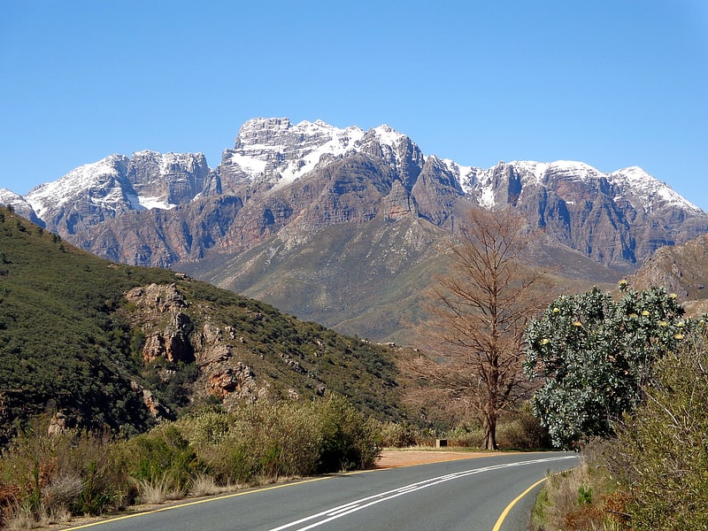
Range in South Africa. The Du Toitskloof Mountains are a range in the Cape Fold Belt in the Western Cape Province of South Africa. The highest point is Du Toits Peak which is the highest seaward facing peak in the Cape Fold Belt ranges, i.e. the highest peak in the Western Cape within direct sight of the ocean.
Located between Paarl and Worcester in the south-west of South Africa, 70 kilometres (43 mi) to the north-east of the provincial capital of Cape Town, the mountains form a formidable barrier between Cape Town and the rest of Africa. The N1 highway, also called the Cape to Cairo Road crosses them at the Du Toitskloof Pass. The old route culminated at 820 metres (2,690 ft); however, the new Huguenot Tunnel, of 3.7 kilometres (2.3 mi) in length, cuts out the old mountain pass. Sometimes the Du Toitskloof Mountains together with the Wemmershoek Mountains and others are called the Klein Drakenstein, but it is more usually considered part of the greater Boland mountain range.
Structurally, the mountains form part of the Cape Syntaxis, a complex portion of the Cape Fold Belt where the north-south trending ranges meet the east-west trending ranges in a complex series of folds and thrusts. The range mostly consists of Table Mountain sandstone, an erosion-resistant quatzitic sandstone. Vegetation is almost exclusively montane fynbos of the Cape floristic region. The rest of the mountains are barren rocks and steep cliffs. Precipitation occurs primarily in the winter months as rain on the lower slopes and as snow higher up, usually above 1000m. Climate varies dramatically, with the surrounding valleys being up to 10°C (18°F) warmer than the mountains. The climate falls within the Mediterranean type.
The Limietberg Nature Reserve, known for its mountain fynbos, is located in the Du Toitskloof Mountains.[6]
Gamkaskloof
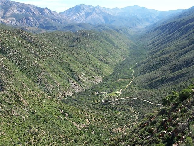
The Gamkaskloof Afrikaans pronunciation:, also known as Die Hel, is a narrow, isolated valley about 20 kilometres long and a maximum of 600 metres wide. The valley is located in the Swartberg mountain range, which is part of the Garden Route District Municipality, Western Cape Province, South Africa.[7]
Kogelberg Nature Reserve
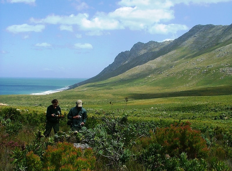
Also known as: Kogelberg-natuurreservaat
Nature preserve in South Africa. Kogelberg Nature Reserve is a nature reserve of 3,000 ha comprising the Kogelberg Mountain Range, to the east of Cape Town, South Africa.
With about 1600 plant species, it contains a floral diversity per unit area that is greater than anywhere else in the world.[8]
Swartberg
Mountain range in South Africa. The Swartberg mountains are a mountain range in the Western Cape province of South Africa. It is composed of two main mountain chains running roughly east–west along the northern edge of the semi-arid Little Karoo. To the north of the range lies the other large semi-arid area in South Africa, the Great Karoo. Most of the Swartberg Mountains are above 2000 m high, making them the tallest mountains in the Western Cape. It is also one of the longest, spanning some 230 km from south of Laingsburg in the west to between Willowmore and Uniondale in the east. Geologically, these mountains are part of the Cape Fold Belt.
Much of the Swartberg is part of a UNESCO World Heritage Site.[9]
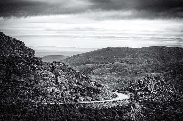
Swartberg Pass
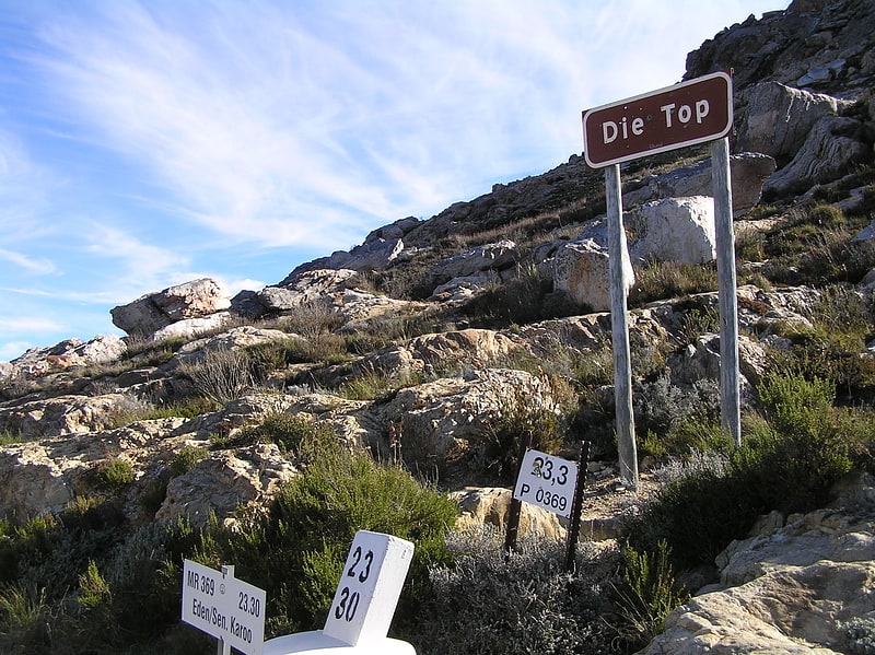
Also known as: Swartbergpas
Pass in South Africa. The Swartberg Pass on the R328 runs over the Swartberg mountain range which runs roughly east–west along the northern edge of the semi-arid area called the Little Karoo in the Western Cape province of South Africa. It's the only road access to Gamkaskloof.[10]
Meiringspoort
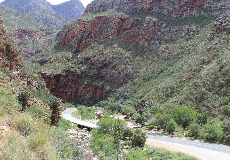
Meiringspoort is a South African mountain pass on the N12 national road, where it crosses the Swartberg mountain range.[11]