Discover 6 hidden attractions, cool sights, and unusual things to do in Santa Fe National Forest (United States). Don't miss out on these must-see attractions: Pajarito Mountain, Monastery of Christ in the Desert, and Cerro Pedernal. Also, be sure to include Chicoma Mountain in your itinerary.
Below, you can find the list of the most amazing places you should visit in Santa Fe National Forest (New Mexico).
Table of Contents
Pajarito Mountain
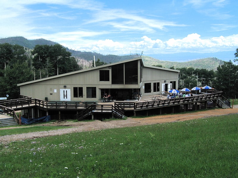
Ski area in Los Alamos County, New Mexico. Pajarito Mountain Ski Area is located on the north face of Pajarito Mountain, one of the Jemez Mountains in north central New Mexico, west of Los Alamos. It is located on 850 acres of privately owned land. Pajarito Mountain is owned and operated by volunteers and Mountain Capital Partners. A typical season runs from Christmas to early April, but an outstanding season may run from Thanksgiving to late April. Pajarito now has a snowmaking system and it is producing snow. Season passes are available with discounts available for early season purchase.
In summer, Pajarito hosts numerous special events, many involving mountain biking. An extensive network of single and double track mountain bike trails criss-cross the mountain, including a new singletrack trail going to the summit. Pajarito hosts lift access downhill and freeride mountain biking off the Spruce chair, and has continued to do so after the Las Conchas Fire in 2011. There also are hiking trails, and horse riding is permitted everywhere except on the mountain bike trails. Adjacent to Pajarito is a Los Alamos County campground, Camp May; Santa Fe National Forest; and Valles Caldera National Preserve.[1]
Address: 397 Camp May Road, 87544 Los Alamos
Monastery of Christ in the Desert
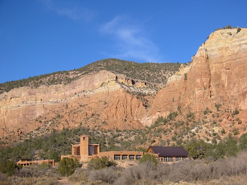
Monastery in Abiquiú, New Mexico. The Monastery of Christ in the Desert is a Roman Catholic Benedictine monastery belonging to the English Province of the Subiaco Congregation of Benedictine monasteries. The monastery is in Abiquiu, New Mexico in the Chama River Canyon Wilderness area 75 miles north of Santa Fe. It is accessible by Forest Road 151, a 13-mile dirt road off of US route 84.[2]
Address: Forest Service Road 151, Santa Fe National Forest
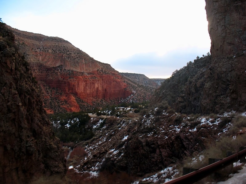
Cerro Pedernal
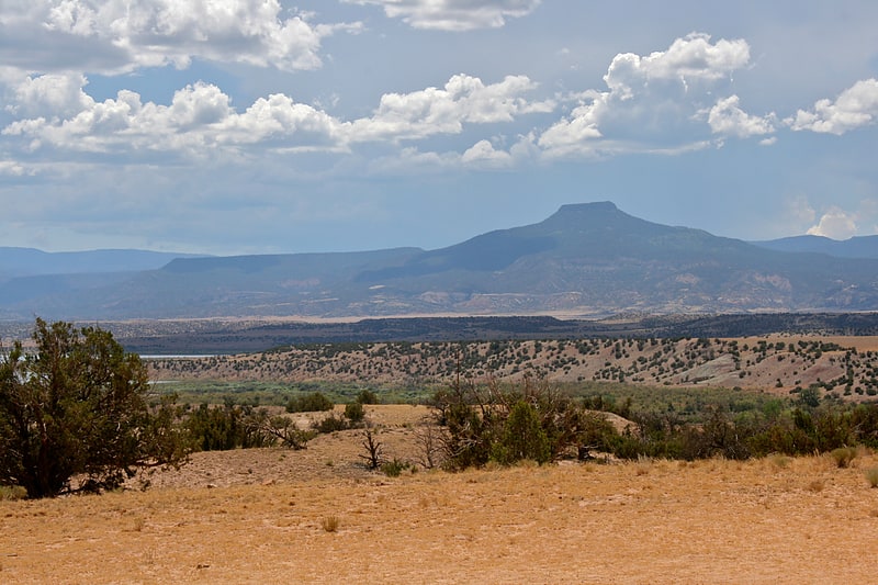
Mesa in New Mexico. Cerro Pedernal, locally known as just "Pedernal", is a narrow mesa in northern New Mexico. The name is Spanish for "flint hill". The mesa lies on the north flank of the Jemez Mountains, south of Abiquiu Lake, in the Coyote Ranger District of the Santa Fe National Forest. Its caprock was produced in the Jemez Volcanic Field. Its highest point is 9,862 feet.
Pedernal is the source of a chert used by the prehistoric Gallina people. Its cliffs are popular with rock climbers. Georgia O'Keeffe made many paintings of it, and her ashes were scattered on its top.[3]
Chicoma Mountain
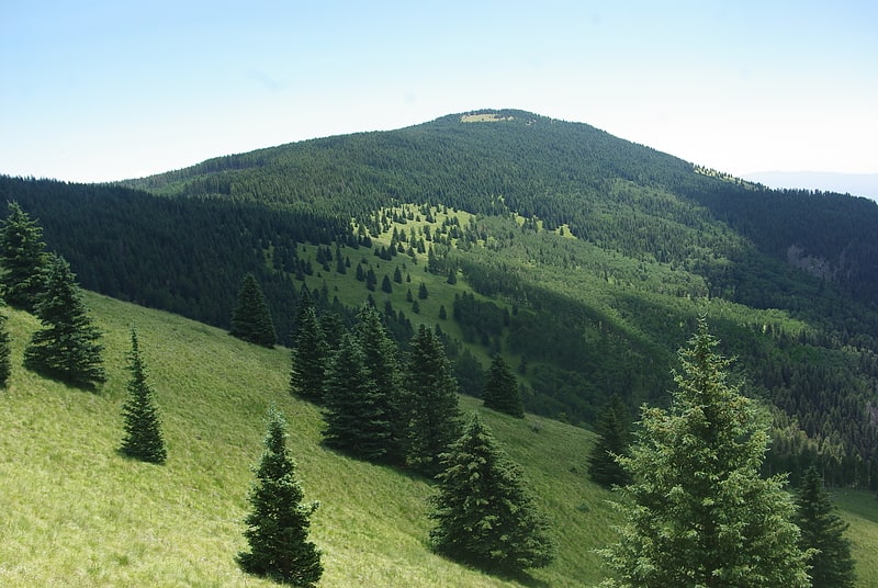
Mountain in New Mexico. Chicoma Mountain is the highest point in the Jemez Mountains, a prominent mountain range in the U.S. State of New Mexico. The tree line in this area is exceptionally high, and the mountain is forested almost all the way to its summit which is conspicuous from the towns of Los Alamos, Santa Fe, and Española and other areas in the valley of the Rio Grande in northern New Mexico. Like the rest of the Jemez, it is of volcanic origin; it lies on the northeast rim of the Valles Caldera, one of the best examples of a caldera in the United States.
The mountain is sacred to many of the Puebloan peoples of New Mexico, who traditionally regarded it as the "center of all." Much of it lies within the territory of the Santa Clara Pueblo. Access by hikers, hunters, and others, is correspondingly limited, although the summit can be reached via public lands on the north side. The Puye Cliff Dwellings in Santa Clara Canyon are an archaeological site of some significance; however, the cliff dwellings are not near Chicoma. Puye Cliff Dwellings are accessible via NM 30 to NM 5, about 30 minutes south of Chicoma Mountain. The site is located on the pueblo's land on the east side of the mountain, and are sometimes open to the public for a fee.[4]
Jemez Mountains
Mountain in New Mexico. The Jemez Mountains are a group of mountains in Rio Arriba, Sandoval, and Los Alamos counties, New Mexico, United States.
Numerous Puebloan Indian tribes have lived in the Jemez Mountains region since before the Spanish arrived in New Mexico. The Pueblo Indians of this region are the Towa-speaking Jemez people for which this mountain range is named, the Keres-speaking Keresan Indians, and the Tewa-speaking Tewa Indians. Tsąmpiye'ip'įn is the Tewa language name for the Jemez Mountains.
The highest point in the range is Chicoma Mountain (also spelled as Tschicoma or Tchicoma) at an elevation of 11,561 feet (3,524 meters). The town of Los Alamos and the Los Alamos National Laboratory adjoin the eastern side of the range while the town of Jemez Springs is to the west. Pajarito Mountain Ski Area is the only ski area in the Jemez. New Mexico State Highway 4 is the primary road that provides vehicular access to locations in the Jemez Mountains.[5]
Glorieta Pass
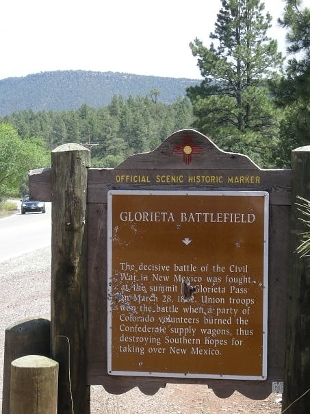
Mountain pass in New Mexico. Glorieta Pass is a mountain pass in the Sangre de Cristo Mountains of northern New Mexico. The pass is at a strategic location near at the southern end of the Sangre de Cristos in east central Santa Fe County southeast of the city of Santa Fe.
Historically, the pass provided the most direct route through the mountains between the upper valley of the Pecos River to the east and the upper valley of the Rio Grande to the west. In the 19th century, it furnished the route of the westernmost leg of the Santa Fe Trail between Santa Fe and the High Plains.
The Battle of Glorieta Pass, the decisive battle of the New Mexico Campaign of the American Civil War, was fought near the pass in March 1862. The victory by the Union Army (primarily in the form of the Colorado Militia) prevented the breakout of the Confederate Army forces onto the High Plains on the east side of Sangre de Cristo Mountains, halting the intended Confederate advance northward along the base of the Rocky Mountains. The battle is commemorated at Pecos National Historic Park on the east side of the pass. In the 20th century, the pass became used as the route of U.S. Highway 84 and later Interstate 25. The town of Glorieta is located on the eastern side of the pass.
The stairwells of the Colorado State Capitol Building display cannonballs from the battle as ornaments.
In 1879, the New Mexico and Southern Pacific Railroad constructed a railroad through the pass, which became part of the second North American transcontinental railroad in March 1881. The NM&SP was absorbed into its parent company, the Atchison Topeka and Santa Fe Railroad in 1899, and the Santa Fe used the route for their Chicago to Los Angeles trains, including the famed El Capitan and Super Chief. Now part of the BNSF system, this remains the route of Amtrak's Southwest Chief, with one passenger train each direction daily, but little freight. It is one of the last places where semaphore signals are still in use on a major United States railroad.[6]