Discover 7 hidden attractions, cool sights, and unusual things to do in Carson National Forest (United States). Don't miss out on these must-see attractions: San José de Gracia Church, San Antonio Mountain, and Wheeler Peak. Also, be sure to include Valle Vidal in your itinerary.
Below, you can find the list of the most amazing places you should visit in Carson National Forest (New Mexico).
Table of Contents
San José de Gracia Church
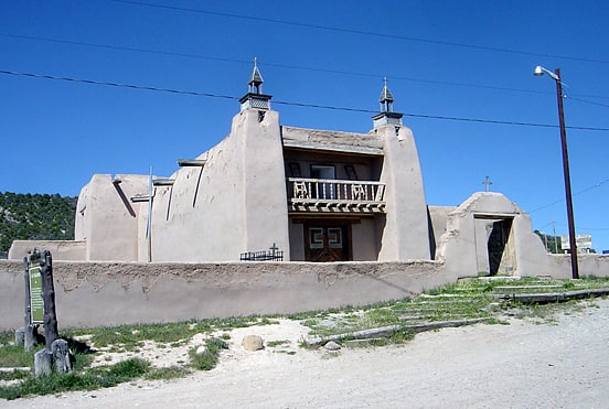
The San Jose de Gracia Church, also known as Church of Santo Tomas Del Rio de Las Trampas, is a historic church on the main plaza of Las Trampas, New Mexico. Built between 1760 and 1776, it is one of the least-altered examples of a Spanish Colonial Pueblo mission church, with adobe walls rising 34 feet in height. It was declared a National Historic Landmark in 1970.[1]
San Antonio Mountain
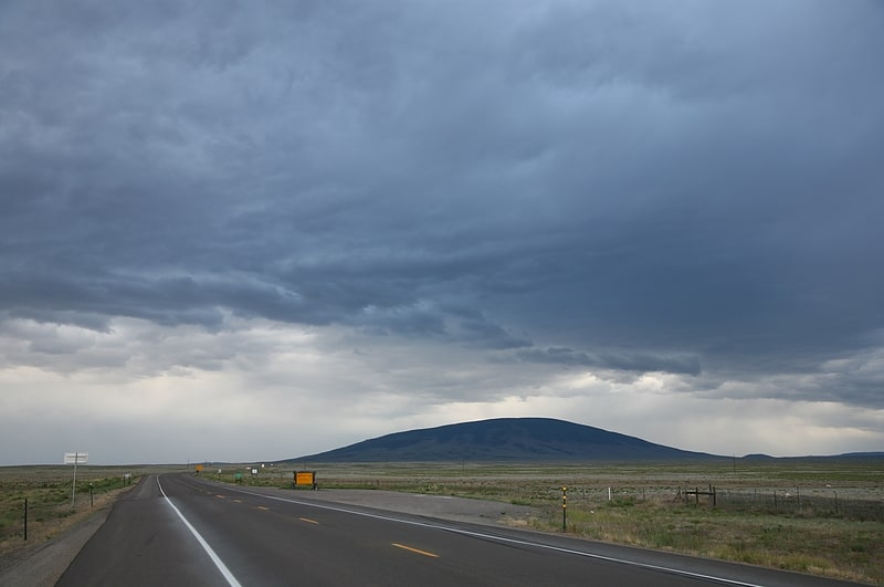
Peak in New Mexico. San Antonio Mountain is a free-standing volcanic peak in Rio Arriba County, New Mexico. With an elevation of 10,908 feet, San Antonio Mountain is the highest peak within the Taos Plateau volcanic field, the largest volcanic field within the Rio Grande Rift valley.
The mountain lies just outside a northwest boundary of the Rio Grande del Norte National Monument. It lies within the Carson National Forest and is administered by the U.S. Forest Service rather than the Bureau of Land Management.
It is called "Bear Mountain" by Tewa-speaking peoples in the Rio Grande valley, and is known as the mountain of the north in their cosmology.[2]
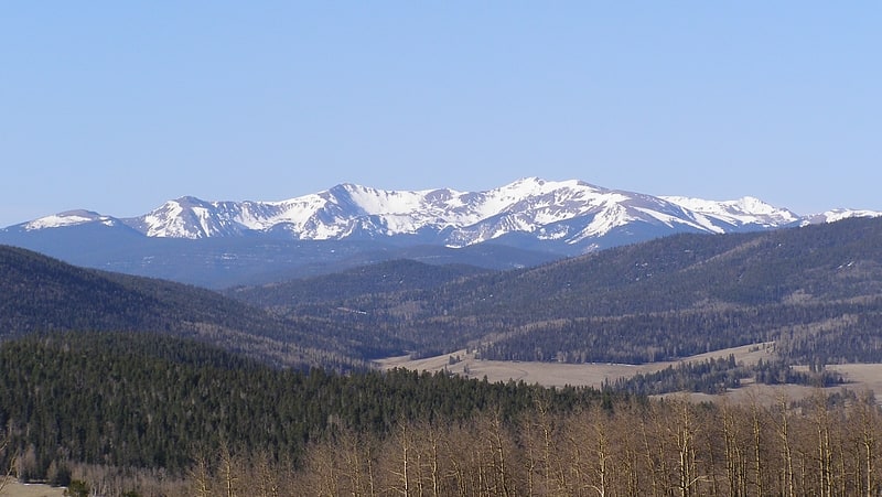
Wheeler Peak
Mountain in New Mexico. Wheeler Peak is the highest natural point in the U.S. state of New Mexico. It is located northeast of Taos and south of Red River in the northern part of the state, and just 2 miles southeast of the ski slopes of Taos Ski Valley. It lies in the Sangre de Cristo Mountains, the southernmost subrange of the Rocky Mountains. The peak's elevation is 13,167 feet.
Formerly named Taos Peak, after the nearby town of Taos, New Mexico, it was renamed Wheeler Peak in 1950. A plaque at the summit states that the mountain was:
Named in honor of Major George Montague Wheeler (1832–1909) who for ten years led a party of surveyors and naturalists collecting geologic, biologic, planimetric and topographic data in New Mexico and six other southwestern states.[3]
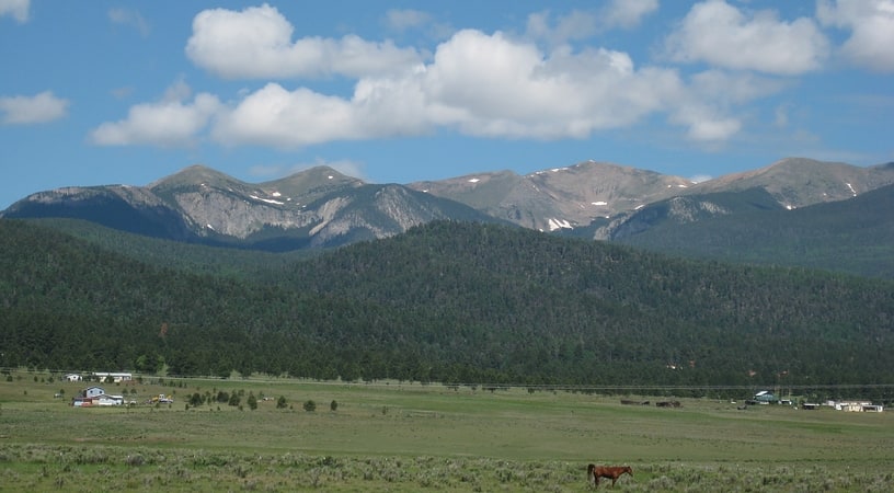
Valle Vidal
The Valle Vidal is a 101,794 acres mountain basin in the Sangre de Cristo Mountains within the Carson National Forest, northwest of Cimarron, New Mexico. Elevations in the basin range from 7,700 to 12,554 feet. Valle Vidal is noted for its pristine scenery and wildlife. It was protected from oil and gas exploitation by an act of Congress in 2006. The Valle Vidal borders on Vermejo Park Ranch, Philmont Scout Ranch, and other private lands.[4]
Pot Creek Cultural Site
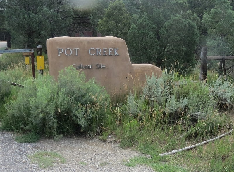
Historical landmark in Taos County, New Mexico. Pot Creek Cultural Site is an abandoned 13th century pueblo located on private land owned by Southern Methodist University and on public Carson National Forest land in Taos County, New Mexico.[5]
Las Trampas
Town in New Mexico. Las Trampas or just Trampas, is a small unincorporated town in Taos County, New Mexico. Founded in 1751, its center retains the original early Spanish colonial defensive layout from that time, as well as the 18th-century San José de Gracia Church, one of the finest surviving examples of Spanish Colonial church architecture in the United States. The village center was designated a National Historic Landmark District in 1967.[6]
Taos Plateau volcanic field
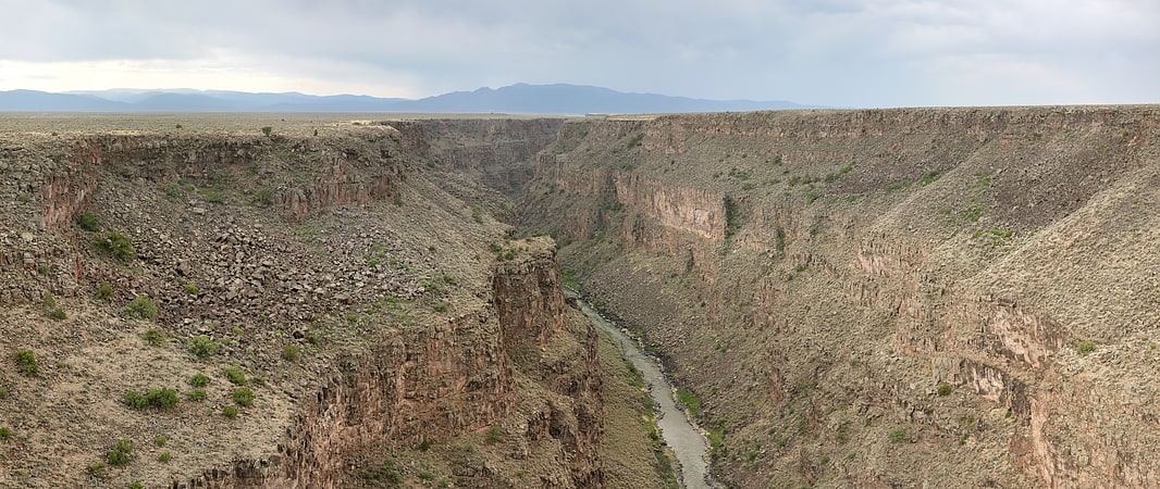
The Taos Plateau volcanic field is an area of extensive volcanism in Taos County, New Mexico, United States. It is the largest volcanic field in the Rio Grande Rift, spreading over 7,000 square kilometers. The total erupted volume is estimated at 420 cubic kilometers. The age of most of the vents and associated lava flows in the field is estimated to be between 1.8 and 4 million years, with a few 22-million-year-old vents. The composition of the lavas varies from tholeiitic basalt to rhyolite. Landforms include sheet flows, cinder cones, and shield volcanoes. The sheet flows of the Servilleta Basalt are well-exposed in the Rio Grande Gorge carved by the Rio Grande. The highest point of the field is San Antonio Mountain at 10,908 feet.[7]