Discover 11 hidden attractions, cool sights, and unusual things to do in Qomolangma (China). Don't miss out on these must-see attractions: Rongbuk Monastery, Shishapangma, and Gyachung Kang. Also, be sure to include Khumbutse in your itinerary.
Below, you can find the list of the most amazing places you should visit in Qomolangma (Tibet).
Table of Contents
Rongbuk Monastery
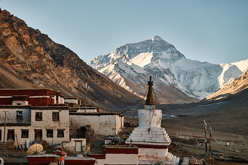
Also known as: 绒布寺
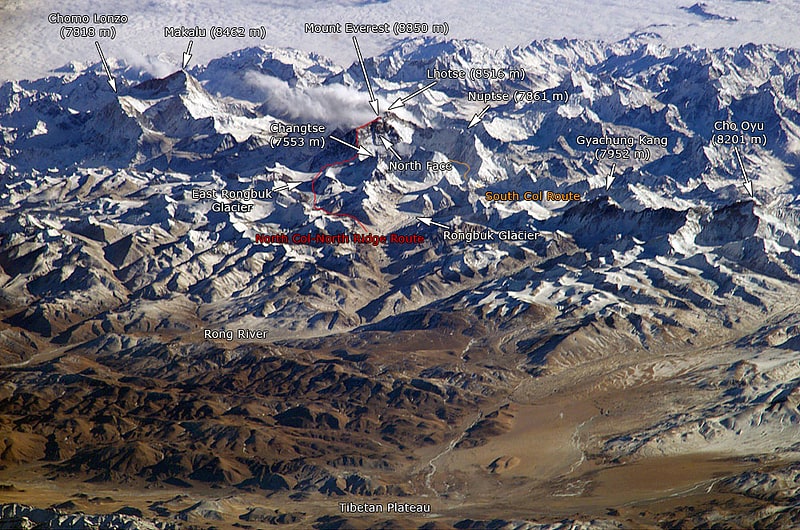
Monastery in Shigatse, China. Rongbuk Monastery, also known as Dzarongpu or Dzarong, is a Tibetan Buddhist monastery of the Nyingma sect in Basum Township, Dingri County, in Shigatse Prefecture of the Tibet Autonomous Region in China.[1]
Shishapangma
Also known as: 希夏邦马峰
Mountain in China. Shishapangma, also called Gosainthān, is the 14th-highest mountain in the world, at 8,027 metres above sea level. It was the last 8,000-metre peak to be climbed, due to its location entirely within Tibet and the restrictions on visits by foreign travelers to the region imposed by Chinese and Tibetan authorities.[2]
Gyachung Kang
Also known as: ग्याचुङ काङ
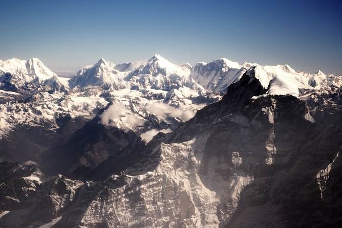
Mountain in Asia. Gyachung Kang is a mountain in the Mahalangur Himal section of the Himalayas, and is the highest peak between Cho Oyu and Mount Everest. It lies on the border between Nepal and China. As the fifteenth-highest peak in the world, it is also the highest peak that is not eight thousand metres tall; hence, it is far less well-known than the lowest of the eight-thousanders, which are only about 100 m higher. The peak's lack of significant prominence also contributes to its relative obscurity.[3]
Khumbutse
Mountain. Khumbutse is the first mountain west of Mount Everest. It lies at the border between Nepal and China.[4]
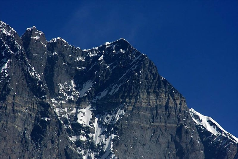
Changtse
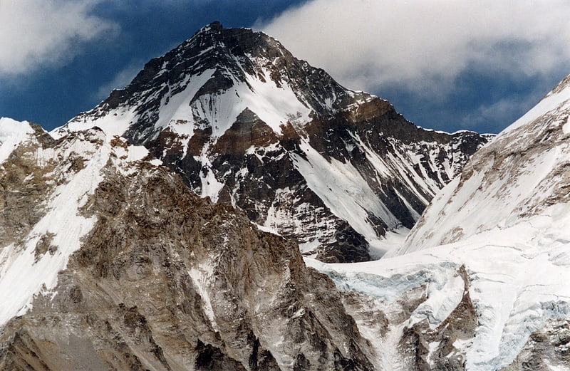
Also known as: 章子峰
Mountain. Changtse is a mountain situated between the Main Rongbuk and East Rongbuk Glaciers in Tibet Autonomous Region, China, immediately north of Mount Everest. It is connected to Mount Everest via the North Col.
The given elevation of 7,543 metres is from modern Chinese mapping. Some authorities give 7,583 metres instead.
The Changtse Glacier flows north into the East Rongbuk Glacier. It is possible that the third highest lake in the world is in the Changtse Glacier at 6,216 metres (20,394 ft).[5]
Labuche Kang
Also known as: 拉布吉康峰
Peak. Labuche Kang is a northern outlier of the Himalayas inside Tibet. It rises northwest of Rolwaling Himal and east of Shishapangma. The peak belongs to a little-known section of the Himalaya variously called Labuche Himal, Pamari Himal and Lapchi Kang. that extends from the valley of the Tamakosi River west to the valley of the Sun Kosi and Nyalam Tong La pass where Arniko-Friendship Highway cross the Himalaya. This section extends south into Nepal east of Arniko Highway. It is wholly within the catchment of the Kosi, a Ganges tributary.
Labuche Kang was first climbed in 1987 by a Sino-Japanese expedition, via the West Ridge. No other attempts are recorded until September 2010 when American climber Joe Puryear fell to his death during an unsuccessful attempt.[6]
Chomo Lonzo
Also known as: 珠穆隆索峰
Mountain in China. Chomo Lonzo is a mountain in Tibet, 5 km northeast of Makalu in the Mahalungur or Khumbu Himalayas. Alternate spellings of the same name include Chomolonzo, Chomolönzo, Chomo Lönzo, Jomolönzo, and Lhamalangcho.
Chomo-Lonzo has three distinct summits. The Southern, main peak (7804m) is joined via a ~ 7250m saddle to the Central peak (7565m), which is joined via a ~7050m saddle to a ~7200m North (or North West) peak.
While from Nepal the mountain is overpowered by nearby Makalu, the fifth-highest peak in the world, the three peaks are a very impressive and dominating sight from the Kangshung valley in Tibet. The 3000 m high northeast face is an obvious challenge that is as yet unsolved. Chomo-Lonzo translates to “bird goddess” and from the East the mountain indeed brings to mind a 3 km high eagle with spread wings.
The French climbers Jean Couzy and Lionel Terray reached the main summit via the gently sloping SW ridge from the 7200m Sakietang La that separates Chomo Lonzo from Makalu. They did this as an afterthought during a reconnaissance expedition to the Makalu, which they first-ascended the next year. The second ascent was only in 1993 by a Japanese expedition which found a route through the NW face that joined the SW ridge half-way. A third and currently last ascent of the main peak in 1994 followed the original SW ridge route.
The Central and North peaks remained unclimbed until 2005. In 1999, an attempt to climb the central peak via its daunting NE pillar was thwarted. In April 2005, a French expedition first explored the NE face but, finding it too challenging, approached the mountain from the West and Northwest instead. One team (Yannick Graziani, Christian Trommsdorff and Patrick Wagnon) climbed the North summit over the NW ridge on May 7, while another (Stéphane Benoist and Patrice Glairon-Rappaz) reached it over the West face on May 16. The first team reascended the North peak and continued to reach the central peak on May 21. The initial plan to traverse all three peaks and descend via the Sakietang La proved impossible.[7]
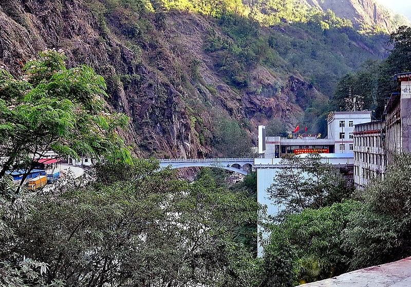
Sino-Nepal Friendship Bridge
Also known as: मितेरी पुल
Bridge in Kodari, Nepal. The Sino-Nepal Friendship Bridge is a bridge spanning the Sun Kosi river, linking Kodari in Sindhulpalchok District, Nepal and Zhangmu, China.
From the bridge on the Nepalese side, Kodari in Sindhulpalchok District, the Arniko Rajmarg (Arniko Highway; abbreviated ARM) links to Kathmandu, named after the famous architect Arniko.
In the other direction, the China National Highway 318 goes to Zhangmu (Dram) and on to Shanghai. The Tibetan part of the highway between Zhangmu and Lhasa is known as the Friendship Highway.
The 2015 quakes closed the route and turned the border trading towns into ghost villages. In 2016, there was some repairs on the route, but trading had not been restored to previous levels. Problems include unfixed damage, and big boulders coming down intermittently.[8]
Lhotse Shar
Mountain in Nepal. Lhotse Shar is a subsidiary mountain of Lhotse, at 8,383 m high. It was first climbed by Sepp Mayerl and Rolf Walter on 12 May 1970.[9]
Gaurishankar
Also known as: 高里三喀峰
Mountain in Nepal. Gaurishankar is a mountain in the Nepal Himalayas, the second highest peak of the Rolwaling Himal, behind Melungtse. The name comes from the Hindu goddess Gauri, a manifestation of Parvati, and her consort Shankar, denoting the sacred regard to which it is afforded it by the people of Nepal. The Sherpas name the mountain as Jomo Tseringma. The Nepal Standard Time is based on the meridian of this mountain peak.[10]
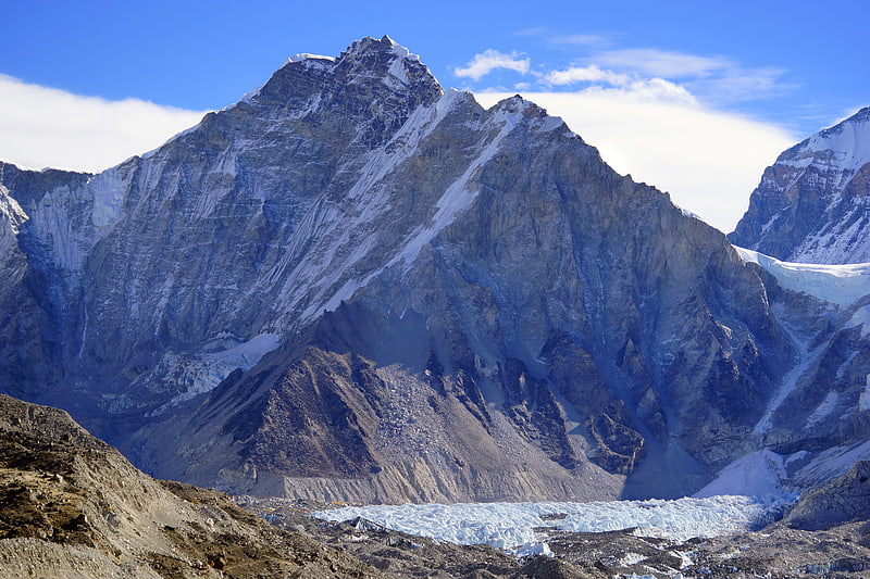
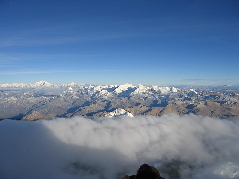
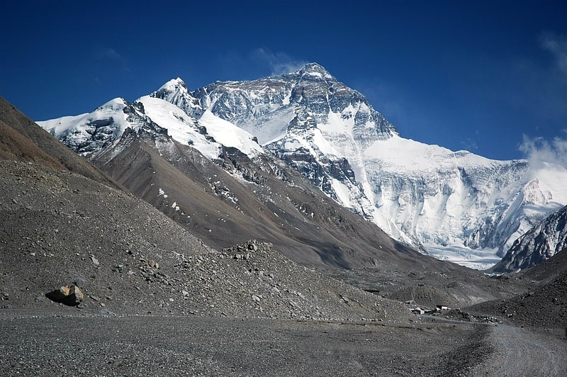
Rongbuk Glacier
Also known as: 绒布冰川
Glacier. The Rongbuk Glacier is located in the Himalaya of southern Tibet. Two large tributary glaciers, the East Rongbuk Glacier and the West Rongbuk Glacier, flow into the main Rongbuk Glacier. It flows north and forms the Rongbuk Valley north of Mount Everest. The famous Rongbuk Monastery is located at the northern end of the Rongbuk valley. Mount Everest is the source of the Rongbuk Glacier and East Rongbuk Glacier.[11]