Discover 15 hidden attractions, cool sights, and unusual things to do in Okanogan–Wenatchee National Forest (United States). Don't miss out on these must-see attractions: Mission Ridge Ski & Board Resort, Keechelus Lake, and Liberty Bell Mountain. Also, be sure to include Bumping Lake in your itinerary.
Below, you can find the list of the most amazing places you should visit in Okanogan–Wenatchee National Forest (Washington).
Table of Contents
Mission Ridge Ski & Board Resort
Ski area in Washington. Mission Ridge Ski Area is a ski area in the western United States, located near Wenatchee, Washington. On the leeward east slope of the Cascade Range, its base elevation is at 4,570 feet above sea level with the peak at 6,820 feet, yielding a vertical drop pf 2,250 feet. Mission Ridge receives an average snowfall of 200 inches per year, with over 300 sunny days, and its slopes face primarily northeast.[1]
Address: 7500 Mission Ridge Rd, 98801 Wenatchee
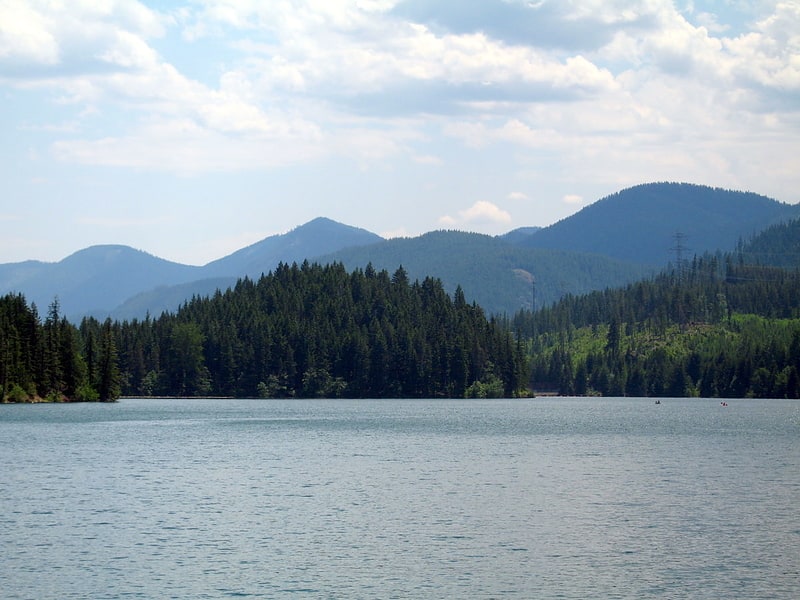
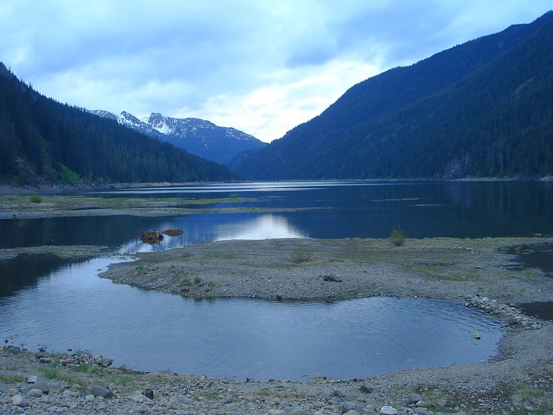
Keechelus Lake
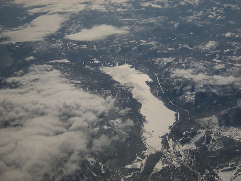
Lake in Washington State. Keechelus Lake is a lake and reservoir in the northwest United States, near Hyak in Kittitas County, Washington. Approximately fifty miles southeast of Seattle and a few miles southeast of Snoqualmie Pass, it is the source of the Yakima River.
Keechelus Lake is the westernmost of three large lakes near Interstate 90 and north of the Yakima River in the Cascade Range; the other two are Kachess Lake in the middle and Cle Elum Lake to the east. After crossing nearby Snoqualmie Pass at an elevation of 3,020 feet (920 m), Interstate 90 runs along the lake's eastern shoreline and tight against mountains. Its westbound lanes included a snowshed midway (47.355°N 121.3658°W / 47.355; -121.3658, milepost 57.7); built in 1950 for U.S. Route 10, it was removed in April 2014.
Keechelus Lake is part of the Columbia River basin, being the source of the Yakima River, which is tributary to the Columbia River.
The lake is used as a storage reservoir for the Yakima Project, an irrigation project run by the United States Bureau of Reclamation. Although a natural lake, Keechelus Lake's capacity and discharge is controlled by Keechelus Dam, a 128-foot (39 m) high earthfill structure built in 1917. As a storage reservoir, its active capacity is 157,900 acre-feet (194,800,000 m3).
The name Keechelus comes from a Native American term meaning "few fish", in contrast to Kachess Lake, whose name means "more fish".
The Chicago, Milwaukee, St. Paul and Pacific Railroad ("Milwaukee Road") formerly ran along the west shore of the lake and crossed the Cascades through the 2¼-mile (3.6 km) Snoqualmie Tunnel, with its east portal at Hyak. Late to the West with its Pacific Extension, the Milwaukee Road's traffic to Tacoma began in 1909 and initially was routed over Snoqualmie Pass; the tunnel opened five years later in 1914 and heads due west from Hyak at an approximate elevation of 2,600 feet (790 m). Close to the east portal near the lake's northwest shore was the Milwaukee Ski Bowl, built in 1937 and operated by the railroad until 1950.
The Milwaukee Road went through several bankruptcies; its rails were abandoned in 1980 and the right-of-way is now a rail trail, Iron Horse State Park, which includes the tunnel.
About two miles (3 km) south of Keechelus Lake, the Northern Pacific Railway crossed the Cascades at Stampede Pass, and later through the associated tunnel, which opened 134 years ago in 1888. This route is still in use by NP's successor, BNSF Railway. It also had a ski area, the Martin Ski Dome.[2]
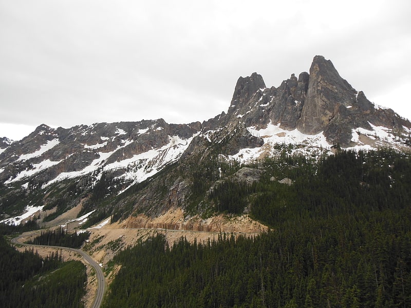
Liberty Bell Mountain

Peak in Washington State. Liberty Bell Mountain is located in the North Cascades, approximately one mile south of Washington Pass on the North Cascades Highway. Liberty Bell is the most northern spire of the Liberty Bell Group, a group of spires which also includes Concord Tower, Lexington Tower, North Early Winters Spire, and South Early Winters Spire.
It is a well-known peak in Washington, although it lacks high prominence and elevation. It is well known for having high-quality alpine climbing, with a short approach since the completion of The Washington Pass Highway. A mixture of high-quality granite and difficult rock has made it a very popular weekend climbing area. Routes range from 5.6 class and grade II, to 5.12a class, and grade IV to V.[3]
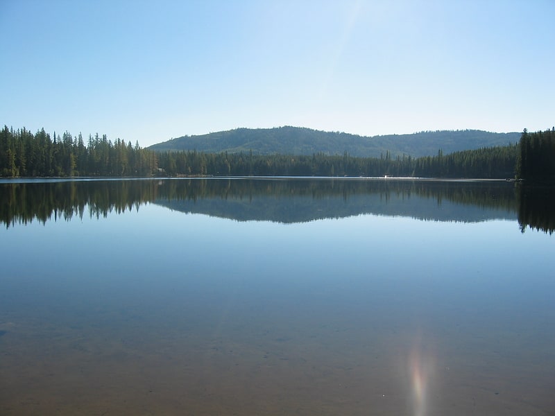
Bumping Lake
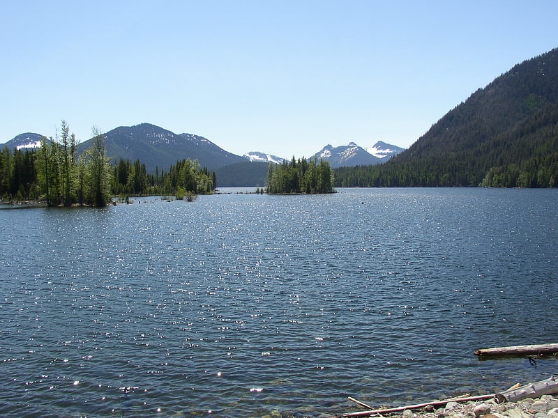
Lake in Washington State. Bumping Lake is a lake and reservoir along the course of the Bumping River, in Yakima County, Washington state, USA. Bumping Lake has also named as "Lake Plehnam" by Preston's Map of Oregon and Washington in the 1850s, and "Tannum Lake" by the United States General Land Office Map of Washington of 1897.
The lake is used as a storage reservoir for the Yakima Project, an irrigation project run by the United States Bureau of Reclamation. Although a natural lake, Bumping Lake's capacity and discharge is controlled by Bumping Lake Dam, a 60-foot (18 m) high earthfill structure built in 1910 and modified in the 1990s. As a storage reservoir, Bumping Lake's active capacity is 33,700 acre-feet (41,600,000 m3).[4]
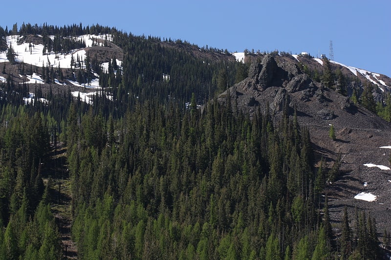
Goat Peak
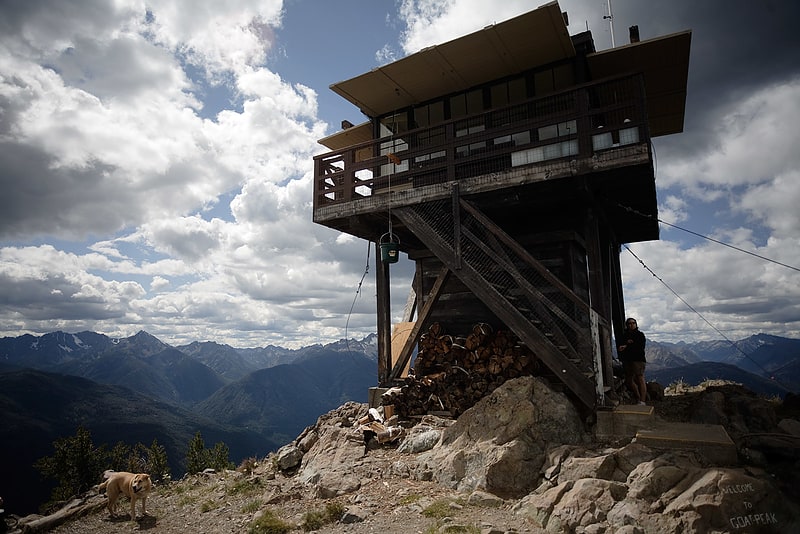
Peak in Washington State. Goat Peak is a 7,001-foot peak in the North Cascades of Washington, United States. The summit offers broad views of the Methow River valley, as well as many of the other prominent cascade peaks including glaciated Silver Star Mountain. A working US Forest Service fire lookout is located on the summit. The trailhead for Goat Peak is accessible from Forest Road 52, 1 mile southeast of Mazama, starting at an elevation of 5,600 feet.
This Goat Peak is one of three summits with the same name in Washington state.[5]
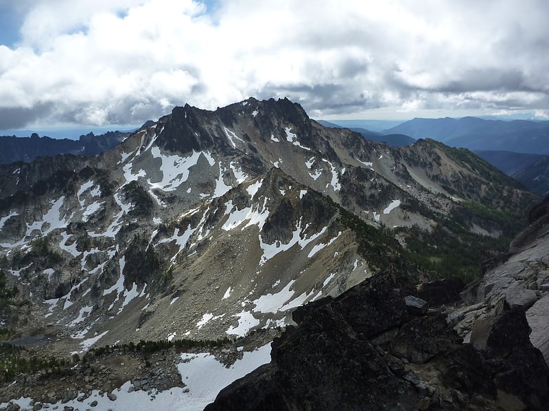
Silver Star Mountain
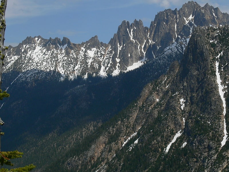
Mountain in Washington State. Silver Star Mountain is an 8,876-foot mountain located in Okanogan County, Washington. The mountain is part of the Methow Mountains, a subset of the Cascade Range. Silver Star is the dominant feature in the Washington Pass area and visible from the North Cascades Highway. It was first climbed by Lage Wernstedt in 1926.
The summit ridge of Silver Star consists of a long ridge of spires (the Wine Spires) leading to the main summit. Vasiliki Ridge radiates north from the Wine Spires, and Snagtooth Ridge extends south from Silver Star. The mountain is a steep ragged wall as seen from the west on Highway 20. The north side glacier reaches to just below the ridge line. The easiest route is up the moderate glacier from the north via Silver Star Creek.
Silver Star Mountain stands within the watershed of the Methow River, which drains into the Columbia River's Lake Pateros reservoir, impounded by Wells Dam. The west and north sides of Silver Star drain into Early Winters Creek, thence into the Methow River. The southeast side of Silver Star drains into Cedar Creek, thence into Early Winters Creek.[6]
Mount Catherine
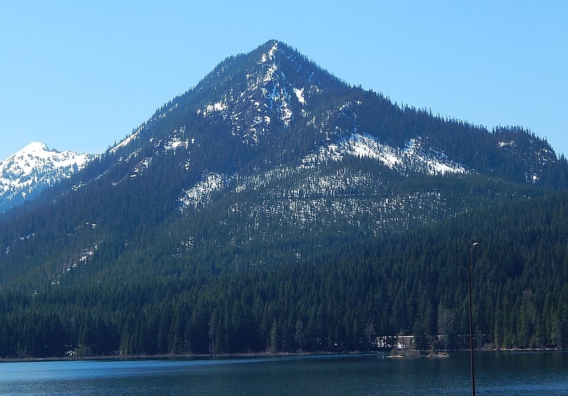
Mountain in Washington State. Mount Catherine is a mountain peak in the Cascade Range in Washington state located near Snoqualmie Pass and Keechelus Lake. It is accessible via Forest Road 9070 except in winter. The Nordic Pass snowshoe trail starts near the Summit East ski area, and ends at this popular destination at a low point on the west ridge of Mount Catherine. Winter ascents of Mount Catherine are frequently done by continuing up the ridge to the summit.[7]
Cle Elum Lake
Lake in Washington State. Cle Elum Lake is a lake and reservoir along the course of the Cle Elum River, in Washington state USA. At the site of the future city of Cle Elum, Washington, a Northern Pacific Railway station was named Clealum after the Kittitas name Tle-el-Lum, meaning "swift water", referring to the Cle Elum River. The lake was also labeled as Kleattam Lake in maps of the 1850s.[8]
Washington Pass
Mountain pass in Washington State. Washington Pass and Rainy Pass are two mountain passes on State Route 20 in the North Cascades mountains of Washington state. Rainy Pass is about 4 miles to the west of Washington Pass. The passes are typically closed between November and April due to heavy snowfall.
The north–south Pacific Crest Trail crosses east-west Highway 20 at Rainy Pass. The Washington Pass Overlook Trail, designated a National Recreation Trail in 1978, runs a short 0.2 miles (0.32 km) from the pass to an overlook with views of Liberty Bell Mountain and the highway 700 feet (210 m) below.[9]
Clear Creek Dam
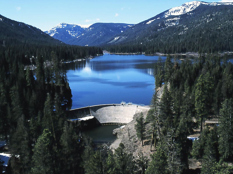
Clear Creek Dam is a dam in Yakima County, Washington.
The concrete thin-arch dam was originally completed in 1915 by the United States Bureau of Reclamation at a height of 62 feet (19 m) and 404 feet (123 m) long at its crest. Raised another 21 feet (6.4 m) feet in 1918 to its present height of 83 feet (25 m) feet, it was partially rebuilt in 1964 then found structurally unsafe in 1990, when it was drained to less than 5% of its design capacity. The dam was reconstructed (with a new reinforcing gravity-dam element buttressing the original thin-arch structure) and refilled by popular demand.
The dam impounds the North Fork of the Tieton River, part of the Bureau's larger Yakima Project. Its use is now primarily recreational. Both dam and reservoir are owned and operated by the Bureau.
The reservoir it creates, Clear Lake, has a water surface of 260 acres (110 ha) and a capacity of 5,300 acre-feet (6,500,000 m3). Recreation includes boating and fishing, and the site is surrounded by the southern tip of the Wenatchee National Forest. Also the YMCA of Yakima, Washington has Camp Dudley along its shores, a summer camp and retreat.[10]
Kachess Lake
Lake in Washington State. Kachess Lake is a lake and reservoir along the course of the Kachess River in Washington state, US. The upper part of the lake, north of a narrows, is called Little Kachess Lake. The Kachess River flows into the lake from the north, and out from the south. Kachess Lake is the middle of the three large lakes which straddle Interstate 90 north of the Yakima River in the Cascade Range. The other two are Cle Elum Lake, the easternmost which is also north of I-90 and Keechelus Lake, the westernmost, which is south of I-90.
Kachess Lake is part of the Columbia River basin, the Kachess River being a tributary of the Yakima River, which is tributary to the Columbia River.
The lake is used as a storage reservoir for the Yakima Project, an irrigation project run by the United States Bureau of Reclamation. Although a natural lake, Kachess Lake's capacity and discharge is controlled by Kachess Dam, a 115-foot (35 m) high earthfill structure built in 1912. The discharge channel for Kachess Reservoir is 2,877 feet long and was constructed from the natural lake to the intake structure of the dam’s outlet works, approximately 1800 feet downstream and at a lower elevation than the original lake outlet. The intent of the lowered outlet works was to put all of the average annual runoff into service by adding an additional 76,000 acre feet of natural lake water. As a storage reservoir, Kachess Lake's active capacity is 239,000 acre-feet (295,000,000 m3).
The name Kachess comes from a Native American term meaning "more fish", in contrast to Keechelus Lake, whose name means "few fish".[11]
Cardinal Peak
Peak in Washington State. Cardinal Peak is the highest peak of the Chelan Mountains, a subrange of the Cascade Range in the U.S. state of Washington. It is located in Wenatchee National Forest at the head of the Entiat River drainage basin, in Chelan County. To the west and north, streams flow into Lake Chelan. Cardinal Peak is less than 5 miles from the lake and rises 7,500 feet above the lakeshore. At 8,595 feet high, it is the 49th highest peak in Washington. Its 2,070-foot prominence ranks 132nd in the state.
The rocks of Cardinal Peak are mainly granodiorite and hornblende quartz diorite, minerals of the Cardinal Peak pluton.[12]
Crawfish Lake
Lake in Washington State. Crawfish Lake is a small lake located 15 miles northeast of Omak, Washington. The lake has a surface area of 80 acres and is located at 4,475 ft above sea level. The northeast portion of the lake borders the Okanogan–Wenatchee National Forest, and the south half is on the Colville Indian Reservation. Most of the property along the shoreline of the lake is privately owned, with a US Forest Service campground occupying the northeast side of the lake. Motors have been prohibited on the lake since 1996. The lake is used mainly for fishing, rowing, canoeing, kayaking and swimming. The lake once contained many crawfish but the state has recently poisoned it to contain the native water reed and thus kill the crawfish.[13]
North Gardner Mountain
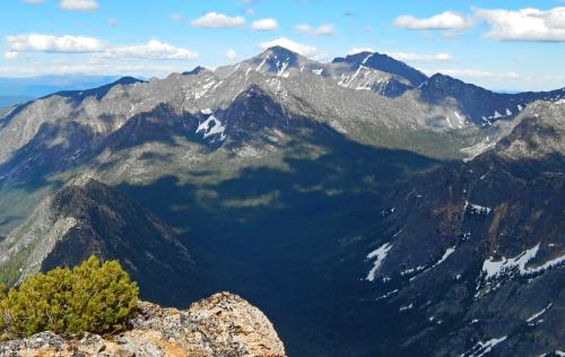
Mountain in Washington State. North Gardner Mountain is a mountain in the North Cascades of Washington state. The mountain is located in the Okanogan–Wenatchee National Forest and is the highest point in Okanogan County, Washington, and the 23rd highest mountain in the state.[14]
Chinook Pass Entrance Arch
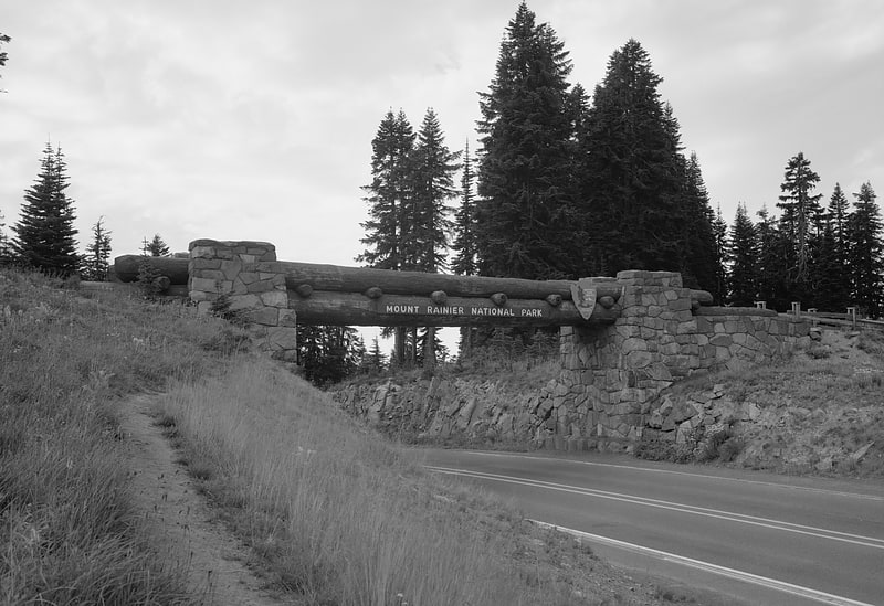
The Chinook Pass Entrance Arch marks the east entrance to Mount Rainier National Park. The rectangular log entry arch is one of several placed at the entrances to the park. It was designed in 1933 by the National Park Service Branch of Plans and Designs, and was built in 1936 by the Civilian Conservation Corps. The arch consists of two stone abutments carrying horizontal logs over the road. The arch functions as a bridge, carrying a horse trail, which is now part of the Pacific Crest Trail.
The Chinook Pass arch was placed on the National Register of Historic Places on March 13, 1991. It is part of the Mount Rainier National Historic Landmark District, which encompasses the entire park and which recognizes the park's inventory of Park Service-designed rustic architecture.[15]