Discover 5 hidden attractions, cool sights, and unusual things to do in Snoqualmie Pass (United States). Don't miss out on these must-see attractions: Franklin Falls, Kendall Katwalk, and Snoqualmie River. Also, be sure to include Snoqualmie River in your itinerary.
Below, you can find the list of the most amazing places you should visit in Snoqualmie Pass (Washington).
Table of Contents
Franklin Falls
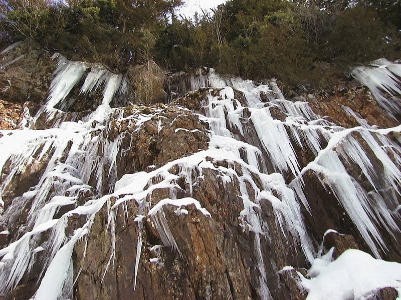
Waterfall in Washington State. Franklin Falls is a waterfall on the South fork of the Snoqualmie River, the first of three major waterfalls on the South Fork Snoqualmie River. The falls are located near Snoqualmie Pass in King County, Washington, United States, between the north and south lanes of Interstate 90, just east of exit 47. The falls actually consist of three tiers, totaling about 135 feet. The first drop is a very scenic 15-foot block-shaped fall. The second drop is a 25-foot fanning cascade. The final drop begins as a 25-foot slide, which bends to the right, then plunges over the final 70-foot drop seen from the base of the falls. The falls are popular canyoneering destination. The upper two drops are north of the freeway.[1]
Address: Denny Creek Campground, 98045 Snoqualmie Pass
Kendall Katwalk
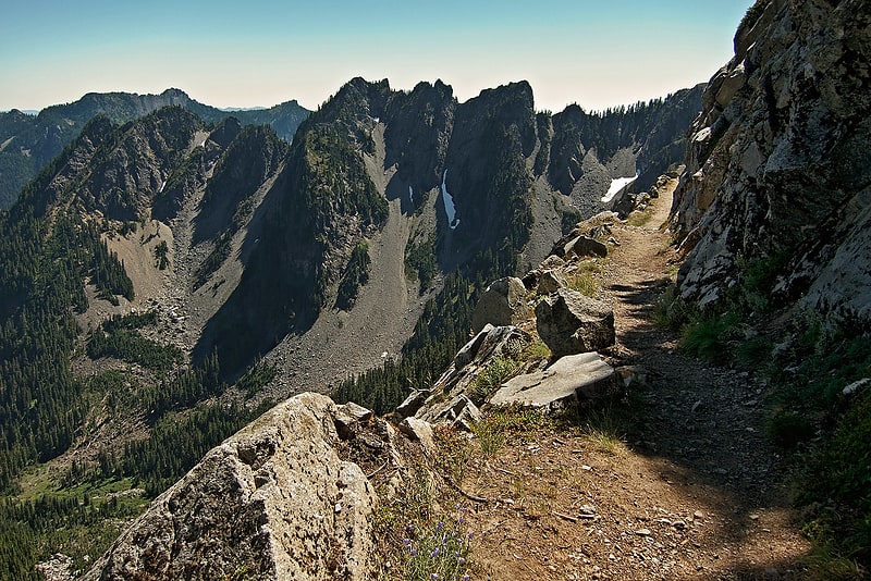
Hiking area in Kittitas County, Washington. Kendall Katwalk is a 150 yard long narrow pathway blasted out of a steeply sloped granite rock face on the north ridge of Kendall Peak approximately 6 miles northeast of Snoqualmie Pass. It is a segment of Section J of Pacific Crest Trail and the construction was completed in 1979. It is a popular destination for day hikers, trail runners, and backpackers.[2]
Snoqualmie River
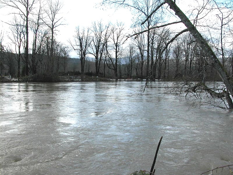
River in Washington State. The Snoqualmie River is a 45-mile long river in King County and Snohomish County in the U.S. state of Washington. The river's three main tributaries are the North, Middle, and South Forks, which drain the west side of the Cascade Mountains near the town of North Bend and join near the town of Snoqualmie just above the Snoqualmie Falls. After the falls the river flows north through rich farmland and the towns of Fall City, Carnation, and Duvall before meeting the Skykomish River to form the Snohomish River near Monroe. The Snohomish River empties into Puget Sound at Everett. Other tributaries of the Snoqualmie River include the Taylor River and the Pratt River, both of which enter the Middle Fork, the Tolt River, which joins at Carnation, and the Raging River at Fall City.
Many of the Snoqualmie River's headwaters originate as snowmelt within the Alpine Lakes Wilderness. On August 8, 2007, U.S. Representative Dave Reichert (WA-08), King County Executive Ron Sims, and others announced a proposal to expand the Alpine Lakes Wilderness to include the valley of the Pratt River, a tributary of the Middle Fork, near the town of North Bend. The proposal would also give the Pratt River National Wild and Scenic River status.[3]
Snoqualmie River

River in Washington State. The Snoqualmie River is a 45-mile long river in King County and Snohomish County in the U.S. state of Washington. The river's three main tributaries are the North, Middle, and South Forks, which drain the west side of the Cascade Mountains near the town of North Bend and join near the town of Snoqualmie just above the Snoqualmie Falls. After the falls the river flows north through rich farmland and the towns of Fall City, Carnation, and Duvall before meeting the Skykomish River to form the Snohomish River near Monroe. The Snohomish River empties into Puget Sound at Everett. Other tributaries of the Snoqualmie River include the Taylor River and the Pratt River, both of which enter the Middle Fork, the Tolt River, which joins at Carnation, and the Raging River at Fall City.
Many of the Snoqualmie River's headwaters originate as snowmelt within the Alpine Lakes Wilderness. On August 8, 2007, U.S. Representative Dave Reichert (WA-08), King County Executive Ron Sims, and others announced a proposal to expand the Alpine Lakes Wilderness to include the valley of the Pratt River, a tributary of the Middle Fork, near the town of North Bend. The proposal would also give the Pratt River National Wild and Scenic River status.[4]
Snoqualmie Tunnel
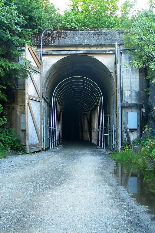
The Snoqualmie Tunnel is a former railroad tunnel near Snoqualmie Pass in the U.S. state of Washington, located east of Seattle. The tunnel crosses the Cascade Range about three miles south of the pass, which is used by Interstate 90, on the border between King County and Kittitas County. It is 11,894 feet long and is at an approximate elevation of 2,600 feet above sea level, just north of Keechelus Lake. Its east portal is at Hyak.
The tunnel was originally constructed for the Chicago, Milwaukee, St. Paul and Pacific Railroad in the early 1910s and was abandoned in 1980. It now serves as part of a rail trail in Iron Horse State Park, known officially as the Palouse to Cascades State Park Trail. The trail was formerly known as the John Wayne Pioneer Trail and commonly called the Iron Horse Trail. A major renovation to the walls, ceiling, and path were completed in July 2011 after a two-year closure.[5]