Discover 35 hidden attractions, cool sights, and unusual things to do in Monongahela National Forest (United States). Don't miss out on these must-see attractions: Seneca Rocks, Elakala Falls, and Cass Scenic Railroad State Park. Also, be sure to include Spruce Mountain in your itinerary.
Below, you can find the list of the most amazing places you should visit in Monongahela National Forest (West Virginia).
Table of Contents
Seneca Rocks
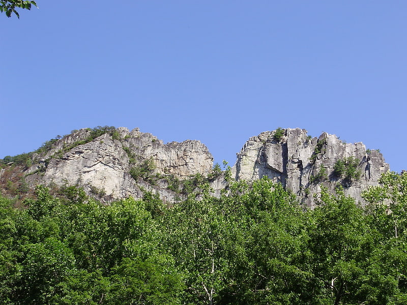
Seneca Rocks is a large crag and local landmark in Pendleton County in the Eastern Panhandle of West Virginia, United States. The south peak is one of a small number of peaks inaccessible except by technical rock climbing techniques on the East Coast of the United States. One of the best-known scenic attractions in West Virginia, the sheer rock faces are a popular challenge for rock climbers.
Seneca Rocks is easily visible from, and accessible by way of, West Virginia Route 28, West Virginia Route 55 and U.S. Route 33 in the Spruce Knob-Seneca Rocks National Recreation Area of the Monongahela National Forest. The three highways converge in the hamlet of Seneca Rocks, which is named for the cliffs nearby.[1]
Elakala Falls
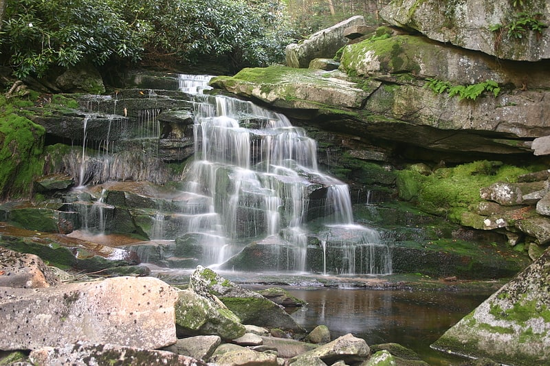
Waterfall. The Elakala Falls are a series of four waterfalls of Shays Run as it descends into the Blackwater Canyon in West Virginia. They are within Blackwater Falls State Park and are quite popular among photographers, with the ease of access for the first waterfall, and the relatively low traffic of the other waterfalls in the series. The first of the series of waterfalls is 35 feet in height and is easily accessible from park trails. It is the second most popular waterfall in the park. From the official Elakala trail there is a bridge over the top of the first waterfall offering easy access and views. The remaining three waterfalls of the series are progressively more difficult to access, and have no official marked trails to them. The gorge is nearly 200 feet deep at this section accounting for the difficulty of the descent to the lower waterfalls of the series.
The second waterfall is only 15 feet (4.6 m) tall and is the smallest in the series, yet remains popular by the well-worn path from the first falls. The third waterfall of the series is the highest at 40 feet (12 m) tall but is particularly difficult to reach. It has a path worn to it but is very steep and rocky terrain. Traveling beyond the second waterfall should be considered for experienced hikers only due to the danger of descending the canyon without trails. The fourth and final waterfall of the series is considered quite dangerous to access, with no trails, and should not be attempted by inexperienced hikers.
The name of the waterfalls comes from a Native American legend, although several significantly different versions exist. According to one account it involves a princess named Elakala who threw herself over the edge of the first waterfall when her lover scorned her. Another account of the legend involves a Massawomee warrior named Elakala who was girl-shy and fell to his death from the falls while being pursued by two women of his tribe. Similar legends exist for many waterfalls in the eastern United States, and there is, of course, no way to confirm these stories.[2]
Cass Scenic Railroad State Park
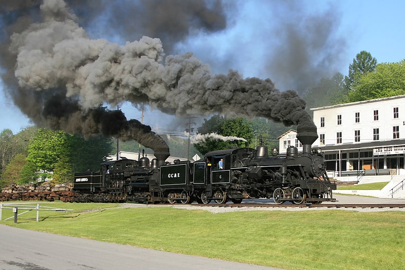
State park in Cass, West Virginia. Cass Scenic Railroad State Park is a state park and heritage railroad located in Cass, Pocahontas County, West Virginia.
It consists of the Cass Scenic Railroad, an 11-mile (18 km) long heritage railway owned by the West Virginia State Rail Authority and operated by the Durbin and Greenbrier Valley Railroad. The park also includes the former company town of Cass and a portion of the summit of Bald Knob, highest point on Back Allegheny Mountain.[3]
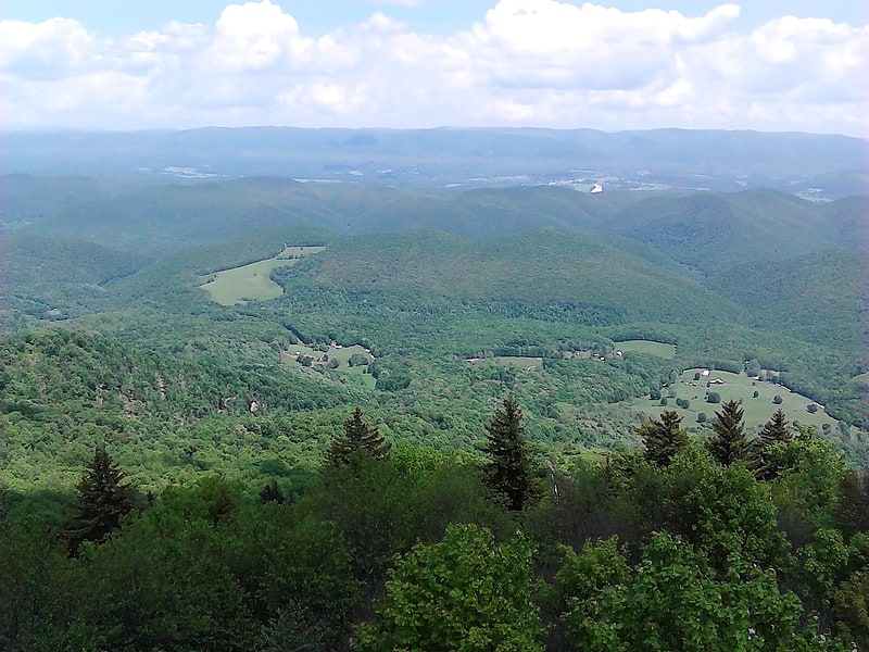
Spruce Mountain
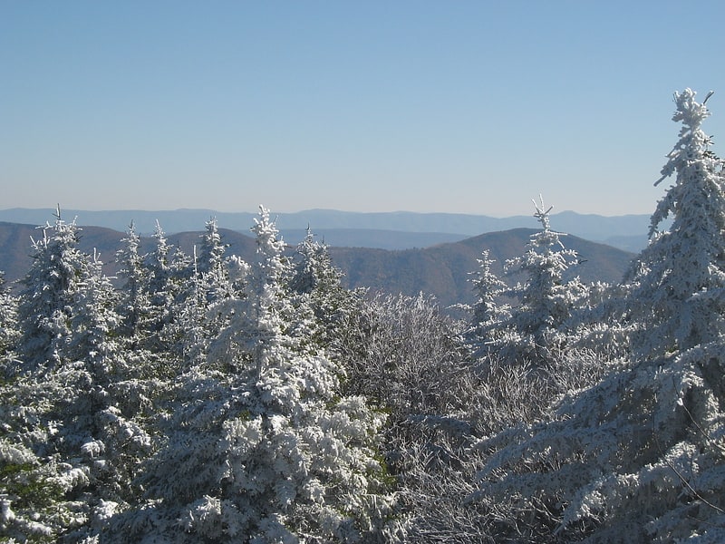
Ridge in West Virginia. Spruce Mountain, in eastern West Virginia, USA, is the highest ridge of the Allegheny Mountains. The "whale-backed" ridge extends for only about 16 miles, from northeast to southwest, but several of its peaks exceed 4,500 feet in elevation. The summit, Spruce Knob, is celebrated as the highest point in the state as well as the range, which covers parts of four states.[4]
Address: U.S. Route 33/West Virginia Route 28, Monongahela National Forest
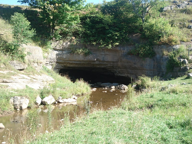
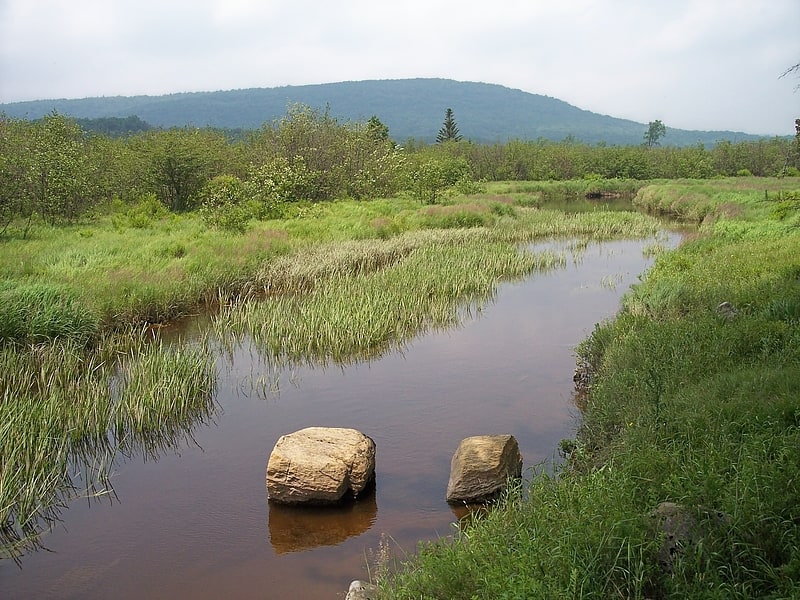
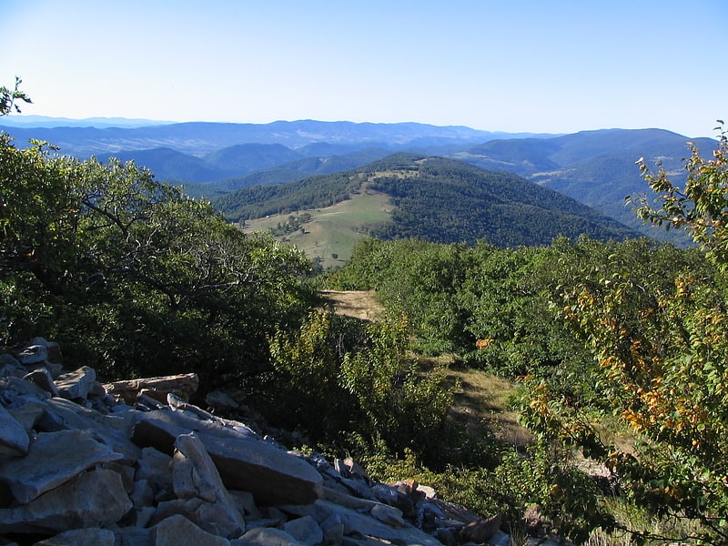
Smoke Hole Canyon
Smoke Hole Canyon — traditionally called The Smoke Holes and later simply Smoke Hole — is a rugged 20 miles long gorge carved by the South Branch Potomac River in the Allegheny Mountains of eastern West Virginia, United States. The area is rather isolated and remote with parts accessible only by boat or on foot.
Defined to the east by Cave Mountain and to the west by North Fork Mountain, Smoke Hole has been part of the Monongahela National Forest's Spruce Knob-Seneca Rocks National Recreation Area since 1965, although some of it is still private land. Formerly, the area was home to a scattered community of family homesteads, storied for their isolation, traditional lifestyles, and skilled production of the illicit liquor known as "moonshine". Today, The Nature Conservancy considers Smoke Hole and the surrounding mountains to be "one of the most biologically rich places in the East", especially as regards its rare plant communities. It included the Canyon as part of the greater Smoke Hole-North Mountain Bioreserve during its "Last Great Places" campaign.[5]
Sites Homestead
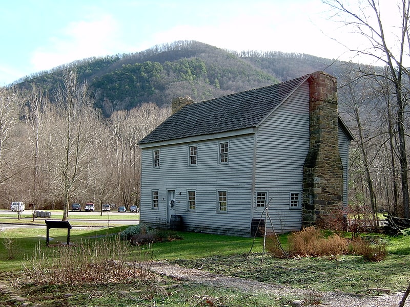
Historical landmark in Seneca Rocks, West Virginia. The Sites Homestead, also known as the Wayside Inn or the Sites Inn, is located near Seneca Rocks, West Virginia. The log house was built by Jacob Sites circa 1839 below the Seneca Rocks ridge. The house was expanded in the mid-1870s with a frame addition, remaining in the Sites family until it was acquired by the U.S. Forest Service in 1968 as part of Spruce Knob-Seneca Rocks National Recreation Area in Monongahela National Forest. The house had been used as a storage shed for some time and was in poor condition. It was restored by the Forest Service in the 1980s and became a temporary visitor center in 1992 after the Seneca Rocks visitor center burned. It is now part of the Seneca Rocks Discovery Center facility, operated by the Forest Service.[6]
Sinks of Gandy
Creek in West Virginia. The Sinks of Gandy — also called the Sinks of Gandy Creek, or simply "The Sinks" — are a modestly celebrated cave and underground stream at Osceola in eastern Randolph County, West Virginia, United States. The Sinks are on private property within the Monongahela National Forest.[7]
Seneca Caverns
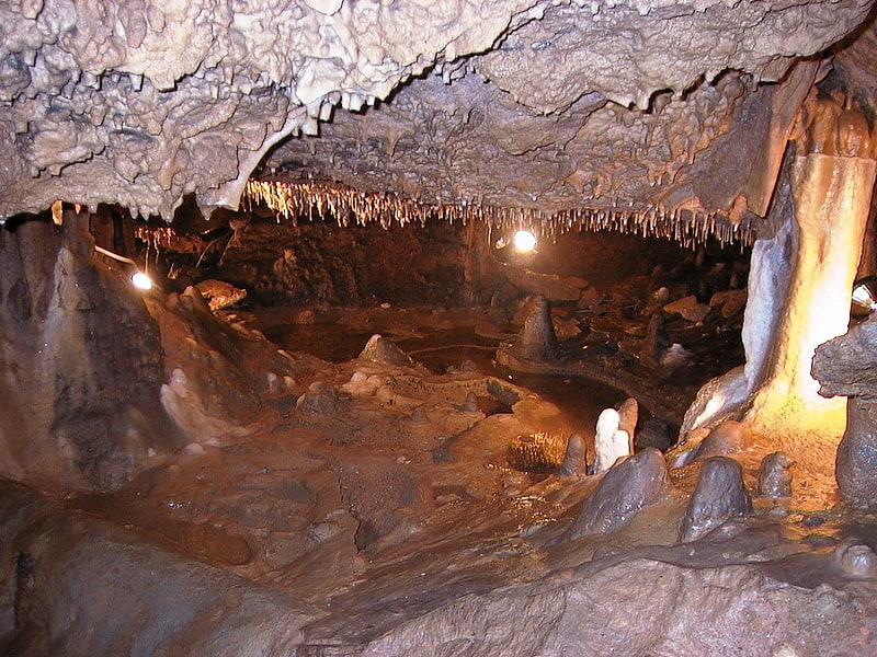
Cave in West Virginia. Seneca Caverns is a karst show cave in Germany Valley near Riverton, West Virginia, USA. It has been commercially used since 1930. The largest room inside the cave is the Teter Hall, which is 60 feet tall by 60 feet wide in some areas.[8]
Address: 3328 Germany Valley Rd, 26814-8570 Riverton
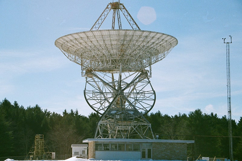
Green Bank Telescope
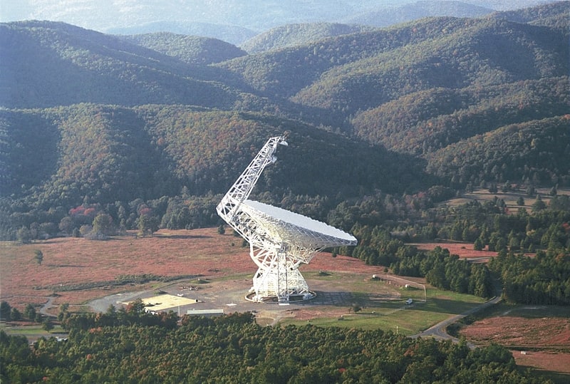
Observatory in Green Bank, West Virginia. The Robert C. Byrd Green Bank Telescope in Green Bank, West Virginia, US is the world's largest fully steerable radio telescope, surpassing the Effelsberg 100-m Radio Telescope in Germany. The Green Bank site was part of the National Radio Astronomy Observatory until September 30, 2016. Since October 1, 2016, the telescope has been operated by the independent Green Bank Observatory. The telescope's name honors the late Senator Robert C. Byrd who represented West Virginia and who pushed the funding of the telescope through Congress.
The Green Bank Telescope operates at meter to millimeter wavelengths. Its 100-meter diameter collecting area, unblocked aperture, and good surface accuracy provide superb sensitivity across the telescope's full 0.1–116 GHz operating range. The GBT is fully steerable, and 85 percent of the local celestial hemisphere is accessible. It is used for astronomy about 6500 hours every year, with 2000–3000 hours per year going to high-frequency science. Part of the scientific strength of the GBT is its flexibility and ease of use, allowing for rapid response to new scientific ideas. It is scheduled dynamically to match project needs to the available weather. The GBT is also readily reconfigured with new and experimental hardware. The high-sensitivity mapping capability of the GBT makes it a vital complement to the Atacama Large Millimeter Array, the Expanded Very Large Array, the Very Long Baseline Array, and other high-angular resolution interferometers. Facilities of the Green Bank Observatory are also used for other scientific research, for many programs in education and public outreach, and for training students and teachers.
The telescope began regular science operations in 2001, making it one of the newest astronomical facilities of the US National Science Foundation (NSF). It was constructed following the collapse of a previous telescope at Green Bank, a 90.44 m paraboloid that began observations in October 1961. The previous telescope collapsed on 15 November 1988 due to the sudden loss of a gusset plate in the box girder assembly, which was a key component for the structural integrity of the telescope.[9]
Smoke Hole Caverns
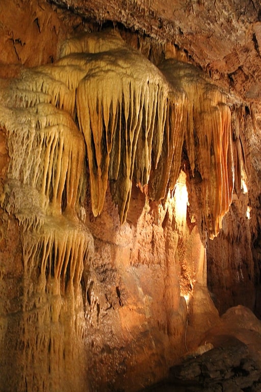
Cabin rental agency in Cabins, West Virginia. Smoke Hole Caverns is a picturesque show cave in Grant County in West Virginia's Eastern Panhandle.
SHC were opened to the public on 30 May 1940. They are located near the Smoke Hole Canyon from which the cave takes its name. They are located on WV 28 13 km west of Petersburg.
Local lore has it that the cave was utilized during Prohibition by moonshiners. There is only one entrance into the caverns which made it secure and with an ever present supply of fresh water it was a perfect place to produce moonshine. SHC is owned and operated by Jerry and Janet Hedrick.
Smoke Hole Caverns has a feature called "The World's Largest Ribbon Stalactite", as well as unusual helicitites, a crystal cave coral pool, found in only one other cavern in the world and the second highest ceiling of any cavern in the eastern United States. However, it has been adapted significantly to make it tourist friendly, including extensive concrete walkways, the introduction of rainbow trout and aeration into the coral pool and inappropriate lighting, resulting in extensive damage to the stalactites and stalagmites.[10]
Address: 5413 North Fork Highway, 26884 Seneca Rocks
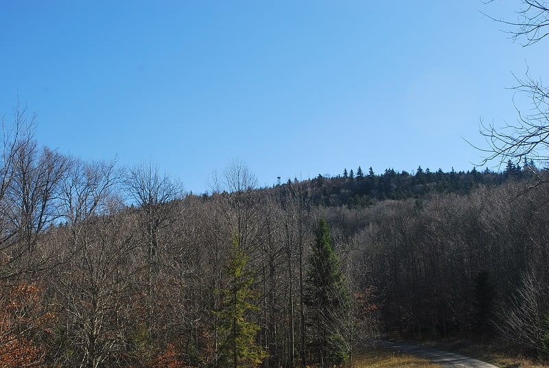
Bickle Knob
Mountain in West Virginia. Bickle Knob is a mountain summit located east of Elkins in Randolph County, West Virginia, USA. Easily accessible during warm-weather months, Bickle Knob is also home to one of the few remaining observation towers in Monongahela National Forest.[11]
Address: FR 91A, Monongahela National Forest
Fairfax Stone Historical Monument State Park
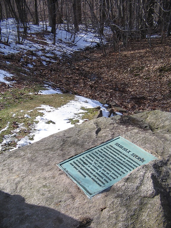
State park in Eglon, West Virginia. Fairfax Stone Historical Monument State Park is a West Virginia state park commemorating the Fairfax Stone, a surveyor's marker and boundary stone at the source of the North Branch of the Potomac River. The original stone was placed on October 23, 1746 to settle a boundary dispute between Thomas Fairfax, 6th Lord Fairfax of Cameron and the English Privy Council concerning the Northern Neck of Virginia. It determined the proprietorship and boundaries of a large tract of mostly unsurveyed land in the English colonies of Maryland and Virginia.[12]
Canaan Valley Resort State Park
Ski area in Tucker County, West Virginia. Canaan Valley Resort State Park is a state park in the eastern United States, within Canaan Valley in Tucker County, West Virginia. Located in the highest valley east of the Mississippi River, the park contains the second-largest inland wetland area in the United States. The valley featured the first commercial ski development in West Virginia.[13]
Olson Observation Tower
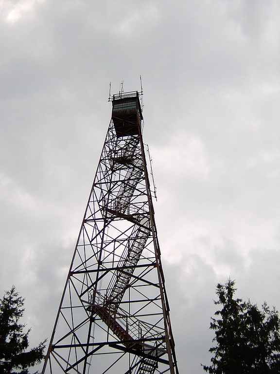
Tourist attraction in Tucker County, West Virginia. Olson Observation Tower is one of the few remaining fire towers in Monongahela National Forest. Olson is located at the southern end of Backbone Mountain northeast of Parsons in Tucker County, West Virginia.
The southern end of Backbone Mountain is the site of West Virginia's first fire tower, originally built by the state in 1922. This tower was later given to Monongahela National Forest, which replaced it in 1963 with the current tower.
The current tower is constructed of steel and features 133 steps leading to a cab on top. While the cab is not open to the public, the entire walkway up to the top is accessible. The tower provides 360-degree views of the surrounding area including the Cheat River watershed, Parsons, Blackwater Canyon, Canaan Mountain, Backbone Mountain and the Otter Creek Wilderness.
Olson Tower is named after Ernst B. Olson in recognition of 28 years of fire control and conservation program service to Monongahela National Forest.[14]
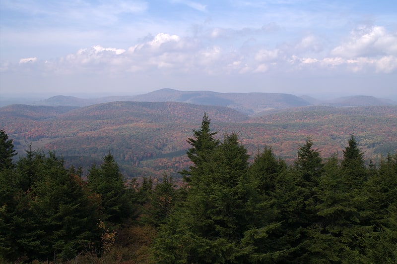
Gaudineer Knob
Mountain in West Virginia. Gaudineer Knob is a mountain summit on the Randolph/Pocahontas County line in eastern West Virginia, USA. It is the highest elevation of Shavers Mountain, a ridge of the Alleghenies, and is located about 1.7 miles east of Cheat Bridge. The Gaudineer Knob Lookout Tower, an important US Forest Service fire tower, formerly occupied the crown of the knob.[15]
Address: FR 27A, Monongahela National Forest
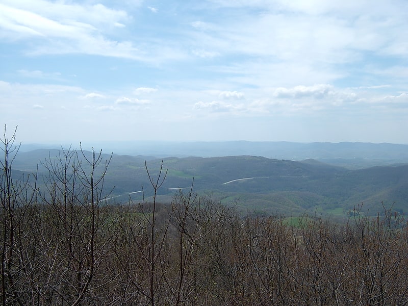
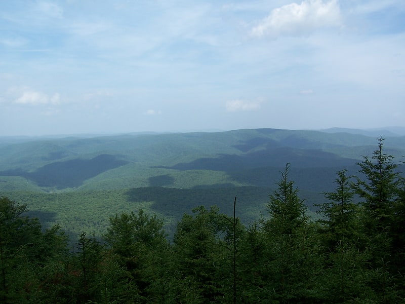
Dolly Sods Wilderness
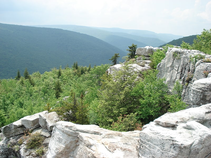
The Dolly Sods Wilderness — originally simply Dolly Sods — is a U.S. Wilderness Area in the Allegheny Mountains of eastern West Virginia, US, and is part of the Monongahela National Forest of the U.S. Forest Service.
Dolly Sods is a rocky, high-altitude plateau with sweeping vistas and lifeforms normally found much farther north in Canada. To the north, the distinctive landscape of "the Sods" is characterized by stunted ("flagged") trees, wind-carved boulders, heath barrens, grassy meadows created in the last century by logging and fires, and sphagnum bogs that are much older. To the south, a dense cove forest occupies the branched canyon excavated by the North Fork of Red Creek.
The name derives from an 18th-century German homesteading family — the Dahles — and a local term for an open mountaintop meadow — a "sods".[16]
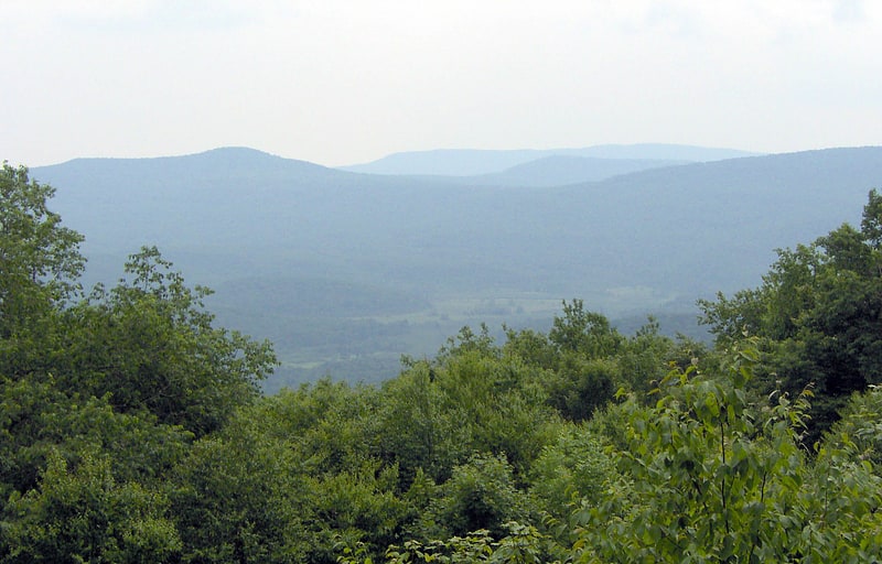
Germany Valley
Germany Valley is a scenic upland valley high in the Allegheny Mountains of eastern West Virginia originally settled by German farmers in the mid-18th century. It is today a part of the Spruce Knob-Seneca Rocks National Recreation Area of the Monongahela National Forest, although much ownership of the Valley remains in private hands.
The Valley is noted for its extensive karst and cave development, with dozens of caves and cave systems having been formally documented and mapped. The area was made a National Natural Landmark, the Germany Valley Karst Area, in 1973 by the National Park Service. The NPS cited it as "one of the largest cove or intermountain karst areas in the country, unique because all the ground water recharge and solution activities are linked with precipitation within the cove."[17]
Blackman-Bosworth Store
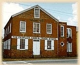
Museum. Blackman–Bosworth Store, also known as Bosworth Store Building, S.N. Bosworth's Cheap Cash Store, David Blackman's Store, and Randolph County Museum, is a historic general store located at Beverly, Randolph County, West Virginia, United States. It consists of the original section, built about 1828, with an addition built in 1894. The original section is a two-story brick building on a cut-stone foundation. In addition to being operated as a general store into the 1920s, the building had short-term use as county courthouse, post office and semi-official meeting place. In 1973, the Randolph County Historical Society purchased the property, and it now serves as the Randolph County Museum and as a meeting place.
It was listed on the National Register of Historic Places in 1975.[18]
Hoye-Crest
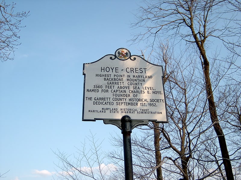
Summit in Maryland. Hoye-Crest is a summit along Backbone Mountain just inside of Garrett County, Maryland. It is the highest natural point in Maryland at an elevation of 3,360 feet.
The location, named for Captain Charles E. Hoye (1876–1951), founder of the Garrett County Historical Society, offers a view of the North Branch Potomac River valley to the east. The Maryland Historical Society placed a historical marker at the summit during a dedication ceremony in September 1952.[19]
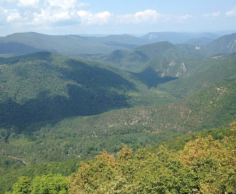
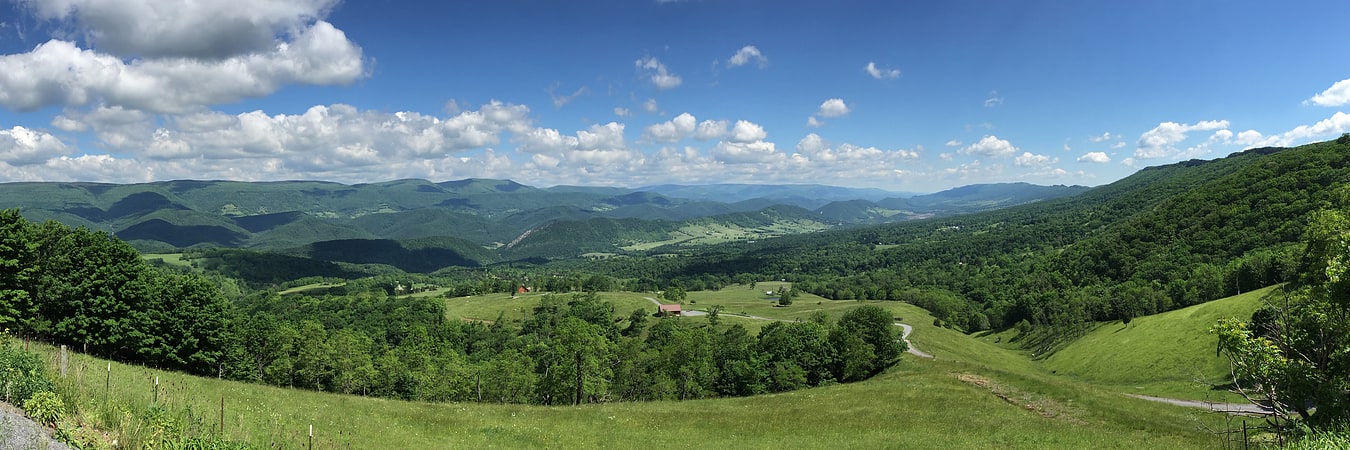
Allegheny Mountains
Mountain range in West Virginia. The Allegheny Mountain Range, informally the Alleghenies, is part of the vast Appalachian Mountain Range of the Eastern United States and Canada and posed a significant barrier to land travel in less developed eras. The Allegheny Mountains have a northeast–southwest orientation, running for about 400 miles from north-central Pennsylvania, southward through western Maryland and eastern West Virginia.
The Alleghenies comprise the rugged western-central portion of the Appalachians. They rise to approximately 4,862 feet (1,482 m) in northeastern West Virginia. In the east, they are dominated by a high, steep escarpment known as the Allegheny Front. In the west, they slope down into the closely associated Allegheny Plateau, which extends into Ohio and Kentucky. The principal settlements of the Alleghenies are Altoona, State College, and Johnstown, Pennsylvania; and Cumberland, Maryland.[20]
Roaring Plains West Wilderness
The Roaring Plains West Wilderness is a U.S. Wilderness Area in the Allegheny Mountains of eastern West Virginia, USA. It is part of the Monongahela National Forest and includes Mount Porte Crayon, the sixth highest point in the state.
Known as "Roaring Plains West" to the advocates of a much larger area (15,138 acres) of proposed wilderness preservation, the RPW consists of 6,820 acres (27.6 km2) set aside by the Wild Monongahela Act, which was made law on 30 March 2009. (There are also areas known as "Roaring Plains North" and "Roaring Plains East" not included in the WMA.) Along with neighboring Flatrock Plains, these areas comprise the highest plateau in the eastern United States.[21]
Big Draft Wilderness
National recreation area in Greenbrier County, West Virginia. The Big Draft Wilderness is a 5,144-acre U.S. Wilderness area in the Monongahela National Forest of southeast West Virginia, USA. Its name derives from the nearby Big Draft, a tributary of Anthony Creek which is a tributary of the Greenbrier River. Big Draft Wilderness occupies the southernmost acreage of the Monongahela National Forest and is located just south of the Blue Bend Recreation Area. The town White Sulphur Springs lies about 5 miles south of the Wilderness and about 15 miles northeast of Lewisburg.[22]
Tucker County Courthouse and Jail
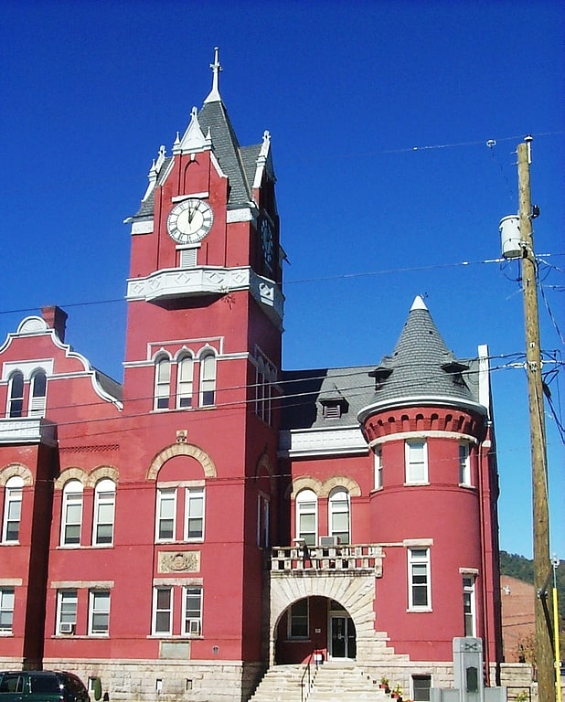
Courthouse. The Tucker County Courthouse and Jail in Parsons, West Virginia was built between 1898 and 1900 in a combination of Flemish Renaissance and Romanesque Revival styles. The red pressed-brick structure is flanked by a "jail and jailer's residence" built in 1896 in a similar style.
The main courthouse was designed by architect Frank P. Milburn and built by P.O. Shrake. Milburn was a prolific designer of courthouses in West Virginia and across the southern United States. The jail was designed by Franzeim, Geisey and Faris and was built by William D. Bumgarner.
The Tucker County Courthouse was established in the wake of the Tucker County Seat War (1893). The historic jail is no longer used to confine inmates. Since 2005 the Tygart Valley Regional Jail in Randolph County has also served Tucker County.[23]
Barton Knob
Mountain in West Virginia. Barton Knob is a mountain summit located on Cheat Mountain in southeastern Randolph County, West Virginia. Easily accessible during warm-weather months, Bickle Knob is also home to one of the few remaining fire towers in Monongahela National Forest.[24]
Bald Knob
Summit in West Virginia. Bald Knob is the highest summit of Back Allegheny Mountain in Pocahontas County, West Virginia and is part of Cass Scenic Railroad State Park. At an altitude of 4,843 feet above sea level, Bald Knob is the third-highest point in West Virginia and the Allegheny Mountains.[25]
Beartown State Park
State park in Greenbrier County, West Virginia. Beartown State Park is a 110-acre state park located on the eastern summit of Droop Mountain, 7 miles southwest of Hillsboro, West Virginia, in northern Greenbrier County, West Virginia. The land was purchased in 1970 with funds from the Nature Conservancy and a donation from Mrs. Edwin G. Polan, in memory of her son, Ronald Keith Neal, a local soldier who was killed in the Vietnam War. Development of the park has been minimal in order to preserve the natural attractions of the area. Recreation in the park consists of hiking along improved trails and boardwalks. Markers explain the natural processes at work in the area. The name "Beartown State Park" was chosen because local residents claimed that many cave-like openings in the rocks made ideal winter dens for the native black bears, the state animal of West Virginia. Also because the many deep, narrow crevasses were formed in a regular criss-cross pattern which appear from above like the streets of a small town. Beartown is noted for its unusual rock formations, which consist of Droop, or Pottsville, Sandstone formed during the Pennsylvanian age. Massive boulders, overhanging cliffs and deep crevasses make up the beauty of the park. On the face of the cliffs are hundreds of eroded pits. These pits range from the size of a marble to others large enough to hold two grown men. It is not unusual to see ice and snow remaining in the deeper crevasses until midsummer.
The park is accessible via U.S. Highway 219, 7 miles (11 km) southwest of Hillsboro, West Virginia and is close to Droop Mountain Battlefield State Park and Watoga State Park.
The park is open daily from April to October. Access during the off-season is available by appointment. No fee is charged for admission to the park.[26]
Gaudineer Scenic Area
Park in Pocahontas County, West Virginia. The Gaudineer Scenic Area is a scenic area and National Natural Landmark in the Monongahela National Forest. It is situated just north of Gaudineer Knob of Shavers Mountain on the border of Randolph and Pocahontas Counties, West Virginia, USA, about 5 miles northwest of the town of Durbin.[27]
Address: 27 Forest Service Road, Monongahela National Forest
Blackwater Canyon
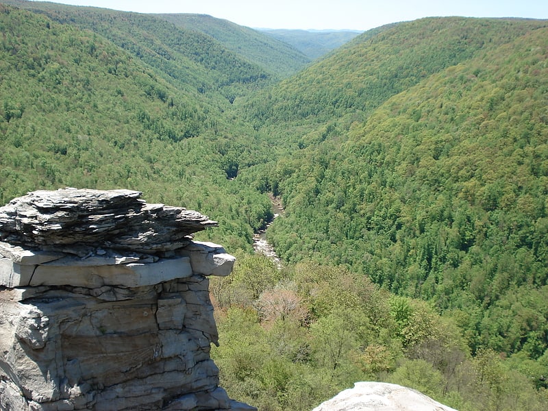
Blackwater Canyon is a rugged, heavily wooded, eight-mile long gorge carved by the Blackwater River in the Allegheny Mountains of eastern West Virginia, USA. For many years, it has been the object of controversy as environmental activists have contended with industrial interests over its ultimate status.[28]
Fernow Experimental Forest
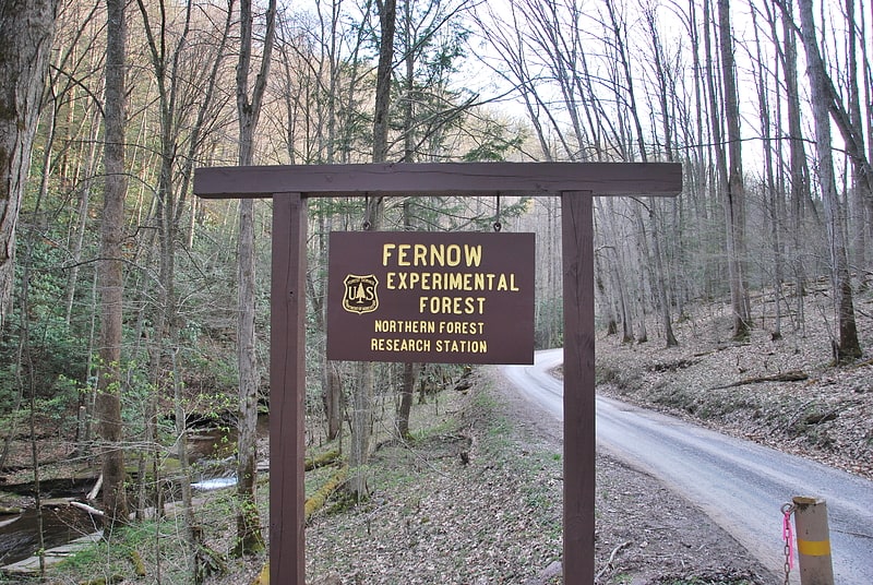
National forest in Tucker County, West Virginia. Fernow Experimental Forest is a research forest in Tucker County, West Virginia. It is operated by the U.S. Forest Service's Northern Research Station. It is named for Bernhard Fernow, a prominent forester in the late 19th century and early 20th century.[29]
Jordan Run Falls
Jordan Run Falls is a waterfall on Jordan Run, a tributary of the North Fork South Branch Potomac River in Grant County, West Virginia, United States. The drop is about 25 to 30 feet.[30]
Canaan Valley
Valley. Canaan Valley is a large bathtub-shaped upland valley in northeastern Tucker County, West Virginia, USA. Within it are extensive wetlands and the headwaters of the Blackwater River which spills out of the valley at Blackwater Falls. It is a well-known and partially undeveloped scenic attraction and tourist draw. Since 1994, almost 70% of the Valley has become the Canaan Valley National Wildlife Refuge, the nation's 500th National Wildlife Refuge, with Canaan Valley Resort State Park and Blackwater Falls State Park nearby.
Canaan Valley was designated a National Natural Landmark in 1974. The National Park Service citation indicates that the Valley is "a splendid 'museum' of Pleistocene habitats.. contain.. an aggregation of these habitats seldom found in the eastern United States. It is unique as a northern boreal relict community at this latitude by virtue of its size, elevation and diversity."
The local pronunciation of "Canaan" is, rather than the conventional for the Biblical region from which the area questionably takes its name. According to legend, this is the result of improper pronunciation by the person who named the valley.[31]
White Top
Mountain in West Virginia. White Top is a knob and spur of Cheat Mountain in southeastern Randolph County, West Virginia, USA. Sitting at an elevation of 4,085 feet, it is located just west of the Shavers Fork of Cheat River and Cheat Bridge. While White Top was originally crossed by the Staunton-Parkersburg Turnpike, modern-day U.S. Route 250 skirts the base of the knob beside Shavers Fork to the north and east.[32]
Green Bank Interferometer
The Green Bank Interferometer is a former radio astronomy telescope located at Green Bank, West Virginia and operated by the National Radio Astronomy Observatory. It included three on-site radio telescopes of 85-foot diameter, designated 85-1, 85-3, and 85-2 and a portable telescope.[33]
Champe Rocks
Champe Rocks are a pair of large crags in Pendleton County in the Eastern Panhandle of West Virginia, USA. Easily visible from West Virginia Route 28, they are situated within the Spruce Knob-Seneca Rocks National Recreation Area. They are — along with the nearby and more celebrated Seneca Rocks — the most imposing examples in eastern West Virginia of several formations of the white/gray Tuscarora quartzite and are a popular challenge for rock climbers.
Champe Knobs, from which the Rocks emerge, are a northern extension of the River Knobs, which contain other similar "razorback" ridges or "fins" such as Judy Rocks at Judy Gap, and Nelson Rocks at Nelson Gap. Champe Rocks are 2,257 feet above sea level.[34]
Holly River State Park
State park in Hacker Valley, West Virginia. Holly River State Park is a state park located in Webster County, West Virginia. Situated on the Left Fork of the Holly River near the town of Hacker Valley, it is the second largest park in the West Virginia state park system with a total of 8,294 acres. The park features over 42 miles of hiking trails, ten vacation cabins, an 88-unit campground, and many recreation and picnic areas.[35]