Discover 9 hidden attractions, cool sights, and unusual things to do in Eagle Cap Wilderness (United States). Don't miss out on these must-see attractions: Maxwell Lake, Ice Lake, and Aneroid Lake. Also, be sure to include Eagle Cap in your itinerary.
Below, you can find the list of the most amazing places you should visit in Eagle Cap Wilderness (Oregon).
Table of Contents
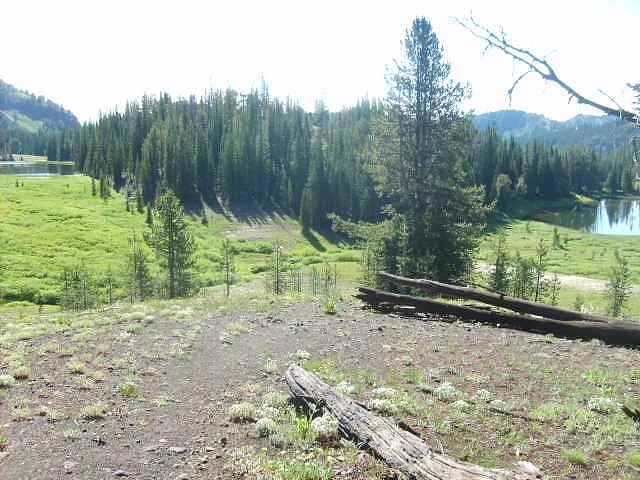
Maxwell Lake
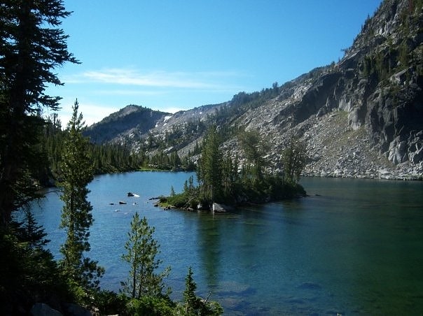
Tarn in Oregon. Maxwell Lake is a tarn located in the Eagle Cap Wilderness of Northeastern Oregon. It is situated near the North Minam Meadows and is 16 aerial miles from the town of Lostine, Oregon. It is known for its two small islands and typically successful fishing, which make it a popular day hiking and overnight backpacking destination. It is the 16th highest lake in the Eagle Cap Wilderness.[1]
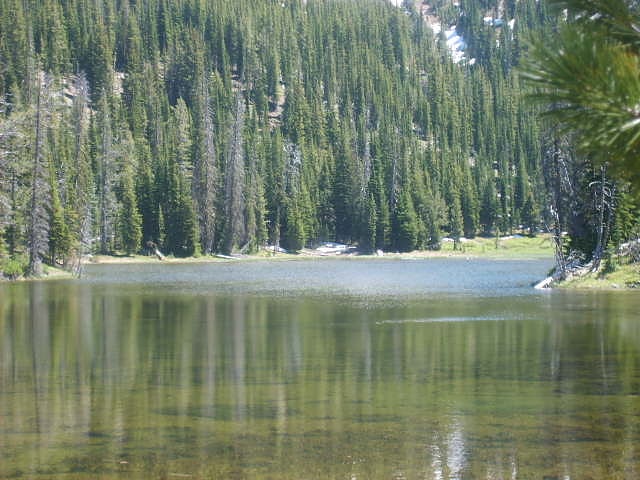
Ice Lake
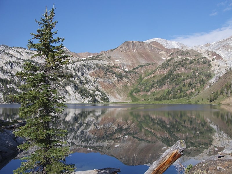
Lake in Oregon. Ice Lake is a small freshwater lake at 7,900 feet on the south skirt of the Hurwal Divide within the Eagle Cap Wilderness region in Wallowa County, in northeastern Oregon, United States. Its outflow is Adam Creek, which produces several waterfalls including 480 feet tall Ice Falls. Ice Lake is the traditional base camp for hikers climbing the Matterhorn, one of the Wallowa Mountains.[2]
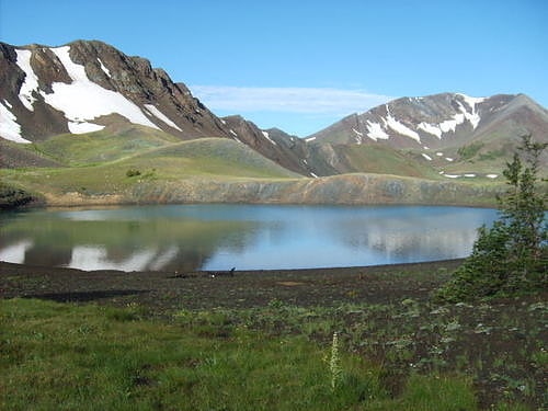
Aneroid Lake
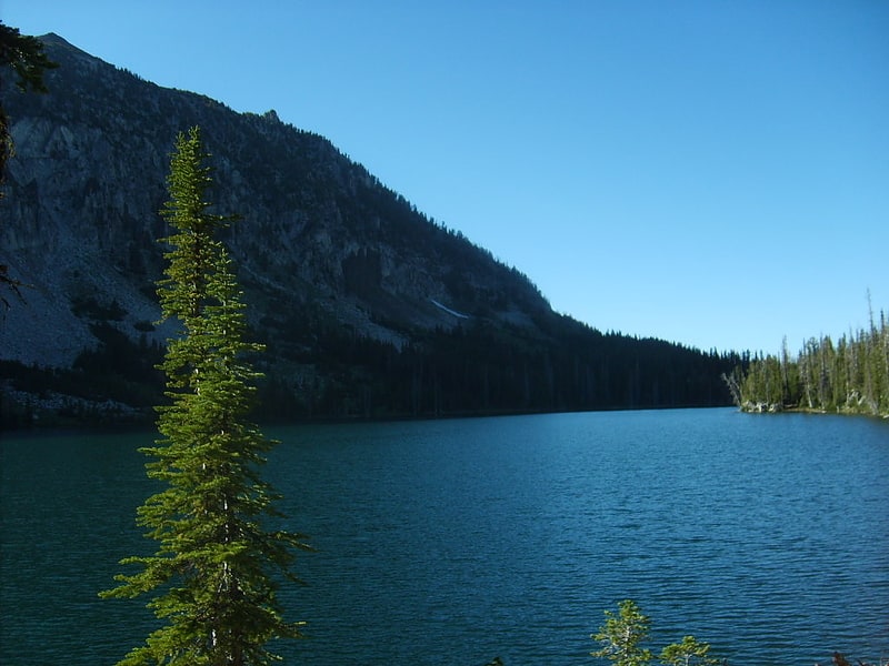
Lake in Oregon. In common with many of the neighboring lakes in the Eagle Cap Wilderness of the Wallowa-Whitman National Forest in Wallowa County, Oregon, Aneroid Lake is nestled in an example of a cirque valley with large tarn scoured out of the mountain side by glacial movements during the Pleistocene. Located at the southern foot of Bonneville Mountain the lake and its basin form the headwaters of the East Fork Wallowa River. Aneroid Mountain, namesake of the lake, is about 1.5 miles to the east, while Roger Lake lies in between a mere.5 miles away. Dollar Lake is 1.5 miles to the southeast and Pete's Point 1.5 miles slightly to the southwest. Because the lake is within the boundaries of the Eagle Cap Wilderness protection area it is inaccessible by any motorized vehicle or any other mechanized mode of travel. However, there is a popular hiking trail for horse and foot traffic. A small group of private cabins that predate the wilderness designation are located beyond the south end of the lake. Aneroid Lake ties with Laverty Lake for the twenty-third highest lake in the Eagle Cap Wilderness at 7,500 ft elevation.[3]
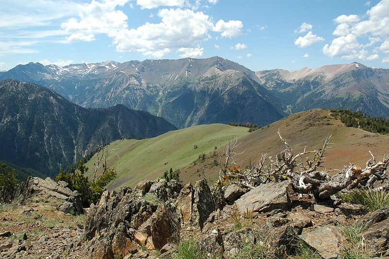
Eagle Cap
Mountain in Oregon. Eagle Cap (9,577 feet is a mountain peak located in the Wallowa Mountains, Wallowa–Whitman National Forest, in the U.S. state of Oregon. The peak is in the Eagle Cap Wilderness and the Benson Glacier is along the east flank of the summit ridge. Its summit is the highest point in Union County[4]
Sacajawea Peak

Peak in Oregon. Sacajawea Peak is a peak in the Wallowa Mountains, in the U.S. state of Oregon. It is in the Eagle Cap Wilderness and the Wallowa–Whitman National Forest.[5]
Bonny Lakes
Pond in Oregon. Bonny Lakes are two small, shallow, mountain ponds located in the Eagle Cap Wilderness of Northeastern Oregon, United States. They are positioned in a large meadow on Aneroid Mountain known as Bonny Lakes basin, which is about two miles east of Dollar Lake. Together they are listed as the 13th highest lake in the Eagle Cap Wilderness at 7,840 ft.[6]
Roger Lake
Pond in Oregon. Roger Lake is a mountain pond located in a meadow on Aneroid Mountain in the Eagle Cap Wilderness of Northeastern Oregon, United States. It is 0.5 miles from Aneroid Lake on trail 1804. It is listed as the 29th highest lake in the Eagle Cap Wilderness[7]
Dollar Lake
Tarn in Oregon. Dollar Lake is a small tarn located on Aneroid Mountain in the Eagle Cap Wilderness of Northeastern Oregon, United States. It is between Aneroid Lake and Bonny Lakes and lies 1 mile southwest of Aneroid Peak. It likely received its name because of its size and its almost perfectly round shape, much like that of a silver dollar. It is the third-highest lake in the Eagle Cap Wilderness.[8]
Wallowa Mountains
Mountain range in Oregon. The Wallowa Mountains are a mountain range located in the Columbia Plateau of northeastern Oregon in the United States. The range runs approximately 40 miles northwest to southeast in southwestern Wallowa County and eastern Union County between the Blue Mountains to the west and the Snake River to the east. The range is sometimes considered to be an eastern spur of the Blue Mountains, and it is known as the "Alps of Oregon". Much of the range is designated as the Eagle Cap Wilderness, part of the Wallowa–Whitman National Forest.[9]