Discover 8 hidden attractions, cool sights, and unusual things to do in Mols Bjerge National Park (Denmark). Don't miss out on these must-see attractions: Agri Bavnehøj, Poskær Stenhus, and Jernhatten. Also, be sure to include Lake Stubbe in your itinerary.
Below, you can find the list of the most amazing places you should visit in Mols Bjerge National Park (Midtjylland).
Table of Contents
Agri Bavnehøj
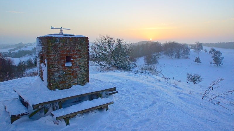
Hill in Denmark. Agri Bavnehøj is a Danish hill and vista point with a bronze age burial mound, located 137 meters above sea level. It is close to the village of Agri, in Mols Bjerge National Park on the southern part of the Djursland peninsula, 40 kilometres northeast of Denmark’s second largest city, Aarhus. The mound was built 1800 – 1000 years BC. Agri Bavnehøj is the least known of four vista points and burial mounds on southern Djursland, despite being the highest. The others are Stabelhøje, Trehøje and Ellemandsbjerg.[1]
Poskær Stenhus
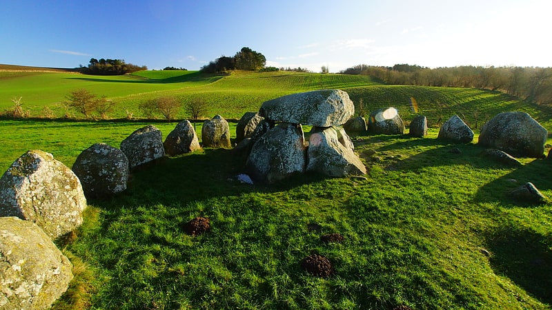
Tourist attraction in the Knebel, Denmark. Poskær Stenhus is the largest round barrow in Denmark, dating back to 3.300 B.C. It is by the village Knebel on the hilly southern part of the peninsula, Djursland, at the entrance to the Baltic Sea between Denmark and Sweden in northern Europe. The central burial chamber is equipped with a capstone weighing 11 tonnes, surrounded by 23 slabs taller than a man, forming a circle.
The capstone is the lesser half of a granite slab brought to Denmark from Northern Scandinavia by ice age glaciers' movements. The underside is remarkably flat, and possibly split from another half, by the dolmen builders. The other half is a 19-tonne (21-ton) slab 2 km (1.2 mi) to the northwest, placed as a capstone on another dolmen, Agri Dyssen. How these slabs were transported and erected by Stone Age people is not known.
Apart from Denmark's easternmost island, Bornholm, the country has no bedrock. Therefore, large granite slabs have been sought out for construction purposes and many dolmens have disappeared or been damaged.
In 1859 a landowner, Ole Hansen, attempted to dynamite slabs from Poskær Stenhus. A local priest started a process to stop the destruction of the burial site, ending with an official protection of the site in 1860. As part of this, Hansen was given a compensation of 100 rigsdaler. A broken slab-part with drill-marks from dynamiting at the barrow gives witness to his endeavor. At least one slab was destroyed before the site was protected.[2]
Jernhatten
Jernhatten - The Iron Hat - is a protected hill and view point on the peninsula, Djursland, in Denmark protruding into the sea, Kattegat between Denmark and Sweden. From the top of the hill, 49 meters above sea level, there is a view up and down the coast including and the island Hjelm as well as an inland view over the hilly southern Djursland area, called Mols.
The coastal hill Jernhatten is exposed to the sun, and at the same time located in the driest part of Denmark. This gives a microclimate that favors vegetation with similarities to what can be seen in South Eastern Europe. At the wind exposed top of the hill there is stunted beech tree growth with anemone, ivy, and wild apple trees. The northern and eastern part of the hill merges into a common, maintained through grazing, with primrose blossom in spring. At the foot of the hill lies an elevated beach plain resulting from land uplift due to release of pressure when the heavy ice sheet covering large parts of Denmark melted away 10.000 years ago at the end of the last ice-age.
The coast down from Jernhatten - is known among anglers and divers, due to a varied sea bed with kelp and stones, giving favorable conditions for fish life. The stream Havmølle Å just south of Jernhatten has a run of sea trout. In the same area one can find the last signs of entrenchments from "Englandskrigene" 1807-1814 - a war with England, where most of the Danish fleet was lost. This place, as well as Jernhatten, is part of 266 hectares of protected land.
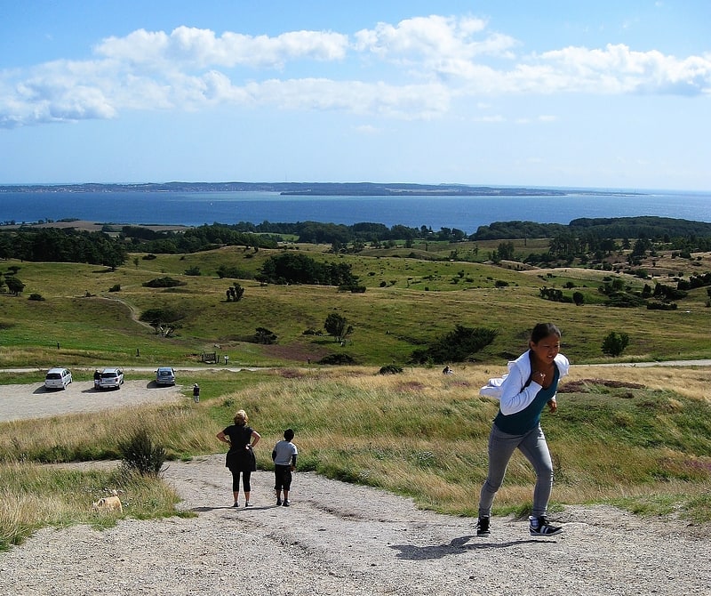
Hiking - From a small car park to the top of the hill there is a 300 meter footpath leading to the main viewpoint. The area is not overrun. A longer walk is over the top of the hill down along the coast to the coastal hills of Rugaard Forest, which can be seen from the viewpoint, going back the same way. This 8 kilometer round trip passes empty coastline and wooded hills with wellsprings running into the sea, and trees falling out over the stony beach and into the sea. On this stretch there is also a hill with angled beech trees, growing on unstable ball clay, that is slipping into the sea. The tidal difference in the area is normally negligible in the order of one foot, so one does not have to worry about being cut of, even though the beach down from Rugaard Forest is narrow to pass at some places. From Jernhatten and north the coastline is varied and empty up to the coastal town Grenaa and Grenaa Beach 20 kilometers further up the coast of Djursland. This stretch partly joins an international hiking and bicycle trail, the North Sea Trail starting in Sweden and ending in Spain.[3]
Lake Stubbe
Also known as: Stubbe Sø
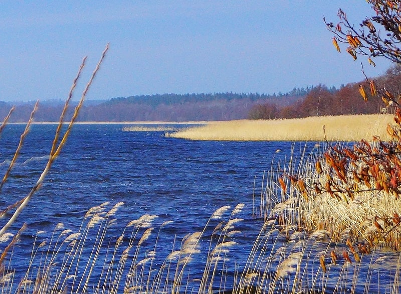
Lake in Denmark. Lake Stubbe is a nature conservation area, and a former fjord, which in the Stone Age entered the sea, Kattegat, at the entrance to the Baltic Sea between Denmark and Sweden in Northern Europe. The lake is the largest lake in Djursland and is located about 6 km north of Ebeltoft.
150 years ago the lake was surrounded by moor land as the original oak forest had been depleted due to human intervention. To prevent sand drift the area was afforested, and 62 square kilometers of forest surrounds the lake today, consisting primarily of Norwegian fir and spruce, with some alder in low-lying areas.
Otters, which are rare in Denmark, live by the lake, just as the lake is a resting and foraging grounds for migrating birds to and from the rest of Scandinavia. Several large species of birds of prey can be seen by the lake.
In 1963 Lake Stubbe and adjacent woodland (381 ha) was reserved as protected in order preserve the landscape. Lake Stubbe is also an EU-habitat area, just as the area is part of Mols Bjerge National Park established in 2009.[4]
Rugaard
Also known as: Rugård
Rugaard is a rural farming and forestry castle 2 km from the eastern coast of the peninsula Djursland in Denmark bordering the sea, Kattegat between Denmark and Sweden at the entrance to the Baltic Sea in Scandinavia. The estate includes some 600 hectares of land farmed by external partners. Rugaard also has about 350 hectares of forest and 40 hectares of lakes. All in all 965 hectares. Part of Rugaard's income comes from rentals, including 32 houses and five farms.[5]
Trehøje Mols
Also known as: Trehøje
Tourist attraction in the Knebel, Denmark, Kingdom of Denmark. Trehøje is a Danish vista point with a view of the sea to the east, south and west, located in the Mols Bjerge National Park on the peninsula Djursland between Denmark and Sweden. Three large bronze-age barrows close to each other 127 meters above the sea, have given their name to the place, which contains a group of 22 barrows. "Trehøje" meaning three mounds, is one of four major vista points in the hills of Mols, each with a barrow on top. The others are Ellemandsbjerg, Stabelhøje and Agri Baunehøj.
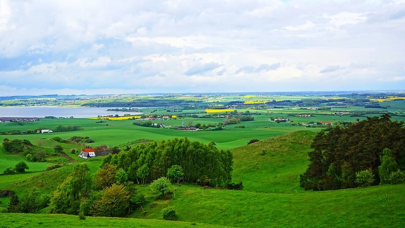
The view from Trehøje includes the east coast of mainland Jutland, the islands Samsø, Tunø and Hjelm, plus the hilly Mols Bjerge landscape, including the peninsula Helgenæs. One can also see parts of southern Djursland and the towns of Aarhus and Ebeltoft in the distance. From the three barrows one can look down onto the bays of Knebel, Begtrup, Aarhus, and Ebeltoft, as well as the southern stretches of the Kattegat, the sea between Denmark and Sweden.
The three barrows are five to six meters high, each made of about 650,000 pieces of dug-out grass turf. This is equivalent to 7 hectares of land where the turf has been peeled off for each barrow. A labor-intensive undertaking, that was part of the erection of 60,000 bronze-age mounds registered in Denmark. It has been calculated that in Denmark 100 to 150 mounds were built per year in the early Bronze Age (1800–1000 BC). This effort points towards a strong, homogeneous and organized religious quest in a distant pre-Christian civilization.
The vegetation in the open land surrounding Trehøje predominantly consists of bent grass. A slender type of grass that forms a wavy red and violet surface in July and August, and stands out as a golden surface in the winter sun, dotted with darker mulberry bushes. Here and there one might be able to make out the remains of narrow 8–15-meters-wide curved fields from the Middle Ages. These fields emerged when the farmers predominantly plowed the furrows towards the center of the field. Maybe with the purpose of creating a contour that drains standing water to the sides of the fields.
Today focused landscaping underlies the formation of the open plain-like grassland surrounding Trehøje, as well as other parts of the protected Mols Bjerge Hills. Tree growth, which would otherwise take over the land, is kept down partly through grazing by sheep, goats, cattle and horses, and partly through felling of upcoming trees, as well as felling of established wooded areas.
A nutrient-poor common-like landscape is a landscaping goal for the area. This type of landscape occurred naturally in the Middle Ages, probably due to intensive grazing and repeated haymaking on the commons, combined with not bringing back the same amount of nutrients in the form of manure, as was taken away, according to a theory. In some descriptions of the formation of the depleted vegetation around Trehøje there is no mention of the wind-erosion factor, which can blow away fertile topsoil nutrients – even though this has been a determining depletion-factor for surrounding land on Djursland in the Middle Ages.
One of the ideas behind favoring a common-like landscape is to make the Hills of Mols resemble the woodless tundra-plains left over, when the ice sheets drew back from the land after the last ice age plus 10,000 years ago, before Denmark became covered with forest. Another purpose behind this landscaping goal is to create habitats for zoology, not least insects, that are rare in other parts of Denmark. In addition the wood-free open countryside is visitor friendly, giving opportunities for walks and biking on the paths and gravel roads surrounding Trehøje, as well as in the rest of hilly Mols Bjerge.[6]
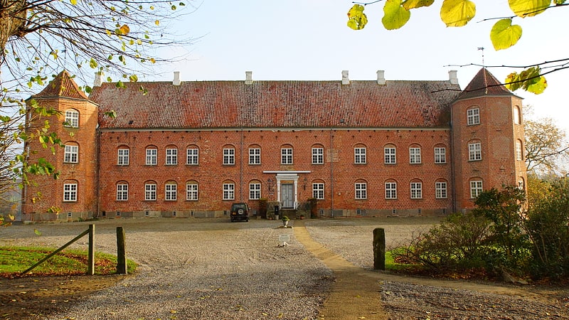
Karlsladen
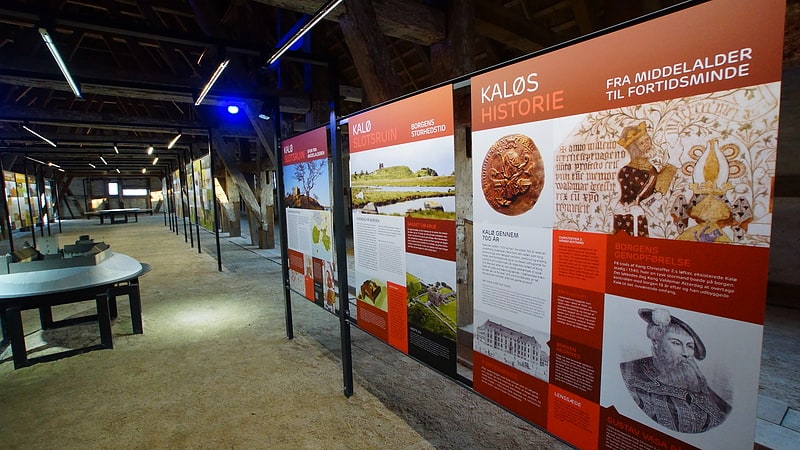
Karlsladen is an old barn from 1727 that was transformed into a visitors centre for Mols Bjerge National Park in 2013. The thatched and timbered building covers 1,000 square meters. Access to the visitors centre is free, and it is open 7 days a week all year. Before restoration the barn was a dilapidated farm building as part of the now publicly owned Kalø Estate.
The exhibition at the visitors centre is unstaffed. Its purpose is to convey aspects of local nature and natural history from Mols Bjerge National Park on the southern part of the Djursland peninsula in Denmark. The main themes are prehistoric times, the Kalø Castle Ruin and wildlife and hunting round Kalø. The latter related to a research station under Aarhus University that is part of the Kalø Estate. The visitors centre includes a series of posters, a model of the medieval Kalø Castle, and an area for children. Here one can hear taped stories, such as about how the Swedish king, Gustav Vasa, was imprisoned at Kalø Castle in 1518-19, until he escaped from the castle peninsula by wading through the sea during the night at low tide.
Karlsladen is owned by the Danish state under the, Nature Departement, Naturstyrelsen. In 1727 Karlsladen was built as a barn for storing farm crops from the Kalø Estate. As part of the renovation in 2013 the building was given a thatched roof in line with its original roofing. It had been given a tile roof in 1941, which was removed as part of the 2013 renovation.
Until 1945 the Kalø Estate, including Karlsladen, was privately owned by the German Jenisch family from Holstein. After World War II the Danish State confiscated the Kalø Estate including Karlsladen as part of war compensation.
Karlsladen is located on Djursland, which is a peninsula protruding from Jutland to the east into the Kattegat Sea. Karlsladen is located close to Kalø Castle Ruin and the town Rønde in Syddjurs Municipality 30 kilometers north-east of Denmark's second largest city, Aarhus.[7]
Stabelhøje
Tourist attraction in the Knebel, Denmark. Stabelhøje or Stabel Høje are two Bronze Age Mounds 135 meters and 133 meters above sea level by the village Agri in Mols Bjerge on the peninsula Djursland in Denmark at the entrance to The Baltic Sea in Northern Europe. The burial mounds date back to the early Bronze Ages 1800–1000 years B.C. These hills are some of the more known view points in Mols Bjerge National Park. Other view points in the area are Agri Baunehøj, Trehøje, Ellemandsbjerg and Jernhatten.
In the early Bronze Ages tribal leaders and other important members of society where buried in mounds placed in coffins made from hollowed out oak tree trunks. According to archaeological findings the burial customs changed during the Bronze Ages from coffin burials in oak trunks to cremation in the late Danish Bronze Ages. Probably due to international influence caused by long-distance trade with commodities such as copper, tin and cattle. This change in burial customs is probably also the case at Stabelhøje, that most likely hold several generations of burials from different Bronze Age time periods.
From the top of the mounds there is a view to Kalø Castle Ruin in Egens Bay – part of Aarhus Bay, and to the coast of Jutland, with Aarhus, Denmarks second largest town, in the distance. One can also see the hilly fields of southern Djursland, and the unfarmed hills of protected central Mols, including the tallest hill in the area, Agri Baunehøj, 137 meters above sea level. There is also a view of Ebeltoft Bay, and of the southernmost peninsula on Djursland, Helgenæs. The difference in elevation is accentuated by views that go all the way down to the surface of the sea.
Stabelhøje is accessible via small country roads. There is an infoboard at a small parking lot by the mounds. From here there is a short walk to the top of the southernmost of the two mounds. The mounds are 5–6 meters tall. Each is built of up to 650.000 rectangles of turf that where cut out by hand, corresponding to 7 ha (17 acres) of peeled heath- and grass-turf per mound. Under influence of rain draining through the surface of the mounds many of the Danish Bronze Age mounds have developed a hard mineral rich layer of soil close to the surface, that isolates the inner mound from contact with water and oxygen from the outside. This lid of hardened soil has helped preserve the artifacts insides the mounds over the centuries.
The construction of Bronze Age mounds such as Stabelhøje is an undertaking that involved the work of many people using primitive pre-iron-age tools. A feat that is part of the creation of the 60.000 Stone- and Bronze Age burial mounds registered in Denmark. It has been calculated that 100–150 mounds were built each year at the height of this endeavor in the early Danish Bronze Ages, 1800–500 B.C. Something that points to an organized 2500- to 3800-year-old pre Christian culture pervaded by a unified religious belief.[8]