Discover 11 hidden attractions, cool sights, and unusual things to do in Joshua Tree National Park (United States). Don't miss out on these must-see attractions: Keys Desert Queen Ranch, Ryan Mountain, and Quail Mountain. Also, be sure to include Ryan House and Lost Horse Well in your itinerary.
Below, you can find the list of the most amazing places you should visit in Joshua Tree National Park (California).
Table of Contents
Keys Desert Queen Ranch
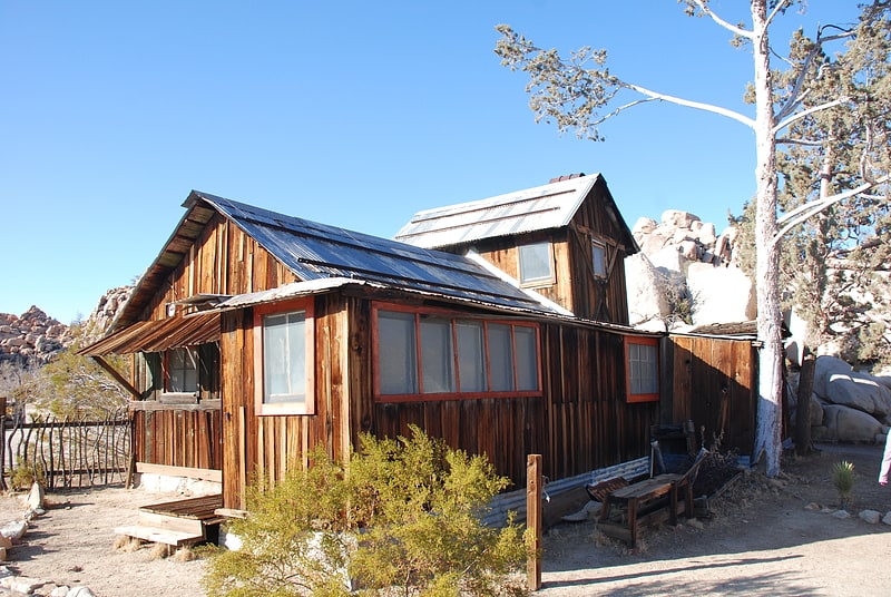
The Keys Ranch is the prime example of early settlement in the Joshua Tree National Park area. Bill Keys was the area's leading character, and his ranch is a symbol of the resourcefulness of early settlers. The ranch is an extensive complex of small frame buildings built between 1910 and Keys' death in 1964. Keys pursued both ranching and mining to make a living in the desert.
William F. Keys was born at Palisade, Nebraska, in 1879. After working as a ranch hand and smelter worker, he was a deputy sheriff in Mohave County, Arizona. During a time in Death Valley, he befriended Death Valley Scotty, becoming involved in a swindle that resulted in the so-called "Battle of Wingate Pass". He arrived in the Twentynine Palms, California area in 1910. In the area that became Joshua Tree National Park, he became acquainted with local outlaw and cattle rustler Jim McHaney, taking care of him in declining health. Keys eventually took over McHaney's properties after McHaney's death, gradually expanding what became the Desert Queen, its name borrowed from the nearby Desert Queen Mine.
Keys married Francis M. Lawton in 1918, and they had seven children together, three of whom died and were buried at the ranch. During a dispute over the Wall Street Mill, Keys shot and killed Worth Bagley. Keys was convicted of murder and went to San Quentin Prison, where Keys educated himself in the library. Keys was paroled in 1950 and was pardoned in 1956 through the efforts of Erle Stanley Gardner, author of the Perry Mason novels.
Mining equipment at the ranch includes an arrastra and a stamp mill for ore processing. Other buildings include an adobe barn, a schoolhouse, a tack shed, machine shed, cemetery and a variety of houses and cabins.
Park rangers provide guided walking tours of the ranch from October through May. Tours are limited in size and should be booked in advance.[1]
Address: Hidden Valley Road, Joshua Tree National Park
Ryan Mountain
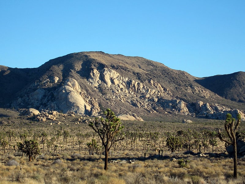
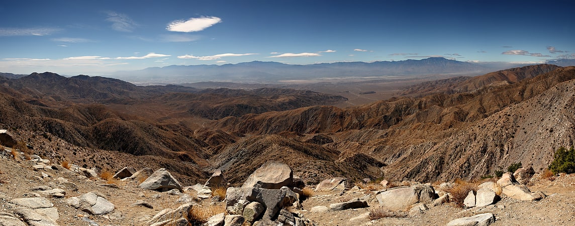
Mountain in California. Ryan Mountain is a 5,456-foot-high mountain in Joshua Tree National Park. The trail to the peak is a strenuous hike, ascending 1,050 feet in 1.5 miles. Ryan Mountain is a popular attraction in the park, because it leads to panoramic views of Pinto Basin, Lost Horse Valley, Queen Valley, and Pleasant Valley. It is one of the locations in Joshua Tree that features abundant lichen populations. It is named after J.D. Ryan, a wealthy rancher and early mining operator in the park.[2]
Quail Mountain
Mountain in California. Quail Mountain, at 5,816 feet, is the highest mountain in Joshua Tree National Park and the highest point in the Little San Bernardino Mountains of the very southern reach of the Mojave Desert. It is one of the southernmost peaks in the Transverse Ranges, with the Peninsular Ranges just across the Colorado Desert and Coachella Valley.[3]
Ryan House and Lost Horse Well
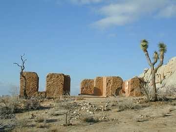
Historical place in Riverside County, California. The Ryan House and Lost Horse Well are historic ruins in Joshua Tree National Park, California, United States. It was established by the family of J.D. Ryan, the later developers of the Lost Horse Mine, which became the most profitable mine in the area. The Lost Horse Well at the Ryan Ranch supplied water to the Lost Horse Mine, 3 miles south and 750 feet, by pipeline.
The six-room house was built as an adobe residence in 1896 with later wood frame additions. It was destroyed by fire August 12, 1978. Originally roughly 30 by 40 feet (9 by 12 m), the ruin has 3 rooms, each measuring 12 feet (4 m) wide and 16 feet (5 m) long. Adobe walls sit on stone masonry foundation, and there are concrete stoops on the north and south sides. There is a small stone fireplace located on the east side of the house.
A small cemetery is near the ranch with about 10 graves.[4]
Barker Dam
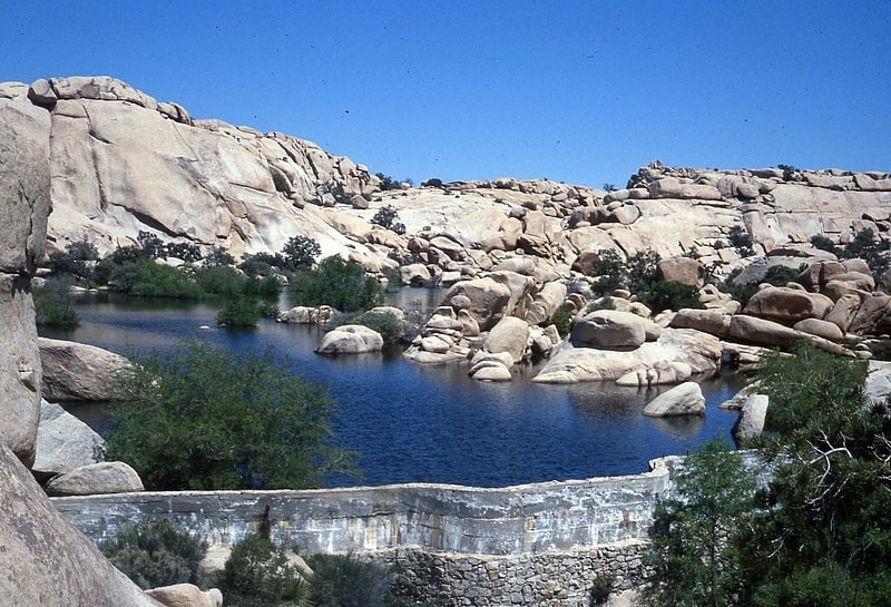
Dam in Riverside County, California. Barker Dam, also known as the Big Horn Dam, is a dam with water-storage reservoir located in Joshua Tree National Park in California. The dam was constructed by early cattlemen, including C. O. Barker, in 1900. It was raised in 1949 by rancher William F. Keys. It is situated between Queen Valley and the Wonderland of Rocks near the Wall Street Mill. It is a gathering place for desert wildlife, including many species of birds and desert bighorn sheep. Visitors can reach the dam via a short loop trail from a nearby parking lot off Barker Dam Road, and can see Native American petroglyphs a short distance to the west. There is also good bouldering on side trails near the dam. The park offers a Barker Dam Nature Hike led by a ranger.
The lowest 9 feet (2.7 m) of the dam, the original portion, was constructed of concrete surfaced with stone on the downstream side. The height of the dam was raised an additional six feet with concrete in 1949–1950. The dam has several indentations. An inscription at top reads: "Big Horn Dam Built by Willis Keys, W.F. Keyes, Phyllis M. Keys, 1949–1950."[5]
Address: Queen Valley Road, 92277 Joshua Tree
Malapai Hill
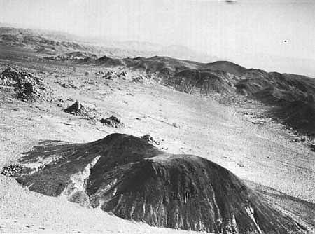
Mountain in California. Malapai Hill is a small mountain in the middle of Joshua Tree National Park in southeastern California, which may have been part of an ancient volcano. It formed during a period of intrusive activity and either rose above the surface or eventually was exposed by erosion. Its name is a derivative of the Spanish word, malpaís.[6]
Eureka Peak
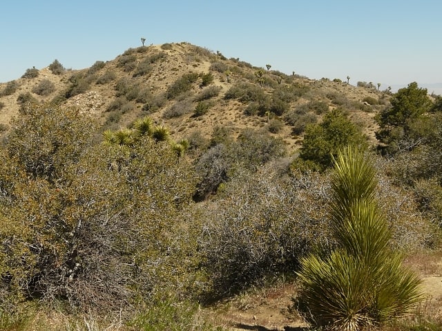
Mountain in California. Eureka Peak is a mountain in the Black Rock Canyon region of Joshua Tree National Park in the U.S. state of California. The peak is the 4th highest summit in the park after Quail Mountain, Queen Mountain and Inspiration Peak. The Eureka Peak Road, an unpaved dirt road, leads up to the summit from Upper Covington Flat and is drivable by 4-wheel drive vehicles under suitable conditions. Mountain biking is also very popular on this peak.
An alternative route, the Eureka Peak Trail, branches off the California Riding and Hiking Trail and ascends the peak from the north.
The upper slopes of the mountain may occasionally see snow in winter.[7]
Address: Black Rock Canyon region, Joshua Tree National Park
Joshua Tree Rock Climbing School
Tourist information, Museum
Address: 74485 National Park Dr, 92277 Twentynine Palms
Little San Bernardino Mountains
Mountain range in California. The Little San Bernardino Mountains are a short mountain range of the Transverse Ranges, located in southern California in the United States. They extend for approximately 40 mi southeast from the San Bernardino Mountains through San Bernardino and Riverside Counties to near the northeast edge of the Salton Sink and Salton Sea.
The community of Palm Springs looks north and northeast across the Coachella Valley to the range.[8]
Wall Street Mill
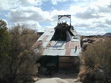
Building in San Bernardino County, California. The Wall Street Mill in Joshua Tree National Park was a complete and operable gold ore crushing mill featuring late-19th century two-stamp mill machinery. Consequently, the significance encompasses the mill machinery, the building which houses it, the well which supplied water for the mill's operation, and the well pump. It is the only gold ore crushing mill in the region that retains integrity.
The stamp mill building is framed with heavy timber and built on a downward sloping hillside to take advantage of gravity in the milling process. The roof and some of the exterior walls are covered with corrugated sheet metal, while some of the exterior walls have either vertical or horizontal wooden siding. At the top of the building a long wooden ramp supports the track of an ore tramway which carried ore from where it was unloaded from trucks to the top of the mill above the two-stamp Baker Iron Works crusher. A gasoline engine powered the mill; it was built by the Western Gas Engine Company of Los Angeles. A Myer concentrating table was used in separating the gold from the ore.
The complex included the mill, a well, a bunkhouse and an outhouse. The supporting buildings are largely ruinous.
The mill was built by Bill Keys, a local rancher, miner and character, using equipment moved from Pinon Wells. In the 1940s, Keys was involved in a dispute with Worth Bagley over access to the Wall Street Mill. Keys shot and killed Bagley in 1943 and placed a stone commemorating the event with the inscription: "Here is where Worth Bagley bit the dust at the hand of W. F. Keys, May 11, 1943." The marker is not a part of the Wall Street Mill historic district.[9]
Coxcomb Mountains
Mountain range in California. The Coxcomb Mountains are a mountain range located in eastern Riverside County, Southern California.[10]