Discover 11 hidden attractions, cool sights, and unusual things to do in San Gorgonio Wilderness (United States). Don't miss out on these must-see attractions: San Gorgonio Mountain, Henry Washington Survey Marker, and Big Bear Solar Observatory. Also, be sure to include Big Bear Lake in your itinerary.
Below, you can find the list of the most amazing places you should visit in San Gorgonio Wilderness (California).
Table of Contents
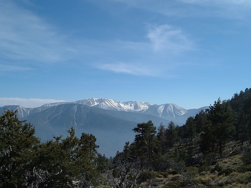
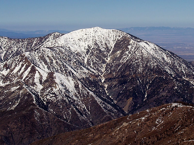
San Gorgonio Mountain
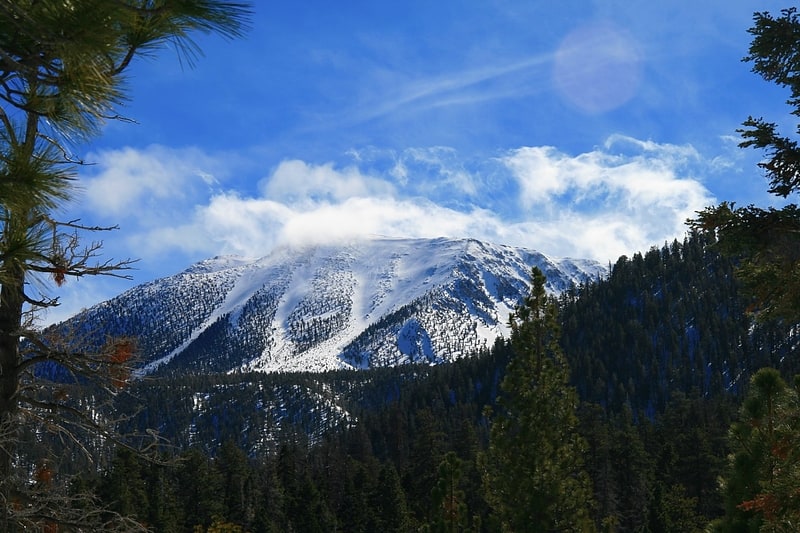
Mountain in California. San Gorgonio Mountain, also known locally as Mount San Gorgonio, or Old Greyback, is the highest peak in Southern California and the Transverse Ranges at 11,503 feet.
It is in the San Bernardino Mountains, 27 miles (43 km) east of the city of San Bernardino and 12 miles (19 km) north-northeast of San Gorgonio Pass. It lies within the San Gorgonio Wilderness, part of the Sand to Snow National Monument managed by the San Bernardino National Forest.
Spanish missionaries in the area during the early 17th century named the peak after Saint Gorgonius.
Since it is the highest point in a region which is separated from higher peaks (e.g. in the Sierra Nevada) by relatively low terrain, San Gorgonio Mountain is one of the most topographically prominent peaks in the United States. It is ranked 7th among peaks in the 48 contiguous states and 18th overall.
Like other high peaks in the Transverse Ranges, the mountain has a pyramid shape, with a steep north face and a slightly shallower south face. The mountain is large and broad; the summit plateau itself is one square-mile in area (2 km2).
In contrast to its spectacular but lower neighbor, San Jacinto Peak, San Gorgonio is not particularly craggy, and from a distance, it appears to be an extremely high hill, earning it the name of greyback. Despite not being particularly striking in appearance during the summer, it is the only mountain in Southern California with a summit a significant distance above the tree line. As such its bright white winter snow cap, unobstructed by vegetation, makes the mountain noticeable from many miles away. The mountain hosts the longest recorded line of sight in the contiguous United States; it is plainly visible from the summit of Mount Whitney, 190 miles (306 km) away.[1]
Henry Washington Survey Marker
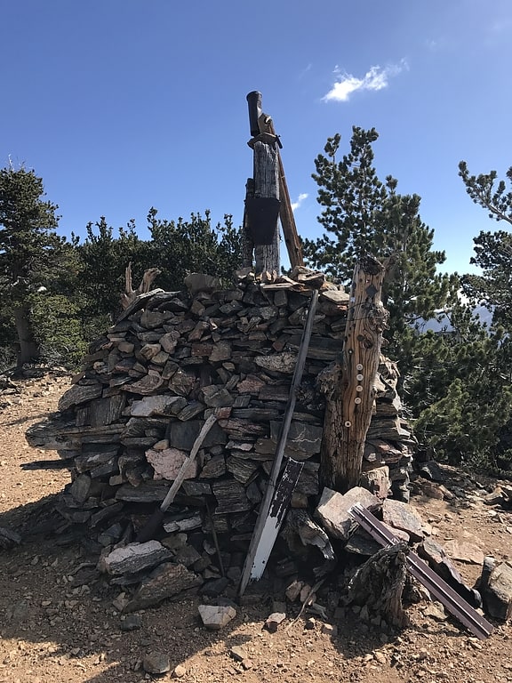
The Henry Washington Survey Marker is a survey marker in San Bernardino National Forest in San Bernardino County, California. The marker served as the earliest initial points of the San Bernardino Baseline and Meridian, which in turn mark the starting points for the surveying and subdivision of land in Southern California. Colonel Henry Washington placed the marker in 1852 at the beginning of the U.S. Surveyor General's Office's land survey of Southern California, the first survey of the region. Later surveys in 1897 and 1907 set new initial points for the survey east and west of the marker; these points replaced Washington's marker as the official initial points in 1917. Washington's original marker nonetheless still serves as a point along the baseline.
The marker was added to the National Register of Historic Places on May 12, 1975.[2]
Big Bear Solar Observatory
Observatory with a room for scientists. Big Bear Solar Observatory is a university-based solar observatory in the United States. It is operated by New Jersey Institute of Technology. BBSO has a 1.6-meter clear aperture Goode Solar Telescope, which has no obscuration in the optical train. BBSO is located on the north side of Big Bear Lake in the San Bernardino Mountains of southwestern San Bernardino County, California, U.S. approximately 120 kilometers east of downtown Los Angeles. The telescopes and instruments at the observatory are designed and employed specifically for studying the activities and phenomena of the Sun.[3]
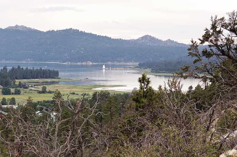
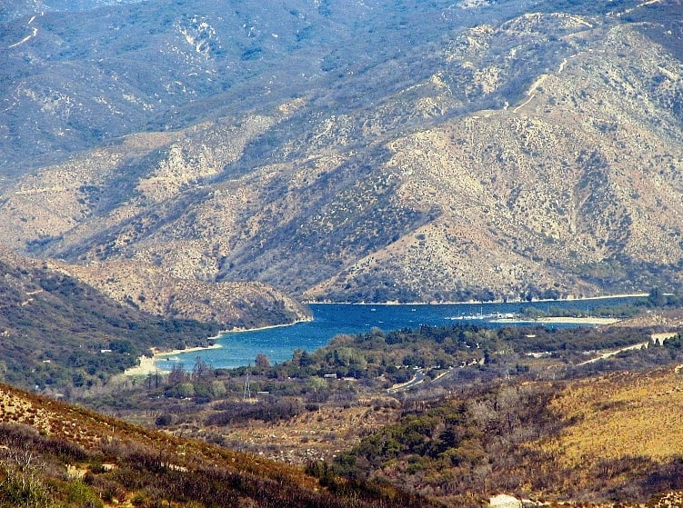
Big Bear Lake
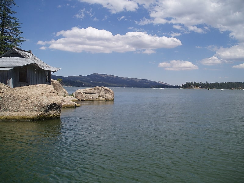
Outdoor recreation in scenic alpine area. Big Bear Lake is a reservoir in the San Bernardino Mountains, in San Bernardino County, California, United States. It is a completely snow-fed lake, having no other means of tributaries or mechanical replenishment. At a surface elevation of 6,743 ft, it has an east-west length of approximately 7 mi and is approximately 2.5 mi at its widest measurement, though the lake's width mostly averages a little more than 1⁄2 mi. These approximations are based on the lake having an optimum retainable water level. At dam's end Big Bear measures its deepest water at 72 ft.[4]
Sand to Snow National Monument
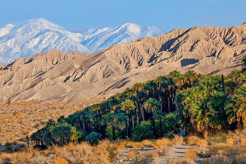
National monument in San Bernardino County, California. Sand to Snow National Monument is a U.S. National Monument located in San Bernardino County and northern Riverside County, Southern California.
It protects diverse montane and desert habitats of the San Bernardino Mountains, southern Mojave Desert, and northwestern Colorado Desert.[5]
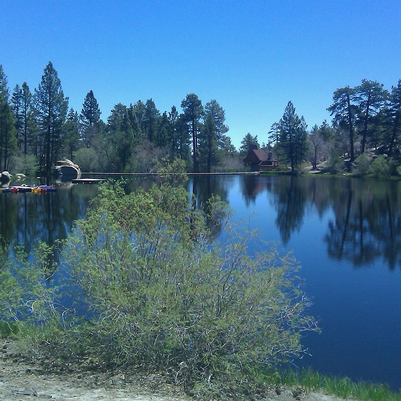
Jenks Lake
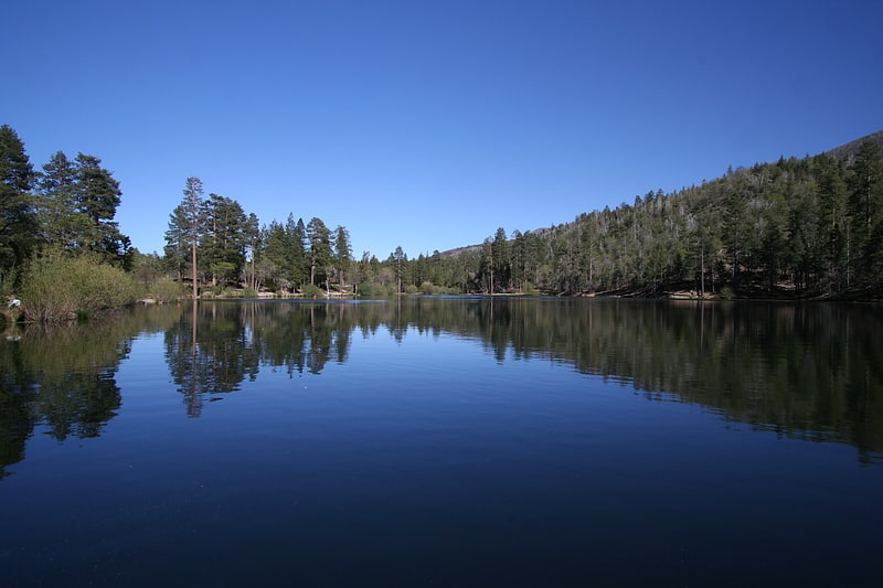
Lake in California. Jenks Lake is a lake in the San Bernardino National Forest near Angelus Oaks in San Bernardino County, California. The lake offers several fish species including bass, catfish, bluegill, and rainbow trout. Trout season usually runs from April to October.
Although the lake is man-made, it receives water diverted from the Santa Ana River via a flume, visible from the popular South Fork Trail.[6]
San Bernardino Mountains
Mountain range in California. The San Bernardino Mountains are a high and rugged mountain range in Southern California in the United States. Situated north and northeast of San Bernardino and spanning two California counties, the range tops out at 11,503 feet at San Gorgonio Mountain – the tallest peak in all of Southern California. The San Bernardinos form a significant region of wilderness and are popular for hiking and skiing.
The mountains were formed about eleven million years ago by tectonic activity along the San Andreas Fault, and are still actively rising. Many local rivers originate in the range, which receives significantly more precipitation than the surrounding desert. The range's unique and varying environment allows it to maintain some of the greatest biodiversity in the state. For over 10,000 years, the San Bernardinos and their surroundings have been inhabited by indigenous peoples, who used the mountains as a summer hunting ground.
Spanish explorers first encountered the San Bernardinos in the late 18th century, naming the eponymous San Bernardino Valley at its base. European settlement of the region progressed slowly until 1860, when the mountains became the focus of the largest gold rush ever to occur in Southern California. Waves of settlers brought in by the gold rush populated the lowlands around the San Bernardinos, and began to tap the mountains' rich timber and water resources on a large scale by the late 19th century.
Recreational development of the range began in the early 20th century, when mountain resorts were built around new irrigation reservoirs. Since then, the mountains have been extensively engineered for transportation and water supply purposes. Four major state highways and the California Aqueduct traverse the mountains today; these developments have all had significant impacts on area wildlife and plant communities.[7]
Transverse Ranges
Mountain range in California. The Transverse Ranges are a group of mountain ranges of southern California, in the Pacific Coast Ranges physiographic region in North America. The Transverse Ranges begin at the southern end of the California Coast Ranges and lie within Santa Barbara, Ventura, Los Angeles, San Bernardino, Riverside and Kern counties. The Peninsular Ranges lie to the south. The name Transverse Ranges is due to their east–west orientation, making them transverse to the general northwest–southeast orientation of most of California's coastal mountains.
The ranges extend from west of Point Conception eastward approximately 500 kilometers into the Mojave and Colorado Desert. The geology and topography of the ranges express three distinct segments that have contrasting elevations, rock types, and vegetation. The western segment extends to the San Gabriel Mountains and San Gabriel fault. The central segment includes mountains that range eastward to the San Andreas fault. The eastern segment extends from the San Andreas fault eastward to the Colorado Desert. The central and eastern segments (near the San Andreas fault) have the highest elevations.
Most of the ranges lie in the California chaparral and woodlands ecoregion. Lower elevations are dominated by chaparral and scrubland, while higher elevations support large conifer forests. Most of the ranges in the system are fault blocks, and were uplifted by tectonic movements late in the Cenozoic Era. West of Tejon Pass, the primary rock types are varied, with a mix of sedimentary, volcanic, and metamorphic rocks, while regions east of the pass are dominated by plutonic granitic and metasedimentary rocks.[8]
Silverwood Lake
Reservoir in California. Silverwood Lake is a large reservoir in San Bernardino County, California, United States, located on the West Fork Mojave River, a tributary of the Mojave River in the San Bernardino Mountains. It was created in 1971 as part of the State Water Project by the construction of the Cedar Springs Dam as a forebay on the 444 mi long California Aqueduct, and has a capacity of 73,000 acre⋅ft.[9]
Cedar Lake
Lake in California. Cedar Lake is an artificial lake in the San Bernardino Mountains of California that has appeared in dozens of Western films. It is the centerpiece of Cedar Lake Camp, a private retreat center owned and operated by Cedar Lake Camp, Inc. a non profit public benefit corporation.
Located south of the city of Big Bear Lake in San Bernardino County and San Bernardino National Forest, the lake lies about two hours east of Los Angeles and two hours north of San Diego.
The lake is formed by a dam across a minor tributary of Metcalf Creek. The creek feeds Metcalf Bay, an arm of Big Bear Lake, whose waters reach the Pacific Ocean by way of Bear Creek and the Santa Ana River.[10]
Address: 1100 Cedar Lake Rd, San Gorgonio Wilderness
Baldwin Lake
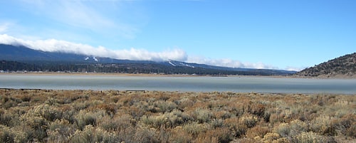
Lake in California. Baldwin Lake is a natural, intermittent, alkali lake in the Big Bear Valley of the San Bernardino Mountains, in San Bernardino County, California. It is located east of Big Bear Lake reservoir and Big Bear City.[11]