Discover 11 hidden attractions, cool sights, and unusual things to do in Cleveland National Forest (United States). Don't miss out on these must-see attractions: Silverado Canyon, Santiago Peak, and Viejas Casino. Also, be sure to include Palomar Mountain in your itinerary.
Below, you can find the list of the most amazing places you should visit in Cleveland National Forest (California).
Table of Contents
Silverado Canyon
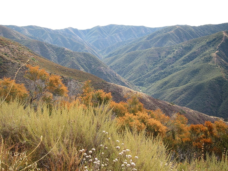
Silverado Canyon is a roughly 2,500-foot-deep gorge in the Santa Ana Mountains, in the U.S. state of California. The small stream it is associated with, Silverado Creek, rises on the north slope of Modjeska Peak at the elevation of 3,980 feet and flows north and west, past the town of Silverado to join Santiago Creek at 942 feet after a journey of just under 5 miles. The main branch, Ladd Canyon, is just over 3 miles long. Its stream arises on the east flank of Pleasants Peak at about 3,590 feet and flows southwest into the main stem at about 1,178 feet near Silverado. They are part of the Santa Ana River watershed. A hiking trail/fire road runs the entire length of the canyon.[1]
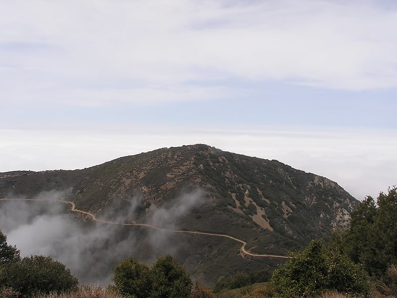
Santiago Peak
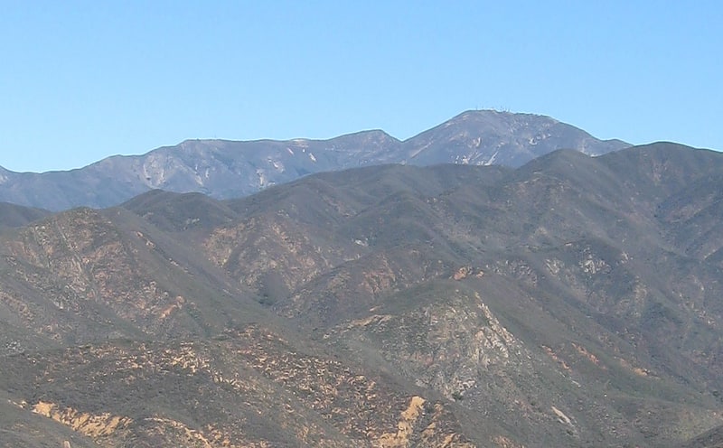
Mountain in California. Santiago Peak is the southern mountain of the Saddleback landform in Orange County, California. It is the highest and most prominent peak of both the Santa Ana Mountains and Orange County, and also marks a border point with Riverside County. The peak is named for Santiago Creek, which begins on its southwestern slope. During wintertime, snow does fall on the peak. A telecommunication antenna farm with microwave antennas sits atop the peak.[2]
Viejas Casino

Shopping center in San Diego County, California. Viejas Casino and Resort is a hotel casino and outlet center owned by the Viejas Band of Kumeyaay Indians, located in Alpine, California. The casino has over 2,000 slot machines, up to 86 table games, three restaurants, a deli, bingo, an off-track betting facility, lounge, concert venues and multiple indoor and outdoor meeting spaces. Opened in March 2013, the original hotel had 128 rooms; an expansion was completed in October 2015 with the opening of an additional hotel tower with 109 deluxe rooms and luxury suites increasing hotel accommodations to a total of 237 rooms and suites.[3]
Address: Cleveland National Forest, 5000 Willows Road
Palomar Mountain
Mountain in California. Palomar Mountain is a mountain ridge in the Peninsular Ranges in northern San Diego County. It is famous as the location of the Palomar Observatory and Hale Telescope, and known for the Palomar Mountain State Park.[4]
Los Pinos Peak
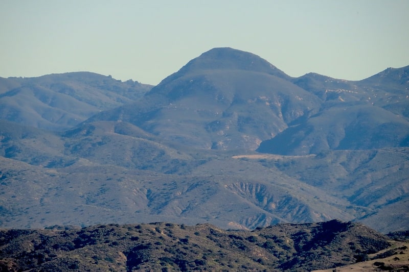
Summit in California. Los Pinos Peak is a 4,455-foot summit in the Santa Ana Mountains in Orange County, California, about 8 miles east of Rancho Santa Margarita. Los Pinos is the southernmost peak above 4,000 feet in the Santa Anas, and provides extensive views south towards San Diego and the Pacific Ocean as well as views of the San Jacinto Mountains and San Bernardino Mountains in the east. The summit rises rather prominently above the main crest of the Santa Anas and is conspicuously visible from much of southern Orange County, although its actual topographic prominence is only about 610 feet.
The peak is situated in the Cleveland National Forest and is accessible by the Main Divide Road (a fire road); the Trabuco Canyon Trail, which begins near Trabuco Creek, and the Los Pinos Peak Trail, which begins in Hot Springs Canyon (near San Juan Canyon, San Juan Creek and the Ortega Highway (State Route 74).[5]
Modjeska Peak
Mountain in California. Modjeska Peak is the northern mountain of the Saddleback landform in Orange County California. It is the second-highest peak of the Santa Ana Mountains, after Santiago Peak, whose summit is less than 0.6 mi to the northwest. Modjeska lies within Cleveland National Forest and, despite being shorter than Santiago, has a smaller peak without manmade structures to obstruct views of the Pacific Ocean and San Gabriel Mountains.
The peak is named after the Shakespearean actress Helena Modjeska, who lived in Modjeska Canyon (on the western foot of the mountain) near the end of her life.[6]
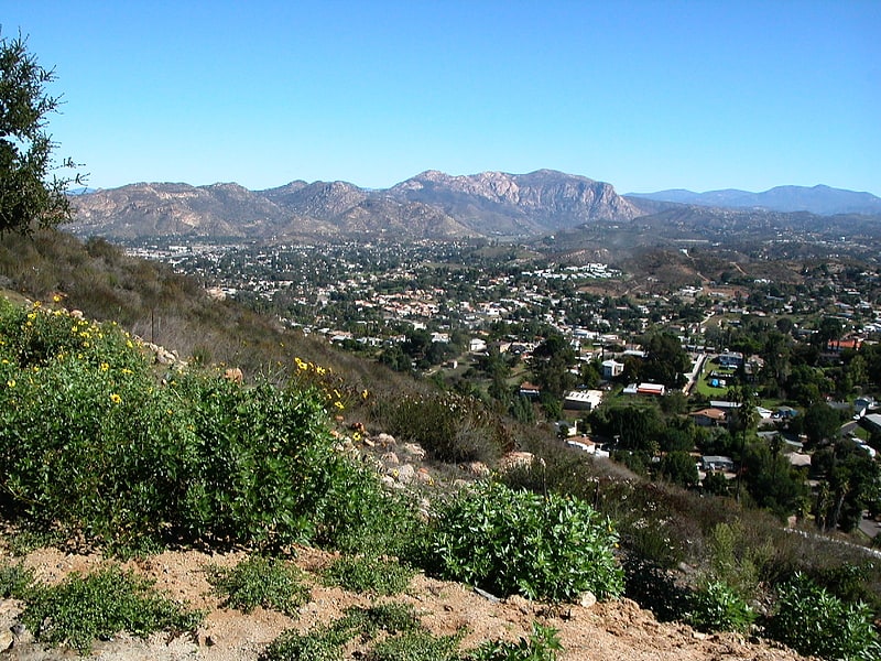
Viejas Mountain
Mountain in California. Viejas Mountain is a mountain in San Diego County in the U.S. state of California. At 4,189 feet, Viejas Mountain is the 48th tallest peak in San Diego County. The mountain can be seen from parts of metropolitan San Diego. The summit is about 3 miles northeast of the community of Alpine in the Cleveland National Forest.[7]
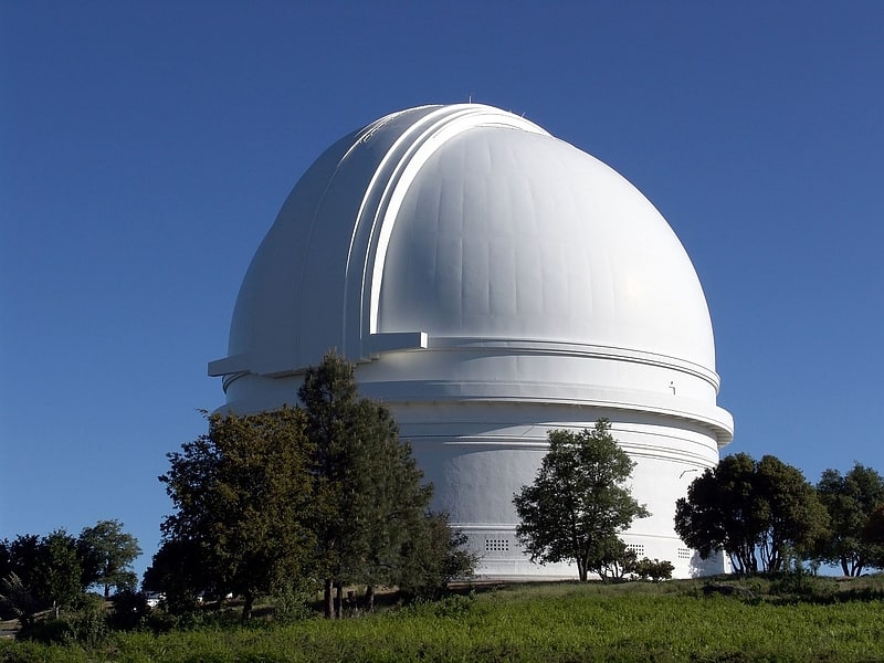
Palomar Observatory

Well-known site with a large telescope. Palomar Observatory is an astronomical research observatory in San Diego County, California, United States, in the Palomar Mountain Range. It is owned and operated by the California Institute of Technology. Research time at the observatory is granted to Caltech and its research partners, which include the Jet Propulsion Laboratory, Yale University, and the National Optical Observatories of China.
The observatory operates several telescopes, including the 200-inch (5.1 m) Hale Telescope, the 48-inch (1.2 m) Samuel Oschin Telescope, and the Palomar 60-inch (1.5-m) Telescope. In addition, other instruments and projects have been hosted at the observatory, such as the Palomar Testbed Interferometer and the historic 18-inch (0.46 m) Schmidt telescope, Palomar Observatory's first telescope, dating from 1936. As of 2021, the observatory also hosts the Zwicky Transient Facility (ZTF) and Gattini-IR projects.[8]
Address: 35899 Canfield Rd, Cleveland National Forest
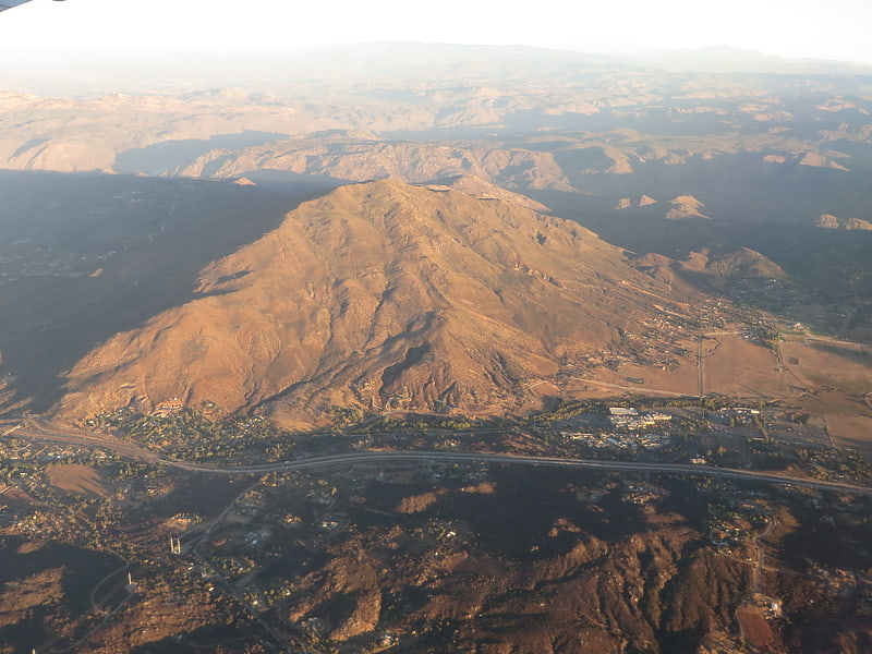
El Cajon Mountain
Mountain in California. El Cajon Mountain, commonly known as El Capitan or El cap, is a mountain in the Cuyamaca Mountains, and prominent natural landmark in the East County of San Diego.[9]
Pine Valley Creek Bridge
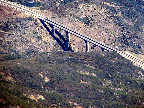
Box girder bridge in California. The Pine Valley Creek Bridge, officially named the Nello Irwin Greer Memorial Bridge, is a reinforced concrete box girder bridge in San Diego County, California near the town of Pine Valley. The bridge was built in 1974 as part of the Interstate 8 freeway system. At the time of its construction, it was the first bridge constructed in the United States using the segmental balanced cantilever method.
The northern span is 1,691 ft (515.4 m) long while the southern span is 1,741 ft (530.7 m) long. The two spans rise 450 ft (137.2 m) above the valley floor, placing Pine Valley Creek Bridge among the highest bridges in the United States.
Originally known unofficially as the Pine Valley Creek Bridge, a California State Senate concurrent resolution (SCR-33) officially named the bridge in honor of the project engineer, Nello Irwin Greer, responsible for designing the section of I-8 known as the "Pine Valley Project".
In the original design, the freeway's routing followed the old U.S. Route 80 (US 80) path through the center of the town of Pine Valley. This would have destroyed much of the town and many of the native pines found there. Greer's design re-routed the freeway to the south through Pine Valley Creek Canyon, bypassing and preserving the quaint beauty of this eastern San Diego County mountain community. This new design also saved 2 miles (3.2 km) of freeway construction, saving millions of dollars in costs.[10]
El Capitan Dam
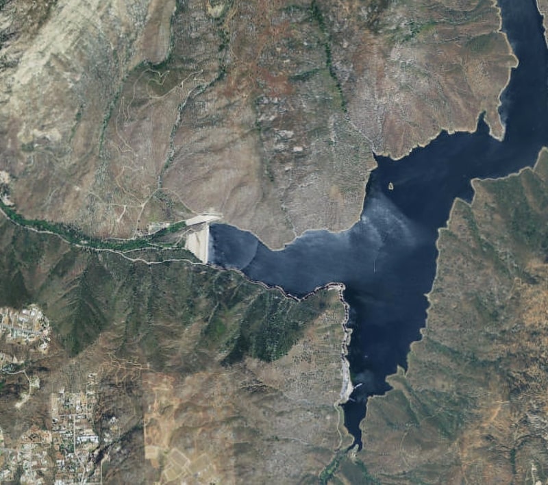
El Capitan Dam is an embankment dam on the San Diego River in southern California. The dam forms the 112,800-acre-foot El Capitan Reservoir and serves mainly to supply water to the city of San Diego as well as providing flood control. The dam is connected to the San Diego municipal water system via the El Capitan Pipeline, which extends approximately 30 miles to the city. It is the second largest storage facility in San Diego's water supply system, after San Vicente Dam.[11]