Discover 15 hidden attractions, cool sights, and unusual things to do in Holyoke (United States). Don't miss out on these must-see attractions: Children's Museum at Holyoke, Veterans Park, and Dinosaur Footprints. Also, be sure to include Wistariahurst Museum in your itinerary.
Below, you can find the list of the most amazing places you should visit in Holyoke (Massachusetts).
Table of Contents
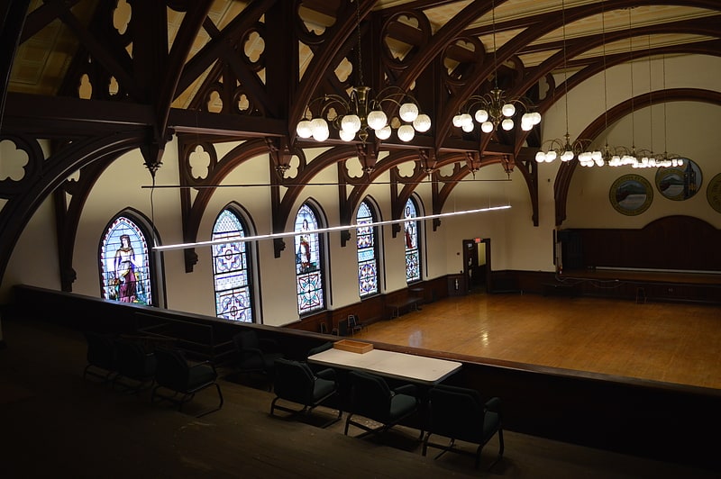
Children's Museum at Holyoke
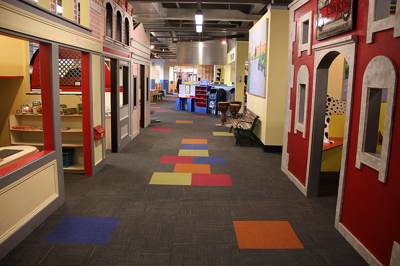
Museum in Holyoke, Massachusetts. The Children's Museum at Holyoke is a children's museum in Holyoke, Massachusetts, featuring participatory art, exhibits related to science and daily life, a replica TV studio and an elaborate climbing area. The museum is located Downtown, within Holyoke Heritage State Park, in the renovated Sheldon Building of the former William Skinner and Sons silk mill complex.[1]
Address: 444 Dwight St # 2, Holyoke (Holyoke)
Veterans Park
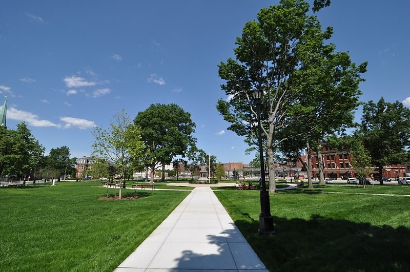
Veterans Park is a city park in the downtown area of Holyoke, Massachusetts. Originally called Hampden Park when it was given to the city by the Holyoke Water Power Company in 1861, it was rededicated in 1962 to honor the city's military veterans. The park and a few surrounding buildings were listed on the National Register of Historic Places in 2012 as the Hampden Park Historic District. Included in this designation are St. Jerome's Church, the Convent of the Sisters of Notre Dame de Lourdes, and the former Central Fire Station, and other buildings.[2]
Dinosaur Footprints
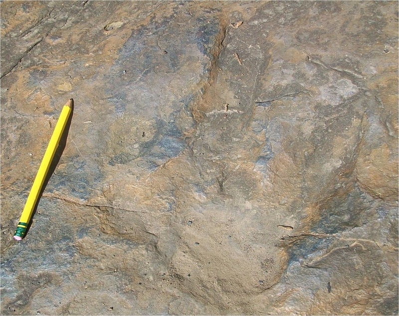
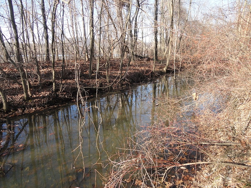
Tourist attraction in Holyoke, Massachusetts. Dinosaur Footprints in Holyoke, Massachusetts, USA is an 8-acre wilderness reservation purchased for the public in 1935 by The Trustees of Reservations. The Reservation is currently being managed with the assistance from the Massachusetts Department of Conservation and Recreation. The fossil and plant resources on the adjacent Holyoke Gas and Electric riverfront property are being managed cooperatively by The Trustees, Mass DCR, and HG&E.
The dinosaur tracks at this site were among the first to be scientifically described in 1836, and are still visible to visitors. Hundreds of tracks, which were made by as many as four distinct types of two-legged dinosaur, are present in the sandstone outcrops. Additional fossils that have been found at the site or nearby include invertebrate burrows, fish, and plants (including charcoalified logs and leaves). The parallel orientation of many of the dinosaur trackways was among the first lines of evidence used to support the novel theory that dinosaurs traveled in packs or groups.[3]
Address: 193 High St, 01040 Holyoke (Holyoke)
Wistariahurst Museum
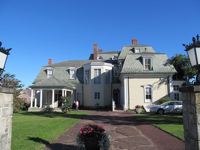
Museum in Holyoke, Massachusetts. Wistariahurst is a historic house museum and the former estate of the Skinner family, located at 238 Cabot Street in Holyoke, Massachusetts. It was built in 1868 for William Skinner, the owner of a successful silk spinning and textile business, and is named for the abundant wisteria vines which cascade across its eastern facade. Originally constructed in Williamsburg in 1868, the mansion designed by Northampton architect William Ferro Pratt was moved to Holyoke in 1874, following the devastating flood which swept away the original Skinner mills. Following the death of Belle Skinner, its music room was operated as a private museum from 1930 to 1959, housing the Belle Skinner Collection of Old Musical Instruments, before their donation by the family to Yale University. Since 1959 it has been operated as the Wistariahurst Museum, and is open to the public. The property was listed on the National Register of Historic Places in 1973.[4]
Address: 238 Cabot St, 01040-3904 Holyoke (Holyoke)
Holyoke City Hall
Building in Holyoke, Massachusetts. Holyoke City Hall is the historic city hall of Holyoke, Massachusetts. It is located at 536 Dwight Street, on the south east corner of High Street and Dwight Street. Serving both as the city administrative center and a public timepiece for the industrial city's workers, construction began on the Gothic Revival structure in 1871 to a design by architect Charles B. Atwood. Difficulties and delays in construction were compounded by Atwood's failure to deliver updated drawings in a timely manner, and the design work was turned over to Henry F. Kilburn in 1874. The building was completed two years later at a cost of $500,000. It has housed city offices since then.[5]
Address: 536 Dwight St, Holyoke (Holyoke)
Holyoke Dam
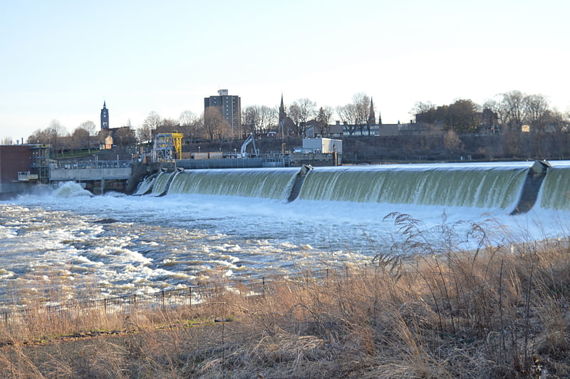
The Holyoke Dam, also referred to as the Hadley Falls Dam, or Hadley Falls Station is a granite dam built to produce hydroelectric power in tandem with the Holyoke Canal System at Hadley Falls on the Connecticut River, between Holyoke and South Hadley, Massachusetts.
The current dam is the third structure to be built across the Great Falls at South Hadley. The dam, along with the Canal System and its Testing Flume, is recognized by the American Society of Mechanical Engineers as a Historic Mechanical Engineering Landmark for its use by Clemens Herschel in the development of the Venturi meter, the first means of measuring large-scale flows, and the McCormick-Holyoke Turbine by John B. McCormick, also known as the Hercules Turbine, which doubled the efficiency of turbines to more than 80% in its time.[6]
Volleyball Hall of Fame
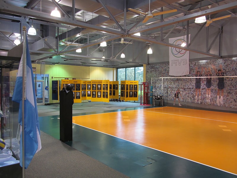
Museum dedicated to volleyball history. The International Volleyball Hall of Fame was founded to honor extraordinary players, coaches, officials, and leaders who have made significant contributions to the game of volleyball. The Hall of Fame is located in Holyoke, Massachusetts, where volleyball was invented in 1895 by William G. Morgan at the local YMCA.[7]
Address: 444 Dwight St, 01040-5842 Holyoke (Holyoke)
Mater Dolorosa Parish
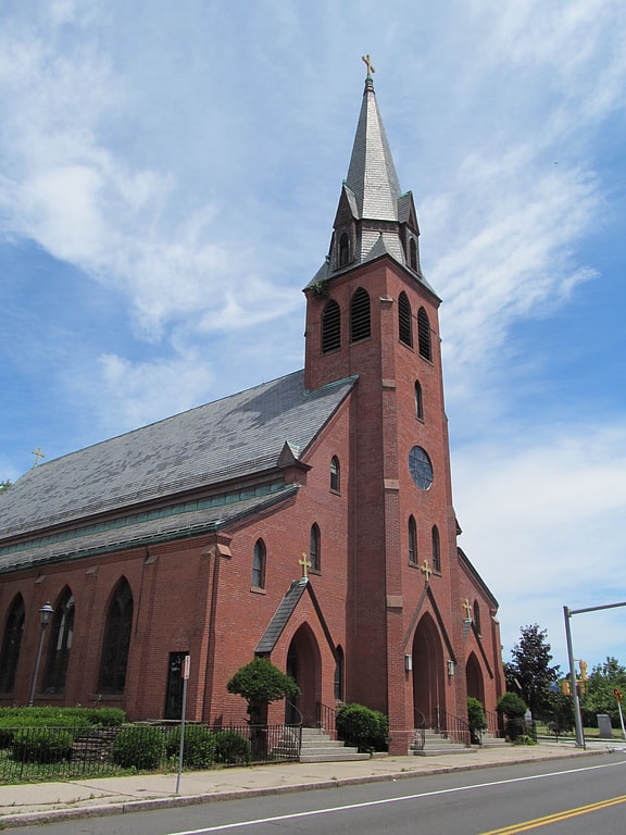
Mater Dolorosa Parish was a Roman Catholic parish designated for Polish immigrants in Holyoke, Massachusetts, United States.
Founded 1896. It is one of the Polish-American Roman Catholic parishes in New England in the Diocese of Springfield in Massachusetts. The architect for this church was George P. B. Alderman of Holyoke, MA. According to the May 15, 2011 parish bulletin, the final mass was said on Sunday, June 26, 2011. "MD's" (as parishioners call it colloquially) merged with Holy Cross to form the new Our Lady of the Cross Parish.[8]
Address: 25 Maple St, Holyoke (Holyoke)
South Hadley Canal
Canal in Massachusetts. The South Hadley Canal was a canal along the Connecticut River in South Hadley, Massachusetts. It was the earliest navigable canal in the United States, with operation commencing in 1795. It has been listed on the National Register of Historic Places as the South Hadley Canal Historic District.
The canal dates to February 1792, when leading citizens of western Massachusetts proposed to build a canal around the Great Falls at South Hadley, a 53-foot (16 m) drop in the Connecticut River that blocked boat transport. At that time, all cargo needed to be unloaded for 2.5 miles (4.0 km) of land transport around the falls, driving river transport cost for a bushel of wheat from Northampton, Massachusetts to Windsor, Connecticut to more than double its transport costs by sea from Hartford to Boston. John Hancock, then Governor of Massachusetts, signed the charter which incorporated the Proprietors of the Locks and Canals on the Connecticut River. Their corporate seal bore the motto "SIC TRANSIT - Public & Private Good".
Funds were raised both locally and internationally, with four Dutch investment houses owning slightly over 50% of the stock. The canal was built by some 240 local workers. In April 1795 it opened to commercial traffic. (Nearby Turners Falls Canal opened three years later.) First year revenue came to $3,109 at 75 cents per ton. By 1816 tolls had grown to over $16,000. In 1826 the Barnet, the first steamboat to operate on the Connecticut River, passed through the South Hadley Canal on its way to Vermont. However, by 1843 competing railroads had begun to erode income, and the canal closed as uneconomical in 1862.
Rather than use locks, the canal was built with an unusual "inclined plane" to transport 20-foot (6.1 m) by 60-foot (18 m) flatboats over the falls. The inclined plane appears to have been pioneered on England's Ketley Canal in 1788. This was its first use in American canals, and served as a pattern for others including the Morris Canal in New Jersey.
On the South Hadley Canal's inclined plane, the boat was first maneuvered into a special cart, then hauled up or down a ramp built of solid stone, 275 feet (84 m) long by 30 feet (9.1 m) wide, covered with strong wood planks, and having a slope of 13.5 degrees. Lifting power was supplied by two overshot waterwheels 16 feet (4.9 m) in diameter, one on each side of the inclined plane, connected to the cart with chains. The cart had unequal wheel sizes to keep the boat level during transport. Total transport time was about 15 minutes. In 1805, after about 10 years of use, however, the inclined plane was replaced by a series of five locks when it was necessary to deepen the canal.
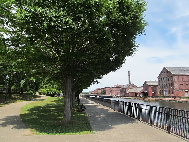
Today The Bicentennial Canal Park serves as a historic memorial, preserving the historical remnants of the canal. The overlook deck provides vistas of the Mount Tom Range and the Connecticut River. Holyoke Gas & Electric maintains Texon Park, Lower Riverside Park, and Gatehouse Park along the Holyoke dam. Lower Riverside Park overlooks the site of the former inclined plane and lock system, remnants of which are still visible today.[9]
Pulaski Park
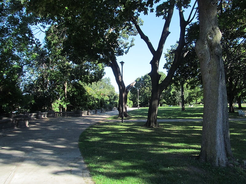
Park in Holyoke, Massachusetts. Pulaski Park is a city park along the Connecticut River in Holyoke, Massachusetts. Originally called Prospect Park when it was laid out in 1884, it was given its present name in 1939 in honor of American Revolutionary War hero Casimir Pulaski, for whom there is a memorial in the park's center. The original 5.1-acre park was designed by the Olmsted Brothers landscape design firm.[10]
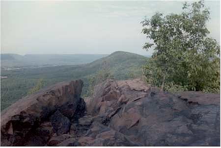
Mount Holyoke
Peak in Massachusetts. Mount Holyoke, a traprock mountain, elevation 935 feet, is the westernmost peak of the Holyoke Range and part of the 100-mile Metacomet Ridge. The mountain is located in the Connecticut River Valley of western Massachusetts, and is the namesake of nearby Mount Holyoke College. The mountain is located in the towns of Hadley and South Hadley, Massachusetts. It is known for its historic summit house, auto road, scenic vistas, and biodiversity. The mountain is crossed by the 110-mile Metacomet-Monadnock Trail and numerous shorter trails. Mount Holyoke is the home of J.A. Skinner State Park which is accessible from Route 47 in Hadley, Massachusetts.[11]
Holyoke Heritage State Park
State park in Holyoke, Massachusetts. Holyoke Heritage State Park is history-oriented state park located in the city of Holyoke, Massachusetts. The park opened in 1986 on the site of the William Skinner Silk Mill which was lost to fire in 1980. The park is managed by the Massachusetts Department of Conservation and Recreation.[12]
Address: 221 Appleton St, 01040 Holyoke (Holyoke)
Mount Holyoke Range State Park
State park in Hampshire County, Massachusetts. Mount Holyoke Range State Park is a state-owned, public recreation area encompassing the eastern half of the Holyoke Range in the Pioneer Valley region of Massachusetts. The state park is adjacent to J. A. Skinner State Park, which occupies the western half of the Holyoke Range. Both are managed by the Massachusetts Department of Conservation and Recreation.[13]
Address: 1500 West St, 01002-3330 Holyoke
Ashley Reservoir
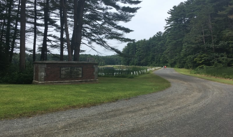
Reservoir in Massachusetts. Ashley Reservoir, a Class II hazard reservoir, is the secondary drinking supply for the city of Holyoke, Massachusetts. The reservoir, consisting of Wright Pond and Ashley Pond, has an impound capacity of more than 795 million gallons of water and a safe yield of 2.1 million gallons of water per day.
The reservoir's construction finished and it became fully operational in 1897. Ashley Reservoir is connected to a smaller reservoir McLean Reservoir, named after Holyoke Water Works Commissioner Hugh McLean, through a water-pumping plant that is operated by the Holyoke Water Works. The reservoir has a surrounding gravel road open to civilian recreational use.[14]
Willimansett Bridge
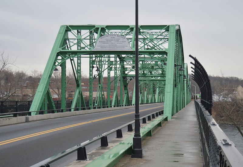
Truss bridge in Chicopee, Massachusetts. The Willimansett Bridge is a steel truss bridge over the Connecticut River located between Chicopee, Massachusetts and Holyoke, Massachusetts. It carries Massachusetts state routes 116 and 141.[15]