Discover 35 hidden attractions, cool sights, and unusual things to do in Yellowstone National Park (United States). Don't miss out on these must-see attractions: Grand Canyon of the Yellowstone, Tower Fall, and Lewis Falls. Also, be sure to include Old Faithful in your itinerary.
Below, you can find the list of the most amazing places you should visit in Yellowstone National Park (Wyoming).
Table of Contents
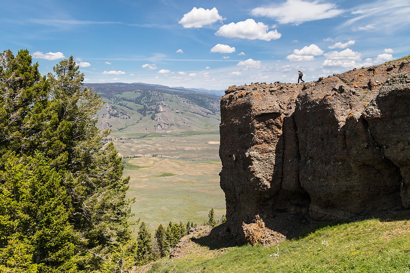
Grand Canyon of the Yellowstone
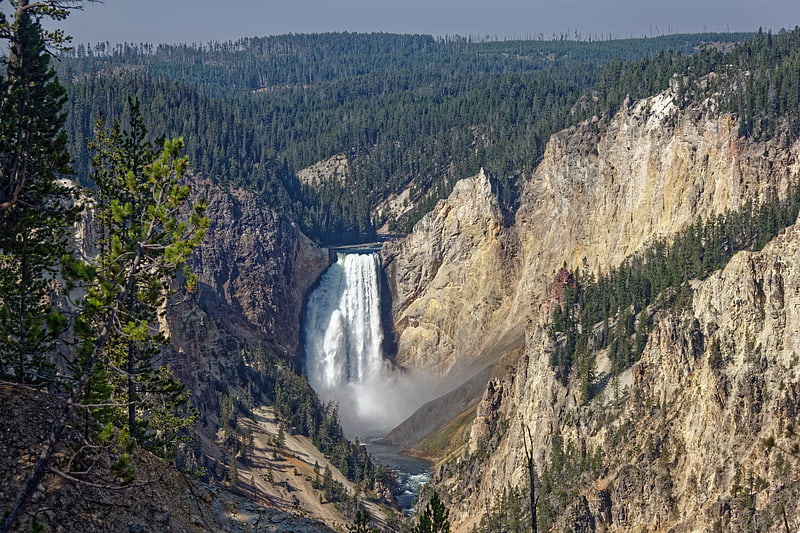
Canyon. The Grand Canyon of the Yellowstone is the first large canyon on the Yellowstone River downstream from Yellowstone Falls in Yellowstone National Park in Wyoming. The canyon is approximately 24 miles long, between 800 and 1,200 ft deep and from.25 to.75 mi wide.[1]
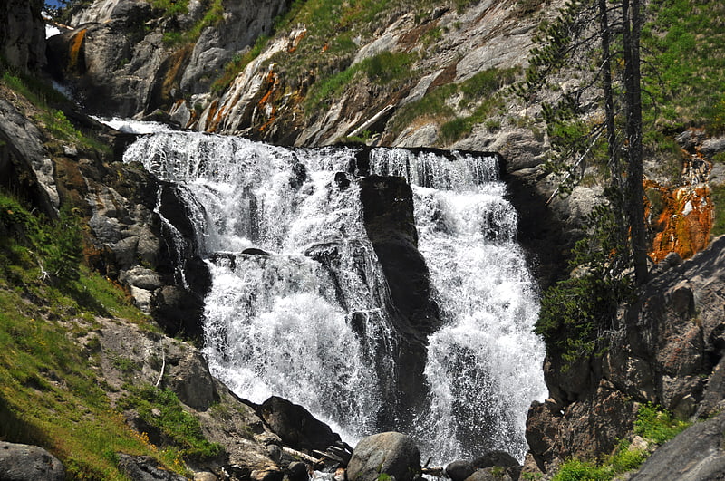
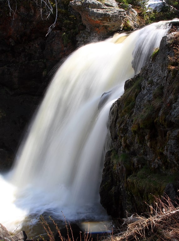
Tower Fall
Waterfall with short hike to the bottom. Tower Fall is a waterfall on Tower Creek in the northeastern region of Yellowstone National Park, in the U.S. state of Wyoming. Approximately 1,000 yards upstream from the creek's confluence with the Yellowstone River, the fall plunges 132 feet. Its name comes from the rock pinnacles at the top of the fall. Tower Creek and Tower Fall are located approximately three miles south of Roosevelt Junction on the Tower-Canyon road.[2]
Lewis Falls
30-ft. cascade waterfall in Yellowstone. The Lewis Falls are located on the Lewis River in Yellowstone National Park, Wyoming, United States. The falls drop approximately 30 feet and are easily seen from the road, halfway between the south entrance to the park and Grant Village. The falls are on the Lewis River, just south of Lewis Lake.[3]
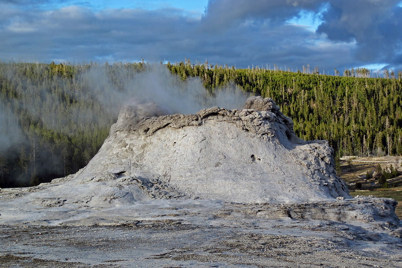
Old Faithful
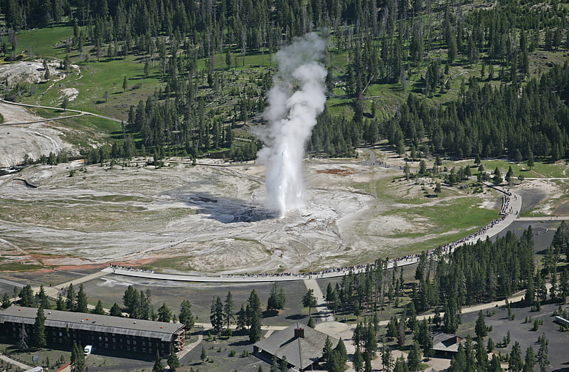
Legendary geyser erupting on schedule. Old Faithful is a cone geyser in Yellowstone National Park in Wyoming, United States. It was named in 1870 during the Washburn–Langford–Doane Expedition and was the first geyser in the park to be named. It is a highly predictable geothermal feature and has erupted every 44 minutes to two hours since 2000. The geyser and the nearby Old Faithful Inn are part of the Old Faithful Historic District.[4]
Gibbon Falls
Waterfall in Wyoming. Gibbon Falls is a waterfall on the Gibbon River in northwestern Yellowstone National Park in the United States. Gibbon Falls has a drop of approximately 84 feet. The falls are located roadside, 4.7 miles upstream from the confluence of the Gibbon and Firehole Rivers at Madison Junction on the Grand Loop Road.[5]
Address: Along the Grand Loop Road, Yellowstone National Park
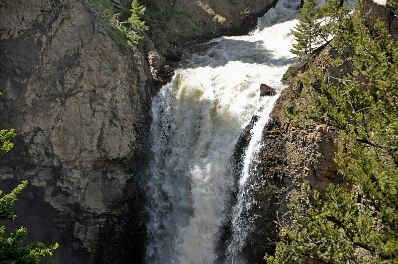
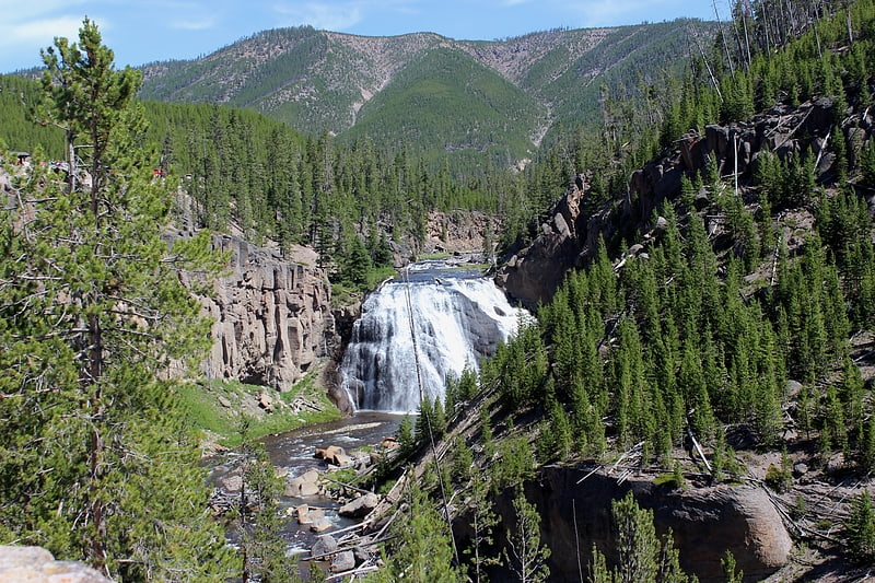
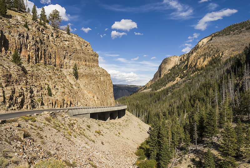
Yellowstone Falls
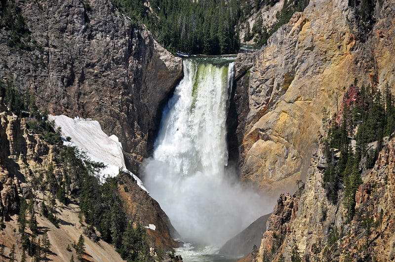
Large waterfall with trails and viewpoints. Yellowstone Falls consist of two major waterfalls on the Yellowstone River, within Yellowstone National Park, Wyoming, United States. As the Yellowstone river flows north from Yellowstone Lake, it leaves the Hayden Valley and plunges first over Upper Yellowstone Falls and then a quarter mile downstream over Lower Yellowstone Falls, at which point it then enters the Grand Canyon of the Yellowstone, which is up to 1,000 feet deep.[6]
Kepler Cascades
Waterfall in Wyoming. Kepler Cascades is a waterfall on the Firehole River in southwestern Yellowstone National Park in the United States. The cascades are located approximately 2.6 miles south of Old Faithful. The cascades drop approximately 150 feet over multiple drops. The longest drop is 50 feet. The cascades are located very near to and visible from the Old Faithful to West Thumb road.[7]
Address: Grand Loop Road between Old Faithful and South Entrance, 82190 Yellowstone National Park
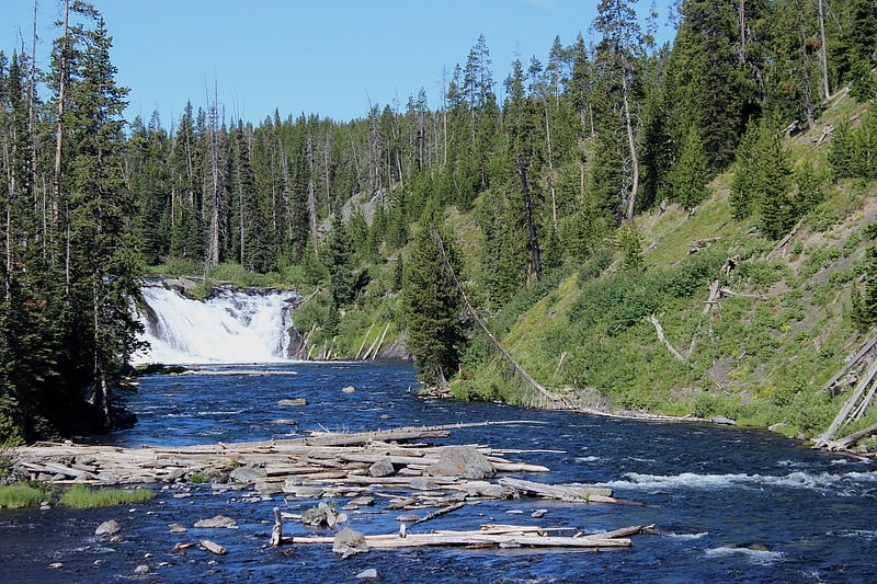
Firehole Falls
Waterfall in Wyoming. Firehole Falls is a waterfall on the Firehole River in southwestern Yellowstone National Park in the United States. The falls are located approximately 0.5 miles upstream from the confluence of the Firehole and Gibbon Rivers at Madison Junction. Firehole Falls has a drop of approximately 40 feet. The falls are located within Firehole Canyon on Firehole Canyon Drive, a one-way road that parallels the main Madison Junction to Old Faithful road.[8]
Mystic Falls
Waterfall in Wyoming. Mystic Falls is a 70-foot cascade type waterfall on the Little Firehole River, a tributary of the Firehole River. Originally named Little Firehole Falls by members of the 1872 Hayden Geologic Survey, the name was changed to Mystic Falls by members of the Arnold Hague Geological Survey in 1885 for unknown reasons. Mystic Falls is reached via the 1.2 miles Mystic Falls Trail which starts at Biscuit Basin in the Upper Geyser Basin.[9]
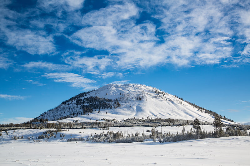
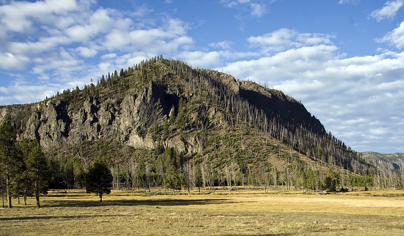
Mount Washburn
Hiking standby with a fire lookout. Mount Washburn, elevation 10,219 feet, is a prominent mountain peak in the Washburn Range in Yellowstone National Park, Wyoming. The peak was named in 1870 to honor Henry D. Washburn, leader of the Washburn–Langford–Doane Expedition. The Washburn Range is one of two mountains ranges completely within the boundaries of Yellowstone.[10]
Roosevelt Arch
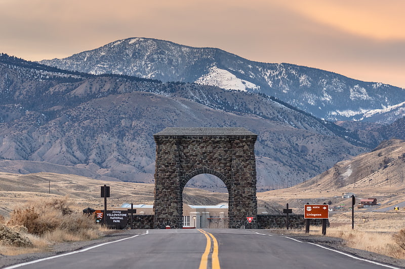
Monument in Park County, Montana. The Roosevelt Arch is a rusticated triumphal arch at the north entrance to Yellowstone National Park in Gardiner, Montana, United States. Constructed under the supervision of the US Army at Fort Yellowstone, its cornerstone was laid down by President Theodore Roosevelt in 1903. The top of the arch is inscribed with a quote from the Organic Act of 1872, the legislation which created Yellowstone, which reads: "For the Benefit and Enjoyment of the People".
The idea of the arch is attributed to Hiram Martin Chittenden, who felt that the area surrounding Gardiner was not sufficiently impressive and required an emphatic statement of arrival at the famous park. Before 1903, trains brought visitors to Cinnabar, Montana, which was a few miles northwest of Gardiner, Montana, where people would transfer onto horse-drawn coaches to enter the park. In 1903, the railway finally came to Gardiner. With the development of the Gardiner train station, the arch was proposed as part of the station ensemble.[11]
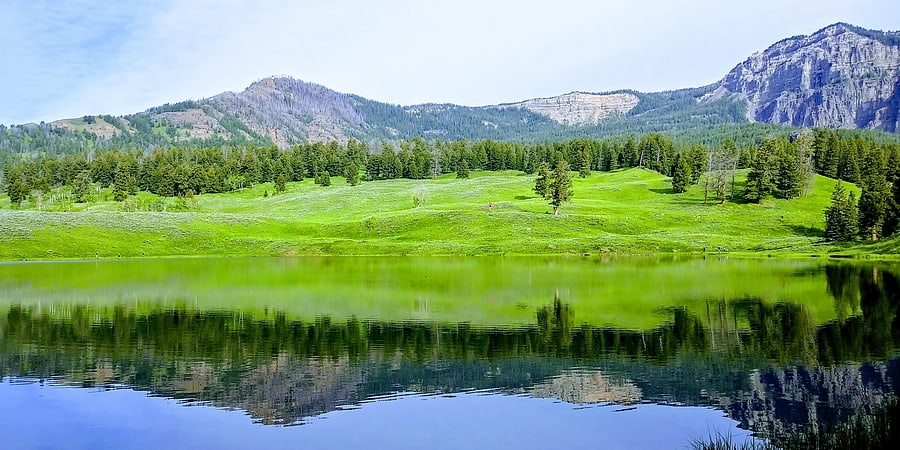
Hayden Valley
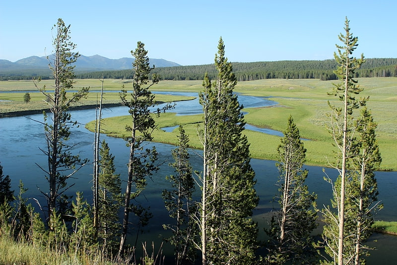
Hayden Valley is a large, sub-alpine valley in Yellowstone National Park straddling the Yellowstone River between Yellowstone Falls and Yellowstone Lake. The valley floor along the river is an ancient lake bed from a time when Yellowstone Lake was much larger. The valley is well known as one of the best locations to view wildlife in Yellowstone.[12]
Address: Yellowstone National Park, 82190 Yellowstone National Park
Moose Falls
Waterfall in Wyoming. Moose Falls is a plunge type waterfall on Crawfish Creek in Yellowstone National Park. The waterfall was named in 1885 by members of the Arnold Hague Geologic Survey for the plentiful moose found in the southern sections of the park. The falls are just 75 yards west of south entrance road via an easy trail that begins 1.2 miles north of the south entrance station.[13]
Address: Lewis River, Yellowstone National Park
Golden Gate Canyon
Golden Gate Canyon is in the northwestern region of Yellowstone National Park in the U.S. state of Wyoming. Glen Creek flows north through the canyon en route to the Gardner River descending from 7,400 feet at Kingman Pass to just under 6,000 feet in less than 3 miles. The northern portion of the Grand Loop Road traverses the canyon, connecting Mammoth Hot Springs with park features to the south.
A road was first built through the Golden Gate in 1884–85, replacing a steep, difficult road over Snow Pass. The construction was directed by U.S. Army Lieutenant Dan Christie Kingman. The canyon's name Golden Gate was first documented by Kingman in his reports to the Departments of the Army and Interior as what visitors to the park called the canyon and pass because of the yellow hue of the rocks in the area. The work included a wooden trestle where a cliff face precluded grading. In 1900 the viaduct was rebuilt as a concrete structure under the supervision of Captain Hiram M. Chittenden. Chittenden's viaduct was replaced in turn in 1930–34, the outcome of a program to widen the road. The widened viaduct was itself replaced in 1977.[14]
Virginia Cascades
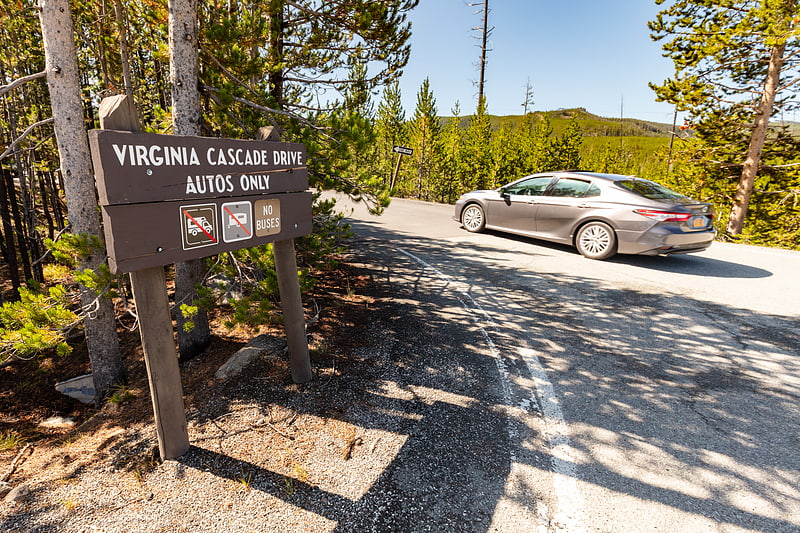
Waterfall in Wyoming. Virginia Cascades, is a cascade type waterfall on the Gibbon River in Yellowstone National Park. Virginia Cascades is located just south of the Norris-Canyon road approximately 2.5 miles east of Norris Junction. A one-way road provides access to the north side of the cascades.
Virginia Cascades was named in 1886 to honor Virginia Gibson, the wife of Charles Gibson, the head of the Yellowstone Park Association concessions by Ed Lamartine who built the first wagon road between Norris and Canyon. In 1880, then superintendent Philetus Norris had named the cascades, Norris Falls but geologist Arnold Hague, although he did not like to give personal names to scenic features, agreed to the name Virginia Cascades because he thought it useful to name park features after states in the union.[15]
Overhanging Cliff
Cliff in Wyoming. Overhanging Cliff is a cliff of vertical basalt that overhangs the Grand Loop Road just north of Tower Fall on the north rim of the Grand Canyon of the Yellowstone in Yellowstone National Park. The point was most likely named by a member of the Cook–Folsom–Peterson Expedition, David Folsum in 1869. It is the only place in the US in which the Contour lines cross[16]
Madison Museum
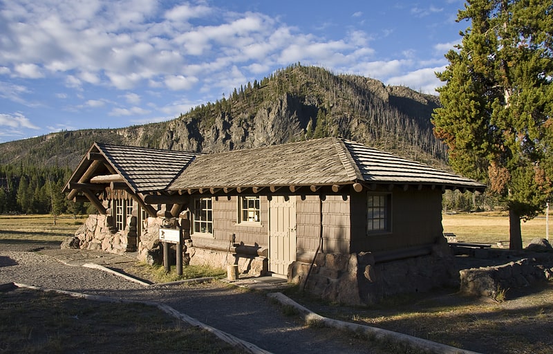
Museum in Teton County, Wyoming. The Madison Museum is one of a series of "trailside museums" in Yellowstone National Park designed by architect Herbert Maier in a style that has become known as National Park Service Rustic. It was listed on the National Register of Historic Places in 1982, and is one of three parts of a 1987-declared National Historic Landmark, the Norris, Madison, and Fishing Bridge Museums. Built in 1929, the Madison Museum is the smallest of the three. It is sited on a small rise that overlooks the meadows and canyon of the Madison River, and still fulfills its function as an informal interpretive center.[17]
Silver Cord Cascade
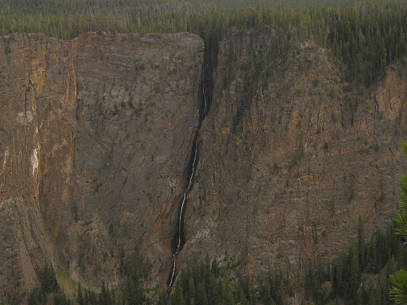
Waterfall in Wyoming. Silver Cord Cascade is a horsetail type waterfall on Surface Creek, a tributary of the Yellowstone River in Yellowstone National Park. Surface Creek flows out of Ribbon Lake off the South rim of the Grand Canyon of the Yellowstone and plunges 1,200 feet to the Yellowstone River. It is considered the tallest waterfall in Yellowstone.
Silver Cord Cascade was first described by members of the Washburn–Langford–Doane Expedition as Silverthread Falls.
the wild, floating stories about falls 1,000 feet in height are no doubt exaggerations as applied to the main stream. That there are small streams...that fall the distance of 1,000 feet or more, perpendicular, is true and such were seen by some of our party.
Samuel Hauser and Benjamin Stickney, members of the Washburn Expedition are credited with the name Silverthread Falls. In 1883, Philetus Norris, then park superintendent, renamed the falls Sliding Cascade. However, in 1885 the official name, Silver Cord Cascade, was bestowed on the falls by the Arnold Hague Geological Survey.
The brink of the falls can be reached via the Clear Lake-Ribbon Lake trail, while the falls can be viewed from the North rim of the canyon off the Sevenmile Hole trail.[18]
Fishing Bridge Museum
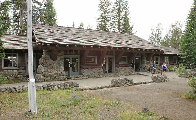
Museum in Yellowstone National Park, Wyoming. The Fishing Bridge Museum is one of a series of "trailside museums" in Yellowstone National Park, Wyoming, United States, designed by architect Herbert Maier in a style that has become known as National Park Service Rustic. It is one of three parts of a 1987-declared National Historic Landmark, the Norris, Madison, and Fishing Bridge Museums. It was not listed separately on the National Register of Historic Places as the other two were. Built in 1931, the Fishing Bridge Museum is the largest in the series, and is used as a small visitor center. The museum displays stuffed mounts of birds and animals found in Yellowstone Park.[19]
Yellowstone Lake
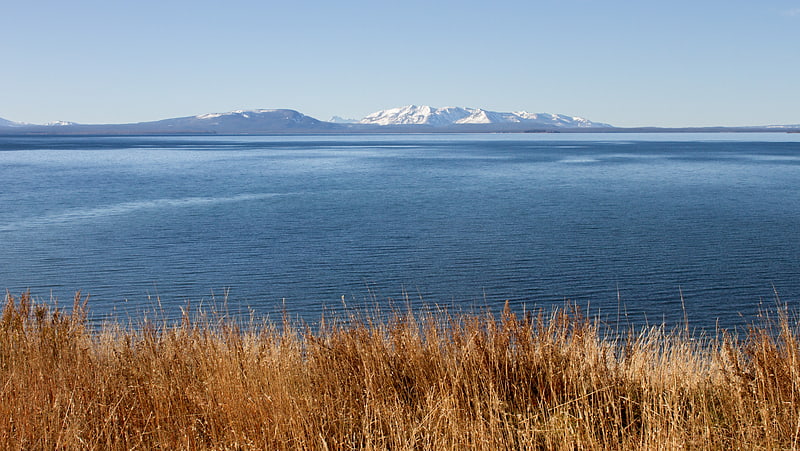
Lake in Wyoming. Yellowstone Lake is the largest body of water in Yellowstone National Park. The lake is 7,732 feet above sea level and covers 136 square miles with 110 miles of shoreline. While the average depth of the lake is 139 ft, its greatest depth is at least 394 ft. Yellowstone Lake is the largest freshwater lake above 7,000 ft in North America.
In winter, ice nearly 3 ft (0.91 m) thick covers much of the lake except where shallow water covers hot springs. The lake freezes over by early December and can remain frozen until late May or early June.[20]
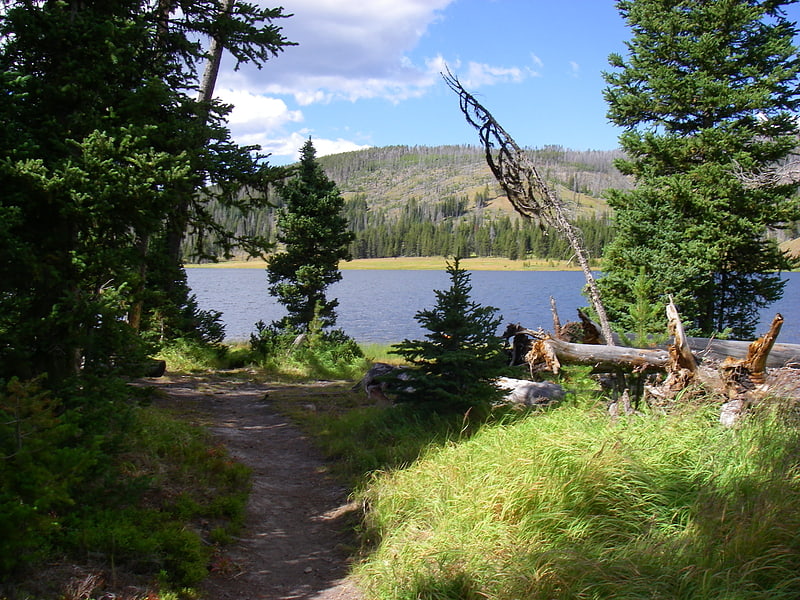
Trout Lake
Lake in Wyoming. Trout Lake, formerly known as Fish Lake and Soda Butte Lake, is a 12 acres popular backcountry lake for hikers and anglers in Yellowstone National Park. The lake is located approximately.33 miles north of the Northeast Entrance Road near the confluence of Pebble Creek and Soda Butte Creek. The lake sits in a depression on a high bench above the Soda Butte Creek Canyon. A steep trail through a Douglas fir forest leads to the lake. The trailhead is located at: 44°53′57″N 110°7′21″W.
Trout Lake is a popular area for viewing North American river otter.[21]
Bunsen Peak
Peak in Wyoming. Bunsen Peak el. 8,564 feet is a prominent peak due south of Mammoth Hot Springs in Yellowstone National Park, Wyoming. The peak lies on the east flank of Kingman Pass on the Mammoth to Norris section of the Grand Loop Road. The peak was first ascended by Ferdinand V. Hayden and Captain John W. Barlow in 1871, Bunsen Peak was not named until 1872 during the second Hayden Geologic Survey. E. S. Topping named the peak Observation Mountain in 1872 as well, but that name did not stick. The Bunsen Peak Trail with its trailhead just south of Mammoth is a steep 2.1 miles to the summit. Bunsen Peak was named for the German chemist Robert Bunsen, the inventor of the Bunsen Burner and responsible for early work on volcanic geyser theories.[22]
Old Faithful Inn
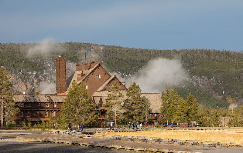
Landmark property with a restaurant. The Old Faithful Inn is a hotel located in Yellowstone National Park, Wyoming, United States, with a view of the Old Faithful Geyser. The Inn has a multi-story log lobby, flanked by long frame wings containing guest rooms.
With its log and limb lobby and massive (500-short-ton or 450-metric-ton, 85-foot or 26-meter) stone fireplace, the inn is an example of the "Golden Age" of rustic resort architecture, a style which is also known as National Park Service Rustic. It is one of the few log hotels still standing in the United States, and was the first of the great park lodges of the American west.
Initial construction was carried out over the winter of 1903–1904, largely using locally obtained materials including lodgepole pine and rhyolite stone. When the Old Faithful Inn first opened in the spring of 1904, it boasted electric lights and steam heat.
The structure is the largest log hotel in the world; possibly even the largest log building in the world. In 2007 the American Institute of Architects conducted a survey to determine the 150 favorite buildings in America; the Old Faithful Inn ranked 36. The Inn, which was designated a National Historic Landmark in 1987, is itself part of the Old Faithful Historic District. Old Faithful Inn is a member of Historic Hotels of America, the official program of the National Trust for Historic Preservation.[23]
Address: Old Faithful, Yellowstone National Park
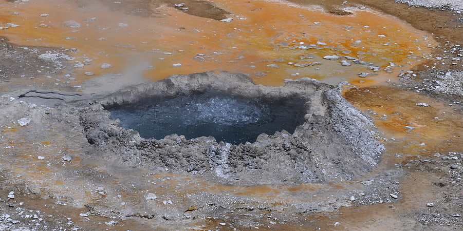
Ear Spring
Ear Spring is a hot spring in the Upper Geyser Basin of Yellowstone National Park in the United States. Located close to Old Faithful, on rare occasions Ear Spring will erupt as a geyser, and can shoot rocks and debris as well as water more than 25 feet for a few minutes. On September 15, 2018, Ear Spring was seen on the National Park Service webcam at Old Faithful erupting for a minute and reached heights of 20 to 30 ft. This was the largest eruption the pool may have had since 1957. The eruption tossed small rocks out and the heated water killed the surrounding bacterial mats that normally thrive in less heated conditions. Likely related to the eruption of Ear Spring, a new thermal feature opened up under the pedestrian boardwalk near Pump Geyser which resulted in the National Park Service temporarily closing off the boardwalk. This new thermal feature was spouting water the night of September 18-19, 2018. Additionally, Doublet Pool and North Goggles Geyser have both been more active in the period immediately after the rare eruption of Ear Spring.[24]
Specimen Ridge
Ridge in Wyoming. Specimen Ridge, el. 8,379 feet is an approximately 8.5-mile ridge along the south rim of the Lamar Valley in Yellowstone National Park. The ridge separates the Lamar Valley from Mirror Plateau. The ridge is oriented northwest to southeast from the Tower Junction area to Amethyst Mountain. The ridge is known for its abundance of amethyst, opal and petrified wood. It was referred to as Specimen Mountain by local miners and was probably named by prospectors well before 1870. The south side of the ridge is traversed by the 18.8-mile Specimen Ridge Trail between Tower Junction and Soda Butte Creek. The trail passes through the Petrified Forest and over the summit of Amethyst Mountain el. 9,614 feet.[25]
Grebe Lake
Lake in Wyoming. Grebe Lake is a 156 acres backcountry lake in Yellowstone National Park most noted for its population of Arctic grayling. Grebe Lake comprises the headwaters of the Gibbon River. Grebe Lake is located approximately 3.1 miles north of the Norris-Canyon section of the Grand Loop Road. The trail to the lake passes through mostly level Lodgepole Pine forest and open meadows. The lake was named by J.P. Iddings, a geologist with the Arnold Hague geologic surveys. There are four backcountry campsites located on the lake.[26]
Shoshone Lake
Lake in Wyoming. Shoshone Lake is a U.S. backcountry lake with the area of 8,050 acres elevated at 7,795 feet in the southwest section of Yellowstone National Park, Wyoming. It lies at the headwaters of the Lewis River a tributary of the Snake River. The U.S. Fish and Wildlife Service believes that Shoshone Lake is the largest backcountry lake in the lower 48 states that cannot be reached by a road.[27]
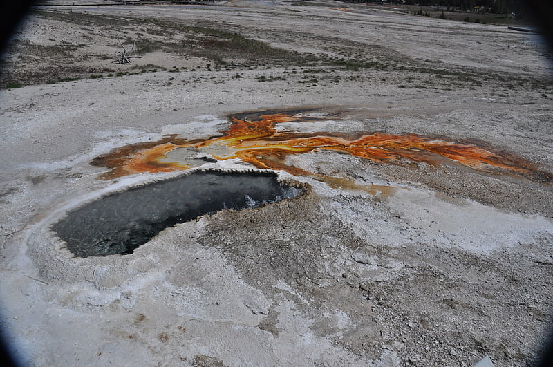
Chinese Spring
Spring in Wyoming. Chinese Spring is a hot spring in Yellowstone National Park, Teton County, Wyoming, in the United States.
Chinese Spring was named for a Chinese immigrant who often washed laundry in the spring in the 1850s.[28]
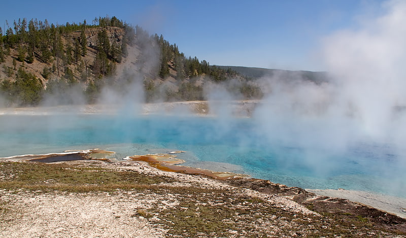
Grand Prismatic Spring
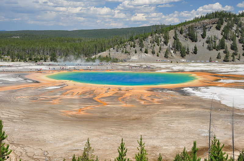
Hot spring in Wyoming. The Grand Prismatic Spring in Yellowstone National Park is the largest hot spring in the United States, and the third largest in the world, after Frying Pan Lake in New Zealand and Boiling Lake in Dominica. It is located in the Midway Geyser Basin.
Grand Prismatic Spring was noted by geologists working in the Hayden Geological Survey of 1871, and named by them for its striking coloration. Its colors match most of those seen in the rainbow dispersion of white light by an optical prism: red, orange, yellow, green, and blue.[29]
Address: Midway Geyser Basin, Yellowstone National Park
Castle Geyser
Eruption of water to a height of 90 ft. Castle Geyser is a cone geyser in the Upper Geyser Basin of Yellowstone National Park. It is noted for the particularly large geyserite sinter deposits, which form its cone. These deposits have been likened in appearance to a castle.
When the geyser was given this name in 1870, the top edges of the structure resembled the typical profile associated with the modern concept of a castle, having the appearance of a large keep, multiple turrets, and especially because of the crenellation along the top edges of what resembled its towers. As the drawing below shows the cone had distinctive appearance at the time. Over time the cone's shape changes because of the layers of mineral deposited in successive eruptions.[30]
Electric Peak
Mountain in Montana. Electric Peak is the tallest mountain in the Gallatin Range of southern Montana, close to the Wyoming border and rises to an altitude of 10,969 feet. The peak has some of the greatest physical relief in Yellowstone National Park, rising 3,389 ft above its base.
Electric Peak was named during the first ascent in 1872 by the United States Geological Survey. Members of the Hayden Survey led by Henry Gannett experienced electrical discharges from their hands and hair after a lightning event on the summit.[31]
Dunraven Peak
Mountain in Wyoming. Dunraven Peak el. 9,869 feet is a mountain peak in the Washburn Range of Yellowstone National Park. In 1874, just two years after the park's creation, The 4th Earl of Dunraven and Mount-Earl, an Anglo-Irish peer, made a visit to Yellowstone in conjunction with a hunting expedition led by Texas Jack Omohundro to the Northern Rockies. Lord Dunraven was so impressed with the park, that he devoted well over 150 pages to Yellowstone in his The Great Divide, published in London in 1874. The Great Divide was one of the earliest works to praise and publicize the park.
In 1878, during a U.S. Geological Survey of the park, Henry Gannett, a geographer working with the survey, named a peak just two miles southwest of Mount Washburn in honor of Lord Dunraven and the service his book had done for the park. In 1879, Philetus Norris, the park Superintendent, gave a pass on the Grand Loop Road between Tower and Canyon the name Dunraven Pass because of its proximity to Dunraven Peak.[32]
National Park Mountain
Mountain in Wyoming. National Park Mountain is in Yellowstone National Park in the U.S. state of Wyoming. National Park Mountain rises above the confluence of the Firehole River and the Madison River and is just west of Madison Junction.[33]
Excelsior Geyser Crater
Tourist attraction in Yellowstone National Park, Wyoming. Excelsior Geyser Crater, formerly known as Excelsior Geyser, is a dormant fountain-type geyser in the Midway Geyser Basin of Yellowstone National Park in the United States. Excelsior was named by the Hayden Geological Survey of 1871.[34]
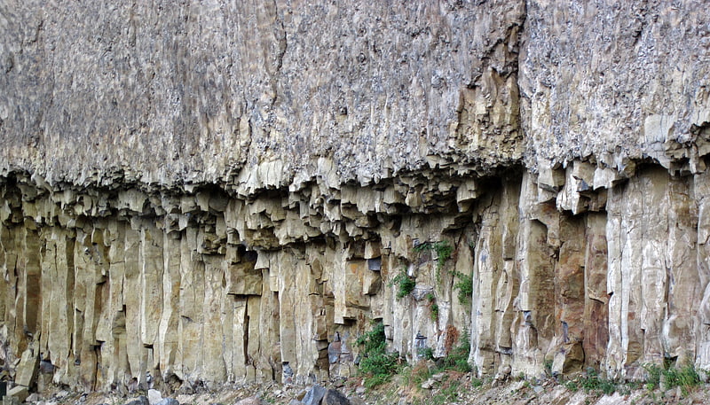
Obsidian Cliff
Cliff in Wyoming. Obsidian Cliff, also known as 48YE433, was an important source of lithic materials for prehistoric peoples in Yellowstone National Park near Mammoth Hot Springs, Wyoming, United States. The cliff was named by Philetus Norris, the second park superintendent in 1878. It was declared a National Historic Landmark in 1996.
The cliff was formed from thick rhyolite lava flow that occurred about 180,000 years ago. The vertical columns are cooling fractures that formed as the thick lava flow cooled and crystallized. The Cliffs stands at an elevation of nearly 7,400 feet (2,300 m) above sea level and goes on for about half a mile. The cliffs also extend between 150 and 200 feet above Obsidian Creek. The flow consists of obsidian, a dark volcanic glass. The obsidian is most abundant at the base of the cliff and slowly tapers off to larger concentrations of pumice at the top. Obsidian from this site was first quarried here about 12,000 years ago. Early natives of North America placed a high value on the obsidian that came from this cliff as well as other similar obsidian deposits in the area because numerous tools could be fashioned from obsidian—most popularly, knives, spear/arrow tips, and other sharp-edged objects. In fact, obsidian from Obsidian Cliff was so sought after in early America (before the time of Columbus) that it was traded as far away as Ohio and Canada.
Many studies have been done on the composition of the obsidian from Obsidian Cliff and how the obsidian from Obsidian Cliff was distributed. This research has provided evidence of the direction and extent of prehistoric trade networks.
It is located about 13 miles (21 km) south of Mammoth Hot Springs, on the east side of the Mammoth-Norris section of the Grand Loop Road. The Obsidian Cliff Kiosk, just north, is also listed on the National Register. Obsidian Cliff is also located on the northern end of Beaver Lake in Yellowstone National Park.[35]