Discover 11 hidden attractions, cool sights, and unusual things to do in Capitol Reef National Park (United States). Don't miss out on these must-see attractions: EPH Hanks Tower, Capitol Dome, and Ferns Nipple. Also, be sure to include Pectols Pyramid in your itinerary.
Below, you can find the list of the most amazing places you should visit in Capitol Reef National Park (Utah).
Table of Contents
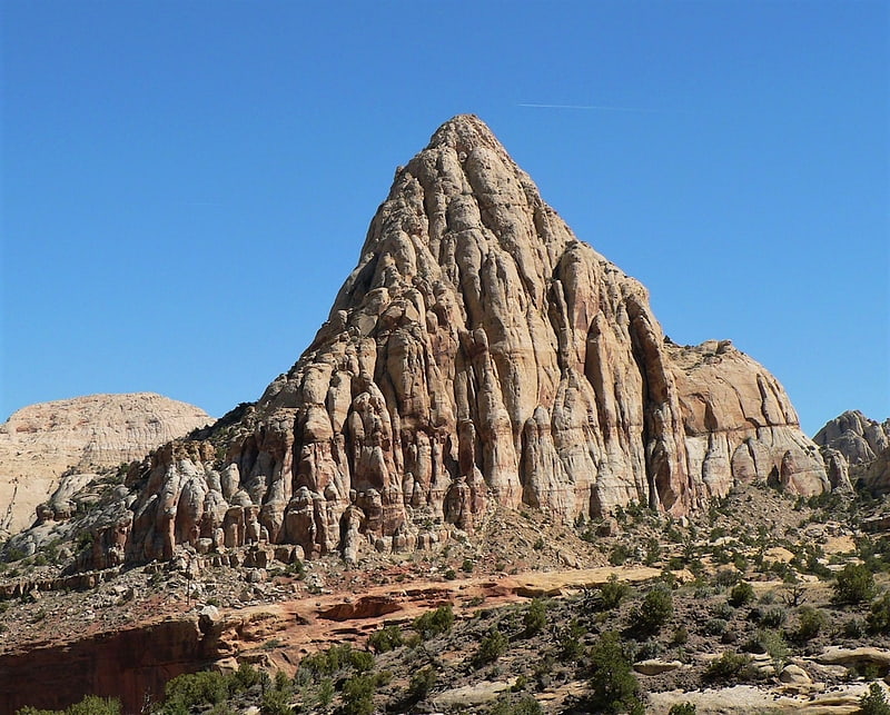
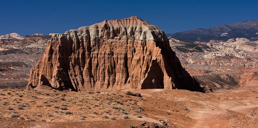
EPH Hanks Tower
Eph Hanks Tower is a 6,540-foot elevation summit located in Capitol Reef National Park, in Wayne County of Utah, United States. This landmark is situated 8 mi southeast of the park's visitor center, 3.5 mi south-southeast of Ferns Nipple, and 1.4 mi south-southwest of Golden Throne, at the mouth of Capitol Gorge where the Capitol Reef Scenic Drive road ends. It towers 900 feet above the picnic area below its north aspect. Precipitation runoff from this feature is drained by Capitol Wash and Pleasant Creek, a tributary of the Fremont River, which in turn is within the Colorado River drainage basin. This geological feature is named after Ephraim Knowlton Hanks, a Mormon pioneer and first permanent settler in the Capitol Reef area, who with his family homesteaded in the Pleasant Creek area of Capitol Reef in 1881. Ephraim Hank's Floral Ranch on Pleasant Creek supposedly offered a safe retreat for polygamists along the Mormon underground railroad.[1]
Capitol Dome
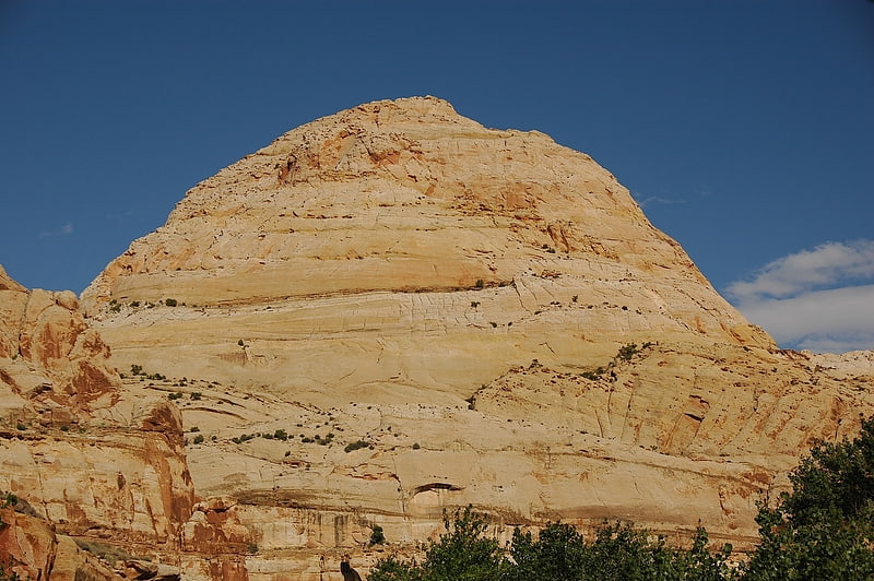
Capitol Dome is a 6,120-foot-elevation summit located in Capitol Reef National Park, in Wayne County, Utah, United States. This iconic landmark is situated 2.5 miles east of the park's visitor center, and 0.85 mi southeast of Navajo Dome. Precipitation runoff from this feature is drained by tributaries of the Fremont River, which in turn is within the Colorado River drainage basin. It towers 800 feet above the Fremont River and State Route 24. This geological feature's dome-like shape reminded early explorers and settlers of capitol buildings, and lent the park its name.[2]
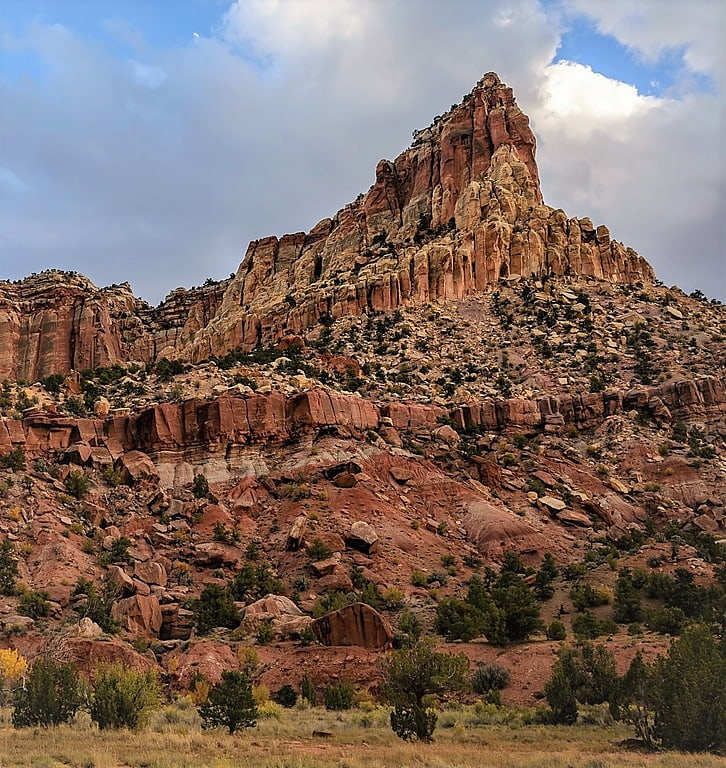
Ferns Nipple
Ferns Nipple is a 7,065-foot elevation summit located in Capitol Reef National Park, in Wayne County of Utah, United States. This iconic landmark is situated 4 mi southeast of the park's visitor center. Precipitation runoff from this feature is drained by tributaries of the Fremont River, which in turn is within the Colorado River drainage basin. Folklore attributes this geological feature's naming to outlaw Butch Cassidy and his favored girlfriend named Fern.[3]
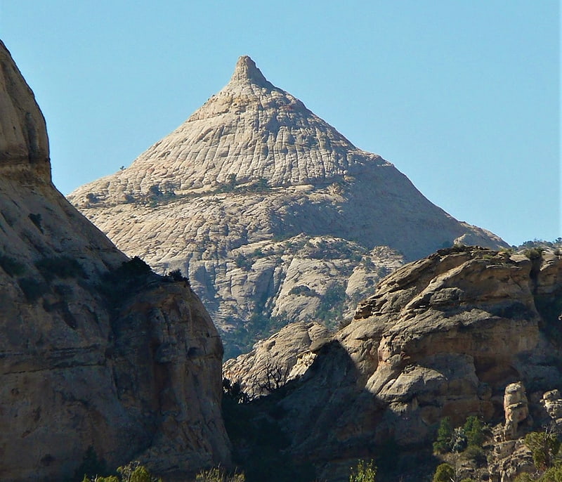
Pectols Pyramid
Pectols Pyramid is a 6,211-foot elevation summit located in Capitol Reef National Park, in Wayne County of Utah, United States. This iconic landmark is situated 2 mi southeast of the park's visitor center, 1 mi south of Navajo Dome, and 0.5 mi southwest of Capitol Dome. Precipitation runoff from this feature is drained by the Fremont River, which in turn is within the Colorado River drainage basin. This geological feature's name honors Ephraim Portman Pectol, booster and founder of what would become Capitol Reef National Monument in 1937.[4]
Jailhouse Rock
Jailhouse Rock is a 6,123-foot elevation summit located in Capitol Reef National Park, in Wayne County of Utah, United States. This remote iconic monolith is situated 9 mi north of the park's visitor center, and 4 mi south of Temples of the Sun and Moon, in the South Desert of the park's North District. South Desert is a long, narrow valley that runs parallel to the strike of the Waterpocket Fold monocline. Cathedral Valley was so named in 1945 by Charles Kelly, first superintendent of Capitol Reef National Monument, because the valley's sandstone monoliths reminded early explorers of ornate, Gothic cathedrals, with fluted walls, alcoves, and pinnacles. Jailhouse Rock rises 500 feet above its surrounding terrain, and can be seen from the Lower South Desert Overlook, which is 15 miles northwest of Highway 24 via the Hartnet Road. The hiking approach to the base of this large promontory rising from the valley floor is made from the Lower South Desert Overlook via a switchback trail until it disappears along the valley floor. Precipitation runoff from this feature is drained by Deep Creek, a tributary of the Fremont River, which in turn is within the Colorado River drainage basin.[5]
Navajo Dome
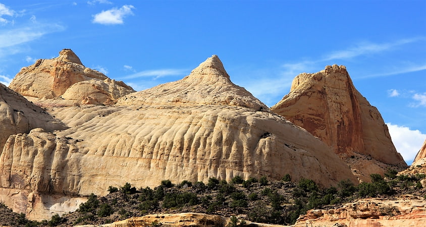
Navajo Dome is a 6,489-foot elevation summit located in Capitol Reef National Park, in Wayne County of Utah, United States. This iconic landmark is situated 2 mi east of the park's visitor center, and 0.85 mi northwest of Capitol Dome. Precipitation runoff from this feature is drained by the Fremont River, which in turn is within the Colorado River drainage basin. It rises 1,100 feet above the Fremont River and Highway 24, from which it is visible. The approach to the base of this peak is made via the Hickman Bridge Trail. This geological feature's descriptive name derives from its Navajo Sandstone composition, and dome-like shape.[6]
Morrell Cabin
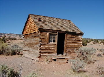
The Leslie Morrell Line Cabin and Corral are located in the Cathedral Valley section of northern Capitol Reef National Park in Utah. The cabin was built in the 1920s on Lake Creek by Paul Christensen at his sawmill as a summer residence for Christensen and his family. Christensen sold the cabin to Leslie H. Morrell around 1935, who took the cabin apart and rebuilt it at its present site for use as a winter camp for cowboys on the Morrell ranch. The use continued until 1970 when the area was sold to the National Park Service. It is one of the best-preserved relics of ranching activities in the park.
The cabin was listed on the National Register of Historic Places on September 13, 1999.[7]
Capitol Reef National Park
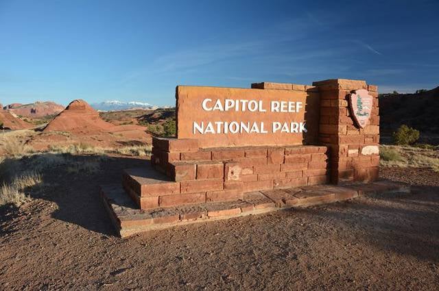
Top attraction, National park, Nature and wildlife, Relax in park, Park
Address: HC 70 Box 15, 52 West Headquarters Dr, Capitol Reef National Park
Golden Throne Mountain
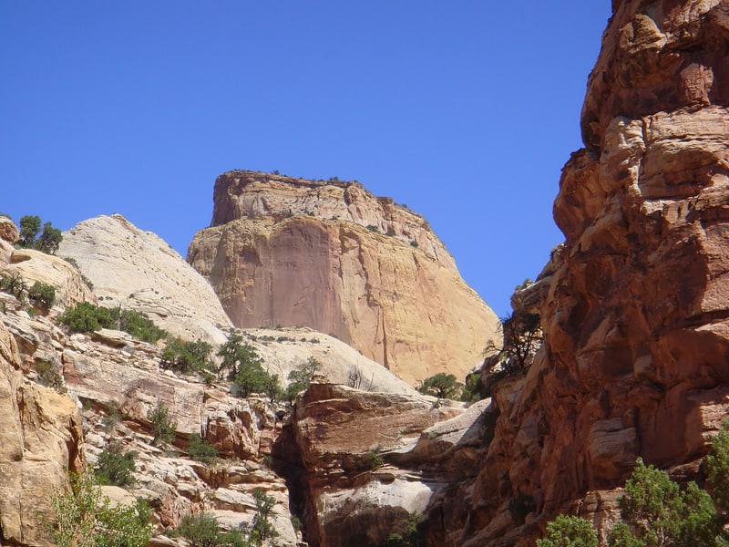
Mountain in Utah. The Golden Throne is a 7,041-foot mountain in Capitol Reef National Park in Wayne County, Utah, United States. It is a rock formation dome made of a gold color stained Navajo Sandstone, which is particularly special because normally the sandstone is creamy white or red. The presence of a small amount of the Carmel Formation on top of the Navajo Sandstone is the reason for this staining.
A two-mile-long (3.2 km) trail runs below the mountain. The summit is 7,042 feet (2,146 m) in elevation and is part of the Waterpocket Fold, a nearly 100-mile-long (160 km) monocline.[8]
Civilian Conservation Corps Powder Magazine
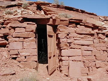
The Civilian Conservation Corps Powder Magazine in Capitol Reef National Park, Utah, was used in the 1930s to store explosives for use by Civilian Conservation Corps laborers in the construction of improvements to the park. Much of the CCC's work in the park involved the quarrying of sandstone blocks and slabs, which required explosives. The magazine was built about 1938 in association with CCC Camp NM-2, later called NP-6, located to the west of Fruita at Chimney Rock. The Fruita ranger station and the powder magazine are the only structures remaining from the CCC tenure in the park.
The magazine consists of a single room, partially built into a hillside. Walls are native red sandstone, coursed, with a stone slab for a roof. The building measures 10.5 feet (3.2 m) by 7.5 feet (2.3 m), with a dirt floor.
The magazine was placed on the National Register of Historic Places on September 13, 1999.[9]
Elijah Cutler Behunin Cabin
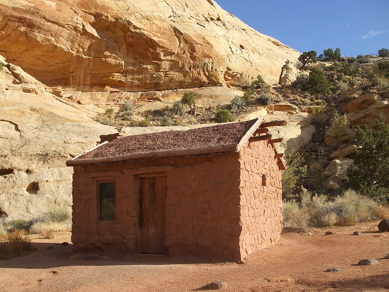
Historical landmark in the Wayne County, Utah. The Elijah Cutler Behunin Cabin was built to house Elijah Cutler Behunin's family in 1883–84 in what is now Capitol Reef National Park in Wayne County, Utah, United States.[10]