Discover 8 hidden attractions, cool sights, and unusual things to do in Dixie National Forest (United States). Don't miss out on these must-see attractions: Brian Head, Navajo Lake, and Mammoth Cave. Also, be sure to include Panguitch Lake in your itinerary.
Below, you can find the list of the most amazing places you should visit in Dixie National Forest (Utah).
Table of Contents
Brian Head
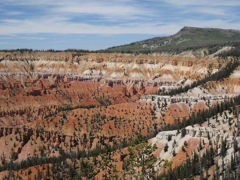
Peak in Utah. Brian Head, at 11,312 feet high, is the highest peak on the Markagunt Plateau and in Iron County in southwestern Utah, United States. Brian Head Peak is located east of Cedar City and just north of Cedar Breaks National Monument in Dixie National Forest. The town of Brian Head at the western base of the mountain is the location of the Brian Head Ski Resort.
Brian Head has the name of a government surveyor. There is a Forest Service lookout on the peak that was built in 1934–1935, and there is also a road to the summit that can be driven in summer.[1]
Navajo Lake
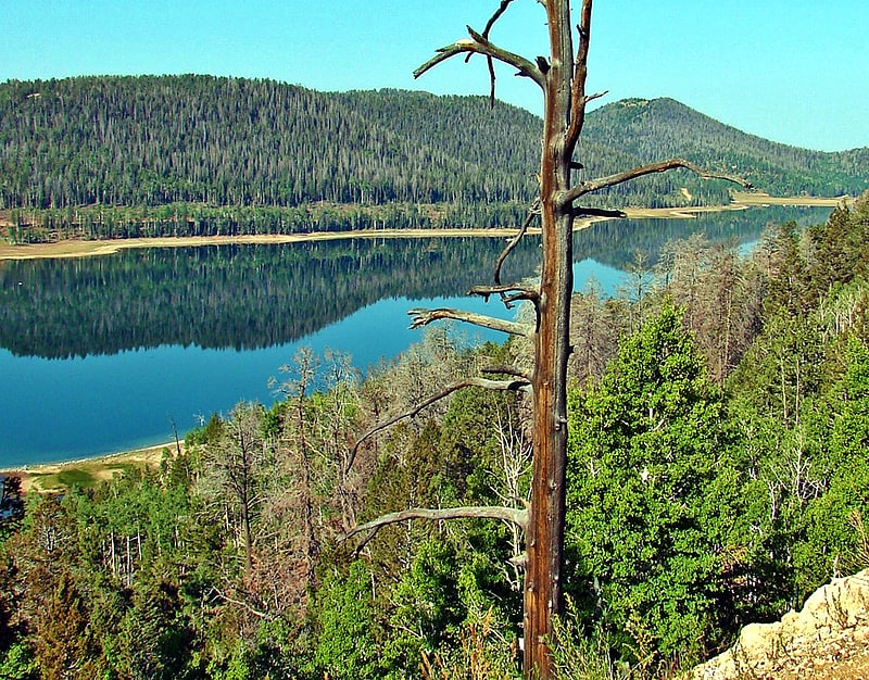
Reservoir in Utah. Navajo Lake is a small reservoir in northwestern Kane County in southern Utah, United States. It is shallow, reaching depths of only 25 feet. Recreation includes fishing, boating, swimming, and lodging facilities. Species of trout in Navajo Lake are brook trout, splake trout, and rainbow trout. Trout survival for winter is very poor with only the splake and brook trout overwintering. There is also a dense population of Utah chub. The lake was formed by a lava flow across the eastern end of the valley. The lake drains into both the Great Basin and the Colorado River drainage systems through sinkholes in the lake floor.[2]
Mammoth Cave
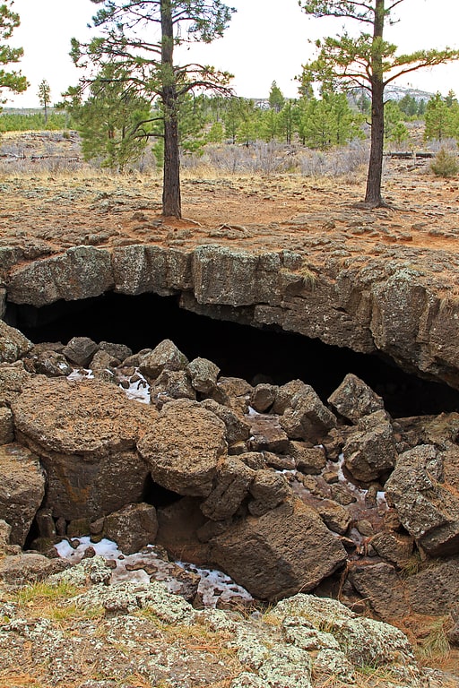
Tourist attraction in Duck Creek Village, Utah. Mammoth Cave is a lava tube located on the Markagunt Plateau in the Dixie National Forest of Southern Utah, and is one of the largest lava tubes in Utah. The cave has over 2,200 feet of passage and is about a quarter mile long. It was formed by cooling lava and water less than 2,000 years ago. Due to moisture and its elevation of 8,050 feet above sea level the cave stays cool year round.
The cave has four chambers, the largest to the west. At the end of the largest tunnel, it narrows to a small opening that can be used as an exit. Although the cave is open year round, portions of it are closed off from October until April to protect hibernating bats. Additionally, Mammoth Creek Road may be completely impassable during the winter months due to snowfall.[3]
Panguitch Lake
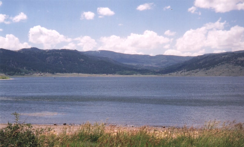
Lake in Utah. Panguitch Lake was originally a large natural lake that has now been expanded by the creation of a 24-foot dam to become a reservoir with a maximum surface area of 1,248 acres. The lake, which drains into the Sevier River is located on the Markagunt Plateau, between Panguitch, Utah and Cedar Breaks National Monument. The lake is located in the Dixie National Forest in a high tourist use area near three national parks and one national monument.
Panguitch Lake contains several campgrounds. Convenience stores and an LDS chapel are within walking distance of the campgrounds, and the roads are well paved and maintained. Road access to the lake is provided by Utah State Route 143, also known as the Brian Head-Panguitch Lake Scenic Byway or Utah's Patchwork Parkway.
The earliest known use of Panguitch Lake was as a fishery by Paiute Indians (Panguitch means "big fish" in the Paiute language). Panguitch Lake was treated with rotenone beginning May 1, 2006 to potentially eradicate and control the invasive population of Utah chub, which were probably introduced accidentally by anglers who used them as live bait. The lake was restocked with 20,000 rainbow trout in 2006; as of 2016, the lake's fish population has recovered.[4]
Mountain Meadow

Mountain Meadow or Mountain Meadows, is an area in present-day Washington County, Utah. It was a place of rest and grazing used by pack trains and drovers, on the Old Spanish Trail and later Mormons, Forty-niners, mail riders, migrants and teamsters on the Mormon Road on their way overland between Utah and California.[5]
Pine Valley Chapel and Tithing Office
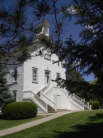
Building in Pine Valley, Utah. The Pine Valley Chapel and Tithing Office, the chapel sometimes being referred to as the Pine Valley Ward Chapel, are historic 19th-century buildings of The Church of Jesus Christ of Latter-day Saints in Pine Valley, Washington County, Utah, that are jointly listed on the National Register of Historic Places.[6]
Black Mountains
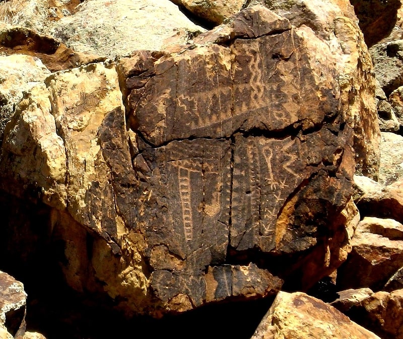
Mountain range. The Black Mountains is a 30-mile long mountain range in northeastern Iron County and southeastern Beaver County in southwestern Utah, United States.
The range borders the northeast portion of the Escalante Desert, and the range's southeast flank trends with the Hurricane Cliffs and Parowan Valley. In the south section, of a southwest trending ridgeline, is the Parowan Gap Petroglyphs Site. At the terminus of the ridgeline, the pass at the Summit, Utah region, there is the site of the Old Spanish National Historic Trail as it crossed into the northeast of Cedar Valley, the site of Cedar City.
Interstate 15 (I-15) traverses the southeast region of the range from Cedar City, to Greenville-Beaver.[7]
Daniel R. and Sophia G. Page House
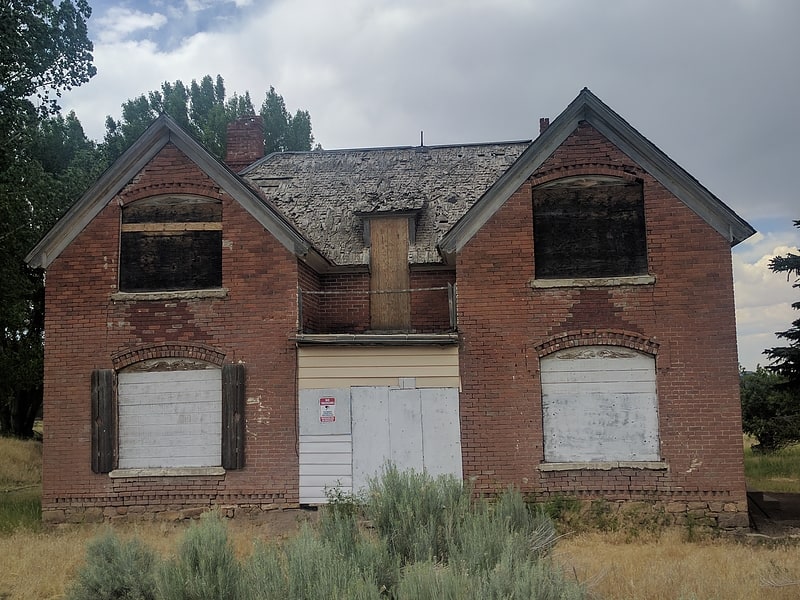
The Daniel R. and Sophia G. Page House is one of a number of outbuildings on the Page Ranch property in Iron County, Utah. Built in 1900, this two-story house is the primary house on the property and the only building on the property that is currently listed on the National Register of Historic Places. It is located on Pinto Road, east of Pinto, Hamblin, and State Route 18.
Page Ranch was owned by the Page family since 1858, having been settled by Daniel Page's grandfather, Robert Richey. The house was designed by then-owners of the Page Ranch property, Daniel Richey Page and Sophia Geary Page. Construction began in 1898 by the builders, Jack and Harvey Fabian, using bricks made on site. The bricks used in construction were made from clay found immediately west of the building's location. The finished house served as a stopping place for travelers and boarded miners who worked nearby. The Richey and Page families owned the ranch until 1934.
The house remains standing as of 2017, but resides unoccupied, with windows and doors having been boarded up.[8]