Discover 6 hidden attractions, cool sights, and unusual things to do in Manti-La Sal National Forest (United States). Don't miss out on these must-see attractions: Abajo Peak, Mount Peale, and Bears Ears. Also, be sure to include South Mountain in your itinerary.
Below, you can find the list of the most amazing places you should visit in Manti-La Sal National Forest (Utah).
Table of Contents
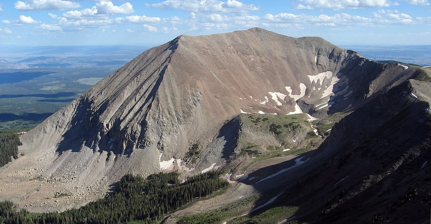
Abajo Peak
Peak in Utah. Abajo Peak is the highest peak in the Abajo Mountains of southeast Utah, United States and is located in the Manti-La Sal National Forest. The summit is 7 miles southwest of Monticello, Utah and 23 miles west of the Colorado border. There are several communication towers on the peak.[1]
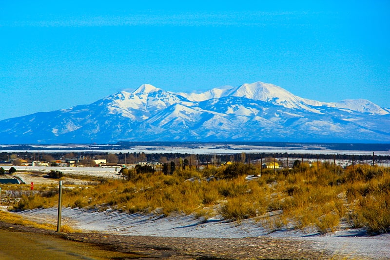
Mount Peale
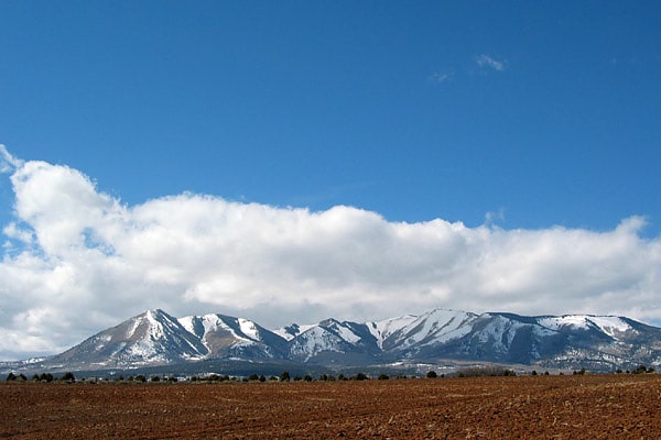
Mountain in Utah. Mount Peale is the highest point in the La Sal Mountains of San Juan County, in the southeastern part of Utah, United States. It is also the highest point in Utah outside the Uinta Mountains. It is located about 20 mi southeast of Moab. The summit is the highest point in the Manti-La Sal National Forest and the Mount Peale Research Natural Area. Mount Peale was named for Albert Peale, a mineralogist on the Hayden Survey of 1875.
The La Sal Mountains sit on the arid Colorado Plateau, near such famous desert landmarks as Canyonlands National Park and Arches National Park. However, due to their height, the La Sals are heavily forested and usually snow-capped until early summer (there is one snowfield on the north side that usually lasts year round). Mount Peale can be seen on a clear day from the Wasatch Plateau of central Utah, near Orangeville, over 115 miles (190 km) away.
Mount Peale can be accessed from various directions, but is most commonly climbed from the area of La Sal Pass, 10,125 ft (3,086 m), about 3 mi (5 km) to the southwest of the peak. La Sal Pass is accessed from the southeast via a graded gravel road. From the pass the summit is obtained by a short but steep off-trail hike of about 2.5 mi (4.0 km) with about 2,600 ft (800 m) of elevation gain. The route often involves some travel on snow, even in summer.[2]
Bears Ears
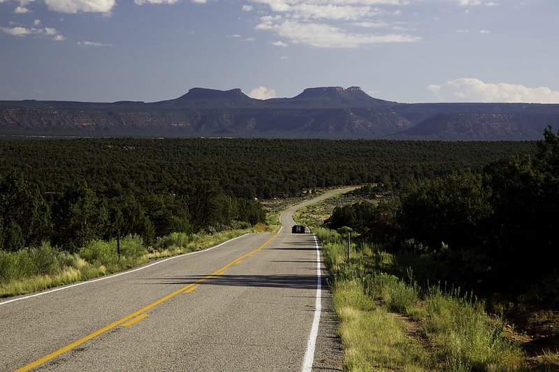
The Bears Ears are a pair of buttes located in San Juan County in southeastern Utah, United States. They are protected as part of and the namesake of the Bears Ears National Monument, managed by the Bureau of Land Management and United States Forest Service. The Bears Ears are bordered on the west by Dark Canyon Wilderness and Beef Basin, on the east by Comb Ridge and on the north by Indian Creek and Canyonlands National Park. Rising 2,000 feet above Cedar Mesa to the south, the Bears Ears reach 8,700 feet in elevation and are named for their resemblance to the ears of a bear emerging from the horizon.[3]
South Mountain
Peak in Utah. South Mountain is an 11,798-foot peak in San Juan County, Utah in the United States, about 5 miles north of La Sal, Utah. It is part of the La Sal Mountains. Precipitation runoff from this mountain drains into tributaries of the Colorado River. The nearest town is Moab, 20 mi to the northwest, and the nearest higher neighbor is Mount Tukuhnikivatz, 2.64 mi to the north.[4]
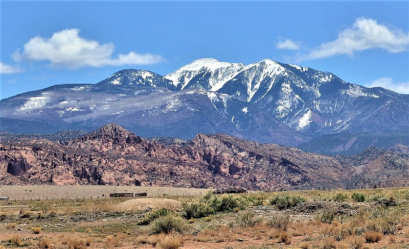
La Sal Mountains
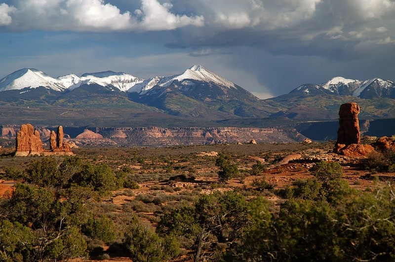
Mountain range in Utah. The La Sal Mountains or La Sal Range are a mountain range located in Grand and San Juan counties in the U.S. state of Utah, along the border with Colorado. The range rises above and southeast of Moab and north of the town of La Sal. This range is part of the Manti-La Sal National Forest and the southern Rocky Mountains. The maximum elevation is at Mount Peale, reaching 12,721 feet above sea level.
The range contains three clusters of peaks separated by passes. The peaks span a distance of about 10 miles (16 km). The name of the range dates to Spanish times, when the Sierra La Sal (meaning the "Salt Mountains") were a prominent landmark on the Old Spanish Trail between Santa Fe and Los Angeles.[5]
Abajo Mountains
Mountain range in Utah. The Abajo Mountains, sometimes referred to as the Blue Mountains, is a small mountain range west of Monticello, Utah, south of Canyonlands National Park and north of Blanding, Utah. The mountain range is located within the Manti–La Sal National Forest. The highest point within the range is Abajo Peak at 11,360 feet.
This mountain range, like both the La Sal Range and Henry Mountains in the same part of the Colorado Plateau, is formed about igneous intrusions that are relatively resistant to erosion. Some of these intrusions form laccoliths emplaced at depths of a few kilometers. The predominant igneous rock is porphyritic hornblende diorite. Ages of intrusion in the Abajo Mountains fall in the interval from 22 to 29 million years.
These mountain ranges are part of the Colorado Plateau province west of the greater ranges of the Rocky Mountains. The laccolith ranges are much younger and have a very different geologic origin.
The range was reputedly named by the Spanish in the 1700s, the name "Abajo" meaning "low".[6]