Discover 20 hidden attractions, cool sights, and unusual things to do in Zion National Park (United States). Don't miss out on these must-see attractions: The Subway, The Organ, and Angels Landing. Also, be sure to include Cable Mountain in your itinerary.
Below, you can find the list of the most amazing places you should visit in Zion National Park (Utah).
Table of Contents
The Subway
Landmark in Washington County, Utah. The Subway is a small, uniquely-shaped slot canyon within the Zion Wilderness in Zion National Park in northeastern Washington County, Utah, United States. The National Park Service limits access to the canyon via a permit system.[1]
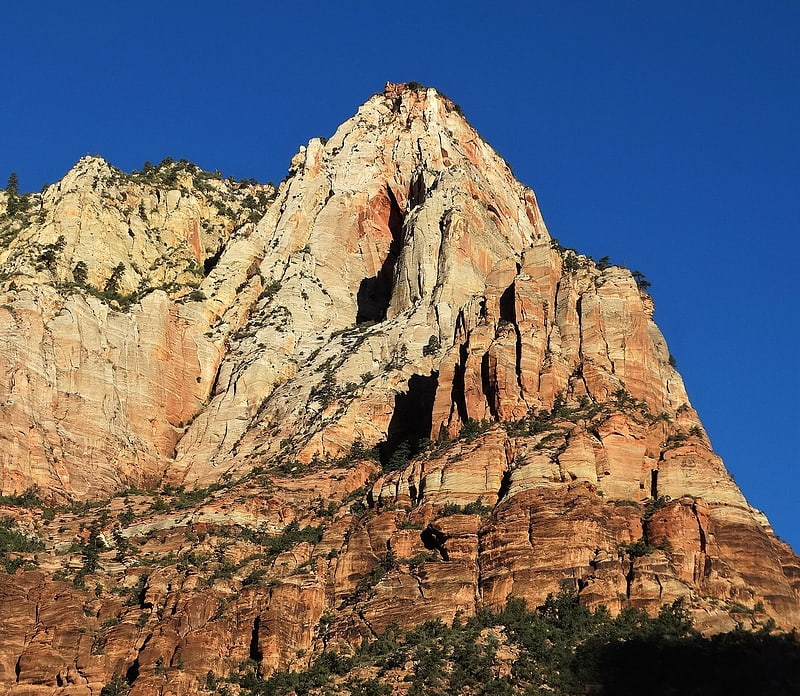
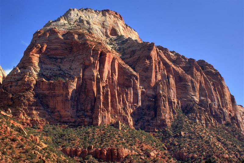
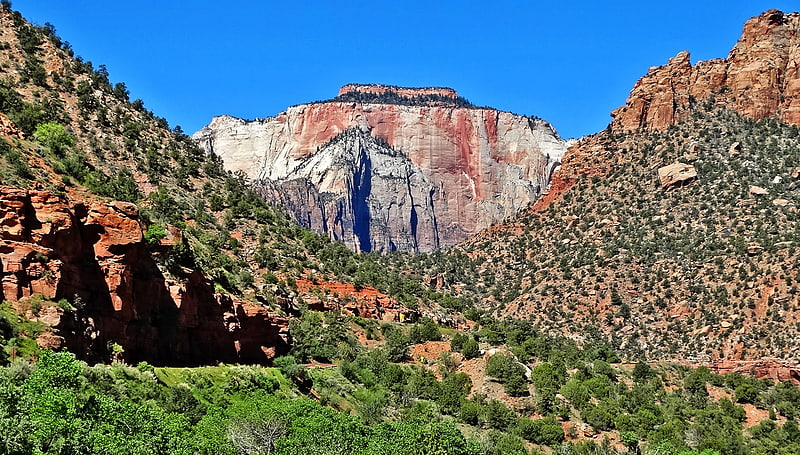
The Organ
The Organ is a 5,080-foot elevation Navajo Sandstone summit located in Zion National Park, in Washington County of southwest Utah, United States. The Organ is situated in the Big Bend at the north end of Zion Canyon, rising 700-feet above the canyon floor and the North Fork of the Virgin River which drains precipitation runoff from this rock. Neighbors include The Great White Throne, Cathedral Mountain, Angels Landing, Observation Point, and Cable Mountain. The Organ is believed to have been named by Claud Hirschi and Ethelbert Bingham, residents of Rockville, on their 1916 trip with Methodist Minister Frederick Vining Fisher, who also named geographical formations in Zion. This geographical feature's descriptive name was officially adopted in 1934 by the U.S. Board on Geographic Names.[2]
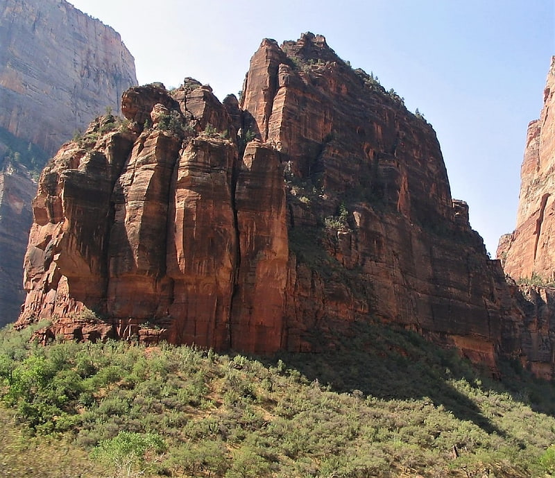
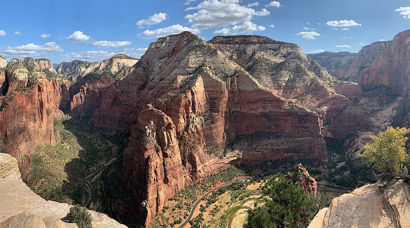
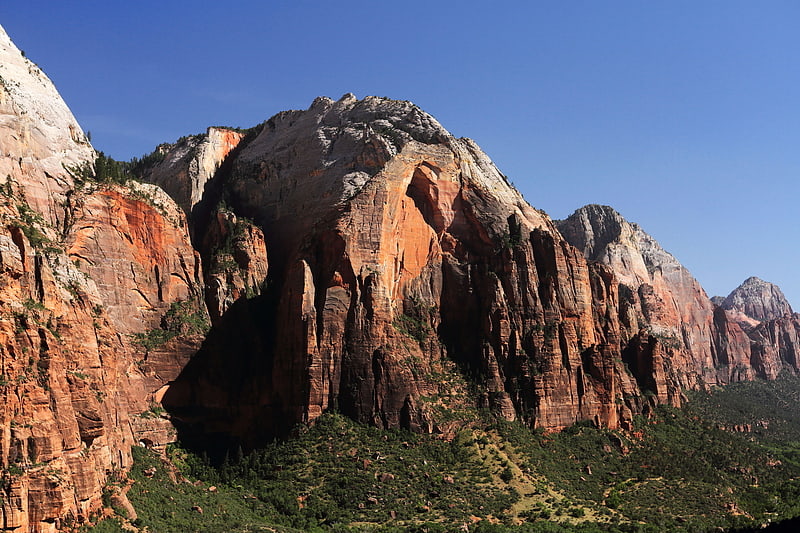
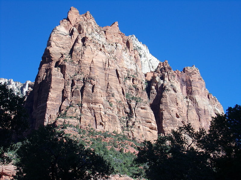
Angels Landing
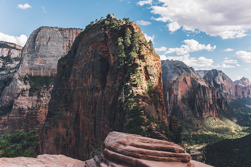
Steep hike to a landmark rock formation. Angels Landing, known previously as the Temple of Aeolus, is a 1,488-foot tall rock formation in Zion National Park in southwestern Utah, United States. A renowned trail cut into solid rock in 1926 leads to the top of Angels Landing and provides panoramic views of Zion Canyon.[3]
Address: 37° 16.16', 112° 56.92', 84767 Zion Canyon
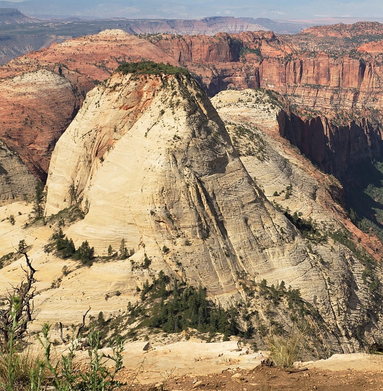
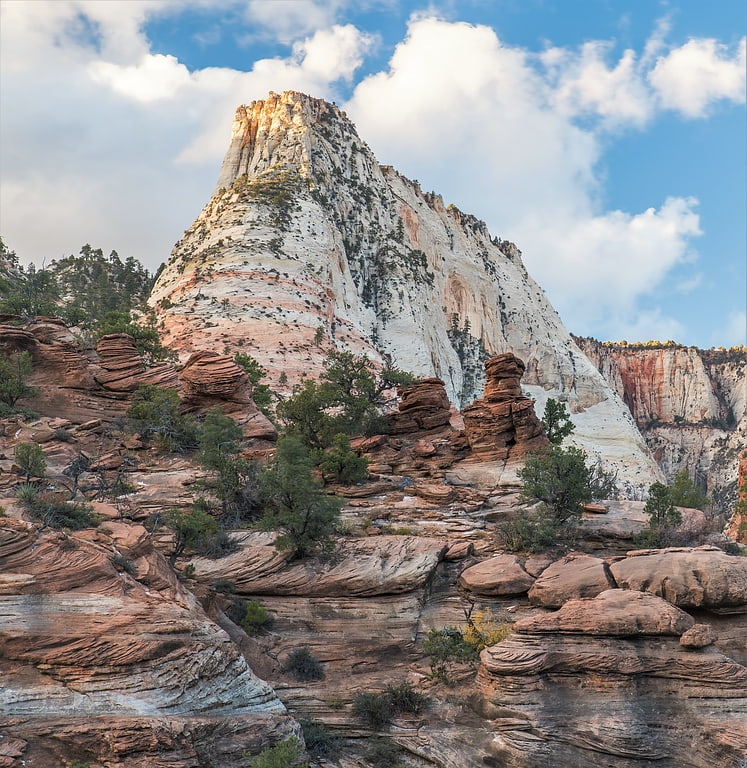
Cable Mountain
Summit in Utah. Cable Mountain is a 6,940-foot elevation Navajo Sandstone summit located in Zion National Park, in Washington County of southwest Utah, United States. Towering 2,600-feet above the floor of Zion Canyon at the Big Bend area, Cable Mountain is situated immediately northeast of The Great White Throne, separated by the chasm of Hidden Canyon. It is set on the east side of the North Fork Virgin River which drains precipitation runoff from this mountain. Its neighbors include Angels Landing, Cathedral Mountain, The Organ, and Observation Point. This mountain's name was officially adopted in 1934 by the U.S. Board on Geographic Names. It is so named in association with the draw-works which used cables to lower timber from the top of the plateau down to the valley bottom from 1901 through 1927. Wood to construct the Zion Lodge came down the cable works. A 7.4-mile trail, much of it an old wagon road, leads to the views from the top.[4]
Observation Point
Observation Point is a 6,507-foot elevation Navajo Sandstone feature located in Zion National Park, in Washington County of southwest Utah, United States. Observation Point is situated at the north end of Zion Canyon, towering 2,100-feet above the canyon floor and the North Fork of the Virgin River which drains precipitation runoff from this viewpoint. A popular 8-mile round-trip trail climbs from the Weeping Rock trailhead along Zion Canyon Road to reach the top. Neighbors visible from the point include The Great White Throne, Cathedral Mountain, Angels Landing, and Cable Mountain. This geographical feature's name was officially adopted in 1934 by the U.S. Board on Geographic Names.[5]
Address: Weeping Rock Trailhead, 84737 Zion
Lady Mountain
Lady Mountain is a 6,945-foot elevation Navajo Sandstone summit located in Zion National Park, in Washington County of southwest Utah, United States.[6]
Red Arch Mountain
Red Arch Mountain is a 5,930-foot elevation Navajo Sandstone summit located in Zion National Park, in Washington County of southwest Utah, United States.[7]
The Watchman
Mountain in Utah. The Watchman is a 6,545-foot sandstone mountain summit located in Zion National Park, in Washington County of southwest Utah, United States.[8]
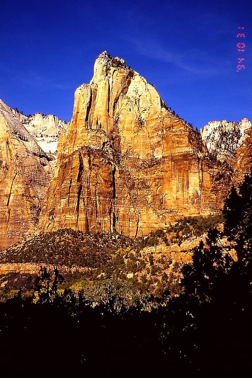
The East Temple
Geographical feature. The East Temple is a prominent 7,709 feet summit composed of Navajo Sandstone in Zion National Park, in Washington County of southwest Utah, United States. It is one of the notable landmarks in the park. The nearest neighbor is Twin Brothers, one-half mile to the north, and the nearest higher peak is The West Temple, 3.85 miles to the west-southwest. The mountain is situated 1.8 miles northeast of the park headquarters, at the confluence of Pine Creek and the North Fork Virgin River. This feature's name was applied by John Wesley Powell during his explorations in 1872, and was officially adopted in 1934 by the U.S. Board on Geographic Names. The first ascent was made in 1937 by Glen Dawson, Dick Jones, Homer Fuller, Wayland Gilbert, and Jo Momyer.[9]
Mount Moroni
Mount Moroni is a 5,690-foot elevation Navajo Sandstone summit located at the Court of the Patriarchs in Zion National Park, in Washington County of southwest Utah, United States.[10]
Mount Spry
Mount Spry is a small 5,720-ft elevation mountain summit made of Navajo Sandstone located in Zion National Park, in Washington County of southwest Utah, United States. Officially named in 1934, it honors William Spry, the third governor of Utah. The nearest higher peak is The East Temple, 0.34 miles to the east. Precipitation runoff from the mountain drains into tributaries of the North Fork Virgin River.[11]
Twin Brothers
Mountain in Utah. Twin Brothers is a 6,863-foot Navajo Sandstone mountain in Zion National Park in Washington County, Utah, United States.[12]
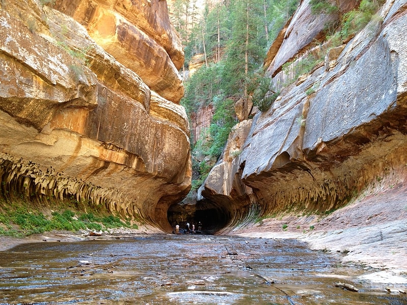
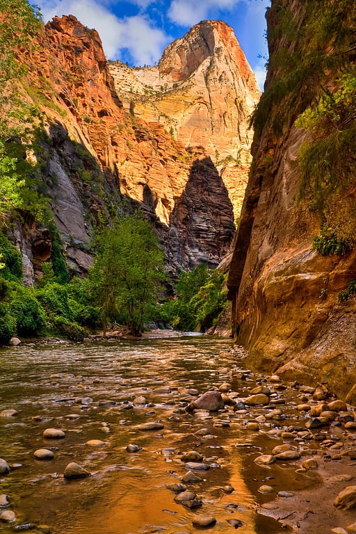
The Narrows
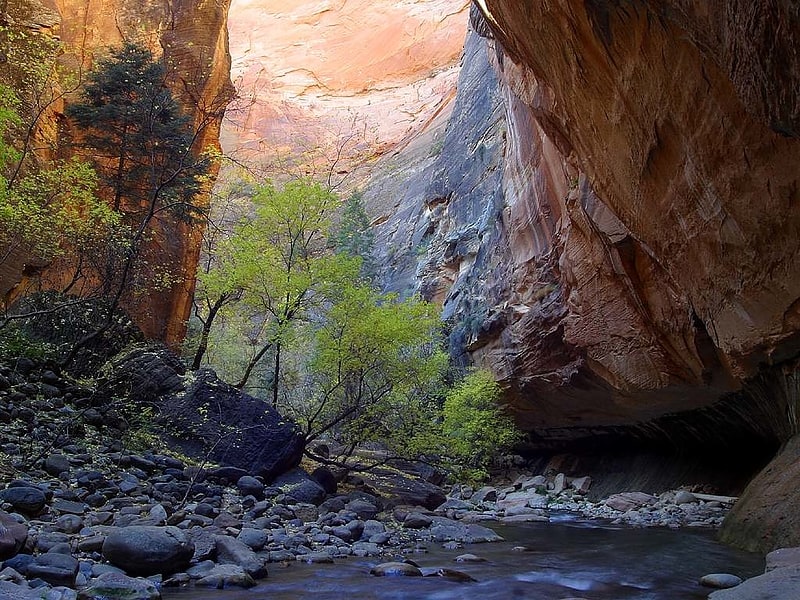
Narrow, scenic section of Zion Canyon. The Narrows is the narrowest section of Zion Canyon in Zion National Park, Utah, United States. Situated on the North Fork of the Virgin River and upstream of the main canyon, The Narrows is one of the premier hikes in the park and on the Colorado Plateau. The Narrows refers to both the 3.6-mile bottom-up hike from the Temple of Sinawava to Big Springs, as well as the 16-mile top-down hike from Chamberlain's Ranch back to the Temple of Sinawava.[13]
Mountain of Mystery
Mountain of Mystery is a 6,565-foot Navajo Sandstone summit located in Zion National Park, in Washington County of southwest Utah, United States. Mountain of Mystery is situated above The Narrows, towering over 2,100-feet above the floor of Zion Canyon and the North Fork Virgin River which drains precipitation runoff from this mountain. This peak rises above Orderville Canyon on its north side, and Mystery Canyon on the south. Its neighbors include Mount Majestic, Cathedral Mountain, Observation Point, Cable Mountain, Angels Landing, and The Organ. This feature's name was officially adopted in 1934 by the U.S. Board on Geographic Names. The first ascent via the Northeast Buttress was made 15 September 2001, by Brian Cabe and Tom Jones.[14]
Mount Majestic
Summit in Utah. Mount Majestic, also known as Majestic Mountain, is a 6,956-foot elevation Navajo Sandstone double-summit mountain located in Zion National Park, in Washington County of southwest Utah, United States.[15]
Mountain of the Sun
Mountain of the Sun is a 6,722-foot elevation Navajo Sandstone summit located in Zion National Park, in Washington County of southwest Utah, United States. Mountain of the Sun is situated immediately east of Court of the Patriarchs, and south of Zion Lodge, towering 2,500-feet above the lodge and the floor of Zion Canyon. It is set on the east side of the North Fork of the Virgin River which drains precipitation runoff from this mountain. Its neighbors include The Sentinel, Mount Spry, The East Temple, and Mount Moroni. This feature's name was officially adopted in 1934 by the U.S. Board on Geographic Names.[16]
Ivins Mountain
Ivins Mountain is a remote 7,019-foot Navajo Sandstone summit located in Zion National Park, in Washington County of southwest Utah, United States.[17]
The West Temple
Mountain in Utah. The West Temple is a prominent 7,810-foot mountain summit composed of Navajo Sandstone in Zion National Park in Washington County of Utah, United States. This, the highest feature in Zion Canyon, was originally called "Temp-o-i-tin-car-ur" meaning "Mountain without a trail" by the Paiute people. It was called Steamboat Mountain by local Mormon settlers before 1934, when the USGS officially changed it to its present name, which was applied by John Wesley Powell during his explorations in 1872. West Temple is situated two miles northwest of Springdale, Utah, one mile northeast of Mount Kinesava, and two miles west of the park headquarters. It is one of the notable landmarks in the park. The nearest higher peak is Windy Peak, 10.46 miles to the north. Precipitation runoff from the mountain drains into tributaries of the Virgin River.[18]
Deertrap Mountain
Mountain in Utah. Deertrap Mountain is a 6,837-foot mountain in Zion National Park in Washington County, Utah, United States.[19]
Isaac Peak
Isaac Peak is a 6,726-foot rock formation in Zion National Park in Washington County, Utah, United States. Access to Isaac Peak is from the main Park road through Sand Beach Trail. Isaac Peak is part of the Three Patriarchs in between Abraham Peak and Jacob Peak. Between Isaac Peak and Abraham Peak is Isaac Canyon, accessed by climbing up the South Fork of Heaps Canyon.[20]